Guest, Sign inJoin

Post to Richmond

We’ll email a one-tap link to publish your post. No password, and nothing is public until you click it.
Already a member? Sign in
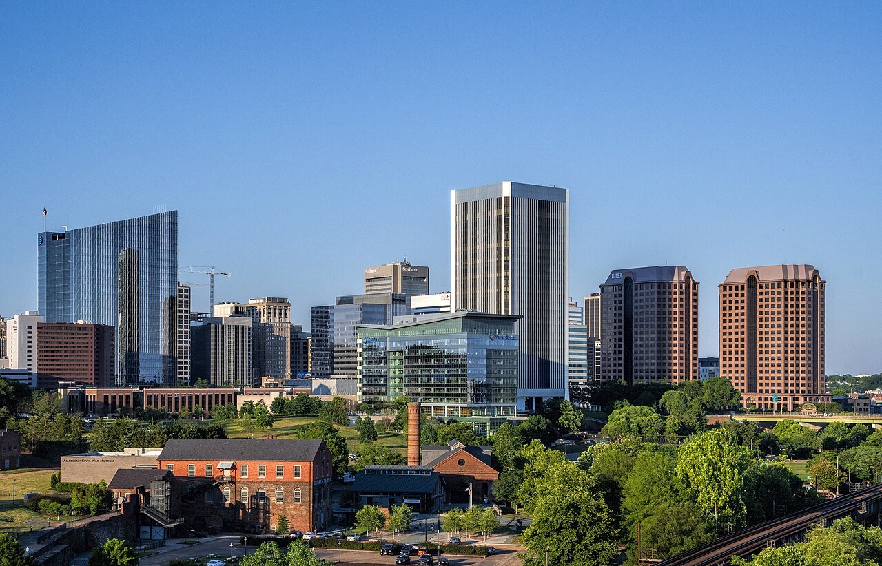
A downtown view of Richmond, VAPhoto: Bruce Emmerling · CC BY-SA 4.0
AOutdoors
Outdoors in Richmond

Richmond has 103 miles of mapped trails, 1.7 for every square mile of land

94% of residents live within a half mile of a park. The biggest trail networks: James River Park System Main Area (5.8 mi), Belle Isle (5 mi), Forest Hill Park (4.2 mi). 8% of Richmond’s land is conserved, about 3,058 acres.

Ahead of 85% of U.S. towns · #61 of 253 in Virginia. What drives it

Conserved land
8%
3,058 acres · of 59.9 sq mi of land
Trails
103 mi
1.7 per sq mi of land
Park land
2,572 ac
11 acres per 1,000 residents
Near a park
94%
of residents within ½ mile
Bike routes
111 mi
63 mi lanes · 15 mi paths
Highest peak
144 ft
Gambles Hill
Lakes & rivers
19
4 boat launches

What kind of outdoors town is Richmond?

Read from the map. The page puts what stands out first.

Outdoors grade

How much outdoors does Richmond have?

On conserved land, trails, park land and how close residents live to a park, Richmond is ahead of 85% of U.S. towns, #61 of 253 in Virginia. Trail miles hold the grade up; park acres per resident pull it down.

A
OutdoorsA character grade: shown, never part of Richmond’s overall grade.
All U.S. towns we grade (21,298)Ahead of 85%
LessMore
Virginia towns of 2,500+ (253)Ahead of 76%

Among the 400 U.S. cities of 100,000 or more, Richmond ranks #133 on Outdoors.

How sure. Graded on any three of the four inputs instead, the letter would range from A− to A. Trails and many small parks come from OpenStreetMap, mapped by volunteers, so coverage varies from town to town; the half mile is a straight line from each census block, so a river or highway in the way isn’t counted against it.

PAD-US, OpenStreetMap (© OpenStreetMap contributors), Census 2025 Gazetteer and 2020 blocks; details in Sources below. How TownRatings grades the outdoors →

The map

Conserved land, trails & bike routes

Tap a number to zoom to a park. Tap a layer to hide it.

12345678
Easements protect land from building but are usually private.© OpenStreetMap contributors · USGS PAD-US
Places to walk

Pick a walk

The longest trail network is James River Park System Main Area, with 5.8 miles. Directions go to the nearest trailhead or public parking.

James River Park System Main Area

Managed by City of Richmond
169 acres5.8 mi of trail
Buttermilk Heights TrailButtermilk TrailReedy Creek TrailButtermilk East+1
Dog rules not recorded
Directionsto JRPS 42nd St Parking

Belle Isle

Managed by City of Richmond
56 acres5 mi of trail
Dog rules not recorded
Directionsto the trail sign

Forest Hill Park

Managed by City of Richmond
101 acres4.2 mi of trail
Forest HillForest Hill - Alternate Reedy Creek Crossing DetourFH Neighborhood Access Spur
Dog rules not recorded
Directionsto Forest Hill Park Parking

Powhite Park

Nature preserve
85 acres4.1 mi of trail
Powhite Park Loop Trail
Dog rules not recorded
Directionsto the parking lot

Byrd Park

Park
229 acres3.7 mi of trail
Dogwood Dell bike trail
No dogs
Directionsto the parking lotWebsite ↗

Lewis G. Larus Park

Nature preserve
109 acres3.4 mi of trail
Dog rules not recorded
Directionsto the parking lot

Pony Pasture Park

Managed by City of Richmond
65 acres3 mi of trail
R.B. Young Riverside TrailPleasant Creek Trail
Dog rules not recorded
Directionsto Pony Pasture
All 72 parks & preserves
James River Park System Main Area169 acres · 5.8 mi of trail · City of Richmond
Directions
Belle Isle56 acres · 5 mi of trail · City of Richmond
Directions
Forest Hill Park101 acres · 4.2 mi of trail · City of Richmond
Directions
Powhite Park85 acres · 4.1 mi of trail
Directions
Byrd Park229 acres · 3.7 mi of trail
Directions
Lewis G. Larus Park109 acres · 3.4 mi of trail
Directions
Bryan Park249 acres · 3.2 mi of trail
Directions
Pony Pasture Park65 acres · 3 mi of trail · City of Richmond
Directions
Maymont109 acres · 2.9 mi of trail
Directions
Ancarrow's Landing42 acres · 2 mi of trail · City of Richmond
Directions
Pony Pasture Park - Wetland Park53 acres · 1.8 mi of trail · City of Richmond
JRPS Texas Beach Park54 acres · 1.7 mi of trail
Directions
Chimborazo Park42 acres · 1.5 mi of trail · City of Richmond
Directions
Pine Camp Cultural Arts and Community Center46 acres · 0.9 mi of trail
Directions
Battery Park16 acres · 0.8 mi of trail · City of Richmond
Huguenot Flatwater Park29 acres · 0.7 mi of trail · City of Richmond
Directions
Pump House Park13 acres · 0.7 mi of trail
Directions
Jefferson Park7 acres · 0.6 mi of trail · City of Richmond
Directions
Great Shiplock Park9 acres · 0.5 mi of trail · City of Richmond
Directions
Broadrock Sports Complex51 acres · 0.4 mi of trail · City of Richmond
Directions
Dry Rocks20 acres · 0.4 mi of trail
Directions
Petronius S. Jones Park7 acres · 0.4 mi of trail
Directions
Dock Street Park5 acres · 0.4 mi of trail · City of Richmond
Directions
ARCpark4 acres · 0.4 mi of trail
Gambles Hill Park17 acres · 0.3 mi of trail
Directions
Capitol Square17 acres · 0.3 mi of trail
Directions
Canoe Run Park8 acres · 0.3 mi of trail
Directions
Oakwood Park7 acres · 0.3 mi of trail · City of Richmond
Bandy Field Nature Park5 acres · 0.3 mi of trail
Directions
Taylor's Hill Park4 acres · 0.3 mi of trail · City of Richmond
Directions
Kanawha Plaza3 acres · 0.3 mi of trail
Directions
Carter Jones Park12 acres · 0.2 mi of trail · City of Richmond
Gillies Creek Park47 acres · 0.1 mi of trail · City of Richmond
Richmond National Battlefield Park19 acres · 0.1 mi of trail
Directions
Hotchkiss Field Community Center11 acres · 0.1 mi of trail
Libby Hill Park11 acres · 0.1 mi of trail · City of Richmond
Directions
Powhatan Playground10 acres · 0.1 mi of trail · City of Richmond
Directions
Highland Plaza7 acres · 0.1 mi of trail
Walker's Creek Retention Basin Park7 acres · 0.1 mi of trail · City of Richmond
E. Clairborne and Lora Robins Sculpture Garden4 acres · 0.1 mi of trail
Directions
Roy West Park (Washington Park)3 acres · 0.1 mi of trail · City of Richmond
Riverside Meadow Greenspace2 acres · 0.1 mi of trail · City of Richmond
Oregon Hill Linear Park1 acres · 0.1 mi of trail
Directions
Thomas Square1 acres · 0.1 mi of trail
Directions
Monroe Park9 acres
Directions
Brown's Island8 acres · City of Richmond
Directions
Wayside Spring Park6 acres · City of Richmond
Lucks Field Playground5 acres
Directions
Bill Robinson Playground5 acres · City of Richmond
Montrose Heights Playground5 acres · City of Richmond
Pollard Park5 acres
JRPS - Archer Island4 acres · City of Richmond
Directions
Abner Clay Park4 acres
Directions
Humphrey Calder Community Center4 acres
Directions
Oregon Hill Park3 acres
Directions
Oak Grove Playground3 acres
Chimborazo Playground2 acres
Westwood Playground2 acres
Pocosham Park2 acres
Providence Park1 acres
Directions
Historic Fulton Memorial Park1 acres · City of Richmond
Directions
Holly Street Park1 acres
Directions
Briel Street Playground1 acres · City of Richmond
Powhatan Pool1 acres · City of Richmond
Directions
Smith-Peters Parks1 acres · City of Richmond Parks, Recreation and Community Facilities
Directions
North Central Park1 acres
Patrick Henry Park1 acres · City of Richmond
Meadow Park1 acres
Directions
Alice Fitz Park1 acres
Riverview Community Park1 acres
Directions
Floodwall Park1 acres
Directions
Lombardy Park1 acres
Directions
Who protects it

3,058 conserved acres

8% of Richmond’s land. Who manages Richmond’s conserved land, from the USGS Protected Areas Database. Approximate, because parcels can overlap.

Town or city2,941 ac
Other state land580 ac
Joint547 ac
State conservation70 ac
National Park Service62 ac
Land trusts & nonprofits29 ac
County23 ac
Local Park · 3,421 acUnknown Easement · 555 acLocal Other or Unknown · 450 acConservation Easement · 406 acOther Easement · 314 ac
Good to know

Conserved doesn’t always mean open to visitors. 235 acres are conservation easements, usually private land. Public access isn’t recorded for 22 of 282 parcels. The walks above are places people visit.

The biggest protected parcels
Parcel (PAD-US)Managed byAcresPublic access
William Byrd Park
Local Park
Town or city528Open
James River Park
Local Park
Not recorded514Open
Bryan Park
Local Park
Town or city249Open
Maymount Park
Local Park
Not recorded190Open
Pine Camp Park and Arts Center
Local Park
Town or city186Open
Larus Park
Local Park
Town or city174Open
Manchester Park
Local Park
Town or city166Open
Oakwood Cemetery
Local Other or Unknown
Town or city159Open
Forest Hill Park
Local Park
Town or city105Open
Broad Rock Sports Complex
Local Park
Not recorded99Open

5 smaller protected places aren’t shown.

Things to do

259 places to go in Richmond

Beaches, playgrounds, peaks, falls and more. Pick a kind.

Community gardens in Richmond
6 Points Community Garden
Directions
Abby's GardenUniversity of Richmond
Directions
Alice Fitz Community Garden
Directions
Blackwell Community GardenCity of Richmond
Directions
Broad Rock Community Garden
Directions
Brookland Park Community Garden
Directions
Byrd Park Community Garden
Directions
Charles S. Gilpin Community Farm
Directions
22 more community gardens
Chimborazo Native GardenIn Chimborazo Park
Directions
Chimborazo Playground Community GardenIn Chimborazo Playground
Directions
Fonticello Food Forest
Directions
Garber Street Community Garden
Directions
HJWA Community GardenHistoric Jackson Ward Association
Directions
Hickory Hill Community Garden
Directions
Hotchkiss Community GardenIn Hotchkiss Field Community Center
Directions
Humphrey Calder Community Garden
Directions
Jefferson Avenue Community Garden
Directions
MCV Community Garden
Directions
Maymont Community GardenIn Riverview Community Park
Directions
McDonough Community GardenCity Of Richmond Recreation & Parks
Directions
Oak Grove Community GardenIn Oak Grove Playground
Directions
Owl Orchard Community GardenCity Of Richmond Recreation & Parks
Directions
Planet Rock Community GardenIn Broadrock Sports Complex
Directions
Pocket Park at 30th & 1/2City of Richmond
Directions
Powhatan Hill Community GardenIn Powhatan Playground
Directions
Randolph Community GardenIn Petronius S. Jones Park
Directions
Roots of Woodville Neighborhood Garden
Directions
Sankofa Community Orchard
Directions
Southside Community Garden
Directions
Stockton Community Garden
Directions

35 community gardens are on OpenStreetMap in all; the list shows named ones from the first 30.

Trails & water

25 named trails and 19 lakes & rivers

Named trails
Open to bikes · 39.3 miHorses · 0.8 miUnpaved · 57.3 mi
Forest Hill3.1 mi
Ancarrow’s Landing3.0 mi
North Bank Trail2.2 mi
Buttermilk Heights Trail1.7 mi
Texas Beach Trail1.7 mi
Powhite Park Loop Trail1.7 mi
The Wetlands1.1 mi
Richmond Slave Trail1.1 mi
Buttermilk Trail1.0 mi
Dogwood Dell bike trail0.8 mi
15 more trails
Reedy Creek Trail
0.8 mi
Texas Beach - Western Extension (Seasonal / Wild)
0.8 mi
R.B. Young Riverside Trail
0.6 mi
Pleasant Creek Trail
0.6 mi
Buttermilk East
0.4 mi
North Bank Heights
0.4 mi
Chapel Island Trail
0.4 mi
Canal Walk
0.4 mi
Manchester Floodwall Walk
0.4 mi
Chimborazo Connector
0.3 mi
Forest Hill - Alternate Reedy Creek Crossing Detour
0.2 mi
Low Water Trail - East
0.2 mi
Low Water Trail
0.2 mi
Proto Path
0.2 mi
High Water Trail
0.2 mi
Lakes & rivers tap for directions
Biking & sports

111 miles of bike routes

Bike lanes are often missing from the map in smaller towns, so that number is likely low.

63 mi
painted or protected bike lanes
15 mi
off-road bike paths
34 mi
shoulders & shared lanes
Dogwood Dell bike trailBike route
0.9 mi
East Coast Greenway (VA)Bike route
0.6 mi
Courts & fields
151Tennis
78Basketball
55Baseball
31Pickleball
29Soccer
17Football
7Tracks
4Skate park

Includes school and college facilities, which aren’t always open to the public.

History along the way

234 places on the National Register, 15 of them National Historic Landmarks

The country’s official list of places worth saving (National Park Service). The map also marks 80 historic points from OpenStreetMap: plaques, memorials and old buildings.

History →
★
John Marshall HouseNational Historic Landmark · Building · listed 1966
About it
★
St. John's Episcopal ChurchNational Historic Landmark · Building · listed 1966
About it
★
Virginia State CapitolNational Historic Landmark · Building · listed 1966
About it
★
White House of the ConfederacyNational Historic Landmark · Building · listed 1966
About it
★
Egyptian BuildingNational Historic Landmark · Building · listed 1969
About it
★
Monumental ChurchNational Historic Landmark · Building · listed 1969
About it
★
Governor's MansionNational Historic Landmark · Building · listed 1969
About it
★
Valentine MuseumNational Historic Landmark · Building · listed 1969
About it
★
City HallNational Historic Landmark · Building · listed 1969
About it
★
Monument Avenue Historic DistrictNational Historic Landmark · District · listed 1970
About it
★
Main Street Station and TrainshedNational Historic Landmark · Building · listed 1970
About it
★
Tredegar Iron WorksNational Historic Landmark · District · listed 1971
About it

222 more on the History page.

When to get out

The best walking months in Richmond: April to June

NOAA’s 1991–2020 normals for the town and the daylight at its latitude. Outlined months have long days, highs of 59 to 86 °F and little rain for the place.

JanFebMarAprMayJunJulAugSepOctNovDec
Daylight (h)9.810.811.913.114.214.714.513.612.411.110.19.6
High (°F)485260717885898781716051
Rain (in)3.42.84.03.44.24.34.54.54.63.73.33.7

February is the driest month (2.8 in) and July the warmest (highs of 89 °F). 4.6 inches fall in September, the wettest month. Summer highs reach 89 °F, too hot for the outline. The climate in Richmond →

Next door

Richmond and its neighbors

Richmond has the most mapped trails of the 8 towns around it. Tap a town to see its outdoors.

TownConserved
of land
Trail mi
per sq mi
Park acres
per 1,000
Near a park
½ mile
Outdoors
Richmond8%1.71194%A
Tuckahoe4%0.5435%C+
Meadowbrookunder 1%0.6140%C
Montrose1%1.6under 115%C
Manchester1%0.8343%C
East Highland Park18%0.26170%A−
Bensley6%0.11896%B+
Bon Air1%0.5445%C

The four inputs of the Outdoors grade, from the engine; shares are of land, not water.

Questions about parks and trails in Richmond

Where can I hike in Richmond?

The longest trail networks: James River Park System Main Area, 5.8 miles; Belle Isle, 5 miles; Forest Hill Park, 4.2 miles; Powhite Park, 4.1 miles. Each one is on the map above, with directions to the nearest trailhead or parking.

How much of Richmond is conserved land?

8% of its land, against a typical 4% for a Virginia town and 4% nationally (PAD-US). Conserved doesn’t always mean open to visitors: easements are usually private land.

Are dogs allowed on Richmond’s trails?

James River Park System Main Area and Belle Isle don’t have dog rules recorded on the map; check the signs at the trailhead.

Where can I bike in Richmond?

111 miles of bike routes are on the map: 63 of painted or protected lanes, 15 of off-road paths and 34 of shoulders and shared lanes. Named routes: Dogwood Dell bike trail and East Coast Greenway (VA).

Is there public land near Richmond?

18,813 acres of parks and open public land lie inside Richmond or within 10 miles of it (PAD-US), 2,572 of them inside the city line.

How much outdoors does Richmond have?

Ahead of 85% of U.S. towns on the Outdoors grade, #61 of 253 in Virginia. The grade combines the share of land that is conserved, miles of mapped trail per square mile of land, park acres per 1,000 residents and the share of residents within a half mile of a park. It’s a character grade, so it isn’t part of the overall grade. How it works.

Trail talk

Conditions, parking and favorite walks from Richmond neighbors.

Town Square →
Share a tip
Sources

Where this page comes from

Conserved and public land: USGS Protected Areas Database of the United States (PAD-US), service updated July 2026. Parks, trails, playgrounds, beaches and other places: OpenStreetMap (© OpenStreetMap contributors, ODbL), map data as of 2026-10-28. Land and water area: Census 2025 Gazetteer. Residents near a park: 2020 Census blocks. National Register: National Park Service. How TownRatings grades the outdoors →