
Teasdale Tithing Granary · National Register of Historic Places
Teasdale’s story
126 years in pictures
1 place on the National Register of Historic Places.
- 1900Teasdale is settled
Each edition grades its towns against each other only.

A town of 308, settled in 1900.
69% of adults 25 and older hold a bachelor’s degree or more in Teasdale, where Utah’s towns sit at 36% and U.S. towns at 29%. No town among the 120 in Utah we compare has a lower median age than Teasdale. 32% of the land in Teasdale is conserved, above both the Utah town median (3.4%) and the median of U.S. towns (4.3%). Teasdale Tithing Granary is on the National Register of Historic Places. Teasdale has fewer than 1,000 residents, too few for fair grades; the figures below are still real.
In a town this size, neighbors are the best guide. Ask them anything.
1 place on the National Register of Historic Places.
Museums, parks, gardens and other places to visit around Teasdale. Close and well known come first.
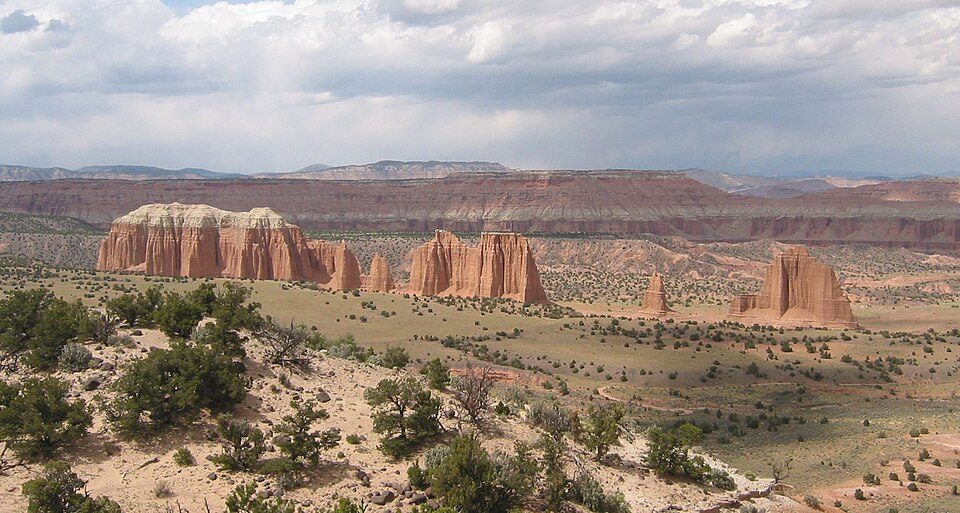 6 mi National ParkCapitol Reef National Park1.4M visitors a year
 4 mi Scenic driveUtah State Route 12
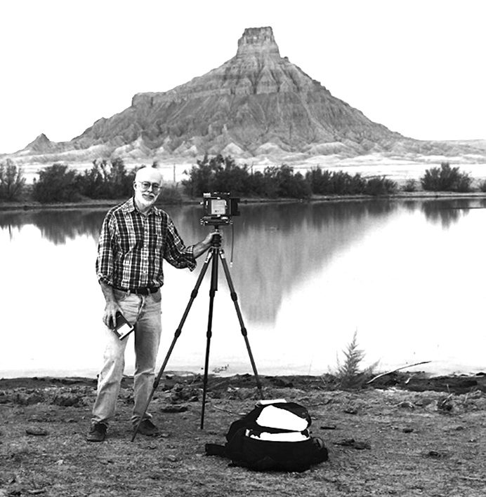 32 mi MountainFactory Butte
 39 mi National forestFishlake National Forest
 26 mi MuseumAnasazi State Park Museum
Capitol Reef National Park: Bob Palin, CC BY-SA 2.5 · Utah State Route 12: Christian Mehlführer, User:Chmehl, CC BY-SA 3.0 · Factory Butte: Ken Karagozian, CC BY-SA 4.0 · Fishlake National Forest: Mark Muir, Public domain · Anasazi State Park Museum: Nickeyrc, Public domain
Teasdale is unincorporated, so Wayne County and regional agencies provide most services.
EPA SDWIS (Oct 9, 2026) · HIFLD + EIA-861 2025 · Census 2020 ZCTAs · NCES 2024–25 · registration: vote.gov, updated Mar 13, 2026.
Ordered by what stands out in Teasdale.
5.1 miles of trail in 1 park or preserve. Teasdale’s trail density is 1.3 miles per square mile. The biggest park or preserve is Fishlake National Forest, at 82 acres.
| Biggest places to walk | Trails | Acres |
|---|---|---|
| 1. Fishlake National Forest | — | 82 |
Trails & parks © OpenStreetMap contributors · Conserved land: USGS PAD-US
The July high in Teasdale is 83°F. Teasdale has chilly winters and pleasant summers, with very little rain.
NOAA U.S. Climate Normals, 1991–2020
Expected storm and flood damage is lower than in 63% of U.S. communities.
FEMA National Risk Index · OpenFEMA
18% of adults report frequent physical distress in Teasdale. Only 5 of the 119 Utah towns we compare have a higher share of adults who say their health is fair or poor than Teasdale. 8.6% of adults binge drink in Teasdale.
| Teasdale | Utah towns | U.S. towns | |
|---|---|---|---|
| Binge drink (CDC PLACES) | 8.6% | 11% | 16% |
| Frequent physical distress (CDC PLACES) | 18% | 12% | 14% |
| High blood pressure (CDC PLACES) | 41% | 28% | 35% |
| Diabetes (CDC PLACES) | 15% | 8.4% | 12% |
| What stands out | Teasdale | UT |
|---|---|---|
| Fewer uninsured adults | 7.1% | 10.5% |
| Fewer binge drinkers | 8.6% | 12.4% |
| More adults with COPD | 9.3% | 4.6% |
CDC PLACES 2025 · modeled estimates for adults · CMS · HRSA
None within 15 miles of Teasdale; the nearest are
About 0 of every 100 Teasdale residents are enrolled in college, against 8 across Utah.
Short answers, built from the data on this page.
Teasdale has fewer than 1,000 residents, too few for fair grades; the figures below are still real.


