165 years in pictures
Census counts: 1,142 in 1870, 95,342 in 2020. The archive holds 10 old photos and papers going back to 1876 and 2 maps from 1956 on.
14 places on the National Register of Historic Places.
- 1861St. George is settled
Each edition grades its towns against each other only.

St. George is a city of 108,713, and it grades B− overall, ranked 91st of 118 in Utah. Residents are healthier than 78% of U.S. towns on CDC estimates. The trade-offs: FEMA rates its natural-hazard risk higher than 87% of U.S. communities, with inland flooding at the top, and the typical home is worth about $516K, 6.4 years of the St. George metro’s $81K median household income. 64% of working residents work locally in St. George, where Utah’s towns sit at 8.2% and U.S. towns at 8%. St. George has 14 places on the National Register of Historic Places, among them Old Washington County Courthouse and St. George Tabernacle. Only 3 of the 119 Utah towns we compare have a higher share of residents 65 or older than St. George.
Where St. George beats most towns, and one thing worth knowing.
Census counts: 1,142 in 1870, 95,342 in 2020. The archive holds 10 old photos and papers going back to 1876 and 2 maps from 1956 on.
14 places on the National Register of Historic Places.
Each subject compared with towns across the country (schools within Utah), ordered by how far St. George is from typical.
How TownRatings grades towns →
Who provides power, water and the rest in St. George, and how to reach them.
EPA SDWIS (Oct 9, 2026) · HIFLD + EIA-861 2025 · Census 2020 ZCTAs · NCES 2024–25 · registration: vote.gov, updated Mar 13, 2026.
Ordered by what stands out in St. George.
St. George has milder winter nights than almost anywhere else in Utah and is healthy by national standards but behind most towns in Utah; it also carries more natural-hazard risk than most of Utah (mostly inland flooding).
136 miles of trail in 43 parks and preserves. The trail density in St. George is 1.8 miles per square mile. Red Cliffs National Conservation Area, at 3,161 acres with 16.1 miles of trail, is the biggest park or preserve.
| St. George | Utah towns | U.S. towns | |
|---|---|---|---|
| Miles of trail per square mile | 1.8 miles per square mile | 1.1 | 0.4 |
| Conserved land | 9.4% | 3.4% | 4.3% |
| Biggest places to walk | Trails | Acres |
|---|---|---|
| 1. Red Cliffs National Conservation Area | 16.1 mi | 3,161 |
| 2. Snow Canyon State Park | 7.9 mi | 1,336 |
| 3. White Dome Nature Preserve | 2.8 mi | 787 |
Trails & parks © OpenStreetMap contributors · Conserved land: USGS PAD-US
Its public schools are run by the Washington District. Three of its 42 schools are below, each with why it’s listed.
| School | Level | Students | Letter |
|---|---|---|---|
| George Washington AcademyLargest public elementary schoolGrades K–8 | Grades K–8 | 1,013 | A |
| Snow Canyon HighLargest public high schoolGrades 10–12 | Grades 10–12 | 1,324 | B− |
| Crimson View SchoolTop results in townGrades PK–5 | Grades PK–5 | 520 | A+ |
NCES · EDFacts · graded within UT on state tests and graduation
FEMA rates its natural-hazard risk higher than 97% of Utah towns, with expected losses of about $599 per resident a year; that rating is what its D for hazard risk is built on.
St. Since 1980, 12 flood insurance claims have been paid out in St. George.
FEMA flood insurance claims · FEMA National Risk Index · OpenFEMA
Within Utah it is less healthy than 70% of the 118 graded towns: Utah sets a high bar.
9.7% of adults binge drink in St. George. Only 6 of the 118 Utah towns we compare have a higher share of adults who have high blood pressure than St. George. 7.9% of adults smoke cigarettes in St. George.
| St. George | Utah towns | U.S. towns | |
|---|---|---|---|
| Binge drink (CDC PLACES) | 9.7% | 11% | 16% |
| Smoke cigarettes (CDC PLACES) | 7.9% | 8% | 14% |
| Yearly checkup (CDC PLACES) | 72% | 72% | 79% |
| Feel lonely (CDC PLACES) | 31% | 33% | 33% |
| What stands out | St. George | UT |
|---|---|---|
| Fewer binge drinkers | 9.7% | 12.4% |
| More adults treating high blood pressure | 73% | 65.6% |
| More adults with heart disease | 6.9% | 4.7% |
CDC PLACES 2025 · modeled estimates for adults · CMS · HRSA
People 65 and older are 22% of residents (12% statewide); adults 18 to 34 are 22% of residents (26% statewide). St. George has grown 14% since 2020, to 108,713 residents in the Census Bureau’s 2025 estimate. 25% of St. George residents are under 18.
| St. George | Utah towns | U.S. towns | |
|---|---|---|---|
| Under 18 | 25% | 30% | 22% |
| Median age | 38.3 years | 32.6 years | 40.5 years |
| Bachelor’s degree or more, 25+ | 37% | 36% | 29% |
51.1% women, 48.9% men
About 96 men for every 100 women. Across Utah, 49.3% of residents are women. Median age: women 38.9, men 37.4.
| St. George | UT | U.S. | |
|---|---|---|---|
| Under 10 | 12.4% | 14.6% | 11.6% |
| 10 to 17 | 12.3% | 13.2% | 10.3% |
| 18 to 24 | 10.5% | 11.6% | 9.1% |
| 25 to 34 | 11.3% | 14.8% | 13.7% |
| 35 to 44 | 11.6% | 13.8% | 13.2% |
| 45 to 54 | 10.7% | 11% | 12.2% |
| 55 to 64 | 9.4% | 9.1% | 12.7% |
| 65 to 74 | 10.9% | 7.3% | 10.2% |
| 75 and older | 10.9% | 4.6% | 7% |
| No diploma | 5.4% | 6.6% | 10.4% |
| High school | 21.6% | 22.3% | 26% |
| Some college | 23.4% | 23.5% | 19.1% |
| Associate’s | 12.9% | 9.9% | 8.8% |
| Bachelor’s | 22.8% | 24.7% | 21.6% |
| Graduate | 13.9% | 13% | 14.1% |
Census population estimates, 2025 · U.S. Census Bureau · ACS 2020-2024 5-year estimates
January nights average 33.2°, the highest of 334 Utah places with climate records; July afternoons average 102.9°. The St George weather station records that the frost-free season runs about 239 days, the highest of 330 Utah places with climate records. The St George weather station records that about 128 days a year reach 90°, more than in 98% of U.S. towns.
No town among the 119 in Utah we compare has a higher July high than St. George. George has mild winters and scorching summers, with very little rain. About 1 inches of snow falls in a winter.
| St. George | Utah towns | U.S. towns | |
|---|---|---|---|
| July high | 103°F | 92°F | 85°F |
| January low | 33°F | 20°F | 22°F |
NOAA U.S. Climate Normals, 1991–2020
Jobs based here grew from 34,877 in 2013 to 56,664.
Since 2013, St. George has added 21,787 jobs, to 56,664 in 2023. George’s working residents work right in town. The top destinations are Washington (6%), Hurricane (4%) and Salt Lake City (3%).
| St. George | Utah towns | U.S. towns | |
|---|---|---|---|
| Average trip to work | 17 minutes | 22 minutes | 25 minutes |
| Below the poverty line | 11% | 6.2% | 9.6% |
| Median household income | $77,000 | $101,000 | $80,000 |
| Work from home | 14% | 16% | 11% |
Census LEHD 2023 · ACS
Reported crimes fell from 1,310 to 1,095 over the last three FBI years, a drop beyond ordinary year-to-year swings.
FBI crime data, 2025 · crimes reported to police
The typical value, about $516K, is 7% below its June 2022 peak.
The typical St. George home is worth about $516,000, down 0.6% in a year, close to the Utah typical home.
| St. George | Utah towns | U.S. towns | |
|---|---|---|---|
| Renters paying 30%+ of income on rent | 57% | 45% | 48% |
| Households that own their home | 67% | 79% | 73% |
| Median rent | $1,545 a month | $1,538 a month | $1,185 a month |
Zillow Home Value Index · Redfin Data Center
Museums, parks, gardens and other places to visit around St. George. Close and well known come first.
Big draw27 mi National ParkZion National Park5.0M visitors a year
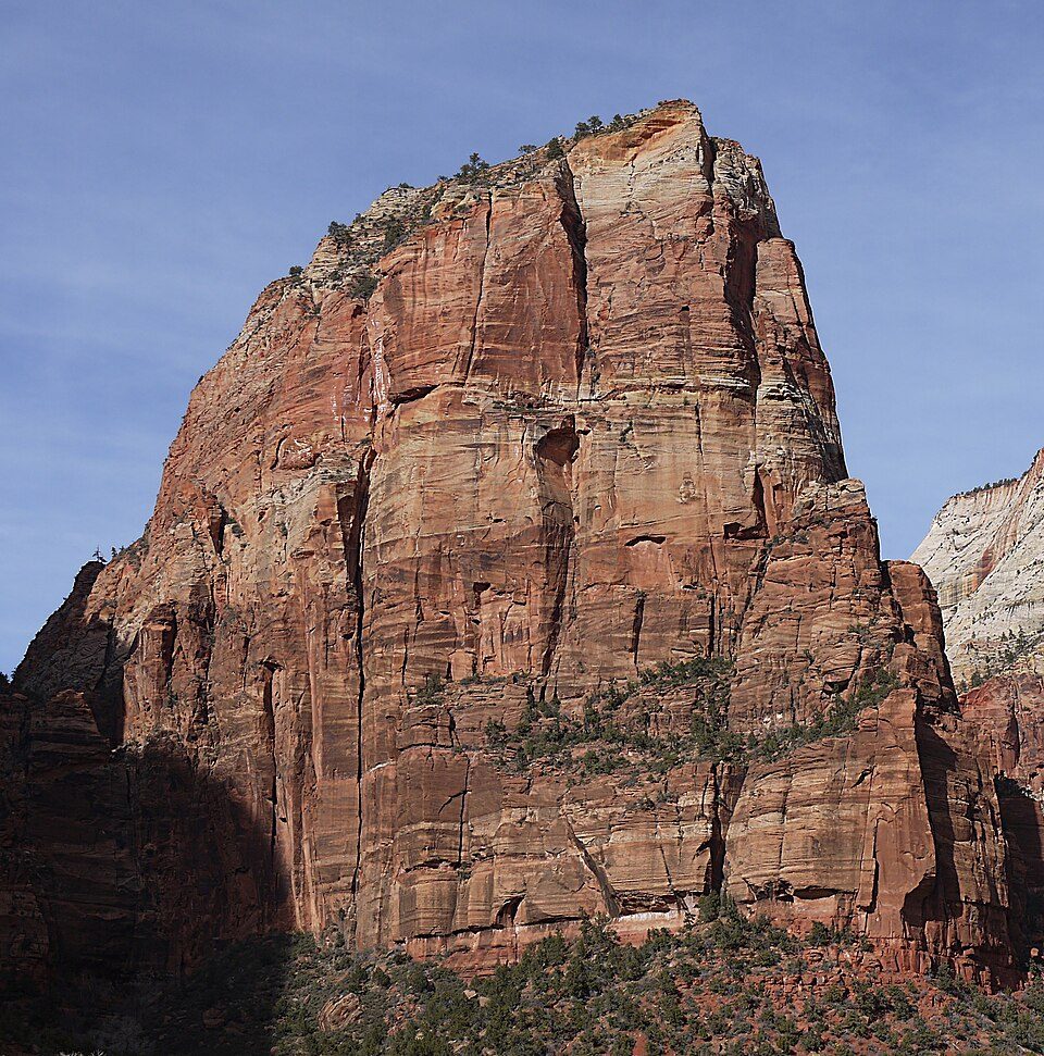
37 mi MountainAngels Landing
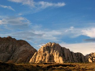
9 mi State parkSnow Canyon State Park
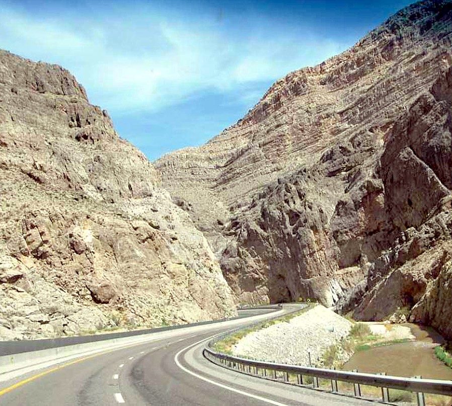
19 mi Canyon & gorgeVirgin River Gorge
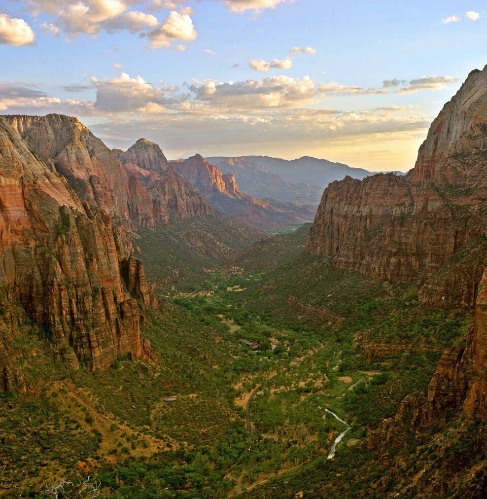
32 mi Canyon & gorgeZion Canyon
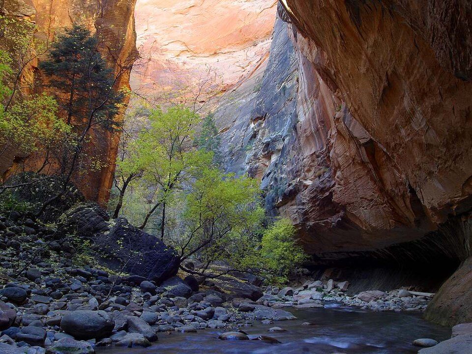
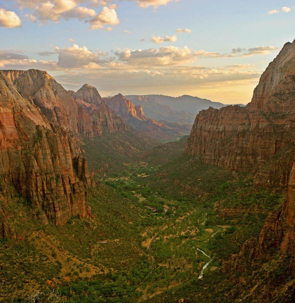
38 mi Canyon & gorgeThe NarrowsZion National Park: Diliff, CC BY-SA 3.0 · Angels Landing: Óðinn, CC BY-SA 2.5 ca · Snow Canyon State Park: Unknown, CC BY 2.5 · Virgin River Gorge: inkknife_2000 (7.5 million views +), CC BY-SA 2.0 · Zion Canyon: No machine-readable author provided. Antilived assumed (based on copyright claim, CC BY-SA 3.0 · The Narrows: Jon Sullivan, Public domain
1 within 15 miles of the center of St. George
About 7 of every 100 St. George residents are enrolled in college, about the same as Utah.
72,897 counted in 2010 and 95,342 in 2020; an estimated 108,713 in 2025.
Growth hasn’t slowed: 14% since 2020, after 30.8% in the decade before.
U.S. Census 2010 & 2020 counts · Census Bureau estimate, July 1, 2025
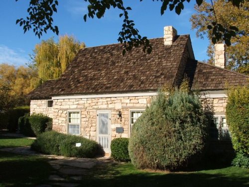
14 places in St. George on the National Register of Historic Places.
19 notable people were born in St. George.
City in Utah, United States
St. George or Saint George is a city in and the county seat of Washington County, Utah, United States. It is Utah's fifth-most populous city and the largest outside the Wasatch Front, with a population of 95,342 at the 2020 census. The St. George metropolitan statistical area has an estimated 208,000 residents. Located in southwestern Utah on the Arizona-Utah border, it lies in the northeasternmost part of the Mojave Desert, immediately south of the Pine Valley Mountains, which mark the southern boundary of the Great Basin. St. George lies slightly northwest of the Colorado Plateau, which ends at the Hurricane Fault. St. George was settled in 1861 to be a cotton mission, earning it the nick…
From Wikipedia, licensed CC BY-SA 4.0 · facts via Wikidata (CC0)
3 towns share a border with St. George.
| Town | UT rank | Overall | Cost | Safety | Schools | Health |
|---|---|---|---|---|---|---|
| St. George | #91 | B− | C− | B− | B+ | A− |
| Washington | #80 | B | C− | B | B+ | A |
| Santa Clara | #85 | B | C− | — | B+ | A |
| Ivins | #106 | C | D | — | B+ | A− |
Santa Clara and Ivins report no FBI crime data of their own. Compare St. George with a neighbor →
Short answers, built from the data on this page.
St. George grades B− overall, better than 54% of U.S. towns and #91 of 118 in Utah. It grades A− for health, B− for safety and B+ for schools. Hazard risk is its weak spot, with a D.
Yes. George, UT metro area). Cost of living, which also weighs rents, property taxes and how many households pay 30% or more of their income for housing, grades C−.
St. 19 notable people were born here, including Amanda Righetti and Brendon Urie.