129 years in pictures
Census counts: 120 in 1910, 4,354 in 2020. The archive holds 24 old photos and papers going back to 2005 and 2 maps from 1954 on.
2 places on the National Register of Historic Places.
- 1897La Verkin is settled
Each edition grades its towns against each other only.

La Verkin's standout: it has 48 miles of trail and 73% conserved land. Overall it grades C−, ranked 112th of 118 in Utah. Its weakest subject is incomes: the median household income is $68K, and 24% of residents live below the poverty line. La Verkin’s July high is 100°F, above both Utah’s towns (92°F) and U.S. towns (85°F). On health, just 7 of Utah’s 172 towns do worse. La Verkin has 2 places on the National Register of Historic Places, among them Hurricane-LaVerkin Bridge and La Verkin Hydroelectric Power Plant.
Where La Verkin beats most towns.
| School | Grades | Students |
|---|---|---|
| LaVerkin School | PK–5 | 447 |
| Sunrise Academy | 8–12 | 35 |
Hurricane-LaVerkin Bridge73.2% of the town is conserved land, across 6 parks and preserves.
Each subject compared with towns across the country (schools within Utah), ordered by how far La Verkin is from typical.
How TownRatings grades towns →
Census counts: 120 in 1910, 4,354 in 2020. The archive holds 24 old photos and papers going back to 2005 and 2 maps from 1954 on.
2 places on the National Register of Historic Places.
Museums, parks, gardens and other places to visit around La Verkin. Close and well known come first.
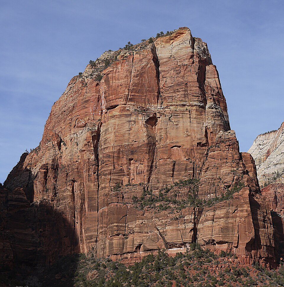
Big draw7 mi National ParkZion National Park5.0M visitors a year
17 mi MountainAngels Landing
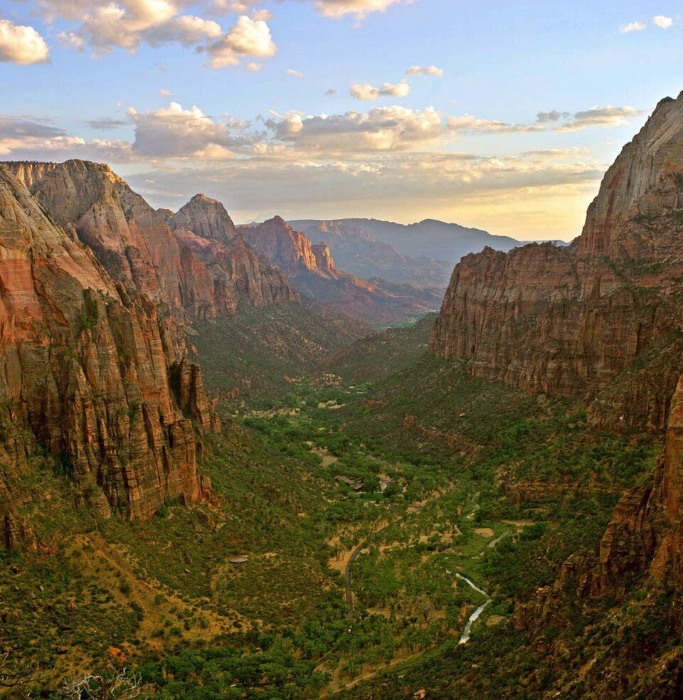
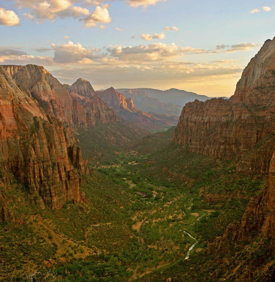
14 mi Canyon & gorgeZion Canyon
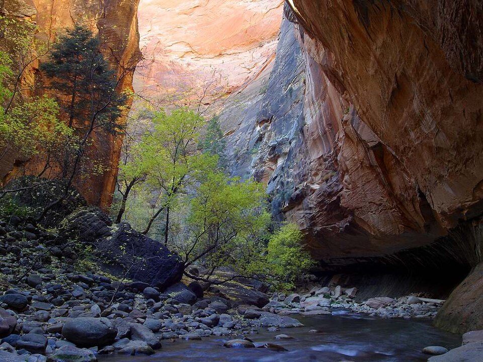
17 mi Canyon & gorgeThe Narrows
22 mi State parkSnow Canyon State Park
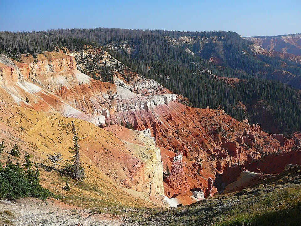
34 mi National MonumentCedar Breaks National Monument718K visitors a yearZion National Park: Diliff, CC BY-SA 3.0 · Angels Landing: Óðinn, CC BY-SA 2.5 ca · Zion Canyon: No machine-readable author provided. Antilived assumed (based on copyright claim, CC BY-SA 3.0 · The Narrows: Jon Sullivan, Public domain · Snow Canyon State Park: Unknown, CC BY 2.5 · Cedar Breaks National Monument: Original uploader was Averette at en.wikipedia, CC BY 3.0
Who provides power, water and the rest in La Verkin, and how to reach them.
EPA SDWIS (Oct 9, 2026) · HIFLD + EIA-861 2025 · Census 2020 ZCTAs · NCES 2024–25 · registration: vote.gov, updated Mar 13, 2026.
Ordered by what stands out in La Verkin.
La Verkin keeps more of its land conserved than most of Utah and has more 90° days than nearly all U.S. towns, but it is a long drive from an emergency room.
Its 6,367 conserved acres are a larger share of the town than in 98% of Utah towns. Its A+ for the outdoors ranks #1 of 119 in Utah.
48 miles of trail in 6 parks and preserves. The trail density in La Verkin is 3.6 miles per square mile. Blackridge Wilderness, at 536 acres with 1.5 miles of trail, is the biggest park or preserve.
| Biggest places to walk | Trails | Acres |
|---|---|---|
| 1. Confluence Park | 3.4 mi | 156 |
| 2. Hurricane Cliffs Recreation Area | 2.5 mi | 172 |
| 3. Blackridge Wilderness | 1.5 mi | 536 |
Trails & parks © OpenStreetMap contributors · Conserved land: USGS PAD-US
Its public schools are run by the Washington District. Its two schools are below.
| School | Level | Students | Letter |
|---|---|---|---|
| LaVerkin SchoolLargest public elementary schoolGrades PK–5 | Grades PK–5 | 447 | B− |
| Sunrise Academy PrivateLargest high schoolGrades 8–12 | Grades 8–12 | 35 | – |
NCES · EDFacts · graded within UT on state tests and graduation
Jobs based here grew from 427 in 2013 to 763.
Most working residents leave La Verkin for work: only 9% work in town. La Verkin’s average trip to work is 29 minutes. Since 2013, La Verkin has added 336 jobs, to 763 in 2023.
| La Verkin | Utah towns | U.S. towns | |
|---|---|---|---|
| Average trip to work | 29 minutes | 22 minutes | 25 minutes |
| Median household income | $68,000 | $101,000 | $80,000 |
Census LEHD 2023 · ACS
Expected storm and flood damage is higher than in 72% of U.S. communities.
FEMA National Risk Index · OpenFEMA
The La Verkin weather station records that about 118 days a year reach 90°, more than in 98% of U.S. towns. July afternoons average 100.1°, hotter than in 99% of U.S. towns; January nights average 29.1°.
La Verkin has mild winters and scorching summers, with very little rain. Only 5 of the 119 Utah towns we compare have a higher January low than La Verkin. About 1 inches of snow falls in a winter.
NOAA U.S. Climate Normals, 1991–2020
Its typical home is the least expensive on its borders; Hurricane is next at $498K.
The typical La Verkin home is worth about $430,000, down 1.4% in a year, 19% below the Utah typical home.
| La Verkin | Utah towns | U.S. towns | |
|---|---|---|---|
| Median rent | $1,392 a month | $1,542 a month | $1,185 a month |
| Households that own their home | 76% | 79% | 73% |
Zillow Home Value Index · Redfin Data Center
At 20.7 crimes per 1,000 residents a year, it reports more crime than 67% of Utah’s graded towns.
FBI crime data, 2025 · crimes reported to police
The nearest emergency room, St. George Regional Hospital, is 21.2 miles away in a straight line.
16% of La Verkin adults report frequent physical distress. Only 3 of the 118 Utah towns we compare have a higher share of adults who say their health is fair or poor than La Verkin. 18% of La Verkin adults report frequent mental distress.
| La Verkin | Utah towns | U.S. towns | |
|---|---|---|---|
| Binge drink (CDC PLACES) | 9.9% | 11% | 16% |
| Frequent physical distress (CDC PLACES) | 16% | 12% | 14% |
| Yearly checkup (CDC PLACES) | 71% | 72% | 79% |
| Fair or poor health (CDC PLACES) | 22% | 15% | 19% |
| What stands out | La Verkin | UT |
|---|---|---|
| Fewer binge drinkers | 9.9% | 12.4% |
| More adults treating high blood pressure | 71% | 65.6% |
| More adults with COPD | 8% | 4.6% |
CDC PLACES 2025 · modeled estimates for adults · CMS · HRSA
None within 15 miles of La Verkin; the nearest are
About 5 of every 100 La Verkin residents are enrolled in college, against 8 across Utah.
Where La Verkin’s working residents go each day. Line width shows the share.
Census LEHD 2023
City in Utah, United States
La Verkin is a city in Washington County, Utah, United States. The population was 4,354 as of 2020, an increase from 4,060 in 2010.
From Wikipedia, licensed CC BY-SA 4.0 · facts via Wikidata (CC0)
3 towns share a border with La Verkin.
| Town | UT rank | Overall | Cost | Safety | Schools | Health |
|---|---|---|---|---|---|---|
| La Verkin | #112 | C− | C | B− | B+ | B− |
| Hurricane | #93 | B− | C− | B− | B+ | B+ |
| Toquerville | — | — | C+ | — | B+ | A− |
| Virgin | — | — | — | — | — | — |
Toquerville has fewer than 2,500 residents, so it gets subject grades but no overall grade. Toquerville reports no FBI crime data of its own. Virgin isn’t graded (fewer than 1,000 residents, or not enough data). Compare La Verkin with a neighbor →
Short answers, built from the data on this page.
La Verkin grades C− overall, better than 24% of U.S. towns and #112 of 118 in Utah. It grades B− for health, B− for safety and B+ for schools. Jobs & income is its weak spot, with a C−.
That is 5.3 years of the area's median household income ($80,632 across the St. George, UT metro area). Cost of living, which also weighs rents, property taxes and how many households pay 30% or more of their income for housing, grades C.