Guest, Sign inJoin
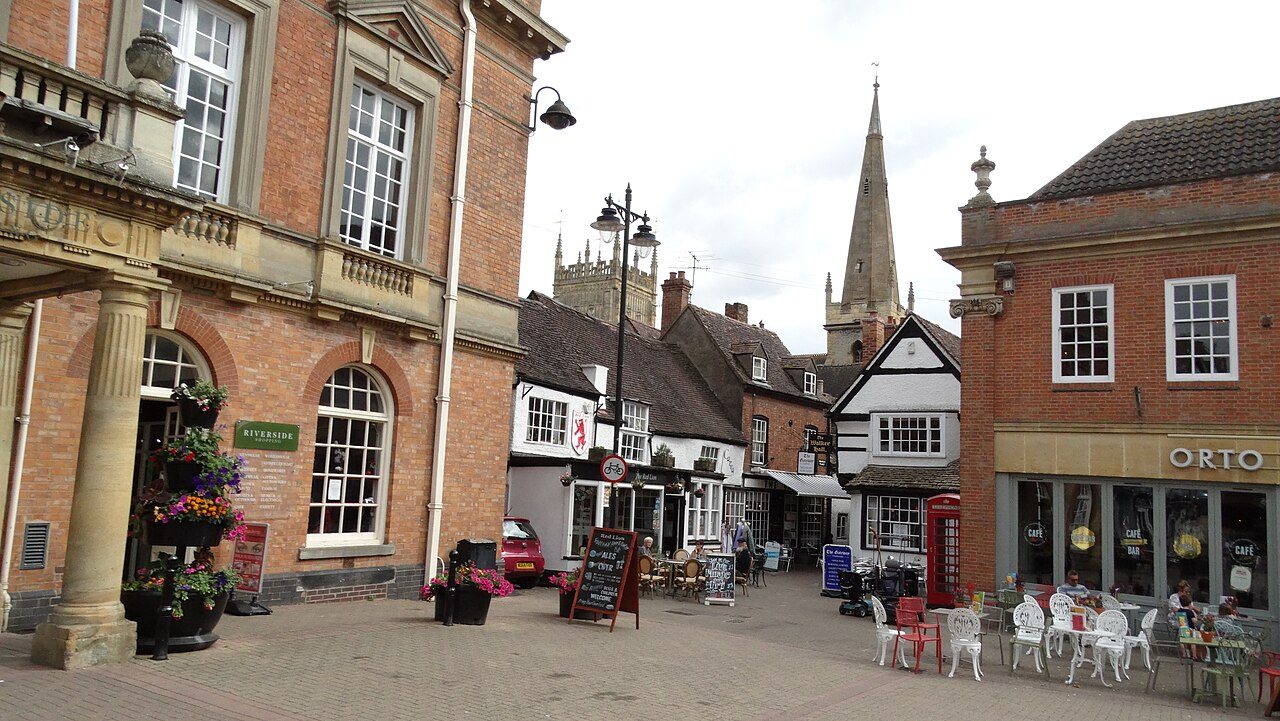
Evesham - Market PlacePhoto: Colin Park · CC BY-SA 2.0
B−Outdoors Grade
Outdoors in Evesham · parks, paths & countryside

80% of Evesham’s residents live within a 5-minute walk of a park

The Cotswolds National Landscape begins 1.8 mi from the town’s edge. Footpaths add up to 97 km in the town and the kilometre around it, 3.5 for every square kilometre. Parks and playing fields in Evesham add up to 1.7 ha for every 1,000 residents; the typical UK town has 2.1. Evesham grades B− for the outdoors: #10 of 22 in Worcestershire. A character grade: it isn’t part of the overall grade.

Green space
1.7 ha
per 1,000 residents
Typical UK town 2.1
Near a park
80%
of residents within 400 m
Typical UK town 83%
Footpaths
97 km
3.5 km per km², town + 1 km
Typical UK town 3.0 per km²
Protected landscape
4%
of the land within 5 km
Nearest: Cotswolds National Landscape
Character

What kind of outdoors town is Evesham?

Read from the data: what stands out first, good and bad.

Evesham’s strongest suit is the Cotswolds National Landscape close by. Where it falls short is park space per person.

Outdoors grade

Evesham grades B− for the outdoors

Each chart is every UK town of 1,000 or more on one measure: the green bar is Evesham, the dashed line the typical town. The number is the share of towns it beats; the five are averaged and the average ranked again.

B−
Better than 54% of UK towns#10 of 22 in Worcestershire · 42nd of 60 UK towns its size
Public green space1.7 haper 1,000 residents: parks, gardens, playing fields, play spaces
typical 2.1 ha010+
35out of
100
A park within a walk80%of residents within 400 m (a 5-minute walk)
typical 83%0100+
48out of
100
National Park or National Landscape4%of the land within 5 km
none100+
67out of
100
Footpaths3.5 kmper km², the town and 1 km around it
typical 3.0 km010+
70out of
100
The sea0%of the area within 5 km · Inland
none80+
42out of
100

Graded, never part of the overall grade (like History and Civic life). It measures what is mapped: OS Open Greenspace leaves out woodland and open-access land that isn’t a park, and OpenStreetMap’s rural paths are more complete in some places than others.

Towns its size

Evesham is 42nd of 60 UK towns its size for the outdoors

The 60 UK towns and cities of 26,100 to 30,600 people with an Outdoors Grade. Hover a dot for its figures; tap one for its page.

0255075100Wisbech (Cambridgeshire): D · 1.2 ha green space per 1,000 · 79% near a park · 1.4 km path per km²Spalding (Lincolnshire): D · 1.1 ha green space per 1,000 · 85% near a park · 1.5 km path per km²Ormskirk (Lancashire): D · 1.5 ha green space per 1,000 · 80% near a park · 1.8 km path per km²Heswall (Merseyside): C− · 1.1 ha green space per 1,000 · 56% near a park · 2.3 km path per km²Heywood (Greater Manchester): C− · 1.3 ha green space per 1,000 · 80% near a park · 2.8 km path per km²Hertford (Hertfordshire): C · 0.9 ha green space per 1,000 · 65% near a park · 5.3 km path per km²Congleton (Cheshire): C · 1.7 ha green space per 1,000 · 72% near a park · 3.1 km path per km²Wickford (Essex): C · 2.4 ha green space per 1,000 · 59% near a park · 3 km path per km²Frome (Somerset): C · 1.3 ha green space per 1,000 · 78% near a park · 2.4 km path per km²Walton-on-Thames (Surrey): C · 1.6 ha green space per 1,000 · 81% near a park · 3.4 km path per km²Newark-on-Trent (Nottinghamshire): C · 2.2 ha green space per 1,000 · 91% near a park · 2 km path per km²Stratford-upon-Avon (Warwickshire): C · 1.6 ha green space per 1,000 · 84% near a park · 3.2 km path per km²Newton Abbot (Devon): C+ · 2.6 ha green space per 1,000 · 62% near a park · 2.3 km path per km²Horley (Surrey): C+ · 1.9 ha green space per 1,000 · 84% near a park · 3.4 km path per km²Kendal (Cumbria): C+ · 0.9 ha green space per 1,000 · 67% near a park · 4 km path per km²Melton Mowbray (Leicestershire): B− · 3.3 ha green space per 1,000 · 84% near a park · 2.4 km path per km²Ashton-in-Makerfield (Greater Manchester): B− · 2.6 ha green space per 1,000 · 93% near a park · 2.5 km path per km²Stanford-le-Hope (Essex): B− · 2.6 ha green space per 1,000 · 84% near a park · 1.4 km path per km²Evesham (Worcestershire): B− · 1.7 ha green space per 1,000 · 80% near a park · 3.5 km path per km²Droitwich Spa (Worcestershire): B · 2.5 ha green space per 1,000 · 84% near a park · 3.8 km path per km²Rhyl (Clwyd): B · 1 ha green space per 1,000 · 84% near a park · 2.2 km path per km²Bushey (Hertfordshire): B · 3.1 ha green space per 1,000 · 77% near a park · 4 km path per km²Atherton (Greater Manchester): B · 3.8 ha green space per 1,000 · 83% near a park · 3.1 km path per km²Egham (Surrey): B · 4.1 ha green space per 1,000 · 63% near a park · 4.9 km path per km²Witham (Essex): B · 1.9 ha green space per 1,000 · 94% near a park · 4.1 km path per km²Rugeley (Staffordshire): B · 1.2 ha green space per 1,000 · 94% near a park · 2.7 km path per km²Darwen (Lancashire): B · 2.2 ha green space per 1,000 · 89% near a park · 4.5 km path per km²Consett (County Durham): B · 1.7 ha green space per 1,000 · 87% near a park · 3.1 km path per km²Shipley (West Yorkshire): B · 2.1 ha green space per 1,000 · 87% near a park · 6 km path per km²Colwyn Bay (Clwyd): B+ · 1.9 ha green space per 1,000 · 77% near a park · 2.4 km path per km²Pontypool (Gwent): B+ · 3.6 ha green space per 1,000 · 93% near a park · 1.8 km path per km²Farnworth (Greater Manchester): B+ · 3 ha green space per 1,000 · 85% near a park · 4.4 km path per km²Deal (Kent): B+ · 1 ha green space per 1,000 · 86% near a park · 2.7 km path per km²Fleetwood (Lancashire): B+ · 2.7 ha green space per 1,000 · 92% near a park · 1.8 km path per km²Longbenton (Tyne and Wear): B+ · 3.3 ha green space per 1,000 · 80% near a park · 6.2 km path per km²Haverhill (Suffolk): B+ · 2.4 ha green space per 1,000 · 91% near a park · 5 km path per km²Portishead (Somerset): B+ · 2 ha green space per 1,000 · 82% near a park · 3.3 km path per km²Cramlington (Northumberland): B+ · 2.3 ha green space per 1,000 · 91% near a park · 6.6 km path per km²Eston (North Yorkshire): B+ · 2.9 ha green space per 1,000 · 93% near a park · 2.8 km path per km²Daventry (Northamptonshire): A− · 4.1 ha green space per 1,000 · 99% near a park · 3.3 km path per km²Cleethorpes (Lincolnshire): A− · 3 ha green space per 1,000 · 84% near a park · 2.7 km path per km²East Grinstead (West Sussex): A− · 1.6 ha green space per 1,000 · 87% near a park · 3.7 km path per km²Great Yarmouth (Norfolk): A− · 1.7 ha green space per 1,000 · 73% near a park · 3.2 km path per km²Tadworth and Epsom Downs (Surrey): A− · 3.4 ha green space per 1,000 · 65% near a park · 5.3 km path per km²Stretford (Greater Manchester): A− · 3.7 ha green space per 1,000 · 92% near a park · 4.9 km path per km²Ewell (Surrey): A− · 7.5 ha green space per 1,000 · 89% near a park · 4.4 km path per km²Rickmansworth (Hertfordshire): A− · 2.9 ha green space per 1,000 · 81% near a park · 4.4 km path per km²Larkfield (Kent): A− · 5.6 ha green space per 1,000 · 75% near a park · 3.4 km path per km²Burntwood (Staffordshire): A− · 5.3 ha green space per 1,000 · 81% near a park · 3.4 km path per km²Totton (Hampshire): A · 1.6 ha green space per 1,000 · 94% near a park · 4.4 km path per km²Lancing and Sompting (West Sussex): A · 1.8 ha green space per 1,000 · 80% near a park · 3 km path per km²Woodley (Berkshire): A · 5 ha green space per 1,000 · 81% near a park · 4.3 km path per km²Witney (Oxfordshire): A · 2.5 ha green space per 1,000 · 88% near a park · 4.6 km path per km²Penarth (South Glamorgan): A · 3.5 ha green space per 1,000 · 83% near a park · 4.1 km path per km²Ashington (Northumberland): A · 5.6 ha green space per 1,000 · 83% near a park · 3.9 km path per km²Stalybridge (Greater Manchester): A · 5 ha green space per 1,000 · 82% near a park · 4.8 km path per km²Sevenoaks (Kent): A · 8.1 ha green space per 1,000 · 76% near a park · 3.8 km path per km²Northfleet (Kent): A · 2 ha green space per 1,000 · 85% near a park · 7.7 km path per km²Jarrow (Tyne and Wear): A+ · 5.3 ha green space per 1,000 · 90% near a park · 6.1 km path per km²Yate (Gloucestershire): A+ · 4.3 ha green space per 1,000 · 99% near a park · 6.8 km path per km²Evesham
Outdoors score: the share of UK towns each one beats
Footpath, km per km²
Evesham3.5
Towns its size3.4
Worcestershire towns2.8
All UK towns3.0
Green space, ha per 1,000 residents
Evesham1.7
Towns its size2.4
Worcestershire towns2.3
All UK towns2.1
Residents within 400 m of a park
Evesham80%
Towns its size84%
Worcestershire towns80%
All UK towns83%

Evesham falls furthest behind on park space per resident, where 43 of the 59 others do better.

Show as a table
TownOutdoorsGreen spaceNear a parkPath per km²Protected
1Yate GloucestershireA+4.399%6.811%
2Jarrow Tyne and WearA+5.390%6.10%
3Northfleet KentA285%7.74%
4Sevenoaks KentA8.176%3.870%
5Stalybridge Greater ManchesterA582%4.812%
6Ashington NorthumberlandA5.683%3.90%
7Penarth South GlamorganA3.583%4.10%
8Witney OxfordshireA2.588%4.619%
9Woodley BerkshireA581%4.31%
10Lancing and Sompting West SussexA1.880%337%
11Totton HampshireA1.694%4.450%
12Burntwood StaffordshireA−5.381%3.412%
13Larkfield KentA−5.675%3.427%
14Ewell SurreyA−7.589%4.40%
15Rickmansworth HertfordshireA−2.981%4.411%
16Stretford Greater ManchesterA−3.792%4.90%
17Tadworth and Epsom Downs SurreyA−3.465%5.316%
18Great Yarmouth NorfolkA−1.773%3.218%
19East Grinstead West SussexA−1.687%3.758%
20Cleethorpes LincolnshireA−384%2.70%
21Daventry NorthamptonshireA−4.199%3.30%
22Eston North YorkshireB+2.993%2.82%
23Cramlington NorthumberlandB+2.391%6.60%
24Portishead SomersetB+282%3.30%
25Haverhill SuffolkB+2.491%50%
26Longbenton Tyne and WearB+3.380%6.20%
27Fleetwood LancashireB+2.792%1.80%
28Deal KentB+186%2.76%
29Farnworth Greater ManchesterB+385%4.40%
30Pontypool GwentB+3.693%1.87%
31Colwyn Bay ClwydB+1.977%2.40%
32Shipley West YorkshireB2.187%60%
33Consett County DurhamB1.787%3.119%
34Darwen LancashireB2.289%4.50%
35Rugeley StaffordshireB1.294%2.737%
36Witham EssexB1.994%4.10%
37Egham SurreyB4.163%4.90%
38Bushey HertfordshireB3.177%40%
39Atherton Greater ManchesterB3.883%3.10%
40Rhyl ClwydB184%2.27%
41Droitwich Spa WorcestershireB2.584%3.80%
42Evesham WorcestershireB−1.780%3.54%
43Stanford-le-Hope EssexB−2.684%1.40%
44Ashton-in-Makerfield Greater ManchesterB−2.693%2.50%
45Melton Mowbray LeicestershireB−3.384%2.40%
46Kendal CumbriaC+0.967%433%
47Horley SurreyC+1.984%3.40%
48Newton Abbot DevonC+2.662%2.36%
49Stratford-upon-Avon WarwickshireC1.684%3.20%
50Newark-on-Trent NottinghamshireC2.291%20%
51Walton-on-Thames SurreyC1.681%3.40%
52Frome SomersetC1.378%2.49%
53Wickford EssexC2.459%30%
54Congleton CheshireC1.772%3.10%
55Hertford HertfordshireC0.965%5.30%
56Heywood Greater ManchesterC−1.380%2.80%
57Heswall MerseysideC−1.156%2.30%
58Ormskirk LancashireD1.580%1.80%
59Spalding LincolnshireD1.185%1.50%
60Wisbech CambridgeshireD1.279%1.40%
The map

Parks, footpaths & countryside

Tap a number to zoom to a park. Tap a layer to hide it. The dashed line is Evesham’s built-up area.

12345678
Green space: parks, gardens, playing fields and play spaces, named or not.© OpenStreetMap contributors · Contains OS data © Crown copyright · Natural England / NRW
Places to walk

Parks to walk in, in and around Evesham

The biggest is The Valley, 10 ha (25 acres). Directions go to the park’s nearest public entrance where Ordnance Survey maps one.

All 16 named parks by size: 41 ha (102 acres) and 8 km of pathThe Valley10 ha · 1.3 km of pathThe Valley: 10 ha, 1.3 km of pathAbbey Park8.4 ha · 2.1 km of…Abbey Park: 8.4 ha, 2.1 km of pathThe Rowing Club5.0 ha · 0.2 km of…The Rowing Club: 5.0 ha, 0.2 km of pathCharity Brook P…3.3 ha · 0.7 km of…Charity Brook Park: 3.3 ha, 0.7 km of pathSt Richards Op…2.9 ha · 0.2 km o…St Richards Open Space: 2.9 ha, 0.2 km of pathCorporation…2.5 ha · 0.4 k…Corporation Meadow: 2.5 ha, 0.4 km of pathCommon M…1.7 ha · 0.…Common Meadow: 1.7 ha, 0.6 km of pathCotswold…1.6 ha · 0.…Cotswold Rise Open Space: 1.6 ha, 0.4 km of path2 haLavender Fields Open Space: 1.6 ha, 0.7 km of path1 haHawthorn Road Open Space: 1.5 ha, 0.3 km of path1 haWorkman Gardens: 1.1 ha, 1 km of path1 haBadsey Lane Nature Reserve: 1.1 ha, 0.4 km of pathWaterside Gardens: 0.2 ha, 0.2 km of pathLavender Fields Play Area: 0.2 haFairwater Close Open Space: 0.1 haCotswold Rise Play Area: 0.0 ha
Parks & gardens 33 haPlaying fields 8.3 haPlay spaces 0.2 ha

The two biggest, The Valley and Abbey Park, are 45% of the named green space and carry 3 km of path between them. 10 of the 16 are under 2 ha: small gardens, play spaces and pitches.

Evesham’s biggest

The Valley

Park or garden · 330 m outside town
10 ha (25 acres)1.3 km of path
15 minto walk all 1.3 km of path
14 pitchesfootball pitches would fit
2.1 mi northfrom the centre
Directionsto the nearest entrance

Abbey Park

Park or garden
8.4 ha (21 acres)2.1 km of path
30 minto walk all 2.1 km of path
12 pitchesfootball pitches would fit
Centralin the middle of Evesham
3 playgrounds 1 listed
Directionsto the nearest entrance

Charity Brook Park

Playing field
3.3 ha (8 acres)0.7 km of path
10 minto walk all 0.7 km of path
5 pitchesfootball pitches would fit
0.5 mi southfrom the centre
Playground
Directionsto the nearest entrance

The Rowing Club

Playing field
5.0 ha (12 acres)0.2 km of path
7 pitchesfootball pitches would fit
Centralin the middle of Evesham
Playground
Directionsto the nearest entrance

St Richards Open Space

Park or garden
2.9 ha (7 acres)0.2 km of path
4 pitchesfootball pitches would fit
Centralin the middle of Evesham
Directionsto the nearest entrance

Corporation Meadow

Park or garden
2.5 ha (6 acres)0.4 km of path
4 pitchesfootball pitches would fit
Centralin the middle of Evesham
Directionsto the nearest entrance

Workman Gardens

Park or garden
1.1 ha (3 acres)1.0 km of path
15 minto walk all 1 km of path
Centralin the middle of Evesham
Directionsto the nearest entrance

Common Meadow

Park or garden
1.7 ha (4 acres)0.6 km of path
10 minto walk all 0.6 km of path
2 pitchesfootball pitches would fit
0.6 mi northfrom the centre
Directionsto the nearest entrance
All 16 named parks and green spaces
The ValleyPark or garden · 10 ha · 1.3 km of path · just outside town
Directions
Abbey ParkPark or garden · 8.4 ha · 2.1 km of path
Directions
Charity Brook ParkPlaying field · 3.3 ha · 0.7 km of path
Directions
The Rowing ClubPlaying field · 5.0 ha · 0.2 km of path
Directions
St Richards Open SpacePark or garden · 2.9 ha · 0.2 km of path
Directions
Corporation MeadowPark or garden · 2.5 ha · 0.4 km of path
Directions
Workman GardensPark or garden · 1.1 ha · 1.0 km of path
Directions
Common MeadowPark or garden · 1.7 ha · 0.6 km of path
Directions
Lavender Fields Open SpacePark or garden · 1.6 ha · 0.7 km of path
Directions
Cotswold Rise Open SpacePark or garden · 1.6 ha · 0.4 km of path
Directions
Hawthorn Road Open SpacePark or garden · 1.5 ha · 0.3 km of path
Directions
Badsey Lane Nature ReservePark or garden · 1.1 ha · 0.4 km of path
Directions
Waterside GardensPark or garden · 0.2 ha · 0.2 km of path
Directions
Fairwater Close Open SpacePark or garden · 0.1 ha
Directions
Lavender Fields Play AreaPlay space · 0.2 ha
Directions
Cotswold Rise Play AreaPlay space · 0.0 ha
Directions
Close to home

How close Evesham’s homes are to a park

Each square is 1 in 100 residents: green lives within 400 m of a public park, garden or playing field (Census 2021 output areas against OS Open Greenspace).

Within 400 m (80%)Further (20%)
Evesham80%
Towns its size84%
Worcestershire towns80%
All UK towns83%

About 6,000 people live further than that. Playing fields count, so a park within reach isn’t always one with paths or trees; 29 playgrounds are mapped in and around the town, about one for every 974 residents.

National Parks & National Landscapes

The Cotswolds National Landscape is 1.8 mi away

Protected landscapes within 30 km, by direction and distance from the edge of the built-up area; circle size shows each one’s area. National Landscapes were called Areas of Outstanding Natural Beauty until 2023.

3.8 mi7.5 mi11.3 mi15 miNCotswolds1.8 mi south-westCotswolds National Landscape: 1.8 mi south-west of Evesham’s edge · 2,041 km² · since 1966Malvern Hills14 mi westMalvern Hills National Landscape: 14 mi west of Evesham’s edge · 107 km² · since 1959Evesham
National ParkNational LandscapeThe 5 km the grade counts
National Landscape

Cotswolds

1.8 mi south-west2,041 km²since 19664% of the land within 5 km
Official site
National Landscape

Malvern Hills

14 mi west107 km²since 1959
Official site

4% of the land within 5 km of Evesham is National Park or National Landscape, more than 67% of UK towns.

Footpaths & waymarked walks

2 waymarked walks pass through or near Evesham

97 km of footpaths, bridleways and rights of way are mapped in Evesham and the kilometre around it, 3.5 km for every square kilometre (the typical UK town has 3.0). Bars show each route’s kilometres within 2 km of the town.

RegionalLocal
Shakespeare's Avon Way11.1 km
Isbourne Way1.8 km

The regional route here is the Shakespeare's Avon Way.

Waymarked walks are OpenStreetMap walking routes. Public rights of way are only as complete as the map in each area.

When to get out

The best walking months in Evesham: May to September

The town’s 1991–2020 averages (Met Office HadUK-Grid) and the daylight at its latitude. Outlined months have 12½+ hours of daylight, highs of 15 °C or more and little rain for the town.

JanFebMarAprMayJunJulAugSepOctNovDec
Daylight (h)8.29.811.713.815.716.716.314.612.610.58.77.8
High (°C)891114172023221915118
Rain (mm)554140495556606552656363

March is the driest month (40 mm) and July the warmest (highs of 23 °C). Winter days are short, about 8 hours of daylight in December, and 65 mm of rain falls in August, the wettest month. Frost comes on about 43 nights a year. The climate in Evesham →

Things to do

2 viewpoints and 29 playgrounds

Mapped within 2 km of the town in OpenStreetMap, against the typical UK town its size per resident. Named places are listed with directions; unnamed ones are only counted.

Every named place, with directions

Viewpoints 2

Plus 2 viewpoints without a name on the map.

Hills and peaks 4

Clark's Hill0.1 mi from town
Directions
Knowle Hill0.4 mi from town
Directions
Bennetts Hill1.1 mi from town
Directions

Plus 1 peak without a name on the map.

Nature reserves 3

Badsey Lane Nature Reserve1.0 ha · in town
Directions
Battleton Brook Open Space1.8 ha · 0.0 mi from town
Directions
New Farm Nature Reserve63 ha · 1.2 mi from town
Directions

Picnic sites 5

Plus 5 picnic sites without a name on the map.

Playgrounds 29

Charity Brook Park Toddlers Play Areain town
Directions
Cotswold Rise Play Areain town
Directions
Crown Meadow Play Areain town
Directions
Evesham Adventure Playgroundin town
Directions
Play Zonein town
Directions
Woodlands Play Areain town
Directions
Water fountain play0.0 mi from town
Directions
Badsey Remembrance Hall Play Area0.7 mi from town
Directions

Plus 21 playgrounds without a name on the map.

Dog parks 3

Little Orchard0.0 mi from town
Directions
Large Orchard0.0 mi from town
Directions
Evesham Dog Walking Field0.3 mi from town
Directions

Campsites 1

Lenchways C & CC0.2 mi from town
Directions

Slipways 2

Plus 2 slipways without a name on the map.

Next door

The outdoors in nearby towns

The nearest towns of 1,000+ within 12 miles. Tap a town for its outdoors page.

ABCDOutdoors Grade
TownOutdoorsGreen space, ha per 1,000Near a parkProtected within 5 km
EveshamB−1.780%4%
Offenham 2.0 miB+2.4100%0%
Badsey 2.0 miC2.854%5%
Bretforton 3.2 miD−0.20%9%
Harvington 3.8 miC+2.6100%0%
Honeybourne 4.8 miB2.980%14%
Broadway 4.8 miB2.065%56%

Offenham, 2 miles away, grades B+, the best next door: every resident lives within 400 m of a park.

Questions about the outdoors in Evesham

What is the biggest park in Evesham?

The Valley, 10 ha (25 acres), with 1.3 km of path, just outside the built-up area. Abbey Park (8.4 ha) is second. 16 named parks, gardens and playing fields are in the town or within 400 m of it.

Is Evesham near a National Park?

The nearest protected landscape is the Cotswolds National Landscape, 1.8 mi south-west of the town’s edge. It covers 2,041 km² and was designated in 1966.

What are the best walks near Evesham?

2 waymarked walking routes pass within 2 km of the town, including the Shakespeare's Avon Way and Isbourne Way.

How many people in Evesham live near a park?

80% of residents live within 400 m, about a 5-minute walk, of a public park, garden or playing field (Census 2021 output areas against OS Open Greenspace). The typical UK town is 83%.

When is the best time of year for walking in Evesham?

May to September: the longest days, the warmest afternoons and the least rain of the year, from the Met Office 1991–2020 averages.

Is Evesham good for walking?

For paths, yes: 3.5 km of footpath and right of way per square kilometre, more than 70% of UK towns. For park space per person it beats 35% (1.7 ha per 1,000 residents).

How is the Outdoors Grade worked out?

From five measures, each placed among UK towns of 1,000 or more: public green space per resident, the share living near a park, National Park or National Landscape within 5 km, footpaths per square kilometre, and the sea within 5 km. It is a character grade and isn’t part of Evesham’s overall grade.

Sources

Where Evesham’s outdoors figures come from

  • Parks and green space: Ordnance Survey OS Open Greenspace (parks and gardens, playing fields, play spaces, and their access points). Contains OS data © Crown copyright and database right 2026, Open Government Licence v3.0.
  • National Parks and National Landscapes: Natural England and Natural Resources Wales boundaries, areas and designation dates, Open Government Licence v3.0.
  • Footpaths, walking routes, beaches and things to do: © OpenStreetMap contributors, Open Database License (ODbL), via Geofabrik, 16 October 2026.
  • Historic parks, listed buildings and monuments: Historic England, National Heritage List for England, Open Government Licence v3.0.
  • Rain and temperature: Met Office HadUK-Grid 1991–2020 averages for the town; daylight calculated from its latitude.
  • The sea: ONS Countries (December 2024) boundaries clipped to mean high water. Residents near a park: ONS Census 2021 output areas.
  • Grade: TownRatings’ Outdoors Grade, ranked against UK towns only.

Contains public sector information licensed under the Open Government Licence v3.0. Contains HM Land Registry data © Crown copyright and database right 2026. Contains OS data © Crown copyright and database right 2026 (ONS boundaries). Northern Ireland: Source: NISRA; contains Land & Property Services data and Ordnance Survey of Northern Ireland information, © Crown copyright, licensed under the Open Government Licence v3.0. Scotland: contains National Records of Scotland data, Registers of Scotland data and SEPA data, © Crown copyright / © SEPA 2025, licensed under the Open Government Licence v3.0.