 I
Church · listed 1950Wymondham AbbeyOn the list as Abbey Church of St Mary and St Thomas of CanterburyPhoto: Abbeygarth · CC BY-SA 4.0
 Abbey Church of St Mary and St Thomas of Canterbury · Photo: Abbeygarth · CC BY-SA 4.0
BHistory Grade
History of Wymondham · Historic England
145 listed buildings, 3 of them Grade I
On the Historic England list, all of them stand inside Wymondham’s built-up area, 89 for every 10,000 residents. It also has 2 scheduled monuments. 8.2% of its homes were built before 1919. We have photos of 7 of its listed buildings and 1 old view of the town. Wymondham grades B for history: #15 of 51 in Norfolk.
Listed buildings
145
89 per 10,000 residents
Grade I
3
exceptional interest
Grade II*
4
more than special interest
Scheduled monuments
2
nationally important sites
Homes built before 1919
8.2%
typical UK town 15%
In pictures
Wymondham in 8 photos and old views
Nearly every Grade I and II* building, photographed, and the town before 1950. Tap a photo to step through them full screen.
 Market CrossGrade I listed
 Becket’s ChapelGrade I listed
 Queen's Head HotelGrade II listed
 Wymondham South Junction Signal BoxGrade II listed
 The BridewellGrade II listed+3See all photos
Photos from Wikimedia Commons and Geograph, copied to our own server, each credited to its photographer with its licence; names open the building’s page or its official list entry.
Through time
Wymondham in old photos
1 old photo or postcard, in date order. All public domain, made before 1950.
 c. 1903
Public domain, from Wikimedia Commons, copied to our own server. Each credit opens the image’s page with its full description and history.
The map
Where Wymondham’s history is
Every Grade I and II* building, monument and historic park, over the age of each neighbourhood’s homes.
Grade IGrade II*Scheduled monument
Homes built before 1919, by neighbourhoodunder 10%10–25%25–50%50%+
0 of 11neighbourhoods have mostly pre-1919 homes; in the oldest, 38% were built before 1919.
Hover a dot for its name; tap one with a photo to open it.
145 listed buildings by grade
3 Grade I4 Grade II*138 Grade II
Historic England lists buildings in three grades: Grade I for buildings of exceptional interest (about 2.5% of all listed buildings), Grade II* for particularly important buildings of more than special interest (about 5.8%), and Grade II for buildings of special interest (about 91.7%). Listing protects the whole building, inside and out.
Every entry on the National Heritage List for England whose point lies inside the ONS 2022 built-up-area boundary. One list entry can cover a terrace or a group of buildings. Neighbourhood dots: the population-weighted centre of each Census 2021 output area, coloured by its neighbourhood’s (LSOA’s) share of homes built before 1919 (Valuation Office Agency, March 2025).
Grade I
The 3 Grade I listed buildings in Wymondham
Buildings of exceptional interest, about 2.5% of all listed buildings. Every one is photographed. Each opens its own page, with the official list entry.
 I
Public · listed 1950Market CrossPhoto: Tim Drury from Cambridge, Cambridgeshire · CC BY-SA 3.0
 I
Church · listed 1950Becket's ChapelOn the list as Becket’s ChapelPhoto: David Robertson · CC BY-SA 2.0
Grade II*
The 4 Grade II* listed buildings in Wymondham
Particularly important buildings of more than special interest. 1 is photographed.
 II*
Inns & shops · listed 1950Green Dragon Public HousePhoto: Paul Shreeve · CC BY-SA 2.0
Church · listed 1950Priory House
House · listed 1995The Chestnuts
House · listed 19503, Market Street
Historic streets
Damgate Street has the most listed buildings
Streets by the listed entries with an address on them. One entry can be a whole terrace, so long rows count once.
Damgate Street24 listed
Market Street15 listed · 1 II*
Bridewell Street7 listed
Market Place6 listed
Fairland Street5 listed
Cock Street4 listed
Middleton Street4 listed
Town Green4 listed
Pople Street3 listed
Vicar Street3 listed
Of the 145 entries, 79 are named by a street address; the rest are named buildings such as churches, halls and bridges.
What’s protected
Most of Wymondham’s listed buildings are homes
Every listed building sorted by what its list name says it is.
Houses, terraces & villas115
Churches, chapels & priories9
Public & civic buildings6
Walls, gates & bridges6
Inns, shops & warehouses5
Memorials, crosses & tombs2
Street furniture2
115 entries (79%) are houses, terraces and villas. 9 are churches, chapels and priories, including 2 of the 3 Grade I buildings.
Buildings are sorted by words in each entry’s name (church, gate, inn, memorial…): the list’s open data has no building type. An entry named only by its address counts as a house.
Grade II
138 Grade II listed buildings
Most listed buildings are in this grade, which covers buildings of special interest. Open any building to read its official list entry.
All 138 Grade II listed buildings, A to Z
Abbey View and Abbey HouseAbbeywayAbbotsfordAda Hart Room and the Abbey SchoolroomAnchor HouseBeech HouseBell CottageCanterbury HouseCauis HouseChurchgate HouseColl's FarmhouseCommunity HallCongregational Church Including RailingsConon HouseCross Keys InnDuddon HouseGarden Walls to West and Wouth West of No 18 (Holmwood House) (Not Included)Gonville HallHarvey HouseHillboroHouse East of Courtyard to 4 (The Bridewell)Ivy Green VillaJetty HouseK6 Telephone KioskLyndhurstLyng CottagesMayfairMethodist ChurchNo 7 and Attached GarageOak House Wincar HouseOakhousePennybrick HallPrecinct Walls to North East of Abbey Church and Attached GatePrecinct Walls to North West of Abbey Church and Attached GatesQueen's Head HotelRailings and Gates to No 47Railway CottagesRemains of Chapter House and Surrounding Fragments of Abbey ChurchRook HouseStables 15 Metres North West of Priory HouseStables 5 Metres North East of the Vicarage and Attached WallStables to East of 12The BridewellThe Cock InnThe CottageThe Little HouseThe Manor HouseThe Old Goods ShedThe Vicarage Including Attached Forecourt WallThe Yeoman's HouseTown Green Villa and Attached RailingsTown HallTraffordVicar Street HouseWarehouse Range to Rear of 22White Hart InnWymondham Railway Station (Main Building) and North PlatformWymondham South Junction Signal BoxWymondham War MemorialYork House1 and 3, Vicar Street1, 3 and 3A, Church Street1, 3 and 5, Pople Street1, Market Place1, Queen Street10 and 12, Damgate Street10 and 12, Middleton Street10, Bridewell Street11 and 13, Market Street11-21, Bridewell Street12 and 14, Cock Street12, Market Street13 and 15, Damgate Street132, Norwich Road14 and 14A, Damgate Street14 and 14A, Market Place14 and 16, Vicar Street14, Bridewell Street15 and 17, Market Street15, Market Place16, 16A and 16C, Market Street16, Damgate Street16, Market Place17, Town Green18 and 20, Cock Street18 and 20, Market Street19 and 21, Market Street2 and 4, Middleton Street2, 2A, 2B and 4, Town Green2, Damgate Street2, Market Street20, Fairland Street21 and 23, Damgate Street21 and 23, Fairland Street23 and 25, Pople Street24 and 26, Fairland Street24 and 26, Market Street24, 26 and 28, Middleton Street25 and 27, Damgate Street26 and 28, Damgate Street29 and 31, Damgate Street3, 3A and 5, Town Green3, Bridewell Street30 and 32, Fairland Street30, Damgate Street30, Market Street33-39, Damgate Street4 and 6, Cock Street4 and 6, Market Street47 and 47A, Market Street49, 51 and 53, Damgate Street49, Market Street5 and 7, Church Street5 and 7, Fairland Street5, Bridewell Street50-56, Damgate Street53A, Damgate Street55, Damgate Street57, Damgate Street58, Damgate Street59, Damgate Street6, 8 and 8A, Middleton Street60 and 62, Damgate Street61 and 63, Damgate Street64 and 66, Damgate Street65, Damgate Street67, Damgate Street68 and 70, Damgate Street7, Bridewell Street7, Market Street7A, Vicar Street8 and 10, Cock Street8, 10 and 10A, Market Street8, Market Place9 and 10, Market Place9, Bridewell Street9, Pople Street9, Town Green
Conservation areas
1 conservation area covers 8.5% of Wymondham
Areas the council protects as a whole: demolition and changes to how buildings look need consent, and trees are protected.
Wymondham 197445 ha
45 hain conservation areas, of 531 ha inside the built-up area.
141 of the 145 listed buildings stand in one.
Historic England’s conservation areas layer, supplied by councils (incomplete in places, so a page fact, never graded). Hectares are the part of each area inside the built-up area.
How the list grew
68 of Wymondham’s 145 listed buildings were added in 1972
The year each building now on the list was first listed.
1972 · 681950 · 62
19501960197019801990200020102020
The first 62 entries were listed in 1950, 3 of the 3 Grade I buildings among them. 68 came in 1972, in the national resurvey of the 1970s and 80s. Only 2 have been added in the last 15 years.
Monuments & landscapes
Monuments, parks and gardens
Designations that overlap the town by a tenth of their area or half a hectare.
2 scheduled monuments
Nationally important archaeological sites and monuments, protected by law; work on them needs consent from the Secretary of State, advised by Historic England.
History Grade
Wymondham grades B for history
Protected heritage and the age of the town’s homes, against all UK towns.
Protected heritage, for its size and in all (159 points, 97 per 10,000 residents)More than 81% of UK towns
Homes built before 1919 (8.2%)More than 19% of UK towns
Two measures, each ranked against every UK town of 1,000 or more, with protected heritage counting twice as much as the age of homes. Protected heritage counts each listed building by its grade (Grade I three points, II* two, II one), each scheduled monument and battlefield two, and each registered park or garden by its grade; it is ranked both per 10,000 residents and as a total, so a village with one fine church doesn’t outrank a historic city. The second measure is the share of homes built before 1919, from the Valuation Office Agency’s council tax records. History is a character grade: it describes the town and isn’t part of the overall grade.
Homes by age
8.2% of Wymondham’s homes were built before 1919
Every home by when it was built, from council tax records, against England & Wales (the dark tick).
7%
Before 1900
1.2%
1900–18
2.2%
1919–29
1.6%
1930s
4.3%
1945–54
3.4%
1955–64
15%
1965–72
8.3%
1973–82
9.5%
1983–92
9.8%
1993–99
7.5%
2000–08
8.2%
2009–15
22%
2016–25
WymondhamEngland & Wales
7% of homes are Victorian or older, against 16% across England and Wales. The busiest period since was 2016–25, which added 22% of today’s homes.
Valuation Office Agency, council tax stock of properties by build period, 31 March 2025, for the neighbourhoods (LSOAs) that make up the town, split by where their residents live. Homes with no recorded build period (24 here) are left out; 1939–44 is not a period in the data.
Born here
7 notable people born in Wymondham before 1900
Their lives on one timeline, earliest first.
Francis Kett
James Kemp
George Clarke
John Wodehouse, 1st Earl of Kimberley
Al Thake
Frank Milburn Howlett
Harry Daniels
1500165018001950
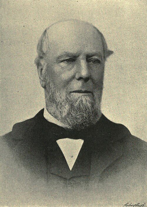
John Wodehouse, 1st Earl of Kimberley1826–1902 · British diplomat (1826-1902)
FK
Francis Kett1547–1589 · English priest (1547-1589)
AT
Al Thake1849–1872 · Major League Baseball player (1849–1872)
GC
George Clarke1798–1875 · New Zealand missionary, teacher, public servant, politician, judge (1…

Frank Milburn Howlett1877–1920 · Entomologist

Harry Daniels1884–1953 · Recipient of the Victoria Cross (1884–1953)

James Kemp1797–1872 · New Zealand missionary (1797-1872)
Everyone born in Wymondham → Birthplaces from Wikidata; portraits from Wikimedia Commons.
Towns its size
Wymondham has the 36th most Grade I buildings of 517 towns its size
Places of 10,000–26,000 people outside London, by Grade I listed buildings.
Wymondham3
#92 of 517for listed buildings per resident (89 per 10,000). Ludlow, Bridport and Monmouth lead.
35 have more. The typical town its size has 0.
Neighbours
Listed buildings in the places around Wymondham
| Town | People | Listed | Grade I | History |
|---|---|---|---|---|
| Wymondham | 16,334 | 145 | 3 | B |
| Hethersett | 7,018 | 20 | 0 | C |
| Little Melton | 1,049 | 3 | 0 | D |
| Mulbarton | 3,807 | 10 | 0 | C− |
| Cringleford | 4,686 | 12 | 0 | C− |
| Besthorpe | 1,007 | 2 | 0 | D |
| Easton | 1,436 | 2 | 1 | D |
| Hingham | 2,304 | 83 | 1 | A |
In brief
Wymondham in brief
Per resident, Wymondham has more listed heritage than 81% of UK towns. All told, the list holds 145 listed buildings, 3 of them Grade I. Its Grade I buildings cluster together: 3 of them stand within 400 m of Wymondham Abbey. Only 35 of the 517 towns nearest its size have more Grade I buildings.
On Damgate Street alone there are 24 listed buildings. A conservation area has protected part of it since 1974. Most entries on the list, 79%, are houses, terraces and villas. The rest is about typical: it also has 2 scheduled monuments.
Questions about Wymondham’s history
How many listed buildings are there in Wymondham?
Historic England lists 145 buildings inside Wymondham’s built-up area: 3 Grade I, 4 Grade II* and 138 Grade II.
What are the Grade I listed buildings in Wymondham?
3, including Abbey Church of St Mary and St Thomas of Canterbury, Becket’s Chapel and Market Cross.
Which street in Wymondham has the most listed buildings?
Damgate Street (24), Market Street (15) and Bridewell Street (7) have the most listed entries named by an address. One entry can be a whole terrace.
Are there scheduled monuments in Wymondham?
Yes, 2 scheduled monuments, including Market cross and Wymondham Abbey.
How many conservation areas are there in Wymondham?
1, covering about 45 hectares of the town. The largest is Wymondham.
When were Wymondham’s buildings listed?
The first in 1950; the most, 68, in 1972.
Are there old photos of Wymondham?
Yes: 1 public-domain photo or postcard from 1903 to 1903, all on this page.
Who was born in Wymondham?
Among people born before 1900: John Wodehouse, 1st Earl of Kimberley (1826), Francis Kett (1547), Al Thake (1849), George Clarke (1798) and Frank Milburn Howlett (1877).
How old are the homes in Wymondham?
8.2% of homes were built before 1919 and 12% before 1940, from the Valuation Office Agency’s council tax records (March 2025).
© Historic England 2026. Contains Ordnance Survey data © Crown copyright and database right 2026. The National Heritage List for England is the official, up-to-date register of all nationally protected historic buildings and sites in England; check an entry on Historic England’s website before relying on it.
Sources: Historic England, National Heritage List for England (listed buildings, scheduled monuments, registered parks and gardens, battlefields, World Heritage Sites), October 2026, inside the ONS 2022 built-up-area boundary · Valuation Office Agency, Council Tax: stock of properties by build period (31 March 2025) · TownRatings grades: our own summary of the data, ranked against UK towns only · Historic England conservation areas (supplied by local planning authorities; October 2026). All under the Open Government Licence v3.0.
Contains public sector information licensed under the Open Government Licence v3.0. Contains HM Land Registry data © Crown copyright and database right 2026. Contains OS data © Crown copyright and database right 2026 (ONS boundaries). Northern Ireland: Source: NISRA; contains Land & Property Services data and Ordnance Survey of Northern Ireland information, © Crown copyright, licensed under the Open Government Licence v3.0. Scotland: contains National Records of Scotland data, Registers of Scotland data and SEPA data, © Crown copyright / © SEPA 2025, licensed under the Open Government Licence v3.0.