 I
Cathedral · listed 1952Liverpool CathedralOn the list as Anglican Cathedral Church of ChristPhoto: calflier001 · CC BY-SA 2.0
 Anglican Cathedral Church of Christ · Photo: calflier001 · CC BY-SA 2.0
AHistory Grade
History of Liverpool · Historic England
1,525 listed buildings, 30 of them Grade I
We have photos of 136 of its listed buildings and 8 old views of the town. 30% of its homes were built before 1919. On the Historic England list, all of them stand inside Liverpool’s built-up area, 30 for every 10,000 residents. It also has 5 scheduled monuments. Liverpool grades A for history: #2 of 25 in Merseyside.
Listed buildings
1,525
30 per 10,000 residents
Grade I
30
exceptional interest
Grade II*
105
more than special interest
Scheduled monuments
5
10 registered parks & gardens
Homes built before 1919
30%
typical UK town 15%
In pictures
Liverpool in 156 photos and old views
Nearly every Grade I and II* building, photographed, and the town before 1950. Tap a photo to step through them full screen.
 Princes Road SynagogueGrade I listed
 Town HallGrade I listed
 Tobacco Warehouse on South Side of Stanley DockGrade II listed
 Lock UpGrade II listed
 Neptune TheatreGrade II listed+151See all photos
Photos from Wikimedia Commons and Geograph, copied to our own server, each credited to its photographer with its licence; names open the building’s page or its official list entry.
Through time
Liverpool from 1825 to 1925
An old map and 8 old photos and postcards, in date order. All public domain, made before 1950.
 1825
 c. 1852
 c. 1860
 c. 1891
 c. 1905
 c. 1910
 1910s
 1911
 1925
Public domain, from Wikimedia Commons, copied to our own server. Each credit opens the image’s page with its full description and history.
The map
Where Liverpool’s history is
Every Grade I and II* building, monument and historic park, over the age of each neighbourhood’s homes.
Grade IGrade II*Scheduled monumentPark or garden
Homes built before 1919, by neighbourhoodunder 10%10–25%25–50%50%+
93 of 319neighbourhoods have mostly pre-1919 homes; in the oldest, 100% were built before 1919.
Hover a dot for its name; tap one with a photo to open it.
1,525 listed buildings by grade
30 Grade I105 Grade II*1,390 Grade II
Historic England lists buildings in three grades: Grade I for buildings of exceptional interest (about 2.5% of all listed buildings), Grade II* for particularly important buildings of more than special interest (about 5.8%), and Grade II for buildings of special interest (about 91.7%). Listing protects the whole building, inside and out.
Every entry on the National Heritage List for England whose point lies inside the ONS 2022 built-up-area boundary. One list entry can cover a terrace or a group of buildings. Neighbourhood dots: the population-weighted centre of each Census 2021 output area, coloured by its neighbourhood’s (LSOA’s) share of homes built before 1919 (Valuation Office Agency, March 2025).
Grade I
The 30 Grade I listed buildings in Liverpool
Buildings of exceptional interest, about 2.5% of all listed buildings. Every one is photographed. Each opens its own page, with the official list entry.
 I
Church · listed 1975Princes Road SynagoguePhoto: David Long · CC BY-SA 2.0
 I
Public · listed 1952Liverpool Town HallOn the list as Town HallPhoto: Rodhullandemu · CC BY-SA 4.0
 I
House · listed 1952Warehouse AOn the list as Atlantic Pavilion, Albert DockPhoto: Peter Church · CC BY-SA 2.0
 I
Inns & shops · listed 1952Bank of England BuildingOn the list as Bank of EnglandPhoto: Rodhullandemu · CC BY-SA 4.0
 I
Public · listed 1952The BluecoatOn the list as Bluecoat ChambersPhoto: Arthur John Picton · CC BY-SA 2.0
 I
House · listed 1952Warehouses B And COn the list as Britannia Pavilion and the Colonnades, Albert DockPhoto: Mike Peel · CC BY-SA 4.0
 I
Church · listed 1952Church of All Hallows, AllertonOn the list as Church of All HallowsPhoto: Rodhullandemu · CC BY-SA 3.0
 I
Church · listed 1952All Saints' Church, ChildwallOn the list as Church of All SaintsPhoto: Rodhullandemu · CC BY-SA 4.0
 I
Church · listed 1952Church of St ClarePhoto: Rodhullandemu · CC BY-SA 4.0
 I
Church · listed 1966St George's Church, EvertonOn the list as Church of St GeorgePhoto: Rodhullandemu · CC BY-SA 4.0
 I
Church · listed 1952Church of Saint John the BaptistOn the list as Church of St John BaptistPhoto: S Parish · CC BY-SA 2.0
 I
Church · listed 1952St Michael's ChurchOn the list as Church of St MichaelPhoto: Rodhullandemu · CC BY-SA 4.0
 I
Public · listed 1952Dock Traffic OfficePhoto: Harry Mitchell · CC BY-SA 3.0
 I
House · listed 1952Edward Pavilion, Royal Albert DockOn the list as Edward Pavilion, Albert DockPhoto: Rodhullandemu · CC BY-SA 4.0
 I
House · listed 1952Liverpool CenotaphPhoto: SomeDriftwood · CC BY-SA 3.0
 I
Public · listed 1952Warehouse DOn the list as Merseyside Maritime Museum and the International Slavery MuseumPhoto: Mike Peel · CC BY-SA 4.0
 I
House · listed 1975Liverpool Metropolitan CathedralOn the list as Metropolitan Cathedral of Christ the KingPhoto: Superchilum · CC BY-SA 4.0
 I
Public · listed 1966Oriel ChambersPhoto: Rodhullandemu · CC BY-SA 4.0
 I
Church · listed 1975Church of St. Agnes and St. Pancras, Toxteth ParkOn the list as Parish Church of St Agnes and St PancrasPhoto: John Bradley · CC BY-SA 3.0
 I
Walls & gates · listed 1975Railings, gates and gate piers, BluecoatOn the list as Railings Gates and Gate Piers Old Bluecoat SchoolPhoto: Rodhullandemu · CC BY-SA 4.0
 I
Street furniture · listed 1966Royal Liver BuildingOn the list as Royal Liver Building, Iron Railings and Stone Piers Surrounding Royal Liver BuildingPhoto: Unknown photographer · CC BY-SA 3.0
 I
Public · listed 1952Speke HallPhoto: Daviessimo · CC BY-SA 3.0
 I
Public · listed 1952St George's HallPhoto: fabiopauleri · CC BY-SA 2.0
 I
House · listed 1952The OratoryPhoto: John Allan · CC BY-SA 2.0
 I
House · listed 1966Philharmonic Dining RoomsOn the list as The Philharmonic Dining RoomsPhoto: Rodhullandemu · CC BY-SA 4.0
 I
Church · listed 1952Toxteth Unitarian ChapelPhoto: Rodhullandemu · CC BY-SA 4.0
 I
Church · listed 1975Ullet Road Unitarian ChurchPhoto: Rodhullandemu · CC BY-SA 4.0
 I
Public · listed 1975Ullet Road Unitarian Church HallPhoto: Rodhullandemu · CC BY-SA 4.0
 I
Public · listed 1982Woolton HallPhoto: J. P. Neale (Life time: 1847) · Public domain
Grade II*
The 105 Grade II* listed buildings in Liverpool
Particularly important buildings of more than special interest. 103 are photographed.
 II*
House · listed 1952Albion HousePhoto: Harry Mitchell · CC BY-SA 3.0
 II*
Public · listed 1975Allerton HallPhoto: Sue Adair · CC BY-SA 2.0
 II*
Church · listed 1966Allerton PrioryPhoto: Rodhullandemu · CC BY-SA 4.0
 II*
House · listed 1966Bishop Eton MonasteryPhoto: Rodhullandemu · CC BY-SA 4.0
 II*
Public · listed 1975The Blue Coat SchoolOn the list as Bluecoat SchoolPhoto: Umgangee · CC BY-SA 3.0
 II*
Inns & shops · listed 1975Bonded Tea WarehouseOn the list as Bonded Tea Warehouse, Great Howard Street, LiverpoolPhoto: Rodhullandemu · CC BY-SA 4.0
 II*
Public · listed 1975Broughton HallPhoto: see below · CC BY-SA 2.0
 II*
House · listed 1952CarfaxPhoto: Rodhullandemu · CC BY-SA 4.0
 II*
House · listed 2007CedarwoodPhoto: TurboGUY · CC BY-SA 4.0
 II*
Public · listed 1975Chapel of Bluecoat SchoolPhoto: Rodhullandemu · CC BY-SA 3.0
 II*
Church · listed 1975St Patrick's ChurchOn the list as Chapel of Saint PatrickPhoto: Rodhullandemu · CC BY-SA 4.0
 II*
Church · listed 1952Holy Trinity Church, WavertreeOn the list as Church of Holy TrinityPhoto: Rodhullandemu · CC BY-SA 4.0
Show the other 93
 II*
Church · listed 1952Church of Saint AndrewPhoto: Rodhullandemu · CC BY-SA 4.0
 II*
Church · listed 1966Church of St. Margaret of AntiochOn the list as Church of Saint MargaretPhoto: Rodhullandemu · CC BY-SA 3.0
 II*
Church · listed 1966Church of St Anne, AigburthOn the list as Church of St AnnePhoto: Rodhullandemu · CC BY-SA 4.0
 II*
Church · listed 1952Church of Saint BridgetOn the list as Church of St Bridget and St ThomasPhoto: Sue Adair · CC BY-SA 2.0
 II*
Church · listed 1981Church of St Christopher, Norris GreenOn the list as Church of St ChristopherPhoto: Rodhullandemu · CC BY-SA 4.0
 II*
Church · listed 1975Church of St ClementPhoto: Rodhullandemu · CC BY-SA 3.0
 II*
Church · listed 1975Church of St DunstanPhoto: Rept0n1x · CC BY-SA 3.0
 II*
Church · listed 1985Church of St JamesPhoto: Rodhullandemu · CC BY-SA 4.0
 II*
Church · listed 1952Church of St LukePhoto: Eric Jones · CC BY-SA 2.0
 II*
Church · listed 1966St Mary's Church, West DerbyOn the list as Church of St MaryPhoto: Jack McGrady · CC BY-SA 3.0
 II*
Church · listed 1975Church of St Matthew and St JamesPhoto: Rodhullandemu · CC BY-SA 4.0
 II*
Church · listed 1966Church of St PaulPhoto: Geoff Williams · CC BY-SA 2.0
 II*
Church · listed 1975St. Peter's ChurchOn the list as Church of St PeterPhoto: Reptonix free Creative Commons licensed photos · CC BY 3.0
 II*
Church · listed 2000Church of St Philip NeriOn the list as Church of St Philip Neri (Rc)Photo: Rodhullandemu · CC BY-SA 4.0
 II*
Public · listed 1966College of Technology and Museum ExtensionPhoto: Rodhullandemu · CC BY-SA 4.0
 II*
Public · listed 1952Croxteth HallPhoto: Unknown photographer · Public domain
 II*
House · listed 1966Cunard BuildingPhoto: Rodhullandemu · CC BY-SA 4.0
 II*
House · listed 1952DairyPhoto: Frombowen · CC BY-SA 4.0
 II*
Public · listed 1974Engine House to North of North Range of Edge Hill StationPhoto: Rodhullandemu · CC BY-SA 4.0
 II*
House · listed 1985Crowne Plaza Liverpool John Lennon Airport HotelOn the list as Former Liverpool Airport Control Tower and TerminalPhoto: Chris j wood · CC BY-SA 4.0
 II*
Inns & shops · listed 1966Former Warehouse at Wapping DockPhoto: John Bradley · CC BY-SA 3.0
 II*
Inns & shops · listed 1975Warehouse On North Side Of DockOn the list as Former Warehouse on North Side of Stanley DockPhoto: Rodhullandemu · CC BY-SA 4.0
 II*
House · listed 1974Fowler's BuildingsPhoto: Rodhullandemu · CC BY-SA 4.0
 II*
House · listed 1952The Friary Or The GlebelandsOn the list as GlebelandsPhoto: Rodhullandemu · CC BY-SA 4.0
 II*
Church · listed 1983Greenbank Drive SynagoguePhoto: PeterMarchantNWBuildings10 · CC BY-SA 4.0
 II*
Public · listed 1952Picton Reading Room and Hornby LibraryOn the list as Hornby Library Picton Reading RoomPhoto: Sue Adair · CC BY-SA 2.0
 II*
Public · listed 1975India BuildingsOn the list as India Buildings, including the Water Street entrance to James Street underground stationPhoto: alan fairweather · CC BY-SA 2.0
 II*
House · listed 1985David Lloyd Sports CentreOn the list as Liverpool Airport Hangar 1Photo: Rodhullandemu · CC BY-SA 4.0
 II*
House · listed 1985Liverpool Airport Hangar No. 2Photo: Rodhullandemu · CC BY-SA 4.0
 II*
Public · listed 1952Liverpool Collegiate SchoolPhoto: Rodhullandemu · CC BY-SA 4.0
 II*
Public · listed 1952Liverpool Medical InstitutionPhoto: Rodhullandemu · CC BY-SA 4.0
 II*
House · listed 1975Lodge to Bishop Eton Monastery, And Adjoining GatewayPhoto: Rodhullandemu · CC BY-SA 4.0
 II*
House · listed 1985Main BridewellPhoto: Rodhullandemu · CC BY-SA 4.0
 II*
Inns & shops · listed 1966Martins Bank BuildingPhoto: Boing! said Zebedee · CC BY-SA 3.0
 II*
Memorials · listed 1975Memorial to the Engine Room Heroes of the TitanicOn the list as Memorial to Heroes of the Marine Engine RoomPhoto: Man vyi · Public domain
 II*
Memorials · listed 1975The Village Cross, West DerbyOn the list as Monument in West Derby VillagePhoto: John Bradley · CC BY 3.0
 II*
Public · listed 1952Much Woolton Old SchoolPhoto: TurboGUY · CC BY-SA 4.0
 II*
House · listed 1966Municipal BuildingsPhoto: 瑞丽江的河水 · CC BY-SA 4.0
 II*
Inns & shops · listed 1952National Westminster BankPhoto: Rodhullandemu · CC BY-SA 4.0
 II*
Memorials · listed 1975Nelson MonumentPhoto: Rodhullandemu · CC BY-SA 4.0
 II*
House · listed 1952Nos. 1-10, GAMBIER TERRACE and No. 2, CANNING STREETPhoto: Rodhullandemu · CC BY-SA 4.0
 II*
House · listed 1952Numbers 20 to 32 Percy Street Including Number 1 Huskisson StreetPhoto: Rodhullandemu · CC BY-SA 4.0
 II*
House · listed 1975Liverpool OlympiaOn the list as Olympia Social ClubPhoto: Rodhullandemu · CC BY-SA 4.0
 II*
House · listed 1975Orleans HousePhoto: John Bradley · CC BY-SA 3.0
 II*
House · listed 1975Saint Joseph's HomeOn the list as OswaldcroftPhoto: PeterMarchantNWBuildings10 · CC BY-SA 4.0
 II*
Public · listed 1981Philharmonic HallOn the list as Philharmonic Hall (Including Detached Poster Piers to South West and North West)Photo: Rodhullandemu · CC BY-SA 4.0
 II*
Public · listed 1975Liverpool PlayhouseOn the list as Playhouse TheatrePhoto: Rodhullandemu · CC BY-SA 4.0
 II*
Walls & gates · listed 1966Port of Liverpool BuildingOn the list as Port of Liverpool Building and stone balustrade, iron gates and piersPhoto: 瑞丽江的河水 · CC BY-SA 4.0
 II*
Walls & gates · listed 1975Gates, railings etc at St Luke's church, Berry StreetOn the list as Railings, Plinth Walls, Gates, Piers and Steps at Church of St LukePhoto: Rodhullandemu · CC BY-SA 4.0
 II*
Public · listed 1974Range on North Side of Edge Hill StationPhoto: Rodhullandemu · CC BY-SA 4.0
 II*
Public · listed 1974Range on South Side of Edge Hill StationPhoto: Rodhullandemu · CC BY-SA 4.0
 II*
Church · listed 1952St Francis XavierOn the list as Roman Catholic Church of Saint Francis XavierPhoto: John Bradley · CC BY-SA 3.0
 II*
Church · listed 1975Church of St Vincent de PaulOn the list as Roman Catholic Church of Saint Vincent de PaulPhoto: Rodhullandemu · CC BY-SA 4.0
 II*
House · listed 1952Royal Insurance BuildingPhoto: Rodhullandemu · CC BY-SA 4.0
 II*
House · listed 1975Royal Insurance BuildingPhoto: Rodhullandemu · CC BY-SA 4.0
 II*
Church · listed 1952St Bride's ChurchOn the list as Saint Bride's ChurchPhoto: David Humphreys · CC BY-SA 3.0
 II*
Church · listed 1975Gustav Adolf ChurchOn the list as Scandinavian Seamen's Church (Gustaf Adolfs Kyrka)Photo: Rodhullandemu · CC BY-SA 4.0
 II*
House · listed 1966Sefton Park Palm HousePhoto: Ben James · CC BY-SA 2.0
 II*
House · listed 1975County Sessions HouseOn the list as Sessions HousePhoto: NeilEvans · Public domain
 II*
House · listed 1952St Agnes & St Pancras vicarageOn the list as St Agnes and St Pancras’ VicaragePhoto: Rept0n1x · CC BY-SA 3.0
 II*
House · listed 1975Stable Block to North and West of Stable YardPhoto: Frombowen · CC BY-SA 4.0
 II*
House · listed 1960Stanlawe GrangeOn the list as Stanlawe Grange the GranaryPhoto: Rodhullandemu · CC BY-SA 3.0
 II*
Memorials · listed 1952Steble FountainPhoto: Dave Wood · CC BY-SA 3.0
 II*
House · listed 1992Tate & Lyle Sugar SiloOn the list as Sugar SiloPhoto: Rodhullandemu · CC BY-SA 4.0
 II*
House · listed 1966AlbanyOn the list as The AlbanyPhoto: Rodhullandemu · CC BY-SA 4.0
 II*
Walls & gates · listed 1952The Carriage House, And Gate Piers to GardenPhoto: Rodhullandemu · CC BY-SA 4.0
 II*
Church · listed 1975The CloistersPhoto: Rodhullandemu · CC BY-SA 4.0
 II*
House · listed 1952The HermitagePhoto: Liverpoolpics · CC BY-SA 3.0
 II*
House · listed 1952The LyceumPhoto: John Bradley · CC BY-SA 3.0
 II*
Public · listed 1952Manor Court House, West DerbyOn the list as The Old Court HousePhoto: Sue Adair · CC BY-SA 2.0
 II*
Inns & shops · listed 1975The Vines public housePhoto: John Bradley · CC BY-SA 3.0
 II*
House · listed 1975Tower BuildingPhoto: Rodhullandemu · CC BY-SA 4.0
 II*
House · listed 1952Tue Brook HousePhoto: Sue Adair · CC BY-SA 2.0
 II*
House · listed 1952Greenbank House, Mossley HillOn the list as University Hostel and Greenbank HousePhoto: Rodhullandemu · CC BY-SA 4.0
 II*
House · listed 1952Walker Art GalleryPhoto: Rept0n1x · CC BY-SA 3.0
 II*
Church · listed 2001Holy Trinity, Wavertree war memorialOn the list as War Memorial at Holy Trinity Church YardPhoto: Rodhullandemu · CC BY-SA 4.0
 II*
House · listed 1952Wellington's ColumnOn the list as Wellington ColumnPhoto: Rodhullandemu · CC BY-SA 4.0
 II*
House · listed 1952Wellington RoomsOn the list as Wellington Rooms (Now the Irish Centre)Photo: Zenichiro · CC BY-SA 3.0
 II*
Public · listed 1952William Brown Library and MuseumPhoto: Chowells · CC BY-SA 3.0
 II*
House · listed 19751 and 3, Duke Street L1Photo: Rodhullandemu · CC BY-SA 4.0
 II*
House · listed 1952102A, High StreetPhoto: Rodhullandemu · CC BY-SA 4.0
 II*
House · listed 1982159-163, Duke StreetPhoto: Rodhullandemu · CC BY-SA 4.0
 II*
House · listed 196616, Cook StreetPhoto: Rodhullandemu · CC BY-SA 4.0
 II*
House · listed 1975169 and 171, Duke StreetPhoto: Rodhullandemu · CC BY-SA 4.0
 II*
House · listed 197524, Hanover Street L1Photo: Rodhullandemu · CC BY-SA 4.0
 II*
House · listed 197526-30, Hanover Street L1Photo: Rodhullandemu · CC BY-SA 4.0
 II*
House · listed 19523-17, Percy StreetPhoto: Rodhullandemu · CC BY-SA 4.0
 II*
House · listed 197538, Castle Street and 1, Brunswick StreetPhoto: Boing! said Zebedee · CC BY-SA 3.0
 II*
House · listed 195262, Rodney StreetPhoto: Rodhullandemu · CC BY-SA 4.0
 II*
House · listed 19858 Brougham Terrace, (Formerly listed as Brougham Terrace)Photo: Rodhullandemu · CC BY-SA 4.0
 II*
House · listed 19528-18, Percy StreetPhoto: Rodhullandemu · CC BY-SA 4.0
House · listed 1975Laundry and Laundry Cottage
Walls & gates · listed 1975Lodge To Saint Joseph's HomeOn the list as The Gatehouse
Historic streets
Rodney Street has the most listed buildings
Streets by the listed entries with an address on them. One entry can be a whole terrace, so long rows count once.
Rodney Street40 listed · 1 II*

Longmoor Lane23 listed
Upper Parliament Street20 listed
Hope Street17 listed
Mount Pleasant16 listed
High Street15 listed · 1 II*

Chatham Street13 listed
Devonshire Road13 listed
Canning Street12 listed
Castle Street10 listed
Catharine Street10 listed
Duke Street10 listed · 2 II*


Of the 1,525 entries, 612 are named by a street address; the rest are named buildings such as churches, halls and bridges.
What’s protected
Most of Liverpool’s listed buildings are homes
Every listed building sorted by what its list name says it is.
Houses, terraces & villas1,029
Public & civic buildings135
Walls, gates & bridges114
Churches, chapels & priories107
Memorials, crosses & tombs59
Inns, shops & warehouses58
Street furniture23
1,029 entries (67%) are houses, terraces and villas. 107 are churches, chapels and priories, including 11 of the 30 Grade I buildings.
Buildings are sorted by words in each entry’s name (church, gate, inn, memorial…): the list’s open data has no building type. An entry named only by its address counts as a house.
Grade II
1,390 Grade II listed buildings
Most listed buildings are in this grade, which covers buildings of special interest. Open any building to read its official list entry.
The first 150 of 1,390 Grade II listed buildings, A to Z
Abbey BuildingsAbbots Lea (Original Mansion Only)Abc Cinema (Formerly Forum Cinema)AcrefieldAcrefield CottageAdelaide HouseAgnes and John Rowe Obelisk at Toxteth Park CemeteryAigburth Road Entrance Entrance Gates, Corner Aigburth Road and Mossley Hill DriveAintree Lodge to Croxteth HallAlder GrangeAlder LodgeAlice and Henry Nixon Obelisk at Toxteth Park CemeteryAll Saints' VicarageAllerton Golf Club HouseAllerton Tower OrangeryAndrew Carnegie LibraryAnfield County Girls Secondary School (Old Building Only)Anglican Chapel at Toxteth Park CemeteryAngorfaArcadiaArchbishop's House (Roman Catholic)ArnewoodArnot St Mary Primary SchoolAshton BuildingBalfour MonumentBaltic Fleet Public HouseBands WarehouseBandstand at West End of Newsham ParkBandstand in Front of ConservatoryBandstand on Island in LakeBank of LiverpoolBanksideBarclay's BankBarclay's BankBarclays BankBarclays BankBarclays BankBarclays BankBark HillBarned's BuildingsBasil GrangeBasil Grange LodgeBeacon HillBeaconsfield HouseBeaconsfield and the CottageBeech MountBeechleyBeechley StablesBeechvilleBellerive BuildingBelvedere Public HouseBereys' BuildingsBlackburne HouseBlackburne TerraceBlair Lea LodgeBloomfield House EastgateBoat House at South End of LakeBoathouse on the east side of the lake in Stanley ParkBoundary BridgeBoundary Public HouseBoundary Stone on South Side of Reservior Road JunctionBoundary Wall and Gatepiers at Holt HouseBoundary Wall, Gate Piers and Letter Box at Margaret Beavan Special SchoolBowden Drinking Fountain at corner of Boaler StreetBowden FountainBradbury HouseBramley Moore Dock Retaining WallsBridewell StudiosBridge HouseBridge at East End of LakeBridge over LakeBridge over Moat to East of Speke HallBridge over Moat to North of Speke HallBridge to East of PavilionBridge to North West of Pavilion to East of LakeBridge to North of East End of LakeBronte VillaBuckleys BuildingsBuilding to South of Newsham Park HospitalBull Box in PaddockCalder High School (Original Building Only)Calderstones HouseCamp Hill LodgeCanal WarehouseCanning Dock Retaining WallCarlisle Buildings and Jerome BuildingsCarriage Ramps and Catacombs to Saint James' CemeteryCarriage Ramps and StepsCarriage Washing Shelter in Stable YardCasematesCastle Moat HouseCathedral House and former Convent of Christ the KingCatherine HouseCentral Block of Convent of Notre Dame Including ChapelCentral BuildingsCentral Fire StationCentral Garden Railings, Gates and Gate PiersCentral HotelChapel and Administration BlockCheltenham and Gloucester Building SocietyCherry Lane Entrance to Anfield CemeteryChildwall Abbey HotelChrist ChurchChrist ChurchChurch CottagesChurch CottagesChurch CottagesChurch HouseChurch of All SaintsChurch of All SaintsChurch of All Souls, including church hall, boundary wall and gatesChurch of Holy TrinityChurch of Our Lady and St NicholasChurch of Saint AnneChurch of Saint ColumbaChurch of St AlbanChurch of St AmbroseChurch of St AnneChurch of St BarnabasChurch of St CyprianChurch of St John EvangelistChurch of St John the EvangelistChurch of St MaryChurch of St MaryChurch of St MaryChurch of St MichaelChurch of St NicholasChurch of St OswaldChurch of St PeterChurch of St StephenChurch of the Sacred HeartChurchfieldCity BuildingsCity Education OfficesClare TerraceClaytons YardCleveley CottageCliff CottageClock Tower, And 4 Iron LampsCollege of Further EducationCollingwood Dock Retaining WallsCompton HouseConservatoryCorporation OfficesCotton Exchange BuildingCrawfordsburn Mossdene Strawberry HouseCrematorium at Anfield CemeteryCressington StationCross and Passion ConventCrown Buildings
Conservation areas
37 conservation areas cover 15% of Liverpool
Areas the council protects as a whole: demolition and changes to how buildings look need consent, and trees are protected.
No data available for publication by HE582 ha
Sefton Park 1971177 ha
Mossley Hill 197196 ha
Woolton Village 196978 ha
Newsham Park74 ha
Princes Park 197056 ha
Castle Street 196846 ha
Stanley Dock45 ha
Lark Lane 197643 ha
Canning Street 197141 ha
Toxteth Park and Avenues39 ha
Wavertree Village37 ha
Albert Dock 197629 ha
Duke Street27 ha
Grassendale Park and Cressington Park 196826 ha
Knotty Ash24 ha
Rodney Street 196818 ha
Fulwood Park 197217 ha
Mount Pleasant 197617 ha
Kensington Fields15 ha
West Derby Village 196914 ha
William Brown Street 196911 ha
Wavertree Garden Suburb 197111 ha
Hunts Cross Avenue11 ha
Princes Road 197111 ha
1,609 hain conservation areas, of 11,039 ha inside the built-up area.
The first, Castle Street, Grassendale Park and Cressington Park and Rodney Street, were designated in 1968; the newest, Grove Park, in 1976. 1,048 of the 1,525 listed buildings stand in one.
Historic England’s conservation areas layer, supplied by councils (incomplete in places, so a page fact, never graded). Hectares are the part of each area inside the built-up area.
How the list grew
More than half of Liverpool’s listed buildings were added in one year, 1975
The year each building now on the list was first listed.
1975 · 8301985 · 2941952 · 152
19501960197019801990200020102020
The first 152 entries were listed in 1952, 19 of the 30 Grade I buildings among them. 830 came in 1975, in the national resurvey of the 1970s and 80s. Only 27 have been added in the last 15 years.
Monuments & landscapes
Monuments, parks and gardens
Designations that overlap the town by a tenth of their area or half a hectare.
5 scheduled monuments
Nationally important archaeological sites and monuments, protected by law; work on them needs consent from the Secretary of State, advised by Historic England.


10 registered parks and gardens

Allerton CemeteryGrade II

Anfield CemeteryGrade II*

Croxteth Hall ParkGrade II

Newsham ParkGrade II

Princes Park, LiverpoolGrade II*

Sefton ParkGrade I


Stanley Park, LiverpoolGrade II*

Toxteth Park CemeteryGrade II

Wavertree Botanic Garden and ParkGrade II*
History Grade
Liverpool grades A for history
Protected heritage and the age of the town’s homes, against all UK towns.
Protected heritage, for its size and in all (1,718 points, 34 per 10,000 residents)More than 73% of UK towns
Homes built before 1919 (30%)More than 84% of UK towns
Two measures, each ranked against every UK town of 1,000 or more, with protected heritage counting twice as much as the age of homes. Protected heritage counts each listed building by its grade (Grade I three points, II* two, II one), each scheduled monument and battlefield two, and each registered park or garden by its grade; it is ranked both per 10,000 residents and as a total, so a village with one fine church doesn’t outrank a historic city. The second measure is the share of homes built before 1919, from the Valuation Office Agency’s council tax records. History is a character grade: it describes the town and isn’t part of the overall grade.
Homes by age
30% of Liverpool’s homes were built before 1919
Every home by when it was built, from council tax records, against England & Wales (the dark tick).
25%
Before 1900
5.1%
1900–18
8.8%
1919–29
12%
1930s
4.6%
1945–54
4.8%
1955–64
3.8%
1965–72
5.1%
1973–82
6%
1983–92
6.4%
1993–99
8.1%
2000–08
3.5%
2009–15
7.4%
2016–25
LiverpoolEngland & Wales
25% of homes are Victorian or older, against 16% across England and Wales. The busiest period since was the 1930s, which added 12% of today’s homes.
Valuation Office Agency, council tax stock of properties by build period, 31 March 2025, for the neighbourhoods (LSOAs) that make up the town, split by where their residents live. Homes with no recorded build period (348 here) are left out; 1939–44 is not a period in the data.
Born here
649 notable people born in Liverpool before 1900
The 20 best known on one timeline, earliest first.
Jeremiah Horrocks
George Stubbs
Robert Morris
William Roscoe
Banastre Tarleton
Felicia Hemans
William Ewart Gladstone
William Stanley Jevons
Charles Booth
Luke Fildes
Walter Crane
Kate Sheppard
Augustine Birrell
May Whitty
Herbert Samuel, 1st Viscount Samuel
Arthur Wynne
Henry Tingle Wilde
James Larkin
Konstantinos Paspatis
Frederick Fleet
16001650170017501800185019001950

William Ewart Gladstone1809–1898 · British Liberal prime minister (1809–1898)
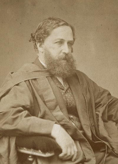
William Stanley Jevons1835–1882 · English economist and logician

Kate Sheppard1847–1934 · Prominent member of New Zealand's women's suffrage (1848–1934)

Jeremiah Horrocks1618–1641 · English astronomer

George Stubbs1724–1806 · British painter (1724–1806)

May Whitty1865–1948 · English actress (1865-1948)

Felicia Hemans1793–1835 · English poet (1793-1835)

Herbert Samuel, 1st Viscount Samuel1870–1963 · British politician (1870–1963)
Everyone born in Liverpool → Birthplaces from Wikidata; portraits from Wikimedia Commons.
Towns its size
Liverpool has the 2nd most Grade I buildings of 9 towns its size
Places of 304,000–811,000 people outside London, by Grade I listed buildings.
Neighbours
Listed buildings in the places around Liverpool
| Town | People | Listed | Grade I | History |
|---|---|---|---|---|
| Liverpool | 506,564 | 1,525 | 30 | A |
| Huyton with Roby | 59,844 | 29 | 0 | C− |
| Knowsley | 2,345 | 3 | 0 | C− |
| Bootle | 53,722 | 25 | 1 | B− |
| Aintree | 6,212 | 5 | 0 | D |
| Prescot | 39,227 | 45 | 1 | C+ |
| Kirkby | 45,559 | 24 | 0 | D |
| Litherland | 18,752 | 4 | 0 | C− |
In brief
Liverpool in brief
The official list counts 1,525 listed buildings in Liverpool, 30 of them Grade I, including Liverpool Cathedral. Its housing is old: 30% of homes date from before 1919, against 15% in the typical UK town. Only one of the 9 towns nearest its size has more Grade I buildings. Rodney Street alone has 40 listed buildings.
Its older streets lie in 37 conservation areas, the first designated in 1968. Of the whole list, 67% are houses, terraces and villas. William Ewart Gladstone (1809), William Stanley Jevons (1835) and Kate Sheppard (1847) are among the 649 people born here before 1900. Otherwise the figures are ordinary: per resident it sits near the middle of UK towns.
Questions about Liverpool’s history
How many listed buildings are there in Liverpool?
Historic England lists 1,525 buildings inside Liverpool’s built-up area: 30 Grade I, 105 Grade II* and 1,390 Grade II.
What are the Grade I listed buildings in Liverpool?
30, including Anglican Cathedral Church of Christ, Atlantic Pavilion, Albert Dock, Bank of England, Bluecoat Chambers, Britannia Pavilion and the Colonnades, Albert Dock and Church of All Hallows.
Which street in Liverpool has the most listed buildings?
Rodney Street (40), Longmoor Lane (23) and Upper Parliament Street (20) have the most listed entries named by an address. One entry can be a whole terrace.
Are there scheduled monuments in Liverpool?
Yes, 5 scheduled monuments, including Edge Hill Engine Station, Liverpool & Manchester Railway, Robin Hood's Stone at the junction of Archerfield Road and Booker Avenue, Speke Hall moated site and The Calderstones: six monoliths decorated with rock art.
How many conservation areas are there in Liverpool?
37, covering about 1,609 hectares of the town. The largest are No data available for publication by HE and Sefton Park.
When were Liverpool’s buildings listed?
The first in 1952; the most, 830, in 1975.
Are there old photos of Liverpool?
Yes: 8 public-domain photos and postcards from 1825 to 1925, and an old map from 1891, all on this page.
Who was born in Liverpool?
Among people born before 1900: William Ewart Gladstone (1809), William Stanley Jevons (1835), Kate Sheppard (1847), Jeremiah Horrocks (1618) and George Stubbs (1724).
How old are the homes in Liverpool?
30% of homes were built before 1919 and 51% before 1940, from the Valuation Office Agency’s council tax records (March 2025).
© Historic England 2026. Contains Ordnance Survey data © Crown copyright and database right 2026. The National Heritage List for England is the official, up-to-date register of all nationally protected historic buildings and sites in England; check an entry on Historic England’s website before relying on it.
Sources: Historic England, National Heritage List for England (listed buildings, scheduled monuments, registered parks and gardens, battlefields, World Heritage Sites), October 2026, inside the ONS 2022 built-up-area boundary · Valuation Office Agency, Council Tax: stock of properties by build period (31 March 2025) · TownRatings grades: our own summary of the data, ranked against UK towns only · Historic England conservation areas (supplied by local planning authorities; October 2026). All under the Open Government Licence v3.0.
Contains public sector information licensed under the Open Government Licence v3.0. Contains HM Land Registry data © Crown copyright and database right 2026. Contains OS data © Crown copyright and database right 2026 (ONS boundaries). Northern Ireland: Source: NISRA; contains Land & Property Services data and Ordnance Survey of Northern Ireland information, © Crown copyright, licensed under the Open Government Licence v3.0. Scotland: contains National Records of Scotland data, Registers of Scotland data and SEPA data, © Crown copyright / © SEPA 2025, licensed under the Open Government Licence v3.0.