
Havering’s places to visit, starting with Rainham Hall
Havering’s list takes in 10 museums, 2 historic houses and 2 attractions. Look within 5 km of its edge and the list grows by 16 beyond the 5 inside Havering’s built-up area. 2 of them are cared for by the National Trust. For a longer trip, British Museum lies 24 km away.
Must-know places in Havering
Rainham Hall aside, the next best known are 3 museums, a historic site and a cathedral.
 Museum · National TrustRainham Hallin town
 MuseumHavering Museumin townMuseumMuseumRAF Hornchurch Heritage Centrein townHistoric siteHistoric siteUpminster Windmillin townMuseumMuseumUpminster Tithe Barnin town
 CathedralBrentwood Cathedral2.9 km outside town, to the northeast
Each has a page of its own: what it is, who runs it, the weather month by month and what else is near it.
The places, mapped
Furthest out is Hall Place and Gardens, at 14 km.
The dashed line is Havering’s built-up area; orange marks its middle (where most people live). Numbers match the list below. © OpenStreetMap contributors · ONS built-up area 2022
By kind
The two biggest groups: museums or galleries (10) and castles or historic places (6).
Green: inside Havering. Grey: within 5 km of its edge.
2 places are cared for by the National Trust (Rainham Hall and Eastbury Manor House).
Every place, in and near Havering
The town has 5; within 5 km of its edge, the list finds 16 more.
Brentwood Cathedral
Roman Catholic cathedral in Brentwood, Essex, England, UK.
 7
Thorndon Hall
Grade I listed country house in Herongate and Ingrave, Essex, England, UK.
 8
Eastbury Manor House
Grade I listed historic house museum in London Borough of Barking and Dagenham, United Kingdom.
 9
Valence House
Local museum within a medieval manor house in Dagenham, United Kingdom.
 10
Lesnes Abbey
Former abbey, now ruined, in Abbey Wood, London Borough of Bexley, England, UK.
 11
Hall Place and Gardens
Grade I listed house and museum in Bexley, Greater London, England, United Kingdom.
The 5 inside Havering come first, best known first; then the places within 5 km, close and well known first. Churches and listed buildings are on the History page, not here.
108 listed buildings and 2 scheduled monuments are on Havering’s History page → · Parks, footpaths and green space in Havering →
Further afield: the best known within 40 km
British Museum, 24 km away, is the best known of the 12.
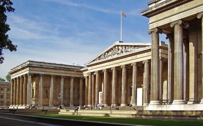 Big drawMuseumBritish Museum24 km west · 5.8M visitors a year (2023)
 Big drawCastleTower of London21 km west · 2.7M visitors a year (2016)
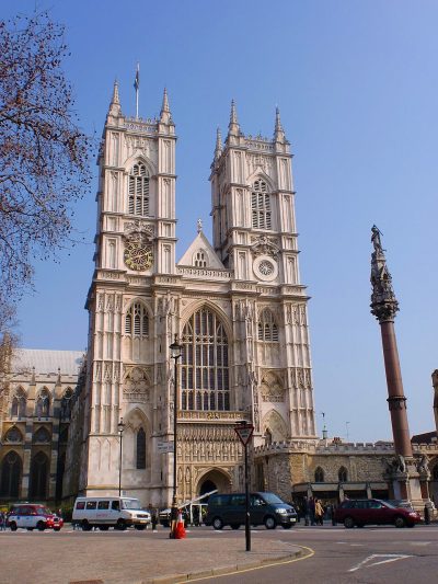 Cathedral · English HeritageWestminster Abbey25 km west
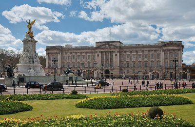 Historic houseBuckingham Palace25 km west
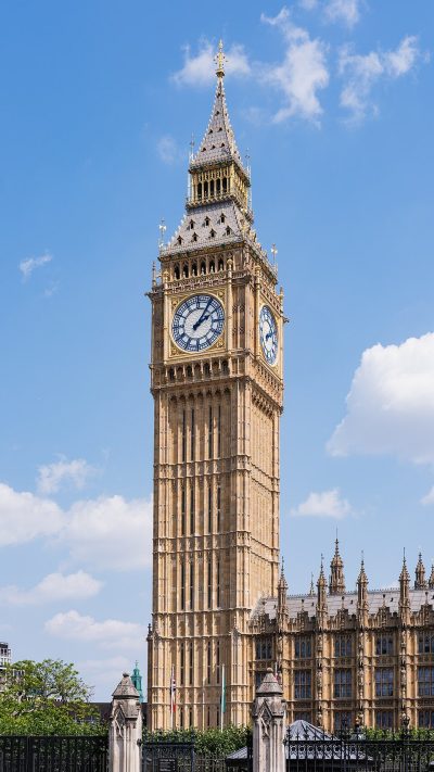 AttractionElizabeth Tower24 km west
 Big drawArt galleryNational Gallery24 km west · 709K visitors a year (2021)
 CathedralSt Paul's Cathedral22 km west
 AttractionLondon Eye24 km westMuseumMuseumRoyal Observatory Greenwich18 km southwest
 Big drawArt galleryTate Modern22 km west · 1.2M visitors a year (2021)
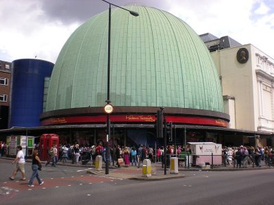 MuseumMadame Tussauds26 km west
 Big drawMuseumVictoria and Albert Museum28 km west · 858K visitors a year (2021)
Places well known beyond Havering (Wikipedia articles in several languages, published visitor counts, or a National Trust, English Heritage or Cadw property), close and famous first. Distances are straight lines from the middle of the town.
What people ask about Havering
What are the main attractions in Havering?
The best known inside Havering’s built-up area are Rainham Hall, Havering Museum, RAF Hornchurch Heritage Centre and Upminster Windmill. In all, 5 places to visit are mapped inside the town, and 16 more within 5 km.
Does Havering have a museum?
10 museums and galleries are in or within 5 km of Havering: Rainham Hall, Havering Museum, RAF Hornchurch Heritage Centre and Upminster Tithe Barn.
Is there a National Trust or English Heritage property near Havering?
Yes. In or within 5 km of Havering, 2 places are cared for by the National Trust (Rainham Hall and Eastbury Manor House).
What are the best-known days out near Havering?
Within 40 km: British Museum (24 km), Tower of London (21 km), Westminster Abbey (25 km), Buckingham Palace (25 km).
Where are Havering’s historic buildings listed?
Havering has 108 listed buildings, 5 of them Grade I. They are on its History page, from Historic England’s list, not repeated here.
How is this list made?
From OpenStreetMap (museums, galleries, zoos, theme parks and attractions, castles, forts and abbeys, and historic houses and gardens that are open to visitors) and Wikidata (what each place is, who runs it, its website and visitor counts). A place counts for Havering when it is inside the ONS 2022 built-up area, and as nearby within 5 km of its edge. Opening times and prices are not shown: check the official site.
Places: OpenStreetMap (© OpenStreetMap contributors, Open Database Licence) and Wikidata (CC0), placed in the ONS 2022 built-up area (Open Government Licence v3.0). Visitor counts are the latest Wikidata gives, with their year.
Photos: each place’s Wikidata image, from Wikimedia Commons under the licence below (our copy, resized).
Photo credits (19)
- Rainham Hall: JRennocks, CC BY-SA 4.0, Wikimedia Commons
- Havering Museum: Mx. Granger, CC0, Wikimedia Commons
- Brentwood Cathedral: Brentwood_Cathedral_-_Rfry.jpg: Rhyddfrydol derivative work: Rabanus Flavus, CC BY-SA 3.0, Wikimedia Commons
- Thorndon Hall: Tomharveybolton, Public domain, Wikimedia Commons
- Eastbury Manor House: Gordon Joly, CC BY 2.5, Wikimedia Commons
- Valence House: Gordon Joly, CC BY-SA 3.0, Wikimedia Commons
- Lesnes Abbey: Ethan Doyle White, CC BY-SA 3.0, Wikimedia Commons
- Hall Place and Gardens: Wellingwebsite at English Wikipedia Later versions were uploaded by P Ingerson at en.wikipedia., Public domain, Wikimedia Commons
- British Museum: Ham, CC BY-SA 3.0, Wikimedia Commons
- Tower of London: Bob Collowan, CC BY-SA 3.0, Wikimedia Commons
- Westminster Abbey: Σπάρτακος, CC BY-SA 3.0, Wikimedia Commons
- Buckingham Palace: Diliff, CC BY-SA 3.0, Wikimedia Commons
- Elizabeth Tower: Christian David, CC BY-SA 4.0, Wikimedia Commons
- National Gallery: Diego Delso, CC BY-SA 4.0, Wikimedia Commons
- St Paul's Cathedral: Mark Fosh, CC BY 2.0, Wikimedia Commons
- London Eye: Christian David, CC BY-SA 4.0, Wikimedia Commons
- Tate Modern: Christine Matthews, CC BY-SA 2.0, Wikimedia Commons
- Madame Tussauds: Citizen59, CC BY-SA 3.0, Wikimedia Commons
- Victoria and Albert Museum: Diliff, CC BY-SA 3.0, Wikimedia Commons
Contains public sector information licensed under the Open Government Licence v3.0. Contains HM Land Registry data © Crown copyright and database right 2026. Contains OS data © Crown copyright and database right 2026 (ONS boundaries). Northern Ireland: Source: NISRA; contains Land & Property Services data and Ordnance Survey of Northern Ireland information, © Crown copyright, licensed under the Open Government Licence v3.0. Scotland: contains National Records of Scotland data, Registers of Scotland data and SEPA data, © Crown copyright / © SEPA 2025, licensed under the Open Government Licence v3.0.