Guest, Sign inJoin
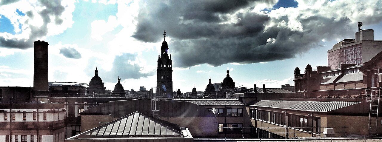
Glasgow skyline - view towards the City ChambersPhoto: Ian Hawfinch · CC BY-SA 2.0
–Not graded
Outdoors in Glasgow · parks, paths & countryside

93% of Glasgow’s residents live within a 5-minute walk of a park

1,208 km of footpaths run through the city and the kilometre around it, 5.2 for every square kilometre. Parks and playing fields in Glasgow add up to 2.8 ha for every 1,000 residents; the typical town in England and Wales has 2.1. Glasgow has no Outdoors Grade: Scottish towns aren’t graded on the outdoors yet.

Green space
2.8 ha
per 1,000 residents
Typical town in England and Wales 2.1
Near a park
93%
of residents within 400 m
Typical town in England and Wales 83%
Footpaths
1,208 km
5.2 km per km², town + 1 km
Typical town in England and Wales 3.0 per km²
Protected landscape
0%
of the land within 5 km
Nearest: Loch Lomond and The Trossachs National Park
Character

What kind of outdoors city is Glasgow?

Read from the data: what stands out first, good and bad.

Glasgow’s strongest suit is the Clyde Walkway, followed by its historic parks.

The map

Parks, footpaths & countryside

Tap a number to zoom to a park. Tap a layer to hide it. The dashed line is Glasgow’s locality.

12345678
Green space: parks, gardens, playing fields and play spaces, named or not.© OpenStreetMap contributors · Contains OS data © Crown copyright · Scottish Government, NatureScot
Places to walk

Parks to walk in, in and around Glasgow

The biggest is Dams To Darnley Country Park, 474 ha (1,171 acres). Directions go to the park’s nearest public entrance where Ordnance Survey maps one.

All 30 named parks by size: 1,499 ha (3,703 acres) and 190 km of pathDams To Darnley Country Pa…474 ha · 23.6 km of pathDams To Darnley Country Park: 474 ha, 23.6 km of pathCathkin Braes Co…171 ha · 30 km of pa…Cathkin Braes Country Park: 171 ha, 30 km of pathPollok Country P…139 ha · 9.7 km of p…Pollok Country Park: 139 ha, 9.7 km of path59 haHogganfield Park: 59 ha, 4.8 km of path56 haRouken Glen Park: 56 ha, 11 km of path54 haBellahouston Park: 54 ha, 5.5 km of pathGlasgow G…49 ha · 2.5…Glasgow Green: 49 ha, 2.5 km of pathQueen's…45 ha · 8.…Queen's Park: 45 ha, 8.7 km of path38 haAlexandra Park: 38 ha, 12.9 km of path35 haLinn Park: 35 ha, 4.9 km of path31 haSpringburn Park: 31 ha, 7.7 km of path30 haFernbrae Meadows: 30 ha, 4.3 km of path29 haAviary Gardens: 29 ha, 5.4 km of path28 haKing's Park: 28 ha, 3.3 km of path27 haCuningar Woodland Park: 27 ha, 4.6 km of path25 haKelvingrove Park: 25 ha, 7.7 km of path25 haHousehill Park: 25 ha, 2.7 km of path22 haBlairtummock Park: 22 ha, 4.5 km of path20 haVictoria Park: 20 ha, 6.5 km of path18 haDrumry Wood: 18 ha, 2.9 km of path18 haRuchill Park: 18 ha, 4.7 km of pathCowlairs Park: 16 ha, 1.3 km of pathKnightswood Park: 15 ha, 3.8 km of path13 haElder Park: 13 ha, 4.6 km of path13 haKing George's Field: 13 ha, 1.7 km of path11 haSighthill Park: 11 ha, 4.1 km of path11 haAuchinlea Park: 11 ha, 0.6 km of pathMaryhill Park: 8.9 ha, 1.4 km of pathRosshall Estate Gardens: 8.8 ha, 1.8 km of pathMaxwell Park: 8.1 ha, 2.8 km of path
Parks & gardens 1,486 haPlaying fields 13 ha

The two biggest, Dams To Darnley Country Park and Cathkin Braes Country Park, are 43% of the named green space and carry 54 km of path between them.

Glasgow’s biggest

Dams To Darnley Country Park

Park or garden
474 ha (1,171 acres)23.6 km of path
5 h 15 minto walk all 23.6 km of path
664 pitchesfootball pitches would fit
4.8 mi south-westfrom the centre
500 Corselet Road, Darnley Mill Grade II*
Directionsto the nearest entrance

Cathkin Braes Country Park

Park or garden
171 ha (423 acres)30.0 km of path
6 h 40 minto walk all 30 km of path
240 pitchesfootball pitches would fit
4.3 mi southfrom the centre
Viewpoint 201 Ardencraig Road, Castlemilk, St Martin's Roman Catholic Church and Presbytery Grade II*Cathkin Braes MTB track (Green)
Directionsto the nearest entrance

Pollok Country Park

Park or garden
139 ha (345 acres)9.7 km of path
2 h 10 minto walk all 9.7 km of path
195 pitchesfootball pitches would fit
2.1 mi south-westfrom the centre
2060 Pollokshaws Road, Pollok Country Park, The Burrell Collection Grade I 2060 Pollokshaws Road, Pollok House Former Stables, Including Courtyard Ranges Grade I +6 listedRhododendron WalkLime Avenue
Directionsto the nearest entrance
Historic park · Grade

Rouken Glen Park

Park or garden
56 ha (139 acres)11.0 km of path
2 h 25 minto walk all 11 km of path
79 pitchesfootball pitches would fit
4.6 mi south-westfrom the centre
Glen Walks
Directionsto the nearest entrance

Hogganfield Park

Park or garden
59 ha (145 acres)4.8 km of path
1 h 5 minto walk all 4.8 km of path
82 pitchesfootball pitches would fit
3.6 mi north-eastfrom the centre
Playground Nature reserve
Directionsto the nearest entrance

Bellahouston Park

Park or garden
54 ha (132 acres)5.5 km of path
1 h 15 minto walk all 5.5 km of path
75 pitchesfootball pitches would fit
1.9 mi south-westfrom the centre
1121 Paisley Road West, Palace of Art Grade II* 52 First Gardens, Hazelwood House Grade II* +1 listed
Directionsto the nearest entrance

Alexandra Park

Park or garden
38 ha (93 acres)12.9 km of path
2 h 50 minto walk all 12.9 km of path
53 pitchesfootball pitches would fit
2.2 mi eastfrom the centre
Alexandra Parade, Alexandra Park, Cast-Iron Fountain Grade I Alexandra Parade, Fountain at Gate to Alexandra Park Grade II* +1 listed
Directionsto the nearest entrance

Queen's Park

Park or garden
45 ha (111 acres)8.7 km of path
1 h 55 minto walk all 8.7 km of path
63 pitchesfootball pitches would fit
1.6 mi southfrom the centre
Picnic site 1 Langside Avenue, Langside Hall Grade I 799 Pollokshaws Road, Camphill House (Within Queen's Park) Grade I +8 listed
Directionsto the nearest entrance
All 30 named parks and green spaces
Dams To Darnley Country ParkPark or garden · 474 ha · 23.6 km of path
Directions
Cathkin Braes Country ParkPark or garden · 171 ha · 30.0 km of path
Directions
Pollok Country ParkPark or garden · 139 ha · 9.7 km of path
Directions
Rouken Glen ParkPark or garden · 56 ha · 11.0 km of path
Directions
Hogganfield ParkPark or garden · 59 ha · 4.8 km of path
Directions
Bellahouston ParkPark or garden · 54 ha · 5.5 km of path
Directions
Alexandra ParkPark or garden · 38 ha · 12.9 km of path
Directions
Queen's ParkPark or garden · 45 ha · 8.7 km of path
Directions
Glasgow GreenPark or garden · 49 ha · 2.5 km of path
Directions
Springburn ParkPark or garden · 31 ha · 7.7 km of path
Directions
Linn ParkPark or garden · 35 ha · 4.9 km of path
Directions
Kelvingrove ParkPark or garden · 25 ha · 7.7 km of path
Directions
Aviary GardensPark or garden · 29 ha · 5.4 km of path
Directions
Fernbrae MeadowsPark or garden · 30 ha · 4.3 km of path
Directions
Cuningar Woodland ParkPark or garden · 27 ha · 4.6 km of path
Directions
King's ParkPark or garden · 28 ha · 3.3 km of path
Directions
Victoria ParkPark or garden · 20 ha · 6.5 km of path
Directions
Blairtummock ParkPark or garden · 22 ha · 4.5 km of path
Directions
Househill ParkPark or garden · 25 ha · 2.7 km of path
Directions
Ruchill ParkPark or garden · 18 ha · 4.7 km of path
Directions
Drumry WoodPark or garden · 18 ha · 2.9 km of path
Directions
Knightswood ParkPark or garden · 15 ha · 3.8 km of path
Directions
Elder ParkPark or garden · 13 ha · 4.6 km of path
Directions
Sighthill ParkPark or garden · 11 ha · 4.1 km of path
Directions
Cowlairs ParkPark or garden · 16 ha · 1.3 km of path
Directions
Maxwell ParkPark or garden · 8.1 ha · 2.8 km of path
Directions
Auchinlea ParkPark or garden · 11 ha · 0.6 km of path
Directions
Rosshall Estate GardensPark or garden · 8.8 ha · 1.8 km of path
Directions
Maryhill ParkPark or garden · 8.9 ha · 1.4 km of path
Directions
King George's FieldPlaying field · 13 ha · 1.7 km of path
Directions
Close to home

How close Glasgow’s homes are to a park

Each square is 1 in 100 residents: green lives within 400 m of a public park, garden or playing field (NRS Census 2022 output areas against OS Open Greenspace).

Within 400 m (93%)Further (7%)
Glasgow93%
Glasgow City towns93%
Towns in England and Wales83%

About 43,000 people live further than that. Playing fields count, so a park within reach isn’t always one with paths or trees; 743 playgrounds are mapped in and around the city, about one for every 832 residents.

National Parks & National Scenic Areas

The Loch Lomond and The Trossachs National Park is 7.6 mi away

Protected landscapes within 30 km, by direction and distance from the edge of the locality; circle size shows each one’s area. National Scenic Areas are Scotland’s finest landscapes, chosen by NatureScot.

5.3 mi10.5 mi15.8 mi21 miNLoch Lomond and The Trossachs National Park7.6 mi north-westLoch Lomond and The Trossachs National Park: 7.6 mi north-west of Glasgow’s edge · 1,861 km² · since 2002Loch Lomond9.6 mi north-westLoch Lomond National Scenic Area: 9.6 mi north-west of Glasgow’s edge · 281 km² · since 1980The Trossachs18 mi northThe Trossachs National Scenic Area: 18 mi north of Glasgow’s edge · 49 km² · since 1980Glasgow
National ParkNational Scenic AreaThe 5 km the grade counts
National Park

Loch Lomond and The Trossachs National Park

7.6 mi north-west1,861 km²since 2002
Official site
National Scenic Area

Loch Lomond

9.6 mi north-west281 km²since 1980
National Scenic Area

The Trossachs

18 mi north49 km²since 1980

Loch Lomond and The Trossachs National Park covers 1,861 km² and has been a National Park since 2002.

Footpaths & waymarked walks

Glasgow is on the Clyde Walkway

1,208 km of footpaths, tracks and core paths are mapped in Glasgow and the kilometre around it, 5.2 km for every square kilometre (the typical town in England and Wales has 3.0). Bars show each route’s kilometres within 2 km of the city.

NationalRegionalLocalOther waymarked
Clyde Walkway21.9 km
Whithorn Way - a Glasgow Cathedral to Girvan18.2 km
Forth & Clyde/Union Canal Towpath15.7 km
Magnificent 1112.9 km
Kelvin Walkway11.7 km
Seven Lochs Trail11.2 km
White Cart Walkway10.0 km
Drumchapel Way7.4 km
Clyde Coastal Path3.7 km
Thomas Muir Trail3.5 km
Clyde Coastal Path: 3: 8 Hardgate to Stockiemuir Road2.8 km
Provan Hall Trail2.2 km
Stamperland Walkway2.0 km
Clyde Coastal Path: 3: 7 Erskine Bridge to Hardgate1.2 km
Cairnhill Woods0.8 km
Old Drove Road Walking Route0.7 km

The Clyde Walkway, a national route, passes Glasgow. Close to home, the Magnificent 11 has 13 km of local walk within 2 km of the city. 4 regional routes pass through, including the Whithorn Way - a Glasgow Cathedral to Girvan, Clyde Coastal Path, Clyde Coastal Path: 3: 8 Hardgate to Stockiemuir Road and Clyde Coastal Path: 3: 7 Erskine Bridge to Hardgate.

Waymarked walks are OpenStreetMap walking routes. Scotland has no rights-of-way register: everyone has a right of responsible access to most land, so tracks and councils’ core paths count. Paths are only as complete as the map in each area.

History along the way

6 historic parks, and what stands in them

Historic Environment Scotland’s Inventory of Gardens and Designed Landscapes, and the listed buildings and scheduled monuments that stand inside Glasgow’s named parks.

Registered park · Grade

Kelvingrove Park

25 ha. A historic garden or designed landscape (Grade ). 24 listed structures and monuments stand inside it or at its edge, including Kelvingrove Park, Roberts Memorial (Grade I).

IKelvingrove Park, Roberts MemorialIKelvingrove Park, Stewart Memorial FountainINo 4 Clairmont GardensIPark Gardens, Stairway to Park Street SouthIPark Terrace Balustrade Railings and Gateway to Kelvingrove ParkII*Eldon Street Bridge over River KelvinII*Kelvingrove Park Monument to Lord KelvinII*Kelvingrove Park Snow BridgeII*Kelvingrove Park Statue Group of Tigress, Cubs and PeacockII*Kelvingrove Park, Kelvin Way, Kelvingrove Bandstand and AmphitheatreII*Kelvingrove Park, Prince of Wales BridgeII*Kelvingrove Park, South African War MemorialII*Kelvinway Bridge over KelvinII*Partick Bridge over River KelvinII*University of Glasgow, Gilmorehill Campus Building B2, West Medical Building Including Entrance Gateway
Registered · Grade Glasgow Botanic Gardens14 ha
Registered · Grade Pollok Park (Nether Pollok)468 ha
Registered · Grade Rouken Glen Park9.3 ha
Registered · Grade The Necropolis12 ha
Registered · Grade Victoria Park20 haInside: Victoria Park Drive North, North Gatepiers to Victoria Park and Gates and 4 more
Listed buildings insideGlasgow GreenGlasgow Green, Doulton Fountain in Front of People's Palace, Glasgow Green, Nelson Monument, Including Railings and 1, 1A Glasgow Green, People's Palace Museum and Winter Garden and 7 more
Listed buildings insidePollok Country Park2060 Pollokshaws Road, Pollok Country Park, The Burrell Collection, 2060 Pollokshaws Road, Pollok House Former Stables, Including Courtyard Ranges and 2060 Pollokshaws Road, Pollok House Including Service Court, Forecourt, Garden Walling and Pavilions and 5 more
Listed buildings insideQueen's Park1 Langside Avenue, Langside Hall, 799 Pollokshaws Road, Camphill House (Within Queen's Park) and Battle Place, Battlefield Monument and 7 more
Heritage walks
Whithorn Way - a Glasgow Cathedral to Girvan 18.2 km Forth & Clyde/Union Canal Towpath 15.7 km

A listed building or monument counts when it sits inside the park’s OS Open Greenspace outline (to about 15 m), so a few at the boundary are included. Historic Environment Scotland designations.

When to get out

The best walking months in Glasgow: May to September

The city’s 1991–2020 averages (Met Office HadUK-Grid) and the daylight at its latitude. Outlined months have 12½+ hours of daylight, highs of 15 °C or more and little rain for the town.

JanFebMarAprMayJunJulAugSepOctNovDec
Daylight (h)7.69.511.614.116.317.517.015.012.610.38.17.0
High (°C)78101216181919171397
Rain (mm)1219985626769849189121114128

April is the driest month (62 mm) and July the warmest (highs of 19 °C). Winter days are short, about 7 hours of daylight in December, and 128 mm of rain falls in December, the wettest month. Frost comes on about 44 nights a year. The climate in Glasgow →

The coast

Beaches near Glasgow

1% of the area within 5 km of Glasgow is sea, so the Outdoors Grade counts it as inland. 4 beaches are mapped within 5 km, 2 with a name.

Netherlee Stone Beach0.3 mi from town
Directions
Bodden Boo2.9 mi from town
Directions

Sea: the area outside the ONS coastline (mean high water). Bathing water quality is published by SEPA; check it before swimming.

Things to do

21 viewpoints and 743 playgrounds

Mapped within 2 km of the city in OpenStreetMap. Named places are listed with directions; unnamed ones are only counted.

Every named place, with directions

Viewpoints 21

Hill Street Viewpoint Garnethillin town
Directions
Mackintosh Towerin town
Directions
The Tur Viewing Platform0.1 mi from town
Directions
Queen Mary's Seat0.3 mi from town
Directions

Plus 17 viewpoints without a name on the map.

Hills and peaks 18

Broom Hill66 m (217 ft) · in town
Directions
Golfhillin town
Directions
Sighthill86 m (282 ft) · in town
Directions
Hurlet Hill0.1 mi from town
Directions
Bartons Hill86 m (282 ft) · 0.2 mi from town
Directions
Roundtree Hill0.3 mi from town
Directions
Kenmuir Hill51 m (167 ft) · 0.4 mi from town
Directions
Temple Hill0.4 mi from town
Directions

Plus 10 hills and peaks more.

Waterfalls 8

Plus 8 waterfalls without a name on the map.

Nature reserves 7

Hamiltonhill Claypits Local Nature Reserve11 ha · in town
Directions
Possil Marsh Nature Reserve30 ha · 0.1 mi from town
Directions
Robroyston Park Local Nature Reserve51 ha · 0.1 mi from town
Directions
Hogganfield Park and Local Nature Reserve63 ha · 0.1 mi from town
Directions
Cardowan Moss Local Nature Reserve63 ha · 0.2 mi from town
Directions
Cathkin Marsh Wildlife Reserve12 ha · 0.9 mi from town
Directions
Jenny's Well Nature Reserve8.8 ha · 1.0 mi from town
Directions

Picnic sites 23

Picnic Areain town
Directions

Plus 22 picnic sites without a name on the map.

Playgrounds 743

Auchinlea Playgroundin town
Directions
Baltic Street Adventure Playgroundin town
Directions
Barrachnie Parkin town
Directions
Downfield Play Parkin town
Directions
Dunard Street Play Parkin town
Directions
Jeely Piece Clubin town
Directions
Jurassic Jungle Soft Play Centrein town
Directions
Kelvindale Community Playparkin town
Directions

Plus 735 playgrounds without a name on the map.

Dog parks 6

Unleash the Dogs – Hillington Dog Fieldsin town
Directions
Unleash the Dogs - Kittoch Field1.2 mi from town
Directions
Unleash the Dogs – Stepps Dog Fields1.2 mi from town
Directions

Plus 3 dog parks without a name on the map.

Slipways 3

Plus 3 slipways without a name on the map.

Next door

The outdoors in nearby towns

The nearest towns of 1,000+ within 12 miles. Tap a town for its outdoors page.

RutherglenBishopbriggsNetherleeGiffnockThornliebankStamperlandRutherglenBishopbriggsNetherleeGiffnockThornliebankStamperlandGlasgow
ABCDOutdoors Grade
TownOutdoorsGreen space, ha per 1,000Near a parkProtected within 5 km
Glasgow–2.893%0%
Rutherglen 3.5 mi–5.189%0%
Bishopbriggs 3.9 mi–2.588%0%
Netherlee 3.9 mi–8.2100%0%
Giffnock 4.0 mi–5.161%0%
Thornliebank 4.2 mi–20.9100%0%
Stamperland 4.5 mi–6.166%0%

Netherlee, Thornliebank and Stamperland have at least twice Glasgow’s green space per resident. None of the neighbours has a protected landscape within 5 km either.

Questions about the outdoors in Glasgow

What is the biggest park in Glasgow?

Dams To Darnley Country Park, 474 ha (1,171 acres), with 23.6 km of path. Cathkin Braes Country Park (171 ha) is second. 30 named parks, gardens and playing fields are in the city or within 400 m of it.

Is Glasgow near a National Park?

Yes. Loch Lomond and The Trossachs National Park begins 7.6 mi north-west of the city’s edge. It covers 1,861 km² and has been a National Park since 2002.

What are the best walks near Glasgow?

16 waymarked walking routes pass within 2 km of the city, including the Clyde Walkway, Whithorn Way - a Glasgow Cathedral to Girvan and Forth & Clyde/Union Canal Towpath. Dams To Darnley Country Park alone has 23.6 km of path.

How many people in Glasgow live near a park?

93% of residents live within 400 m, about a 5-minute walk, of a public park, garden or playing field (NRS Census 2022 output areas against OS Open Greenspace). The typical town in England and Wales is 83%.

When is the best time of year for walking in Glasgow?

May to September: the longest days, the warmest afternoons and the least rain of the year, from the Met Office 1991–2020 averages.

Which parks in Glasgow are historic?

Glasgow Botanic Gardens (Grade ), Kelvingrove Park (Grade ), Pollok Park (Nether Pollok) (Grade ) and Rouken Glen Park (Grade ) are on Historic Environment Scotland’s Inventory of Gardens and Designed Landscapes.

How is the Outdoors Grade worked out?

From five measures, each placed among UK towns of 1,000 or more: public green space per resident, the share living near a park, National Park or National Scenic Area within 5 km, footpaths per square kilometre, and the sea within 5 km. It is a character grade and isn’t part of Glasgow’s overall grade.

Sources

Where Glasgow’s outdoors figures come from

  • Parks and green space: Ordnance Survey OS Open Greenspace (parks and gardens, playing fields, play spaces, and their access points). Contains OS data © Crown copyright and database right 2026, Open Government Licence v3.0.
  • National Parks and National Scenic Areas: Scottish Government and NatureScot boundaries (Loch Lomond and The Trossachs, Cairngorms; the 40 National Scenic Areas), clipped to land, Open Government Licence v3.0.
  • Footpaths, tracks, core paths, walking routes, beaches and things to do: © OpenStreetMap contributors, Open Database License (ODbL), via Geofabrik’s Scotland extract, October 2026.
  • Historic gardens, listed buildings and monuments: Historic Environment Scotland designations, Open Government Licence v3.0.
  • Rain and temperature: Met Office HadUK-Grid 1991–2020 averages for the town; daylight calculated from its latitude.
  • The sea: ONS Countries (December 2024) boundaries clipped to mean high water. Residents near a park: NRS Scotland’s Census 2022 output areas.
  • Grade: Scottish towns have no Outdoors Grade yet.

Contains public sector information licensed under the Open Government Licence v3.0. Contains HM Land Registry data © Crown copyright and database right 2026. Contains OS data © Crown copyright and database right 2026 (ONS boundaries). Northern Ireland: Source: NISRA; contains Land & Property Services data and Ordnance Survey of Northern Ireland information, © Crown copyright, licensed under the Open Government Licence v3.0. Scotland: contains National Records of Scotland data, Registers of Scotland data and SEPA data, © Crown copyright / © SEPA 2025, licensed under the Open Government Licence v3.0.