Rio Grande City dates to 1848, and 7 of its places are on the National Register
More historic than 70% of U.S. towns · #55 of 642 in Texas. What drives it
Most of Rio Grande City was built recently: 2% of its homes predate 1940 and the median home dates from 1991. 7 places in town are on the National Register, among them two historic districts with 118 buildings between them. Below: 4 old photos and papers, maps from 1894 on, and the census since 1950.
Founding year: Wikidata. First post office: 1849.The full story ↓
History grade
What drives Rio Grande City’s History grade
On its age, its old homes and the National Register, Rio Grande City is more historic than 70% of U.S. towns, #55 of 642 in Texas. Its National Register listings hold the grade up; its share of homes from before 1940 pulls it down.
B+
HistoryA character grade: shown, never part of Rio Grande City’s overall grade.
Few Texas towns list much on the Register (a typical Texas town has 0.0 per 10,000 residents, the U.S. 2.4), so Rio Grande City’s 85.1 sits above most of its state (95% of Texas towns have fewer) while its 131 historic buildings outnumber those of 91% of U.S. towns.
How sure. Graded on any two of the three inputs instead, the letter would range from C+ to A. The pre-1940 share (±1.4 points) is firm at this size. Two sources give 1848.
Founding year: Wikidata (other dates in Quick answers). Homes: Census ACS 2020–24. National Register: National Park Service, May 2026 list; each listing counted once (boundary changes and added documentation belong to their listing), and a historic district counts its contributing buildings. How TownRatings grades history →
What stands out about Rio Grande City’s past
Read from the archive, the National Register and the record. The page puts what stands out first.
Lost post offices, old corners and places now gone
Rio Grande City had its own post office from 1849 to 1895. Another post office, Riogrande, opened and closed inside today’s town.
Rio Grande City
1849–1895
Riogrande
1895–1936
18401930today
Hamlets and corners on the map
Arredondo ColoniaCanales ColoniaCortez ColoniaDoyno West Side Number 2 ColoniaFrancisca ColoniaGarcia's ColoniaGarza-Gutierrez ColoniaGarza-Salinas ColoniaGuerra ColoniaJ L Garcia ColoniaJoseph Griggs ColoniaLeal ColoniaLive Oak Estates ColoniaLoma Alta ColoniaLos Olmos ColoniaMitchell ColoniaOlivarez ColoniaOlmosReyna ColoniaRodriguez Number 1 ColoniaRodriguez Number 2 ColoniaSan Jose ColoniaTrevinos ColoniaTrevinos Number 1 Colonia
Gone or out of use
Silverio de la Pena Drugstore and Post Officepost office
US Post Offices dataset (Blevins & Helbock, CC0). Places and cemeteries from the USGS Geographic Names Information System (2021).
Help out
Start Rio Grande City’s collection
The first neighbors to add old photos shape how Rio Grande City’s history is told.
Decades since 1900 with photos
00s10s20s30s40s50s60s70s80s90s
4 of 10 decades. The empty ones are waiting for someone’s album.
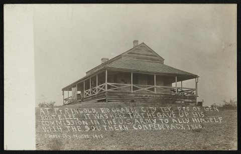
The area around Rio Grande City was first settled by Spanish colonists on the southern bank of the river as Camargo. The northern bank became more densely settled after the Mexican-American War and United States' annexation of the territory.
In 1846 the northern bank was gradually developed— still under the name Camargo. It was used by the US Army as a supply depot for its invading Mexico as part of the Mexican–American War. The area was strategic as the furthest point up the Rio Grande that was navigable and regularly accessible to the era's steamboats.
Nothing in the archives for these yearsWeddings on Main Street, storms, parades, school pictures, the old store. If it’s in your family album, it belongs here.
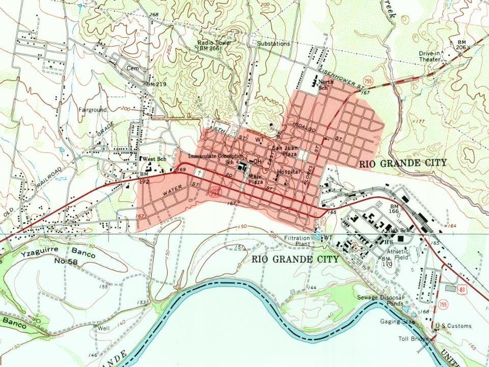
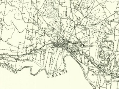
Every edition of the U.S. Geological Survey’s map of Rio Grande City. Tap a year, or press play to watch the town change.
1956Escobares sheet · 1:62,500
U.S. Geological Survey historical topographic maps (public domain), via Esri’s collection of the scans. The red ring marks the center of Rio Grande City.
Every building
Rio Grande City, building by building, 1894–1925
Fire insurance maps drew every building, what it was made of and what it was used for, so insurers could price the risk of fire. Pick a year, then a sheet.
In 1848, according to Wikidata. Rio Grande City’s post office opened in 1849, and the census of 1950 counted 3,992 people here.
How does Rio Grande City rank for history?
Rio Grande City is more historic than 70% of U.S. towns, #55 of 642 in Texas. The History grade combines the town’s founding era, the share of homes built before 1940 and its National Register listings. It’s a character grade, so it isn’t part of the overall grade. How it works.
What is on the National Register in Rio Grande City?
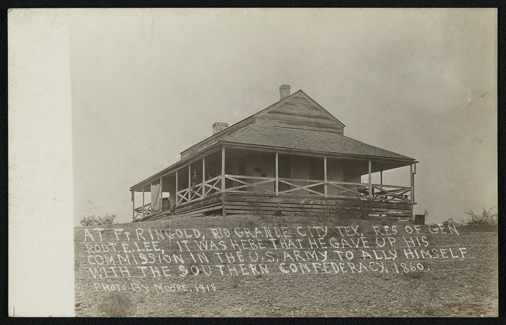
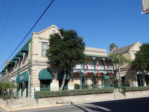
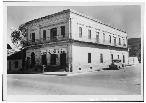
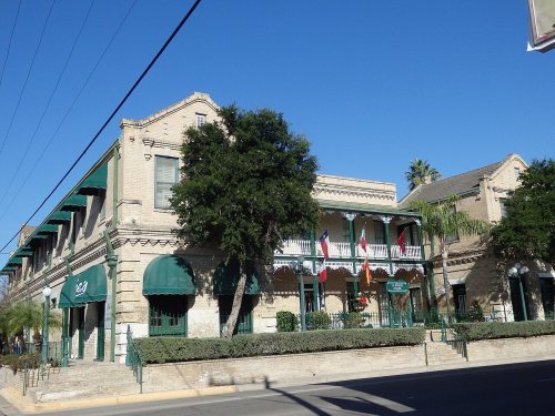
7 listings: 5 buildings, among them the LaBorde House, Store and Hotel (listed 1980, the first), and 2 historic districts, the Fort Ringgold Historic District and the Rio Grande City Downtown Historic District, with 118 contributing buildings. 131 historic buildings in all.
How old are the homes in Rio Grande City?
2% of Rio Grande City’s homes were built before 1940 (Census estimate, ±1.4 points), against a typical 1.6% for a Texas town; the median home was built in 1991.
Founding dates: Wikidata, Wikipedia, the U.S. post office records of Blevins & Helbock (CC0) and the Census. Homes by year built: Census ACS 2020–24. National Register of Historic Places: National Park Service (list of May 22, 2026). Old photos, postcards and papers: Wikimedia Commons, the Library of Congress and other public archives, credited on each item’s page. Maps: U.S. Geological Survey historical topographic maps (via Esri) and Sanborn fire-insurance maps (Library of Congress). History text and census tables: Wikipedia (CC BY-SA 4.0). Places that used to be: USGS Geographic Names Information System (2021).
From Wikimedia Commons (4), the Library of Congress (2), the National Register of Historic Places (7), Wikipedia, Wikidata and Wikipedia for famous people, U.S. Geological Survey historical maps, U.S. Census counts (via Wikipedia), the US Post Offices dataset (Blevins & Helbock), the USGS Geographic Names Information System and Sanborn fire insurance maps (Library of Congress). Archive images are copied here with their credits and licenses, shown on each photo’s page. Refreshed monthly.









 2014
 2011