Guest, Sign inJoin

Post to Fort Worth

We’ll email a one-tap link to publish your post. No password, and nothing is public until you click it.
Already a member? Sign in
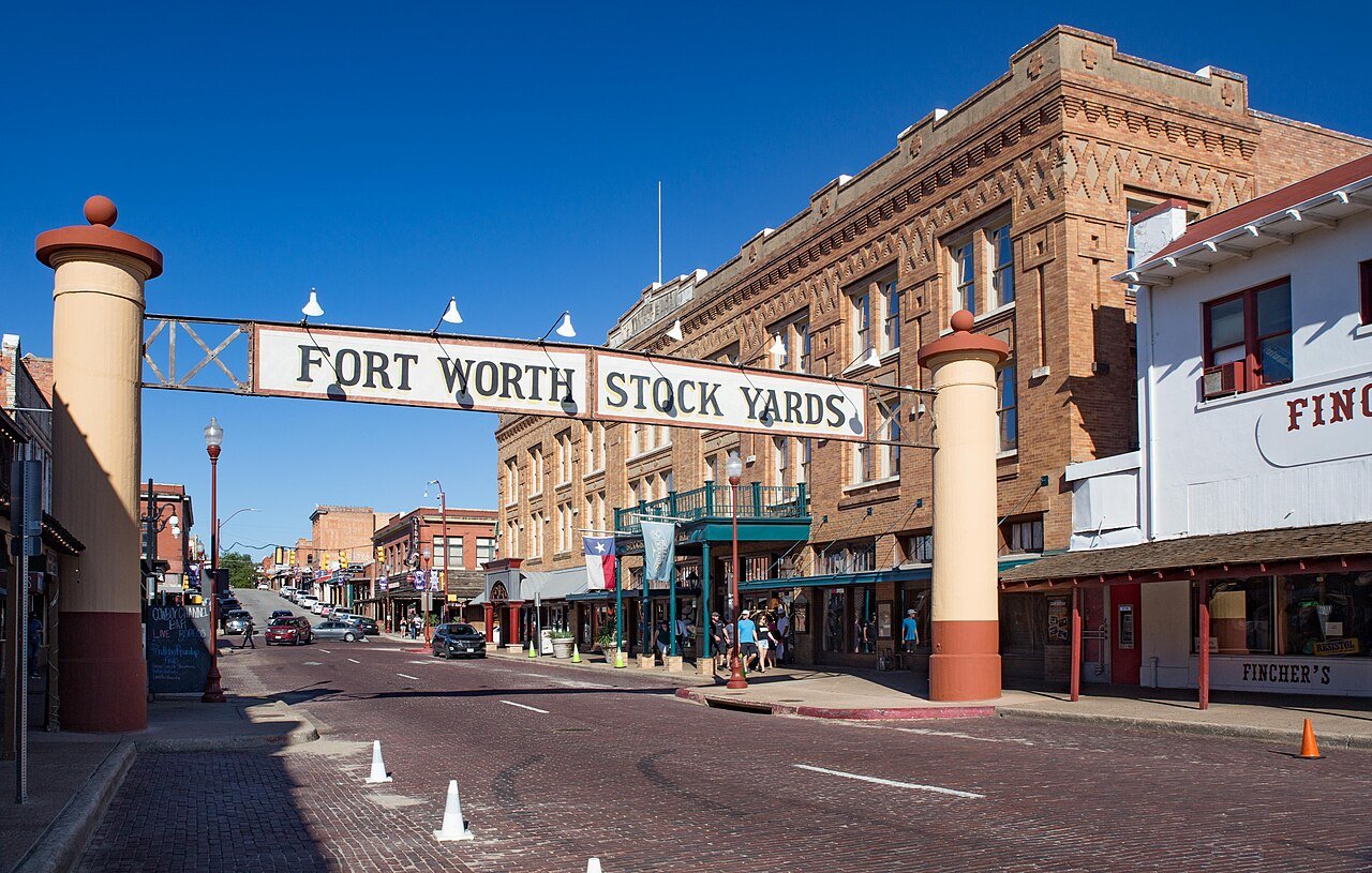
Fort Worth Stock Yards Entrance Wiki (1 of 1)Photo: Renelibrary · CC BY-SA 4.0
B+Outdoors
Outdoors in Fort Worth

Fort Worth has 217 miles of mapped trails, 0.6 for every square mile of land

The biggest trail networks: Fort Worth Nature Center & Refuge (17.4 mi), Marion Sansom Park (11 mi), Fort Worth Botanic Garden (5.6 mi). 85% of residents live within a half mile of a park. 6% of Fort Worth’s land is conserved, about 14,105 acres.

Ahead of 69% of U.S. towns · #122 of 642 in Texas. What drives it

Conserved land
6%
14,105 acres · of 352.0 sq mi of land
Trails
217 mi
0.6 per sq mi of land
Park land
9,983 ac
10 acres per 1,000 residents
Near a park
85%
of residents within ½ mile
Bike routes
232 mi
72 mi lanes · 149 mi paths
Lakes & rivers
49
2 beaches

What kind of outdoors town is Fort Worth?

Read from the map. The page puts what stands out first.

Outdoors grade

How much outdoors does Fort Worth have?

On conserved land, trails, park land and how close residents live to a park, Fort Worth is ahead of 69% of U.S. towns, #122 of 642 in Texas. The share of residents near a park holds the grade up; park acres per resident pull it down.

B+
OutdoorsA character grade: shown, never part of Fort Worth’s overall grade.
All U.S. towns we grade (21,298)Ahead of 69%
LessMore
Texas towns of 2,500+ (642)Ahead of 81%

Among the 400 U.S. cities of 100,000 or more, Fort Worth ranks #272 on Outdoors.

Few Texas towns conserve much land (a typical one, 2%; the U.S., 4%), so Fort Worth’s 6% is ahead of 81% of Texas towns, while its trails per square mile lead 77% of them.

How sure. Graded on any three of the four inputs instead, the letter would range from B to A−. Trails and many small parks come from OpenStreetMap, mapped by volunteers, so coverage varies from town to town; the half mile is a straight line from each census block, so a river or highway in the way isn’t counted against it. A citywide figure averages neighborhoods that differ a lot.

PAD-US, OpenStreetMap (© OpenStreetMap contributors), Census 2025 Gazetteer and 2020 blocks; details in Sources below. How TownRatings grades the outdoors →

The map

Conserved land, trails & bike routes

Tap a number to zoom to a park. Tap a layer to hide it.

12345678
Easements protect land from building but are usually private.© OpenStreetMap contributors · USGS PAD-US
Places to walk

Pick a walk

The longest trail network is Fort Worth Nature Center & Refuge, with 17.4 miles. Directions go to the nearest trailhead or public parking.

Fort Worth Nature Center & Refuge

Park
3,517 acres17.4 mi of trail
Riverbottom TrailCanyon Ridge TrailCrosstimbers TrailOak Motte Trail+1
Dog rules not recorded
Directionsto the parking lotWebsite ↗

Marion Sansom Park

Park
266 acres11 mi of trail
Lone Wolf LoopThe Dam DropGangsterJojo's+1
Dog rules not recorded
Directionsto the parking lot

Fort Worth Botanic Garden

Managed by City of Fort Worth
101 acres5.6 mi of trail
Dog rules not recorded
Directionsto the parking lotWebsite ↗

Tandy Hills Natural Area

Park
127 acres3.4 mi of trail
Wildflower LoopWestside TrailSunset TrailSecond Meadow Path+1
Dog rules not recorded
No trailhead mapped yet

Trinity Trail Park

Managed by City of Fort Worth
167 acres2.9 mi of trail
Dog rules not recorded
Directionsto the parking lot

Sycamore Park

Park
98 acres2.8 mi of trail
Dog rules not recorded
Directionsto the parking lot

Cobb Park

Park
297 acres2.7 mi of trail
Dog rules not recorded
Directionsto the parking lot

Oakland Lake Park

Park
58 acres2.2 mi of trail
Dog rules not recorded
Directionsto the parking lot
All 208 parks & preserves
Fort Worth Nature Center & Refuge3,517 acres · 17.4 mi of trail
Directions
Marion Sansom Park266 acres · 11 mi of trail
Directions
Fort Worth Botanic Garden101 acres · 5.6 mi of trail · City of Fort Worth
Directions
Tandy Hills Natural Area127 acres · 3.4 mi of trail
Trinity Trail Park167 acres · 2.9 mi of trail · City of Fort Worth
Directions
Sycamore Park98 acres · 2.8 mi of trail
Directions
Cobb Park297 acres · 2.7 mi of trail
Directions
Oakland Lake Park58 acres · 2.2 mi of trail
Directions
Trinity Park225 acres · 1.7 mi of trail · City of Fort Worth
Directions
Arcadia Trail Park263 acres · 1.4 mi of trail
Directions
Carter Park153 acres · 1.3 mi of trail
Directions
Riverside Park38 acres · 1.2 mi of trail
Directions
Panther Island72 acres · 1 mi of trail · City of Fort Worth
Directions
Alliance Park69 acres · 0.9 mi of trail · City Of Fort Worth
Directions
Overton Park58 acres · 0.8 mi of trail
Foster Park26 acres · 0.8 mi of trail
Directions
North Park46 acres · 0.7 mi of trail · Southlake
Directions
Burnett Park3 acres · 0.7 mi of trail
Directions
Rolling Hills Park110 acres · 0.6 mi of trail
Directions
Trails at University95 acres · 0.6 mi of trail
Directions
Sinclair Park64 acres · 0.6 mi of trail
Greenbriar Park58 acres · 0.6 mi of trail
Directions
Heritage Park26 acres · 0.6 mi of trail
Directions
Arcadia Trail Park North64 acres · 0.5 mi of trail
Directions
Sylvania Park32 acres · 0.5 mi of trail
Directions
Sendera Ranch Park26 acres · 0.5 mi of trail
Directions
North Side Park14 acres · 0.5 mi of trail
Directions
Eastover Park12 acres · 0.5 mi of trail
Directions
Wind Ridge Park9 acres · 0.5 mi of trail
Buck Sansom Park130 acres · 0.4 mi of trail
Deer Creek Park14 acres · 0.4 mi of trail
Ninnie Baird Park14 acres · 0.4 mi of trail
Nutt Lake Park14 acres · 0.4 mi of trail
Directions
Martin Luther King Park14 acres · 0.4 mi of trail
Fort Worth Water Gardens6 acres · 0.4 mi of trail
Directions
Bluebonnet Circle Park3 acres · 0.4 mi of trail
Chisholm Trail Park84 acres · 0.3 mi of trail · City of Fort Worth
Lake Como Park72 acres · 0.3 mi of trail
Directions
Stratford Park29 acres · 0.3 mi of trail
Directions
River Park29 acres · 0.3 mi of trail
Directions
Hillside Park20 acres · 0.3 mi of trail
Directions
Village Creek Park20 acres · 0.3 mi of trail
Marine Creek Linear Park14 acres · 0.3 mi of trail
Directions
Parque Unidad/Unity Park14 acres · 0.3 mi of trail
Rodeo Park12 acres · 0.3 mi of trail
Directions
Linwood Park6 acres · 0.3 mi of trail
Directions
Dabney Park6 acres · 0.3 mi of trail
Northwest Community Park219 acres · 0.2 mi of trail
Directions
Forest Park40 acres · 0.2 mi of trail · City of Fort Worth
Directions
Rockwood Park38 acres · 0.2 mi of trail
Westcreek Park23 acres · 0.2 mi of trail
Directions
Handley Park17 acres · 0.2 mi of trail
Directions
Kingswood Park14 acres · 0.2 mi of trail
Camelot Park14 acres · 0.2 mi of trail
Coventry Hills12 acres · 0.2 mi of trail
Trails of Fossil Creek9 acres · 0.2 mi of trail
Directions
McPherson Ranch Park9 acres · 0.2 mi of trail
Parkwood Hills Park9 acres · 0.2 mi of trail · City of Fort Worth
Collett Park9 acres · 0.2 mi of trail
Directions
Harvest Ridge Park3 acres · 0.2 mi of trail
Directions
Harrold Park3 acres · 0.2 mi of trail · City of Fort Worth
Directions
Sundance Square Plaza3 acres · 0.2 mi of trail
Directions
Mallard Cove Park90 acres · 0.1 mi of trail
Will Rogers Memorial Center72 acres · 0.1 mi of trail · City of Fort Worth
Directions
Rosemont Park38 acres · 0.1 mi of trail
Directions
Highland Hills Park35 acres · 0.1 mi of trail
Directions
Krauss-Baker Park23 acres · 0.1 mi of trail
Lincoln Park20 acres · 0.1 mi of trail
Directions
Tillery Park20 acres · 0.1 mi of trail
Directions
George Markos Park17 acres · 0.1 mi of trail
Kristi Jean Burbach Park17 acres · 0.1 mi of trail
Directions
Log Cabin Village14 acres · 0.1 mi of trail
Directions
Heritage Addition Park14 acres · 0.1 mi of trail
Directions
Greenway Park9 acres · 0.1 mi of trail
Directions
Fox Run Park9 acres · 0.1 mi of trail · City of Fort Worth, Texas
Summerfield Park9 acres · 0.1 mi of trail
Directions
Western Hills Park6 acres · 0.1 mi of trail
Reata Park6 acres · 0.1 mi of trail
Parkview Hills Park6 acres · 0.1 mi of trail
Little People Park6 acres · 0.1 mi of trail
Trinity Bluff Park6 acres · 0.1 mi of trail
Directions
Pate Park3 acres · 0.1 mi of trail
South Meadows Park3 acres · 0.1 mi of trail
Timberland Park3 acres · 0.1 mi of trail
Directions
Twin Mills Park3 acres · 0.1 mi of trail
Lone Tree Park3 acres · 0.1 mi of trail · Town of Flower Mound
Directions
Z Boaz Park130 acres
Directions
Mosque Point Park95 acres
Candleridge Park78 acres
Pecan Valley Park78 acres
Marine Creek Lake Park78 acres
Directions
Oak Grove Park72 acres
Anderson-Campbell Park64 acres
Z. Boaz South Community Park64 acres
Directions
Marine Creek Ranch Park58 acres
Love Circle Park52 acres
Echo Lake Park49 acres
Directions
Casino Park49 acres
Prairie Dog Park46 acres
Directions
Memorial Oak Park40 acres
Vineyards of Heritage Park40 acres
Arrow S. Park40 acres
Directions
Southwest Park38 acres
Directions
Glenwood Park35 acres
Directions
Sunset Hills Park32 acres
Summerbrook Park29 acres
Directions
C.P. Hadley Park26 acres · City of Fort Worth Park & Recreation Department
Diamond Hill Park26 acres
Directions
William McDonald Park26 acres
Westside Fields23 acres
Directions
Hulen Meadows Park23 acres
Marine Creek Linear Park North23 acres
Hallmark Park20 acres
Sandy Lane Park17 acres
Directions
Longhorn Park17 acres
Directions
Heart of the Ranch17 acres
Directions
Ranches East Park17 acres
Patricia Leblanc Park17 acres
Directions
Settlement Plaza Park17 acres
Shackleford Park17 acres
Bunche Park17 acres
McPherson Park14 acres · The City of Colleyville
Prairie Vista Park14 acres
Directions
Creekside Park14 acres
Lincolnshire Park14 acres
Kellis Park14 acres
Directions
Ellis Park14 acres
Deer Meadow Park14 acres
Marine Park14 acres
Directions
Parks of Deer Creek14 acres
Chuck Silcox Park12 acres · Fort Worth TX
Trinity trails12 acres
Directions
Oakmont12 acres
Rotary Park12 acres
Directions
Dorado Ranch Park12 acres
Willowcreek Park12 acres
Silver Sage Park9 acres
Oakmont Park9 acres
Directions
LaGrave Field9 acres
Directions
Quanah Parker Park9 acres
Directions
Marina Park9 acres
Sundance Springs Park9 acres
Rosemary Ridge9 acres
Friendship Park9 acres · City of Fort Worth Park & Recreation Department
Directions
Willow Ridge Park9 acres · City of Fort Worth Parks & Community Services Department
Directions
Circle Park9 acres
Directions
Lost Spurs Park6 acres
Rosedale Park6 acres
Directions
Tim Watson Park6 acres
Directions
Lake Park6 acres · Walsh
Vinca Circle Park6 acres
Falcon Ridge Park6 acres
Summer Creek Ranch Park6 acres
Wedgewood Park6 acres
Chadwick Farms Park6 acres
Directions
Walnut Creek Park6 acres
Capps Park6 acres
Directions
Doo Kim Park6 acres
Directions
Fairfax Park6 acres
Meadow Creek Park6 acres
Sandybrook Park6 acres
Worth Hills Park6 acres
Twin Points Park3 acres
Roaring Park3 acres
Southcreek Park3 acres
Leonard Park3 acres
Seminary Hill Park3 acres
Directions
Marty Leonard Park3 acres
Summerfields/Chisholm Park3 acres
Directions
Plover Circle Park3 acres
Cold Spring Park3 acres
Trail Lake Estates Park3 acres
Newby Park3 acres
Directions
Springdale Park3 acres
Monticello Park3 acres
Smith-Wilemon Park3 acres
Sagamore Hills Park3 acres
Thorny Ridge Park3 acres · City of Fort Worth
Lost Creek Ranch Park3 acres
Eastern Hills Park3 acres
Overlook Park3 acres · Walsh
Bonnie Brae Park3 acres
Arnold Park3 acres
Directions
Morningside Middle School Park3 acres
Wellington Neighborhood Park3 acres · Wellington of Flower Mound HOA
Trader Oak Park3 acres
Fire Station Communty Center Park3 acres
Directions
Eugene McCray Community Center Park3 acres
Directions
Park Vista Park3 acres
Thomas Place Park3 acres
South Creek Park3 acres
Crescent Park3 acres
Parkwood Hill3 acres
Founders Park3 acres · North Richland Hills
Directions
Southridge Park3 acres
Old Denton Road Park3 acres
Directions
Normandy Park3 acres
Bear Creek Vista Community Park3 acres
Wild Pear Park3 acres
Harriet Creek Park3 acres
Directions
River Hills Park3 acres
Directions
Harvey Street Park3 acres
Directions
Veteran's Memorial Park3 acres
Fairmount Park3 acres
RCCE Park3 acres
Highcrest Park3 acres
Waterside Grove3 acres
Directions
Angel Food Park3 acres
Who protects it

14,105 conserved acres

6% of Fort Worth’s land. Who manages Fort Worth’s conserved land, from the USGS Protected Areas Database. Approximate, because parcels can overlap.

Town or city25,000 ac
Army Corps of Engineers2,477 ac
Joint139 ac
Other or Unknown Local Government98 ac
Private owners95 ac
Regional Water Districts29 ac
Regional agency12 ac
Conservation Easement · 11,377 acLocal Park · 5,922 acLocal Conservation Area · 4,077 acLocal Recreation Area · 2,913 acRecreation or Education Easement · 2,322 ac
Good to know

Conserved doesn’t always mean open to visitors. 647 acres are conservation easements, usually private land. Public access isn’t recorded for 1 of 542 parcels. The walks above are places people visit.

The biggest protected parcels
Parcel (PAD-US)Managed byAcresPublic access
Fort Worth Nature Center And Wildlife Refuge
Local Conservation Area
Town or city3,537Restricted
Benbrook Recreation Area
Recreation Management Area
Army Corps of Engineers1,019Open
Gateway Park
Local Recreation Area
Town or city785Open
Pecan Valley Golf Course
Local Recreation Area
Town or city462Open
Marion Sansom Park
Local Park
Town or city266Open
River Legacy Park
Local Conservation Area
Town or city254Open
Cobb Park
Local Park
Town or city248Open
Rockwood Golf Course
Local Recreation Area
Town or city237Open
Rolling Hills Park
Local Recreation Area
Town or city225Open
Arcadia Trail Park North
Local Park
Town or city219Open

5 smaller protected places aren’t shown.

Things to do

308 places to go in Fort Worth

Beaches, playgrounds, peaks, falls and more. Pick a kind.

Playgrounds in Fort Worth
Creekside Park PlaygroundIn Creekside Park
Directions
Dream Park Fort WorthIn Trinity Park
Directions
Harriet Creek PlaygroundIn Harriet Creek Park
Directions
Hat Creek Burger CompanyHours: Sun–Thu 8 am – 9 pm; Fri–Sat 8 am – 9:30 pm
Directions
Hat Creek Playground
Directions
Joe's Crab Shack Playground
Directions
Kidmania
Directions
Krauss Baker parkIn Krauss-Baker Park
Directions
6 more playgrounds
Lindstrom Playground
Directions
Mallard Cove Park PlaygroundIn Mallard Cove Park
Directions
Montessori School Playground
Directions
Ninnie Baird PlaygroundIn Ninnie Baird Park
Directions
South Meadows Park PlaygroundIn South Meadows Park
Directions
Walnut Creek ParkIn Walnut Creek Park
Directions

266 playgrounds are on OpenStreetMap in all; the list shows named ones from the first 30.

Trails & water

25 named trails and 49 lakes & rivers

Named trails
Open to bikes · 60.4 miHorses · 2.3 miUnpaved · 48.3 mi
Riverbottom Trail4.2 mi
River Legacy MTB Trail3.9 mi
Lone Wolf Loop3.6 mi
Trinity Trail3.4 mi
Canyon Ridge Trail3.0 mi
Crosstimbers Trail2.6 mi
Oak Motte Trail2.2 mi
The Dam Drop1.7 mi
Trinity River Trail1.5 mi
Old Bankhead Highway1.2 mi
15 more trails
Prairie Trail
1.1 mi
Wikd Plum South
0.7 mi
Gangster
0.7 mi
Deer Mouse Trail
0.6 mi
Jojo's
0.6 mi
Wildflower Loop
0.6 mi
Grass Loop
0.6 mi
Forked Tail Creek Trail
0.5 mi
Rocket
0.5 mi
Caprock Trail
0.5 mi
Westside Trail
0.4 mi
Oakcliff Trail
0.4 mi
Skyline
0.4 mi
Cut-In Trail
0.4 mi
Stratford Path
0.3 mi
Lakes & rivers tap for directions
Biking & sports

232 miles of bike routes

Bike lanes are often missing from the map in smaller towns, so that number is likely low.

72 mi
painted or protected bike lanes
149 mi
off-road bike paths
11 mi
shoulders & shared lanes
Trinity TrailsBike route
15.3 mi
Courts & fields
338Tennis
123Baseball
103Soccer
79Basketball
54Football
22Golf
16Multi-sport
16Beach volleyball

Includes school and college facilities, which aren’t always open to the public.

History along the way

103 places on the National Register

The country’s official list of places worth saving (National Park Service). The map also marks 80 historic points from OpenStreetMap: plaques, memorials and old buildings.

History →
Knights of Pythias BuildingBuilding · listed 1970
About it
Gulf, Colorado and Sante Fe Railroad Passenger StationBuilding · listed 1970
About it
Tarrant County CourthouseBuilding · listed 1970
About it
Flatiron BuildingBuilding · listed 1971
About it
Pollock-Capps HouseBuilding · listed 1972
About it
Wharton-Scott HouseBuilding · listed 1975
About it
Paddock ViaductStructure · listed 1976
About it
Fort Worth Stockyards Historic DistrictDistrict · listed 1976
About it
Texas & Pacific Steam Locomotive No. 610Structure · listed 1977
About it
Neil P. Anderson BuildingBuilding · listed 1978
About it
M. A. Benton HouseBuilding · listed 1978
About it
Texas and Pacific Terminal ComplexBuilding · listed 1978
About it

91 more on the History page.

When to get out

April is the best month for walking in Fort Worth

NOAA’s 1991–2020 normals for the town and the daylight at its latitude. Outlined months have long days, highs of 59 to 86 °F and little rain for the place.

JanFebMarAprMayJunJulAugSepOctNovDec
Daylight (h)10.211.011.913.013.814.314.113.312.311.310.410.0
High (°F)576269778492969789796759
Rain (in)2.22.43.33.24.43.62.02.53.14.12.62.6

July is the driest month (2.0 in) and August the warmest (highs of 97 °F). 4.4 inches fall in May, the wettest month. Summer highs reach 97 °F, too hot for the outline. The climate in Fort Worth →

Next door

Fort Worth and its neighbors

Fort Worth has the most mapped trails of the 8 towns around it. Tap a town to see its outdoors.

TownConserved
of land
Trail mi
per sq mi
Park acres
per 1,000
Near a park
½ mile
Outdoors
Fort Worth6%0.61085%B+
Arlington8%0.51085%B+
Benbrook13%0.63096%A
Rendonunder 1%under 0.1under 110%D−
Euless6%0.61199%A−
Grand Prairie24%0.33380%A−
Lakesideunder 1%under 0.1499%+C−
Forest Hill1%0.1270%C−

The four inputs of the Outdoors grade, from the engine; shares are of land, not water.

Questions about parks and trails in Fort Worth

Where can I hike in Fort Worth?

The longest trail networks: Fort Worth Nature Center & Refuge, 17.4 miles; Marion Sansom Park, 11 miles; Fort Worth Botanic Garden, 5.6 miles; Tandy Hills Natural Area, 3.4 miles. Each one is on the map above, with directions to the nearest trailhead or parking.

How much of Fort Worth is conserved land?

6% of its land, against a typical 2% for a Texas town and 4% nationally (PAD-US). Conserved doesn’t always mean open to visitors: easements are usually private land.

Are dogs allowed on Fort Worth’s trails?

Fort Worth Nature Center & Refuge and Marion Sansom Park don’t have dog rules recorded on the map; check the signs at the trailhead.

Where can I bike in Fort Worth?

232 miles of bike routes are on the map: 72 of painted or protected lanes, 149 of off-road paths and 11 of shoulders and shared lanes. Named routes: Trinity Trails.

Is there public land near Fort Worth?

47,306 acres of parks and open public land lie inside Fort Worth or within 10 miles of it (PAD-US), 11,048 of them inside the city line.

How much outdoors does Fort Worth have?

Ahead of 69% of U.S. towns on the Outdoors grade, #122 of 642 in Texas. The grade combines the share of land that is conserved, miles of mapped trail per square mile of land, park acres per 1,000 residents and the share of residents within a half mile of a park. It’s a character grade, so it isn’t part of the overall grade. How it works.

Trail talk

Conditions, parking and favorite walks from Fort Worth neighbors.

Town Square →
Share a tip
Sources

Where this page comes from

Conserved and public land: USGS Protected Areas Database of the United States (PAD-US), service updated July 2026. Parks, trails, playgrounds, beaches and other places: OpenStreetMap (© OpenStreetMap contributors, ODbL), map data as of 2026-10-28. Land and water area: Census 2025 Gazetteer. Residents near a park: 2020 Census blocks. National Register: National Park Service. How TownRatings grades the outdoors →