Blountville dates to 1795, and 3 of its places are on the National Register
More historic than 74% of U.S. towns · #28 of 177 in Tennessee. What drives it
Most of Blountville was built recently: 5% of its homes predate 1940 and the median home dates from 1973. 3 places in town are on the National Register, among them a historic district with 28 buildings. Below: 4 old photos and papers, maps from 1935 on, and the census since 2000.
Founding year: Wikidata. First post office: 1819.The full story ↓
History grade
What drives Blountville’s History grade
On its age, its old homes and the National Register, Blountville is more historic than 74% of U.S. towns, #28 of 177 in Tennessee. Its National Register listings hold the grade up; its share of homes from before 1940 pulls it down.
B+
HistoryA character grade: shown, never part of Blountville’s overall grade.
Tennessee towns list more on the Register than most of the country (a typical Tennessee town has 6.1 per 10,000 residents, the U.S. 2.4), so Blountville’s 127 sits above most of its state (91% of Tennessee towns have fewer) while its 42 historic buildings outnumber those of 84% of U.S. towns.
How sure. Graded on any two of the three inputs instead, the letter would range from B− to A. The pre-1940 share is a Census survey estimate (±4.1 points). Two sources give 1795.
Founding year: Wikidata (other dates in Quick answers). Homes: Census ACS 2020–24. National Register: National Park Service, May 2026 list; each listing counted once (boundary changes and added documentation belong to their listing), and a historic district counts its contributing buildings. How TownRatings grades history →
What stands out about Blountville’s past
Read from the archive, the National Register and the record. The page puts what stands out first.
The area that is now Blountville is thought to have been the location of a longhunter fort prior to its permanent settlement. The site of the town was part of a tract of about 600 acres (240 ha) of land bought by James Brigham in 1782. In 1792 Brigham gave 30 acres (12 ha) to Sullivan County for use as a county seat and established a hotel nearby. Blountville was laid off as a town and established as the county seat in 1795. The county's first courthouse and jail was a log structure. In 1825 it was replaced with a brick building. By 1830, the settlement had 209 residents, two churches, six stores, two taverns, ten mechanics, one doctor, and one lawyer.
interests and was more instrumental than any other man in introducing blooded stock into the county. He succeeded Gen. John Sevier as military commandant of the district. Gen. Rutledge died July 1, 1813, fifty-three years of age and is buried at Blountville. He was at first buried near his home, but shortly after the graveyard was laid out at Blountville, was exhumed and buried there. His wife survived him several years and died at Kingsport. The remains were brought to Blountville, and as this funeral party approached from the west, the cortege in charge of the general's remains came over the hill from the east, a bell tolling all
Text read by machine from the scan; it may contain errors.
The first church to be erected on Tennessee soil was called Taylor Meeting House and was located near Gunning's, about four miles west of Blountville. Rev. Jacob Lake preached to the congregation that assembled there. This church antedates all other claims by a year if not 1 Allison claims Salem church was erected in 1777. Others claim it was erected in 1778.
Text read by machine from the scan; it may contain errors.
Scans and text from the Internet Archive. Books published in 1930 or earlier, which are in the public domain.
In 1795, according to Wikidata. Blountville’s post office opened in 1819, and the census of 2000 counted 2,959 people here.
How does Blountville rank for history?
Blountville is more historic than 74% of U.S. towns, #28 of 177 in Tennessee. The History grade combines the town’s founding era, the share of homes built before 1940 and its National Register listings. It’s a character grade, so it isn’t part of the overall grade. How it works.
What is on the National Register in Blountville?
Three places: the Old Deery Inn (listed 1973), the Blountville Historic District (1973) and the Erwin Farm (1973).
How old are the homes in Blountville?
5% of Blountville’s homes were built before 1940 (Census estimate, ±4.1 points), against a typical 4.9% for a Tennessee town; the median home was built in 1973.
Founding dates: Wikidata, Wikipedia, the U.S. post office records of Blevins & Helbock (CC0) and the Census. Homes by year built: Census ACS 2020–24. National Register of Historic Places: National Park Service (list of May 22, 2026). Old photos, postcards and papers: Wikimedia Commons, the Library of Congress and other public archives, credited on each item’s page. Maps: U.S. Geological Survey historical topographic maps (via Esri) and Sanborn fire-insurance maps (Library of Congress). History text and census tables: Wikipedia (CC BY-SA 4.0). Places that used to be: USGS Geographic Names Information System (2021).
From Wikimedia Commons (1), the Library of Congress (4), the National Register of Historic Places (3), Wikipedia, Wikidata and Wikipedia for famous people, U.S. Geological Survey historical maps, U.S. Census counts (via Wikipedia), the US Post Offices dataset (Blevins & Helbock), the USGS Geographic Names Information System and old county and town histories (Internet Archive). Archive images are copied here with their credits and licenses, shown on each photo’s page. Refreshed monthly.


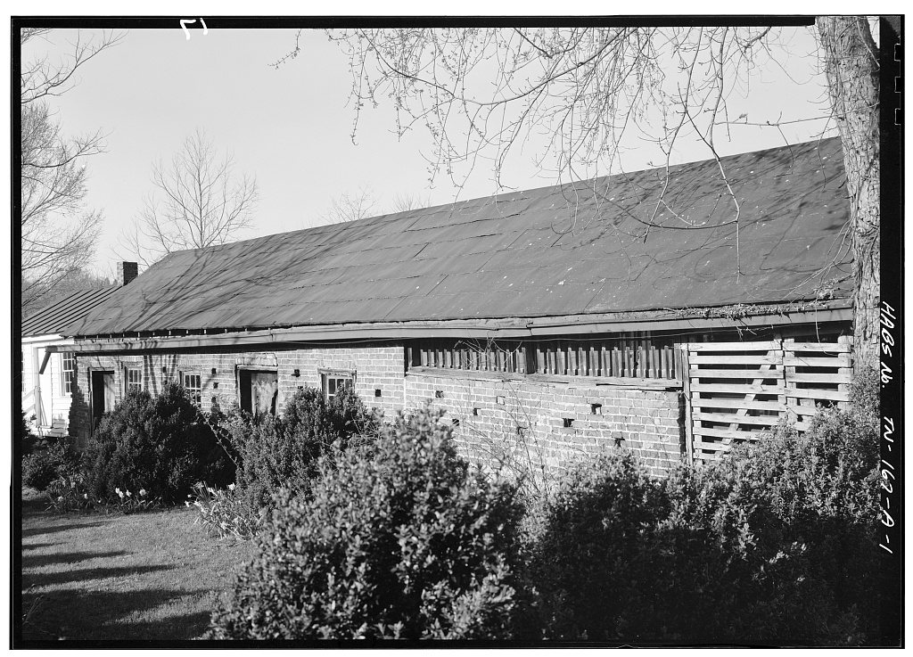


 Date?
 Date?
 Date?
 Date?
 2009


