Tiverton dates to 1659, and 16% of its homes were built before 1940
More historic than 83% of U.S. towns · #22 of 38 in Rhode Island. What drives it
9 places in town are on the National Register, among them two historic districts with 38 buildings between them. Below: 15 old photos and papers, maps from 1888 on, and the census since 1790.
Founding year: Wikidata. First post office: 1810.The full story ↓
History grade
What drives Tiverton’s History grade
On its age, its old homes and the National Register, Tiverton is more historic than 83% of U.S. towns, #22 of 38 in Rhode Island. All 3 inputs are above most U.S. towns; its age ranks highest and its National Register listings lowest.
A−
HistoryA character grade: shown, never part of Tiverton’s overall grade.
Rhode Island towns list more on the Register than most of the country (a typical Rhode Island town has 94.7 per 10,000 residents, the U.S. 2.4), so Tiverton’s 40.2 sits below most of its state (21% of Rhode Island towns have fewer) while its 65 historic buildings outnumber those of 87% of U.S. towns.
NoteThe founding year comes from Wikidata alone; no second source gives 1659.
How sure. Graded on any two of the three inputs instead, the letter would range from B to A. The pre-1940 share is a Census survey estimate (±3.3 points).
Founding year: Wikidata (other dates in Quick answers). Homes: Census ACS 2020–24. National Register: National Park Service, May 2026 list; each listing counted once (boundary changes and added documentation belong to their listing), and a historic district counts its contributing buildings. How TownRatings grades history →
What stands out about Tiverton’s past
Read from the archive, the National Register and the record. The page puts what stands out first.
Lost post offices, old corners, places now gone and burying grounds
Tiverton’s post office has been open since 1810. Three other post offices opened and closed inside today’s town.
Tiverton
1810–today
Tiverton Four Corners
1829–1933
Bliss Four Corners
1857–1864
North Tiverton
1886–1906
18101920today
Hamlets and corners on the map
Bliss CornersBridgeportEaglevilleGrayvilleNorth TivertonTiverton Four Corners
Gone or out of use
Fort BartonmilitaryTiverton Airportairport
48family graveyards and cemeteries inside Tiverton
Benjamin Borden LotBenjamin Hambly LotBenjamin Manchester LotCaptain Isaac Cook LotCaptain Joseph Church LotCaptain Thomas Osborn LotCharles Durfee LotChristopher Manchester LotClark - Shaw LotColonel Pardon Gray LotCongregationalConstant and Susannah Seabury Burying GroundConstant Hart LotCornell LotDaniel Dwelly LotDavid Durfee LotDavid Rounds LotEdward Simmons LotGabriel Hicks LotGideon Grinnell LotGodfrey KingHillsideHonorable Thomas Durfee LotIsaac Sherman LotJohn Almy LotJohn Brown LotJohn Carr LotJohn Grinnell LotJoseph Rounds LotLakeMoses Hunt LotMosher - Manchester LotOld LakePelrg BurroughsPhilip Gray LotPhillip Cory LotPleasant ViewPocasset HillSamuel Negus LotStephen Cook LotStone ChurchTiverton Historical Cemetery 52TownWilcox LotWilliam Almy LotWilliam Cook LotWilliam Gray LotWilliam Humphrey Lot
See all 48
Benjamin Borden Lot Cemetery · Benjamin Hambly Lot Cemetery · Benjamin Manchester Lot Cemetery · Captain Isaac Cook Lot Cemetery · Captain Joseph Church Lot Cemetery · Captain Thomas Osborn Lot Cemetery · Charles Durfee Lot Cemetery · Christopher Manchester Lot Cemetery · Clark - Shaw Lot Cemetery · Colonel Pardon Gray Lot Cemetery · Congregational Cemetery · Constant and Susannah Seabury Burying Ground Cemetery · Constant Hart Lot Cemetery · Cornell Lot Cemetery · Daniel Dwelly Lot Cemetery · David Durfee Lot Cemetery · David Rounds Lot Cemetery · Edward Simmons Lot Cemetery · Gabriel Hicks Lot Cemetery · Gideon Grinnell Lot Cemetery · Godfrey King Cemetery · Hillside Cemetery · Honorable Thomas Durfee Lot Cemetery · Isaac Sherman Lot Cemetery · John Almy Lot Cemetery · John Brown Lot Cemetery · John Carr Lot Cemetery · John Grinnell Lot Cemetery · Joseph Rounds Lot Cemetery · Lake Cemetery · Moses Hunt Lot Cemetery · Mosher - Manchester Lot Cemetery · Old Lake Cemetery · Pelrg Burroughs Cemetery · Philip Gray Lot Cemetery · Phillip Cory Lot Cemetery · Pleasant View Cemetery · Pocasset Hill Cemetery · Samuel Negus Lot Cemetery · Stephen Cook Lot Cemetery · Stone Church Cemetery · Tiverton Historical Cemetery 52 · Town Cemetery · Wilcox Lot Cemetery · William Almy Lot Cemetery · William Cook Lot Cemetery · William Gray Lot Cemetery · William Humphrey Lot Cemetery
US Post Offices dataset (Blevins & Helbock, CC0). Places and cemeteries from the USGS Geographic Names Information System (2021).
Timeline
Tiverton, 1659 to 1973
Woven from the archive, old maps, post office records, the National Register and the people born here.
Tiverton was incorporated by English colonists in 1694 within Bristol County in the Province of Massachusetts Bay. As well as being part of Old Dartmouth. In 1746, in the final settlement of a long colonial boundary dispute between Rhode Island and Massachusetts, Tiverton—together with its fellow towns along the eastern shore of Narragansett Bay, Barrington, Bristol and Little Compton, and the town of Cumberland, to the north of Providence—were annexed to Rhode Island by Royal Decree, effective January 27, 1747. Tiverton was incorporated as a town in 1747. Until that year, Tiverton also controlled the area of East Freetown, Massachusetts, as an outpost. The boundary settlement of 1746 had put East Freetown in Massachusetts, and in 1747 it was purchased by Freetown.
Another example : King George III. in May, 1746, ordered Tiverton to be set to Rhode Island, and the Legislature afterwards, in obedience to that order, in January of the same year, incorporated anew the town of Tiverton.
Text read by machine from the scan; it may contain errors.
History of Newport County, Rhode Island. From the year 1638 to the year 1887, including the settlement of its towns, and their subsequent progress1888 · page 902Read the page →
Read the text
Tiverton as a Town.— When the territory of Tiverton, being then included in Bristol county, became, in 1691, a part of Massachusetts, it was still known by the Indian name of Pocasset. In some of the court orders for the government of the settlement prior to this time, and while under the jurisdiction of Plymouth, the term " settlements at Pocasset and places adjacent" occurs, by which it seems the intention to include the southern settlement at Puncatest.
Text read by machine from the scan; it may contain errors.
condition of Fall River ; particularly of this village. This village stands at the head of Mount Hope Bay, on both sides of the river of Fall River ; and is in the South-west corner of the town of Fall River, Mass., and in the North-west corner of the town of Tiverton, R. I. ; about seven-eighths of the population, and the whole of the water-power being in Mass. The River of Fall River is less than one rod in width, and about two miles in length. The Indian name of this river was " Quequechan,"* which signifies falling water, or quick
Text read by machine from the scan; it may contain errors.
History of Newport County, Rhode Island. From the year 1638 to the year 1887, including the settlement of its towns, and their subsequent progress1888 · page 895Read the page →
Read the text
ment and are informed by Joseph Anthony Esq that he hath lately been sued for a certain tract of land in his possession by one Othniel Campbell who calls himself a Settled Minister of the Congregational Church in the town of Tiverton, and hath the aforesaid land in that capacity as appears by a Writt produced by sd. Anthony at this meeting where upon this meeting is Adjourned to Monday ye thirteenth Day of this Instant at two oClock in ye afternoon (to consider and advise thereon) at
Text read by machine from the scan; it may contain errors.
Scans and text from the Internet Archive. Books published in 1930 or earlier, which are in the public domain.
By decade
Tiverton, decade by decade
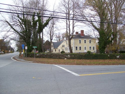
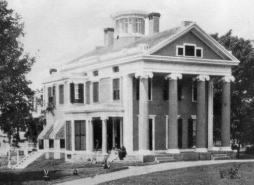
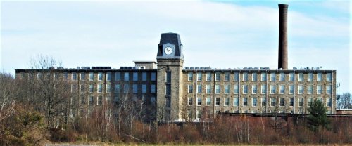
6 decades in the archive, from the 1830s to the 1970s. Scroll each row; tap a photo for its story.
Nothing in the archives for these yearsWeddings on Main Street, storms, parades, school pictures, the old store. If it’s in your family album, it belongs here.
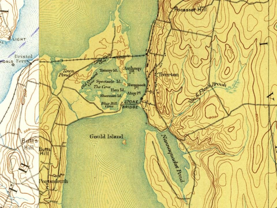
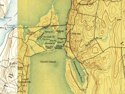
Every edition of the U.S. Geological Survey’s map of Tiverton. Tap a year, or press play to watch the town change.
1888Fall River sheet · 1:62,500
U.S. Geological Survey historical topographic maps (public domain), via Esri’s collection of the scans. The red ring marks the center of Tiverton.
Every building
Tiverton, building by building, 1902–1920
Fire insurance maps drew every building, what it was made of and what it was used for, so insurers could price the risk of fire. Pick a year, then a sheet.
In 1659, according to Wikidata. Tiverton’s post office opened in 1810, and the first U.S. census counted 2,453 people here in 1790.
How does Tiverton rank for history?
Tiverton is more historic than 83% of U.S. towns, #22 of 38 in Rhode Island. The History grade combines the town’s founding era, the share of homes built before 1940 and its National Register listings. It’s a character grade, so it isn’t part of the overall grade. How it works.
What is on the National Register in Tiverton?
9 listings: 5 buildings, 2 historic districts, the Tiverton Four Corners Historic District and the Osborn-Bennett Historic District, with 38 contributing buildings, and 1 site. 65 historic buildings in all.
How old are the homes in Tiverton?
16% of Tiverton’s homes were built before 1940 (Census estimate, ±3.3 points), against a typical 20% for a Rhode Island town; the median home was built in 1972.
Founding dates: Wikidata, Wikipedia, the U.S. post office records of Blevins & Helbock (CC0) and the Census. Homes by year built: Census ACS 2020–24. National Register of Historic Places: National Park Service (list of May 22, 2026). Old photos, postcards and papers: Wikimedia Commons, the Library of Congress and other public archives, credited on each item’s page. Maps: U.S. Geological Survey historical topographic maps (via Esri) and Sanborn fire-insurance maps (Library of Congress). History text and census tables: Wikipedia (CC BY-SA 4.0). Places that used to be: USGS Geographic Names Information System (2021).
From Wikimedia Commons (21), the Library of Congress (8), the National Register of Historic Places (8), Wikipedia, Wikidata and Wikipedia for famous people, U.S. Geological Survey historical maps, U.S. Census counts (via Wikipedia), the US Post Offices dataset (Blevins & Helbock), the USGS Geographic Names Information System, Sanborn fire insurance maps (Library of Congress) and old county and town histories (Internet Archive). Archive images are copied here with their credits and licenses, shown on each photo’s page. Refreshed monthly.

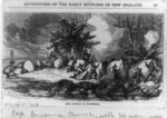




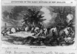 1857
 1940
 1940
 1940
 1940
 1940
 1940
 1973
 1973
 2019
 2019
 2019
 2018
 2017
 2014
 2012
 2010
 2010
 2010
 2010
 2009
 2008
 2006