St. ClairPA
The town, home to 37 people, lies in Pennsylvania.
Is St. Clair a good place to live?
57% of residents live below the poverty line in St. Clair, against 7.6% in Pennsylvania’s towns and 9.6% across U.S. towns. Of the 1,036 Pennsylvania towns we compare, none has a higher owner-occupancy rate than St. Clair. St. Clair has fewer than 1,000 residents, too few for fair grades; the figures below are still real.
37 people, and everyone knows the way
In a town this size, neighbors are the best guide. Ask them anything.
Moving to St. Clair: who provides what
St. Clair is unincorporated, so Blair County and regional agencies provide most services.
EPA SDWIS (Oct 9, 2026) · HIFLD + EIA-861 2025 · Census 2020 ZCTAs · NCES 2024–25 · registration: vote.gov, updated Nov 18, 2024.
The data
Ordered by what stands out in St. Clair.
Four seasons and pleasant summers: that is St. Clair’s year
July afternoons reach 84°, January nights drop to 20° and about 26 inches of snow falls in a winter.
Typical low → high °F
NOAA U.S. Climate Normals, 1991–2020
Natural hazards: high risk in St. Clair, mostly inland flooding
On expected storm and flood damage, St. Clair sits above nearly two thirds of U.S. communities. 87% of the town’s expected losses from natural hazards come from inland flooding.
FEMA National Risk Index · OpenFEMA
How healthy St. Clair is
Among adults in St. Clair, 41% sleep under 7 hours and 26% have been diagnosed with depression. The share of adults in St. Clair who smoke cigarettes: 20%.
| St. Clair | Pennsylvania towns | U.S. towns | |
|---|---|---|---|
| Smoke cigarettes (CDC PLACES) | 20% | 17% | 14% |
| Sleep under 7 hours (CDC PLACES) | 41% | 38% | 36% |
| Depression (CDC PLACES) | 26% | 24% | 23% |
| Frequent physical distress (CDC PLACES) | 15% | 14% | 14% |
| What stands out | St. Clair | PA |
|---|---|---|
| More uninsured adults | 8.3% | 5.8% |
| More older adults who have lost all their teeth | 19.5% | 14.5% |
| More adults with COPD | 9.7% | 7.7% |
CDC PLACES 2025 · modeled estimates for adults · CMS · HRSA
Beaver Stadium and 21 more within 40 miles
Museums, parks, gardens and other places to visit around St. Clair. Close and well known come first.
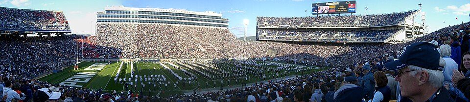 Big draw30 mi Stadium & arenaBeaver Stadium
 12 mi LakeRaystown Lake
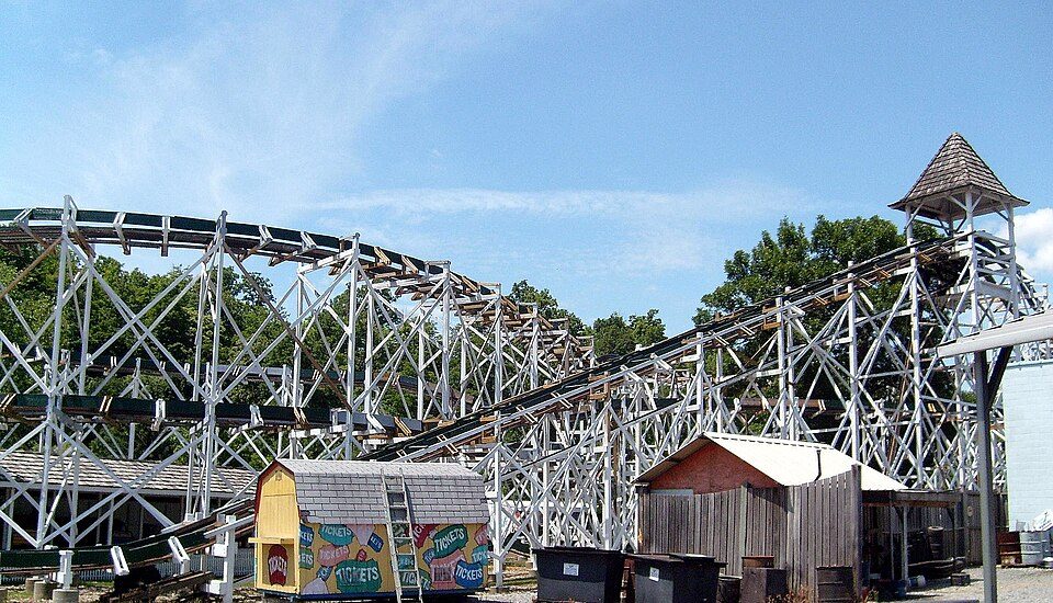 9 mi Theme parkLakemont Park
 30 mi DamSouth Fork Dam
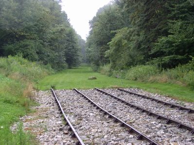 13 mi National Historic SiteAllegheny Portage Railroad National Historic Site163K visitors a year
 30 mi Stadium & arenaBryce Jordan Center
Photo credits
Beaver Stadium: Sbvr6 (talk), CC BY-SA 3.0 · Raystown Lake: Tex Jobe, U.S. Army Corps of Engineers, Public domain · Lakemont Park: Bhakta Dano. Original uploader was Oldano at en.wikipedia, Public domain · South Fork Dam: Ernest Walter Histed, Public domain · Allegheny Portage Railroad National Historic Site: Matthew A. Lynn; Original uploader was Mosamiazaz at en.wikipedia, Public domain · Bryce Jordan Center: Robert J. La Verghetta, CC BY-SA 3.0


Everything we know about St. Clair
Colleges nearby
2 within 15 miles of the center of St. Clair
About 3 of every 100 St. Clair residents are enrolled in college, against 6 across Pennsylvania.
About St. Clair
Unincorporated community in Pennsylvania, US
St. Clair is an unincorporated community and census-designated place (CDP) in Blair County, Pennsylvania, United States. It was first listed as a CDP prior to the 2020 census. The CDP is in eastern Blair County, in the southern part of Catharine Township. It is bordered to the southwest by the Frankstown Branch of the Juniata River, which forms the border with Woodbury Township to the south. Pennsylvania Route 866 passes through St. Clair, leading southeast 2 miles (3 km) to Williamsburg and northwest 1.5 miles (2.4 km) to U.S. Route 22 near Point View. St. Clair sits at the southern base of Short Mountain, which rises 900 feet (270 m) above the community to an elevation of 1,790 feet (550 …
From Wikipedia, licensed CC BY-SA 4.0 · facts via Wikidata (CC0)
- Elevation
- 876 ft
Questions about St. Clair
Short answers, built from the data on this page.
Is St. Clair, PA a good place to live?
St. Clair has fewer than 1,000 residents, too few for fair grades; the figures below are still real.