Reading dates to 1748, and 57% of its homes were built before 1940
Among the most historic 1% of U.S. towns · #9 of 1,035 in Pennsylvania. What drives it
31 places in town are on the National Register, among them three historic districts with 2,412 buildings between them. Below: 17 old photos and papers, maps from 1887 on, and the census since 1790.
Founding year: Wikidata. First post office: 1897.The full story ↓
History grade
What drives Reading’s History grade
On its age, its old homes and the National Register, Reading is among the most historic 1% of U.S. towns, #9 of 1,035 in Pennsylvania. All 3 inputs put Reading near the top nationally; its share of homes from before 1940 ranks highest.
A+
HistoryA character grade: shown, never part of Reading’s overall grade.
Pennsylvania towns list about as much on the Register as the country (a typical Pennsylvania town has 2.1 per 10,000 residents, the U.S. 2.4), so Reading’s 257 sits above most of its state (92% of Pennsylvania towns have fewer) while its 2,447 historic buildings outnumber those of 99% of U.S. towns.
NoteThe founding year comes from Wikidata alone; no second source gives 1748.
How sure. Graded on any two of the three inputs instead, the letter would still be A+. The pre-1940 share (±2.4 points) is firm at this size.
Founding year: Wikidata (other dates in Quick answers). Homes: Census ACS 2020–24. National Register: National Park Service, May 2026 list; each listing counted once (boundary changes and added documentation belong to their listing), and a historic district counts its contributing buildings. How TownRatings grades history →
What stands out about Reading’s past
Read from the archive, the National Register and the record. The page puts what stands out first.
Lenape people, also known as Delaware Indians, inhabited the Reading area prior to European settlement of the region in the 17th century. The Colony of Pennsylvania was a 1680 land grant from King Charles II of England to William Penn. Comprising more than 45,000 square miles (120,000 km2), it was named for his father, William Penn.
In 1743, Richard and Thomas Penn, both sons of William Penn, mapped out the town of Reading with Pennsylvania German
Passages that mention Reading, cut from the printed page as they were published.
History of Reading, Pennsylvania, and the anniversary proceedings of the sesqui-centennial, June 5-12, 18981898 · page 163Read the page →
Read the text
Reading Iroyi Co. — The first large iron works at Reading were established in 1836 by Benneville Keim, George M. Keim, James Whittaker and Simon Seyfert, who traded under the firm name of Reims, Whittaker & Co. , and were known as “Reading Iron and Nail Works.” They were located at the extreme southern end of the town between the Schuylkill and the railroad to facilitate the shipment of their products by canal as well as by railroad. The canal had been carried on for twelve years,
Text read by machine from the scan; it may contain errors.
History of Reading, Pennsylvania, and the anniversary proceedings of the sesqui-centennial, June 5-12, 18981898 · page 49Read the page →
Read the text
Telegraph. — In 1844, the telegraph was first introduced to transmit messages by electricity between Washington and Baltimore. In 1847, a company was organized to maintain telegraph lines between Philadelphia, Reading and Pottsville, and in May of that year, the first message was sent to Reading, (this relating to the Mexican war.) It has been maintained since that time along the railroad. As other railroads were constructed in different directions from Reading, it was extended. In 1879,.
Text read by machine from the scan; it may contain errors.
tended to connect with the Shamokin Railroad, thus afibrding a connection with the Susquehanna, and passing through the great Mohanoy coal region : — it M'ill thus bring an incalculable amount of additional tonnage and passengers to the Reading Railroad) also at Port Clinton, with the Little Schuylkill Railroad extending to Tamaqua, and thence into several lateral branches to numerous coal districts adjacent. The roads have each many miles of branches, penetrating all the coal districts of this unparalleled region, and the greater
Text read by machine from the scan; it may contain errors.
It was originally designed for its present purpose, an outlet or avenue to market for the Schuylkill Coal Region ; but its first charter extended only to the city of Reading, fifty-nine miles from its terminus on the Delaware River, near Philadelphia, as the right of constructing a railroad between Reading and Port Clinton, twenty miles, had already been granted another corporation, the Little Schuylkill Railroad Company, extending from Tamaqua to Port Clinton, twenty miles. From insufficient means, this company was unable to ex-
Text read by machine from the scan; it may contain errors.
Scans and text from the Internet Archive. Books published in 1930 or earlier, which are in the public domain.
Timeline
Reading, 1748 to 2006
Woven from the archive, old maps, post office records, the National Register and the people born here.
Nothing in the archives for these yearsWeddings on Main Street, storms, parades, school pictures, the old store. If it’s in your family album, it belongs here.
Every edition of the U.S. Geological Survey’s map of Reading. Tap a year, or press play to watch the town change.
1894Reading sheet · 1:62,500
U.S. Geological Survey historical topographic maps (public domain), via Esri’s collection of the scans. The red ring marks the center of Reading.
Every building
Reading, building by building, 1887–1920
Fire insurance maps drew every building, what it was made of and what it was used for, so insurers could price the risk of fire. Pick a year, then a sheet.
In 1748, according to Wikidata. Reading’s post office opened in 1897, and the first U.S. census counted 2,225 people here in 1790.
How does Reading rank for history?
Reading is among the most historic 1% of U.S. towns, #9 of 1,035 in Pennsylvania. The History grade combines the town’s founding era, the share of homes built before 1940 and its National Register listings. It’s a character grade, so it isn’t part of the overall grade. How it works.
What is on the National Register in Reading?
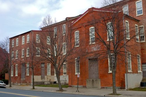
31 listings: 25 buildings, among them the Pagoda (listed 1972, the first), 3 historic districts, the Meinig Glove Factory-Meinig, E. Richard, Co., the Reading Hardware Company and the Queen Anne Historic District, with 2,412 contributing buildings, 1 site, and 2 structures. 2,447 historic buildings in all.
How old are the homes in Reading?
57% of Reading’s homes were built before 1940 (Census estimate, ±2.4 points), against a typical 18% for a Pennsylvania town; the median home was built in 1938.
Founding dates: Wikidata, Wikipedia, the U.S. post office records of Blevins & Helbock (CC0) and the Census. Homes by year built: Census ACS 2020–24. National Register of Historic Places: National Park Service (list of May 22, 2026). Old photos, postcards and papers: Wikimedia Commons, the Library of Congress and other public archives, credited on each item’s page. Maps: U.S. Geological Survey historical topographic maps (via Esri) and Sanborn fire-insurance maps (Library of Congress). History text and census tables: Wikipedia (CC BY-SA 4.0). Places that used to be: USGS Geographic Names Information System (2021).
From Wikimedia Commons (13), the Library of Congress (4), Wikidata (1), the National Register of Historic Places (31), Wikipedia, Wikidata and Wikipedia for famous people, U.S. Geological Survey historical maps, U.S. Census counts (via Wikipedia), the US Post Offices dataset (Blevins & Helbock), the USGS Geographic Names Information System, Sanborn fire insurance maps (Library of Congress) and old county and town histories (Internet Archive). Archive images are copied here with their credits and licenses, shown on each photo’s page. Refreshed monthly.




 1868
 1873
 1873
 1881
 1881
 1890
 1890
 1893
 1898
 1899
 1900


