Montgomery Township dates to 1887, and 18% of its homes were built before 1940
More historic than 72% of U.S. towns · #440 of 1,035 in Pennsylvania. What drives it
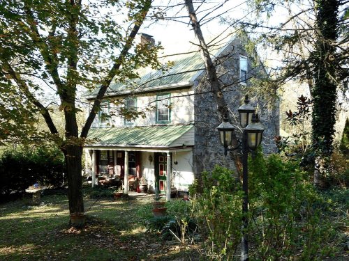
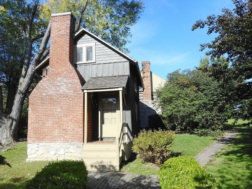
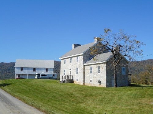
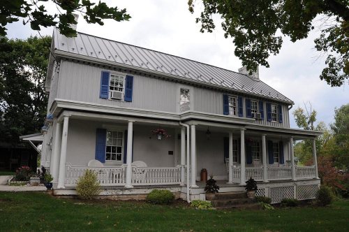
10 places in town are on the National Register, among them three historic districts with 24 buildings between them. Below: 4 old photos and papers, maps from 1900 on, and the census since 1880.
Founding year: Wikipedia. First post office: 1830.The full story ↓
History grade
What drives Montgomery Township’s History grade
On its age, its old homes and the National Register, Montgomery Township is more historic than 72% of U.S. towns, #440 of 1,035 in Pennsylvania. Its National Register listings hold the grade up; its age pulls it down.
B+
HistoryA character grade: shown, never part of Montgomery Township’s overall grade.
Pennsylvania towns list about as much on the Register as the country (a typical Pennsylvania town has 2.1 per 10,000 residents, the U.S. 2.4), so Montgomery Township’s 97.3 sits above most of its state (88% of Pennsylvania towns have fewer) while its 56 historic buildings outnumber those of 86% of U.S. towns.
NoteThe founding year comes from Wikipedia alone; no second source gives 1887.
How sure. Graded on any two of the three inputs instead, the letter would range from B− to A. The pre-1940 share is a Census survey estimate (±6.4 points).
Founding year: Wikipedia (other dates in Quick answers). Homes: Census ACS 2020–24. National Register: National Park Service, May 2026 list; each listing counted once (boundary changes and added documentation belong to their listing), and a historic district counts its contributing buildings. How TownRatings grades history →
What stands out about Montgomery Township’s past
Read from the archive, the National Register and the record. The page puts what stands out first.
Every edition of the U.S. Geological Survey’s map of Montgomery Township. Tap a year, or press play to watch the town change.
1900Mercersburg sheet · 1:62,500
U.S. Geological Survey historical topographic maps (public domain), via Esri’s collection of the scans. The red ring marks the center of Montgomery Township.
Montgomery was incorporated as a borough by the Court of Quarter Sessions of the Peace of Lycoming County, Pennsylvania on March 21, 1887, from part of Clinton Township. The history of the settlement of Montgomery begins in 1783 when John Lawson established a homestead there. Nicholas Shaffer built a gristmill in Montgomery in 1795. A sawmill and a wool carding mill were other early industries found on Black Hole Creek which flows through Montgomery.
Passages that mention Montgomery Township, cut from the printed page as they were published.
History of Franklin county, Pennsylvania1887 · page 514Read the page →
Read the text
April 14, 1857, the people of Mercersburg and surrounding community applied to the coiu't of Franklin County to be incorporated into a separate district from Montgomery Township. Viewers were appointed who met in June of the same year, and August 14, 1857, the grant was obtained. This, then, is the basis from which we date the existence of Mercersburg Independent School District.
Text read by machine from the scan; it may contain errors.
History of Franklin County, Pennsylvania1887 · page 514Read the page →
Read the text
April 14, 1857, the people of Mercersburg and surrounding community applied to the court of Franklin County to be incorporated into a separate district from Montgomery Township. Viewers were appointed who met in June of the same. year, and August 14, 1857, the grant was obtained. This, then, is the basis from which we date the existence of Mercersburg Independent Sehool District. i Cn the 14th of September, 1857, Gcethean Hall and the lot of ground on which it stood were sold by Franklin and Marshall College to J. O. Carson, W.
Text read by machine from the scan; it may contain errors.
History of Franklin county, Pennsylvania1887 · page 505Read the page →
Read the text
Mountain to Baltimore. The site of the town is a beautiful one, being but three miles from North or Kittatinny Mountains, which lie in graceful waves along the west and, jn autumn, afford views of exceeding grandeur. The larger part of the town is in Montgomery Township, the remainder being in Peters. settlement.
Text read by machine from the scan; it may contain errors.
Scans and text from the Internet Archive. Books published in 1930 or earlier, which are in the public domain.
Timeline
Montgomery Township, 1815 to 1950
Woven from the archive, old maps, post office records, the National Register and the people born here.
Nothing in the archives for these yearsWeddings on Main Street, storms, parades, school pictures, the old store. If it’s in your family album, it belongs here.
In 1887, according to Wikipedia’s history of the town. Montgomery Township’s post office opened in 1830, and the census of 1880 counted 414 people here.
How does Montgomery Township rank for history?
Montgomery Township is more historic than 72% of U.S. towns, #440 of 1,035 in Pennsylvania. The History grade combines the town’s founding era, the share of homes built before 1940 and its National Register listings. It’s a character grade, so it isn’t part of the overall grade. How it works.
What is on the National Register in Montgomery Township?
10 listings: 7 buildings and 3 historic districts, the Hays Bridge Historic District, the Mercersburg Academy and the Rock Hill Farm, with 24 contributing buildings. 56 historic buildings in all.
How old are the homes in Montgomery Township?
18% of Montgomery Township’s homes were built before 1940 (Census estimate, ±6.4 points), against a typical 18% for a Pennsylvania town; the median home was built in 1980.
Founding dates: Wikidata, Wikipedia, the U.S. post office records of Blevins & Helbock (CC0) and the Census. Homes by year built: Census ACS 2020–24. National Register of Historic Places: National Park Service (list of May 22, 2026). Old photos, postcards and papers: Wikimedia Commons, the Library of Congress and other public archives, credited on each item’s page. Maps: U.S. Geological Survey historical topographic maps (via Esri) and Sanborn fire-insurance maps (Library of Congress). History text and census tables: Wikipedia (CC BY-SA 4.0). Places that used to be: USGS Geographic Names Information System (2021).
From Wikimedia Commons (12), the National Register of Historic Places (10), Wikipedia, U.S. Geological Survey historical maps, U.S. Census counts (via Wikipedia), the US Post Offices dataset (Blevins & Helbock), the USGS Geographic Names Information System and old county and town histories (Internet Archive). Archive images are copied here with their credits and licenses, shown on each photo’s page. Refreshed monthly.





 1917
 1917
 2011
 2011
 2011
 2009
 2009
 2009
 2008
 2008