Wikipedia doesn’t have a history of Jefferson yet. The photos, dates and memories neighbors add here are how it gets written.
Jefferson is a borough in York County, Pennsylvania, United States. The population was 655 at the time of the 2020 census. It is part of the York–Hanover metropolitan area. The name of the post office serving Jefferson is Codorus.
Jefferson was established in 1812. Between the 2010 and 2020 censuses its population fell from 733 to 658 (-10%).
Intro from Wikipedia. Population: U.S. Census Bureau.
From the old history books
What they wrote about Jefferson, 1888–1905
Passages that mention Jefferson, cut from the printed page as they were published.
A pioneer history of Jefferson County, Pennsylvania and my first recollections of Brookville, Pennsylvania, 1840-1843,1898 · page 388Read the page →
Read the text
Turnpike Company authorized, to begin "at the northern termination of the Freeport and Kittanning turnpike road, on the top of the Mahoning hills, and continue by the most practical route, via the borough of Brookville, in Jefferson County, and the Brandy Camp, to the Milesburg and Smethport turnpike road, at or near Ridgeway, in Jefferson County. By same act James Kerr, Hance Robinson, Jacob Miller, of the county of Armstrong ; and Hiram Wilson, William Jack, John Dougherty, and Jacob Shaffer, of the county of Jefferson ; and Isaac Horton, Daniel
Text read by machine from the scan; it may contain errors.
A pioneer outline history of northwestern Pennsylvania, embracing the counties of Tioga, Potter, McKean, Warren, Crawford, Venango, Forest, Clarion, Elk, Jefferson, Cameron, Butler, Lawrence, and Mercer1905 · page 285Read the page →
Read the text
By an act of Assembly of March 10, 1806, Jefferson County was annexed to the county of Indiana, and the authority of the county commissioners and other count)' officers of said Indiana County was extended over and within the county of Jefferson. Jefferson remained annexed to Indiana County until 1824, and for judicial purposes alone until, by act of Assembly, April 2, 1830, to org-anize the provisional county of Jefferson for judicial purposes, it was stipulated in Section 2 that the county should be attached to and form part of the Fourth Judicial District, and that the president judge of the
Text read by machine from the scan; it may contain errors.
History of Jefferson county, Pennsylvania, with illustrations and biographical sketches of some of its prominent men and pioneers1888 · page 583Read the page →
Read the text
mostly tiirough woods. They purchased land north and west of the Lucases, and formed what was afterwards known as the Irish Settlement; that at Troy was called the Yankee Settlement, and one further down the creek, in what is now Beaver township, of Jefferson, and Redbanl-, of Clarion county, was called the Dutch Settlement. The Irish Settlement is just north of Diiwlingville. The buildings north of the creek a: Baxter Station are called Dowlingville ; those on the south side are called Baxter.
Text read by machine from the scan; it may contain errors.
History of Jefferson county, Pennsylvania, with illustrations and biographical sketches of some of its prominent men and pioneers1888 · page 90Read the page →
Read the text
Commissioners of Jefferson county authorized to borrow money, not exceeding $45,000, and to issue bonds therefor, at rate of interest not exceeding eight per cent., to be appropriated to the payment of certain articles of settlement and compromise made by and between the county of Jefferson and the Allegheny Valley Railroad Company. Act of 19th of February, 1870. — P. L., page 212.
Text read by machine from the scan; it may contain errors.
Scans and text from the Internet Archive. Books published in 1930 or earlier, which are in the public domain.
Founding dates: Wikidata, Wikipedia, the U.S. post office records of Blevins & Helbock (CC0) and the Census. Homes by year built: Census ACS 2020–24. National Register of Historic Places: National Park Service (list of May 22, 2026). Old photos, postcards and papers: Wikimedia Commons, the Library of Congress and other public archives, credited on each item’s page. Maps: U.S. Geological Survey historical topographic maps (via Esri) and Sanborn fire-insurance maps (Library of Congress). History text and census tables: Wikipedia (CC BY-SA 4.0). Places that used to be: USGS Geographic Names Information System (2021). How TownRatings grades history →
From Wikimedia Commons (3), U.S. Geological Survey historical maps, U.S. Census counts (via Wikipedia), the US Post Offices dataset (Blevins & Helbock), the USGS Geographic Names Information System and old county and town histories (Internet Archive). Archive images are copied here with their credits and licenses, shown on each photo’s page. Refreshed monthly.


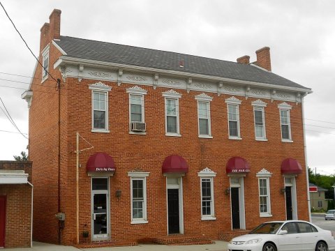 2015
 2015
 2015


