Homestead dates to 1871, and 38% of its homes were built before 1940
More historic than 88% of U.S. towns · #209 of 1,035 in Pennsylvania. What drives it
3 places in town are on the National Register, among them the Bost Building, a National Historic Landmark, and two historic districts with 457 buildings between them. Below: 25 old photos and papers, maps from 1891 on, and the census since 1880.
Founding year: Wikidata. First post office: 1874.The full story ↓
History grade
What drives Homestead’s History grade
On its age, its old homes and the National Register, Homestead is more historic than 88% of U.S. towns, #209 of 1,035 in Pennsylvania. Its National Register listings hold the grade up; its age pulls it down.
A
HistoryA character grade: shown, never part of Homestead’s overall grade.
Pennsylvania towns list about as much on the Register as the country (a typical Pennsylvania town has 2.1 per 10,000 residents, the U.S. 2.4), so Homestead’s 1,594 sits above most of its state (99% of Pennsylvania towns have fewer) while its 458 historic buildings outnumber those of 97% of U.S. towns.
How sure. Graded on any two of the three inputs instead, the letter would range from B+ to A+. The pre-1940 share is a Census survey estimate (±7.3 points). Two sources give 1871.
Founding year: Wikidata (other dates in Quick answers). Homes: Census ACS 2020–24. National Register: National Park Service, May 2026 list; each listing counted once (boundary changes and added documentation belong to their listing), and a historic district counts its contributing buildings. How TownRatings grades history →
What stands out about Homestead’s past
Read from the archive, the National Register and the record. The page puts what stands out first.
Nothing in the archives for these yearsWeddings on Main Street, storms, parades, school pictures, the old store. If it’s in your family album, it belongs here.
Nothing in the archives for these yearsWeddings on Main Street, storms, parades, school pictures, the old store. If it’s in your family album, it belongs here.
The area on the south bank of the Monongahela River now comprising the boroughs of Homestead, Munhall, and West Homestead saw the first white settlers arrive in the 1770s. About 100 years later, much of the existing farmland on the flats and hillsides by the river was purchased, laid out in lots and sold by local banks and landowners to create the town of Homestead. The town was chartered in 1880. The building of a railroad, glass factory, and in 1881 the first iron mill began a period of rapid growth and prosperity. In 1883, Andrew Carnegie bought out Homestead Steel Works, adding it to his empire of steel and coke enterprises. Carnegie had recently acquired a controlling interest in Henry Clay Frick's coke works on the Monongahela, setting the stage for the dramatic labor clash in Homestead.
Passages that mention Homestead, cut from the printed page as they were published.
History of Allegheny county, Pennsylvania1889 · page 298Read the page →
Read the text
Homestead, where he operated several years. He then came to Mifflin township, and by industry and frugality became a wealthy man. Since 1878 he lias resided in Homestead, where he lives a retired life. He has five farms, four of which are located in Lawrence county and one near Homestead, on all of which his children reside. His
Text read by machine from the scan; it may contain errors.
History of Allegheny county, Pennsylvania1889 · page 388Read the page →
Read the text
Temperanceville, Pittsburgh, and also numerous stamp sale stations, which are a great accommodation to the public. In July, 1886, he came to Homestead, where he engaged extensively in the real-estate business, and now edits the Eagle, a spicy weekly. Capt.
Text read by machine from the scan; it may contain errors.
Scans and text from the Internet Archive. Books published in 1930 or earlier, which are in the public domain.
Timeline
Homestead, 1871 to 1999
Woven from the archive, old maps, post office records, the National Register and the people born here.
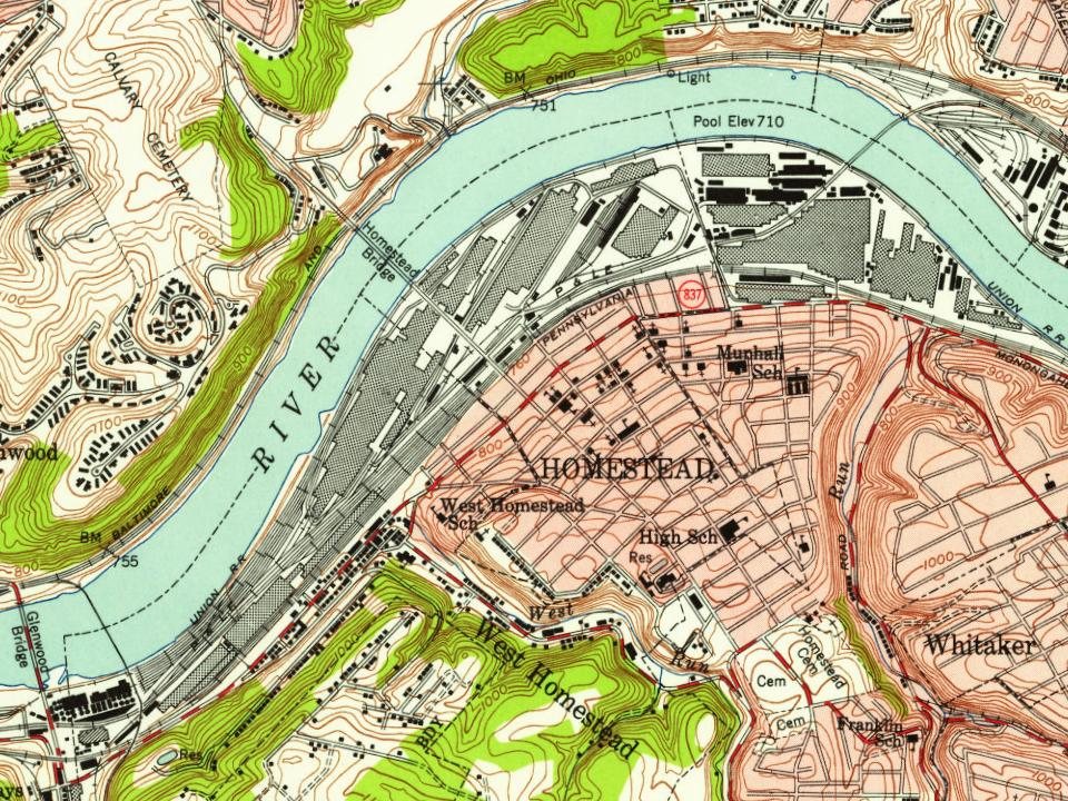
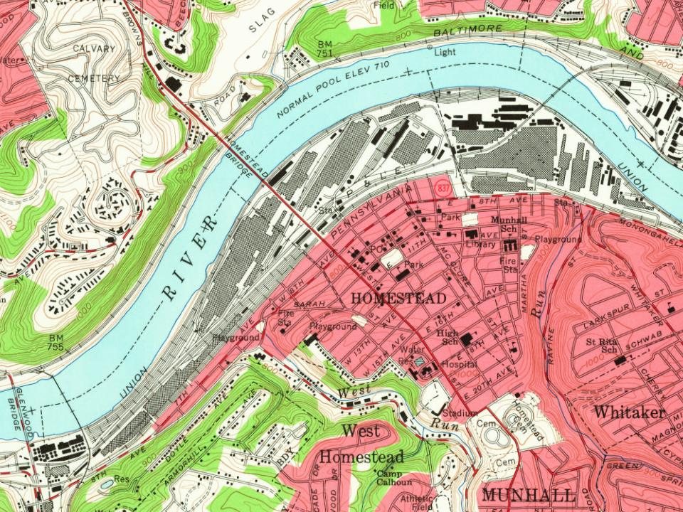
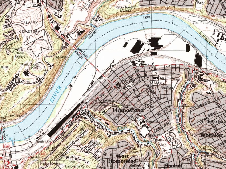
Every edition of the U.S. Geological Survey’s map of Homestead. Tap a year, or press play to watch the town change.
1904Pittsburgh sheet · 1:62,500
U.S. Geological Survey historical topographic maps (public domain), via Esri’s collection of the scans. The red ring marks the center of Homestead.
Every building
Homestead, building by building, 1891–1913
Fire insurance maps drew every building, what it was made of and what it was used for, so insurers could price the risk of fire. Pick a year, then a sheet.
In 1871, according to Wikidata. Homestead’s post office opened in 1874, and the census of 1880 counted 592 people here.
How does Homestead rank for history?
Homestead is more historic than 88% of U.S. towns, #209 of 1,035 in Pennsylvania. The History grade combines the town’s founding era, the share of homes built before 1940 and its National Register listings. It’s a character grade, so it isn’t part of the overall grade. How it works.
What is on the National Register in Homestead?
Three places: the Bost Building (listed 1999), the Homestead Pennsylvania Railroad Station (1985) and the Homestead Historic District (1990).
How old are the homes in Homestead?
38% of Homestead’s homes were built before 1940 (Census estimate, ±7.3 points), against a typical 18% for a Pennsylvania town; the median home was built in 1952.
Founding dates: Wikidata, Wikipedia, the U.S. post office records of Blevins & Helbock (CC0) and the Census. Homes by year built: Census ACS 2020–24. National Register of Historic Places: National Park Service (list of May 22, 2026). Old photos, postcards and papers: Wikimedia Commons, the Library of Congress and other public archives, credited on each item’s page. Maps: U.S. Geological Survey historical topographic maps (via Esri) and Sanborn fire-insurance maps (Library of Congress). History text and census tables: Wikipedia (CC BY-SA 4.0). Places that used to be: USGS Geographic Names Information System (2021).
From Wikimedia Commons (30), the Library of Congress (8), Wikidata (4), the National Register of Historic Places (3), Wikipedia, Wikidata and Wikipedia for famous people, U.S. Geological Survey historical maps, U.S. Census counts (via Wikipedia), the US Post Offices dataset (Blevins & Helbock), the USGS Geographic Names Information System, Sanborn fire insurance maps (Library of Congress) and old county and town histories (Internet Archive). Archive images are copied here with their credits and licenses, shown on each photo’s page. Refreshed monthly.


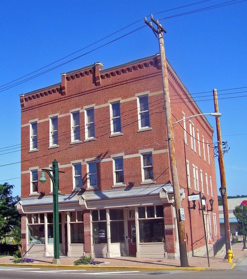 ★ Landmark

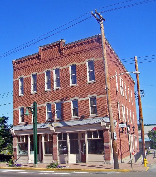
 1892
 1892
 1899
 1900
 1900
 1900
 1900
 1901
 1901
 1902
 1902
 1902
 1907
 1907
 1908
 1908
 1908
 1909
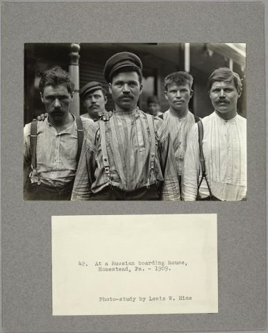 1909
 1909
 1919
 1965
 1965
 Date?
 Date?
 2026
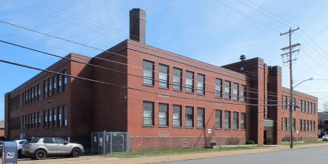 2026
 2026
 2019
 2019
 2016
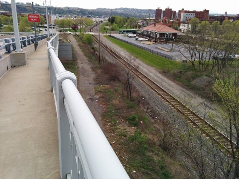 2015
 2014
 2010
 2008
 2008
 2008
 2007