Nothing in the archives for these yearsWeddings on Main Street, storms, parades, school pictures, the old store. If it’s in your family album, it belongs here.
Fallston takes its name from a waterfall in the Beaver River. It lies on the west side of the Beaver River immediately opposite New Brighton, Pennsylvania and about a mile below Beaver Falls. The narrow space between the hills on either side and the Beaver River was dammed at the lower falls; the water power allowed Fallston to achieve great importance as a manufacturing center. The Harris's Pittsburgh Business Directory for the year 1837 states "This place and the surrounding neighborhood, bids fair to be extensively increased, in consequence of the immense mineral and water advantages which it possesses."
Passages that mention Fallston, cut from the printed page as they were published.
History of Beaver County, Pennsylvania1888 · page 475Read the page →
Read the text
Fallston was regularly incorporated in 1829. At the November session of court, 1854, a petition signed by Joseph Thompson, burgess, John Jackson, G. N, Taylor, James Duncan, James Beacon, Samuel Kennedy, Albin Coats and Andrew Jackson, and approved by a number of prominent citizens, was presented, asking that Fallston, in- <3orporated under the act of March 19, 1829, be incorporated under the act of April 3, 1851, as the borough of Fallston. The decree was granted Nov. 30, 1854.
Text read by machine from the scan; it may contain errors.
History of Beaver County, Pennsylvania1888 · page 153Read the page →
Read the text
The rush in Big Beaver swept away the Fallston bridge, which, lodging against the old wooden bridge at Bridgewater, carried it down. Both swept against the railroad bridge of the C. & P. line, and the three then crashed against the P. & L. E. R. P. bridge, tearing out a number of the iron spans.
Text read by machine from the scan; it may contain errors.
Genealogical and personal history of Beaver County, Pennsylvania1914Read the page →
Read the text
Steubenville, Ohio. Resigning his position with this firm, he was employed by Matthew Elder, a woolen manufacturer of Darlington township, one mile south of Watt's Mills. After a few years residence in that locality he moved to Fallston and became a boatsman on the Erie Canal, running two boats, the "Banner" and the "Prairie State," between Pittsburgh, Meadville, and Erie. His next position was as toll-collector of the Fallston bridge, in which capacity he was employed at the time of his death, 1866.
Text read by machine from the scan; it may contain errors.
History of Beaver County, Pennsylvania1888 · page 473Read the page →
Read the text
Fallston was regularly incorporated in 1829. At the November session of court, 1854, a petition signed by Joseph Thompson, burgess, John Jackson, G. N. Taylor, James Duncan, James Beacon, Samuel Kennedy, Albin Coats and Andrew Jackson, and approved by a number of prominent citizens, was presented, asking that Fallston, incorporated under the act of March 19, 1829, be incorporated under the act of A])ril 3, 1851, as the borough of Fallston. The decree was granted Nov. 30, 1854.
Text read by machine from the scan; it may contain errors.
Scans and text from the Internet Archive. Books published in 1930 or earlier, which are in the public domain.
Then & now
Stand where they stood
No then-and-now pairs yet. Take a photo from the same spot as an old one and they appear here side by side.
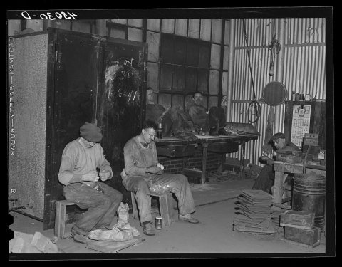
Retake this viewWorker at Correct Manufacturing Company. Fallston, Pennsylvania, 1940
Find the spot, match the angle, and add your photo. It becomes the first then-and-now pair on Fallston’s page.
Founding dates: Wikidata, Wikipedia, the U.S. post office records of Blevins & Helbock (CC0) and the Census. Homes by year built: Census ACS 2020–24. National Register of Historic Places: National Park Service (list of May 22, 2026). Old photos, postcards and papers: Wikimedia Commons, the Library of Congress and other public archives, credited on each item’s page. Maps: U.S. Geological Survey historical topographic maps (via Esri) and Sanborn fire-insurance maps (Library of Congress). History text and census tables: Wikipedia (CC BY-SA 4.0). Places that used to be: USGS Geographic Names Information System (2021). How TownRatings grades history →
From Wikimedia Commons (1), the Library of Congress (12), Wikipedia, Wikidata and Wikipedia for famous people, U.S. Geological Survey historical maps, U.S. Census counts (via Wikipedia), the US Post Offices dataset (Blevins & Helbock), the USGS Geographic Names Information System and old county and town histories (Internet Archive). Archive images are copied here with their credits and licenses, shown on each photo’s page. Refreshed monthly.


 1940
 1940
 1940
 1940
 1940
 1940
 1940
 1940
 1940
 1940
 1940
 Date?
 2009


