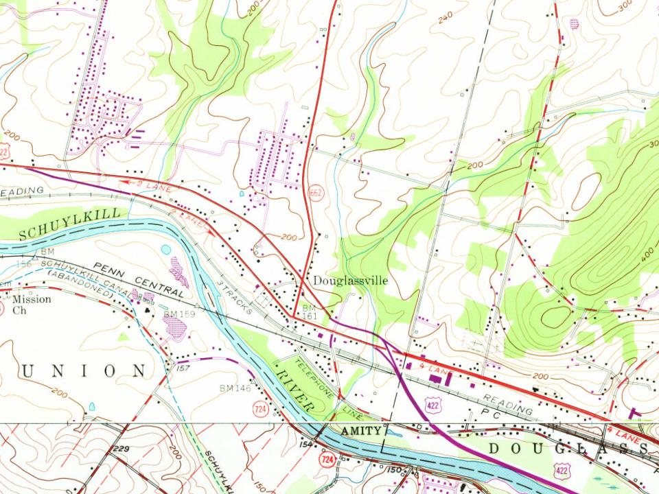
Every edition of the U.S. Geological Survey’s map of Douglassville. Tap a year, or press play to watch the town change.
1902Boyertown sheet · 1:62,500
U.S. Geological Survey historical topographic maps (public domain), via Esri’s collection of the scans. The red ring marks the center of Douglassville.
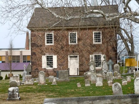
Swedish pioneers were the first European settlers in present Berks County on land granted by William Penn. Swedish Lutheran Minister Andreas Rudman secured an order from William Penn on October 21, 1701, setting aside 10,000 acres (40 km2) up the Schuylkill, near Manatawny Creek, for members of his congregation. The boundaries of Amity Township are almost identical to the boundaries of the original area known as the Swedes' tract. Morlatton Village, an early settlement which became part of what is now Douglassville, was Berks County's first settlement site along the Schuylkill River. The settlement later became the location of Old St. Gabriel's Episcopal Church or Old Swedes, founded in 1720 as the oldest church in Berks County. The site also included the Mouns Jones House, built by Swedish settlers in 1716. The house is the oldest documented dwelling in Berks County.
Passages that mention Douglassville, cut from the printed page as they were published.
History of Berks county in Pennsylvania1886 · page 953Read the page →
Read the text
81 Douglassville is a station on Philadelphia and Reading and Pennsylvania Railroads. Few stations on these great railways are so highly favored in the matter of depot accommodations as this place. It is the railway point of large sections of country, north and south of the river. The village contains the handsome
Text read by machine from the scan; it may contain errors.
History of Berks county in Pennsylvania1886 · page 972Read the page →
Read the text
student at the College of Pharmacy in Philadelphia. Since 1851 Mr. Mauger has been largely engaged in the settlement of estates. He has been secretary of the Douglassville and Yellow House Turnpike Company since its organization in 1867 ; was elected one of the directors of the Schuylkill Bridge Company, at Douglassville, in 1866, and in 1867 became the successor to
Text read by machine from the scan; it may contain errors.
Historical and biographical annals of Berks County, Pennsylvania, embracing a concise history of the county and a genealogical and biographical record of representative families, comp. by Morton L. Montgomery ..1909 · page 694Read the page →
Read the text
Maunce Jones, a Swede, came from the Wissahickon to Douglassville, in Berks county, with a colony of Swedes in 1701. He located on the east bank of the Schuylkill river where he built a stone house in 1716, where the Douglassville county "covered" bridge spans the river. This house has a very thick wall, and is very substantially built, having in its earlier days been a place of refuge for the pioneer settlers during In-
Text read by machine from the scan; it may contain errors.
Historical and biographical annals of Berks County, Pennsylvania, embracing a concise history of the county and a genealogical and biographical record of representative families, comp. by Morton L. Montgomery ..1909 · page 301Read the page →
Read the text
Four turnpikes were constructed in the section: the Perkiomen, from the southern county line, via Douglassville and Baumstown, to Reading; the Douglassville, from Douglassville, via Amityville, to Yellow House ; the Oley, from Pikeville, via Pleasantville and Oley Line, to Black Bear ; and the Centre, from Reading to Tuckerton, which extended northwardly through Ontelaunee Section, via Lees-
Text read by machine from the scan; it may contain errors.
Scans and text from the Internet Archive. Books published in 1930 or earlier, which are in the public domain.
Founding dates: Wikidata, Wikipedia, the U.S. post office records of Blevins & Helbock (CC0) and the Census. Homes by year built: Census ACS 2020–24. National Register of Historic Places: National Park Service (list of May 22, 2026). Old photos, postcards and papers: Wikimedia Commons, the Library of Congress and other public archives, credited on each item’s page. Maps: U.S. Geological Survey historical topographic maps (via Esri) and Sanborn fire-insurance maps (Library of Congress). History text and census tables: Wikipedia (CC BY-SA 4.0). Places that used to be: USGS Geographic Names Information System (2021). How TownRatings grades history →
From Wikimedia Commons (4), the Library of Congress (2), Wikipedia, Wikidata and Wikipedia for famous people, U.S. Geological Survey historical maps and old county and town histories (Internet Archive). Archive images are copied here with their credits and licenses, shown on each photo’s page. Refreshed monthly.




 Date?
 Date?
 2011
 2011
 2011
 2011