Columbia dates to 1726, and 52% of its homes were built before 1940
Among the most historic 1% of U.S. towns · #4 of 1,035 in Pennsylvania. What drives it
5 places in town are on the National Register, among them a historic district with 833 buildings. Below: 18 old photos and papers, maps from 1886 on, and the census since 1820.
Founding year: Wikipedia. First post office: 1798.The full story ↓
History grade
What drives Columbia’s History grade
On its age, its old homes and the National Register, Columbia is among the most historic 1% of U.S. towns, #4 of 1,035 in Pennsylvania. All 2 inputs put Columbia near the top nationally; its share of homes from before 1940 ranks highest.
A+
HistoryA character grade: shown, never part of Columbia’s overall grade.
Pennsylvania towns list about as much on the Register as the country (a typical Pennsylvania town has 2.1 per 10,000 residents, the U.S. 2.4), so Columbia’s 820 sits above most of its state (96% of Pennsylvania towns have fewer) while its 843 historic buildings outnumber those of 98% of U.S. towns.
NoteThe founding year comes from Wikipedia alone; no second source gives 1726.
How sure. Graded on two of the three inputs, so a change in either one moves the letter more than it would with three. The pre-1940 share is a Census survey estimate (±6.3 points).
Founding year: Wikipedia (other dates in Quick answers). Homes: Census ACS 2020–24. National Register: National Park Service, May 2026 list; each listing counted once (boundary changes and added documentation belong to their listing), and a historic district counts its contributing buildings. How TownRatings grades history →
What stands out about Columbia’s past
Read from the archive, the National Register and the record. The page puts what stands out first.
Nothing in the archives for these yearsWeddings on Main Street, storms, parades, school pictures, the old store. If it’s in your family album, it belongs here.
The area around present-day Columbia was originally populated by Native American tribes, most notably the Susquehannocks, who migrated to the area between 1575 and 1600 after separating from the Iroquois Confederacy. They established villages just south of Columbia, in what is now Washington Boro, as well as claiming at least hunting lands as far south as Maryland and northern Virginia.
Passages that mention Columbia, cut from the printed page as they were published.
History of Columbia and Montour counties, Pennsylvania, containing a history of each county1887 · page 62Read the page →
Read the text
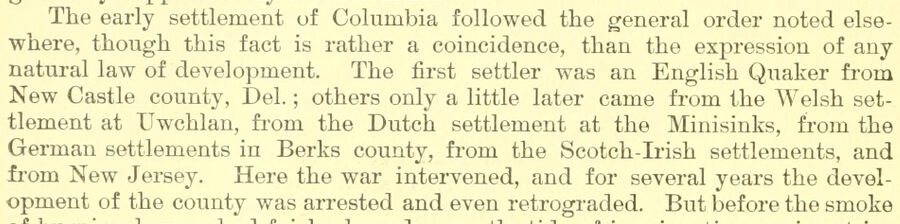
The early settlement of Columbia followed the general order noted elsewhere, though this fact is rather a coincidence, than the expression of any natural law of development. The first settler was an English Quaker from New Castle county, Del. ; others only a little later came from the Welsh settlement at Uwchlan, fi-om the Dutch settlement at the Minisinks, from the German settlements in Berks county, from the Scotch-L'ish settlements, and from New Jersey. Here the war intervened, and for several years the development of the county was arrested and even retrograded. But before the smoke
Text read by machine from the scan; it may contain errors.
A history of Columbia County, Pennsylvania1883 · page 67Read the page →
Read the text
February 2, 1814, Mr. Rupert from the committee to whom were referred on the 11th ult. sundry petitions praying ifec, Report, That they have attended to the same, and on examination find that 1046 of the citizens of Columbia county have signed petitions i)raying the Legislature to pass a law removing the seat of justice from the town of Danville to the town of Bloomsburg.
Text read by machine from the scan; it may contain errors.
Scans and text from the Internet Archive. Books published in 1930 or earlier, which are in the public domain.
Timeline
Columbia, 1726 to 1908
Woven from the archive, old maps, post office records, the National Register and the people born here.
Every edition of the U.S. Geological Survey’s map of Columbia. Tap a year, or press play to watch the town change.
1908Middletown sheet · 1:62,500
U.S. Geological Survey historical topographic maps (public domain), via Esri’s collection of the scans. The red ring marks the center of Columbia.
Every building
Columbia, building by building, 1886–1909
Fire insurance maps drew every building, what it was made of and what it was used for, so insurers could price the risk of fire. Pick a year, then a sheet.
In 1726, according to Wikipedia’s history of the town. Columbia’s post office opened in 1798, and the census of 1820 counted 1,891 people here.
How does Columbia rank for history?
Columbia is among the most historic 1% of U.S. towns, #4 of 1,035 in Pennsylvania. The History grade combines the town’s founding era, the share of homes built before 1940 and its National Register listings. It’s a character grade, so it isn’t part of the overall grade. How it works.
What is on the National Register in Columbia?
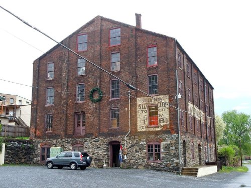
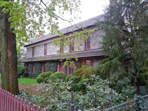
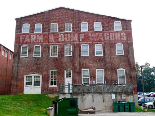
5 listings: 4 buildings, among them the Bachman and Forry Tobacco Warehouse (listed 1979, the first), and 1 historic district, the Columbia Historic District, with 833 contributing buildings. 843 historic buildings in all.
How old are the homes in Columbia?
52% of Columbia’s homes were built before 1940 (Census estimate, ±6.3 points), against a typical 18% for a Pennsylvania town; the median home was built in 1938.
Founding dates: Wikidata, Wikipedia, the U.S. post office records of Blevins & Helbock (CC0) and the Census. Homes by year built: Census ACS 2020–24. National Register of Historic Places: National Park Service (list of May 22, 2026). Old photos, postcards and papers: Wikimedia Commons, the Library of Congress and other public archives, credited on each item’s page. Maps: U.S. Geological Survey historical topographic maps (via Esri) and Sanborn fire-insurance maps (Library of Congress). History text and census tables: Wikipedia (CC BY-SA 4.0). Places that used to be: USGS Geographic Names Information System (2021).
From Wikimedia Commons (17), the Library of Congress (1), the National Register of Historic Places (5), Wikipedia, Wikidata and Wikipedia for famous people, U.S. Geological Survey historical maps, U.S. Census counts (via Wikipedia), the US Post Offices dataset (Blevins & Helbock), the USGS Geographic Names Information System, Sanborn fire insurance maps (Library of Congress) and old county and town histories (Internet Archive). Archive images are copied here with their credits and licenses, shown on each photo’s page. Refreshed monthly.




 1809
 1809
 c. 1811
 c. 1811
 c. 1811
 1832
 1880
 1894
 1894
 1894
 1894
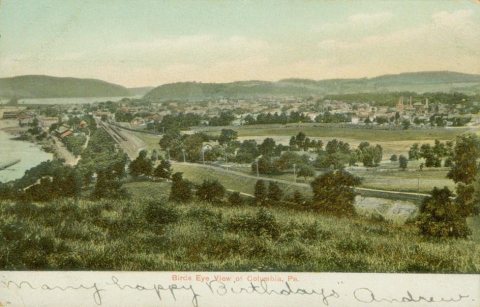 1901
 1901
 1901
 1901
 1905
 1906
 c. 1908