Founding year: the first Clifton Heights post office (Blevins & Helbock, CC0). Wikidata: 1885.The full story ↓
History grade
What drives Clifton Heights’ History grade
On its age, its old homes and the National Register, Clifton Heights is more historic than 41% of U.S. towns, #845 of 1,035 in Pennsylvania. Its share of homes from before 1940 holds the grade up; its National Register listings pull it down.
C+
HistoryA character grade: shown, never part of Clifton Heights’ overall grade.
Pennsylvania towns list about as much on the Register as the country (a typical Pennsylvania town has 2.1 per 10,000 residents, the U.S. 2.4), so Clifton Heights’ 0.0 sits below most of its state (25% of Pennsylvania towns have fewer) while its 0 listings outnumber those of 23% of U.S. towns.
How sure. Graded on any two of the three inputs instead, the letter would range from C− to B−. The pre-1940 share is a Census survey estimate (±6.5 points). The founding year is the first post office, not a stated founding date; Wikidata’s 1885 falls in the same era, so the grade doesn’t depend on which one is used.
Founding year: the first post office (other dates in Quick answers). Homes: Census ACS 2020–24. National Register: National Park Service, May 2026 list; each listing counted once (boundary changes and added documentation belong to their listing), and a historic district counts its contributing buildings. How TownRatings grades history →
What stands out about Clifton Heights’ past
Read from the archive, the National Register and the record. The page puts what stands out first.
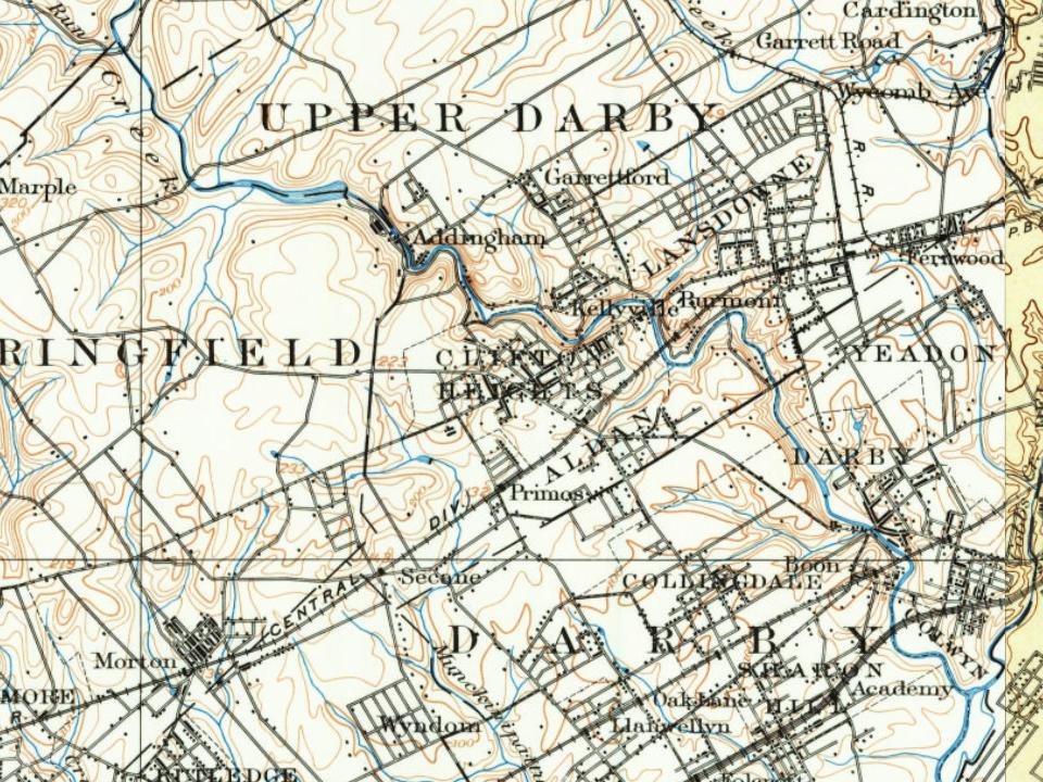
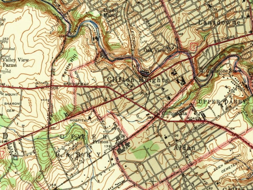
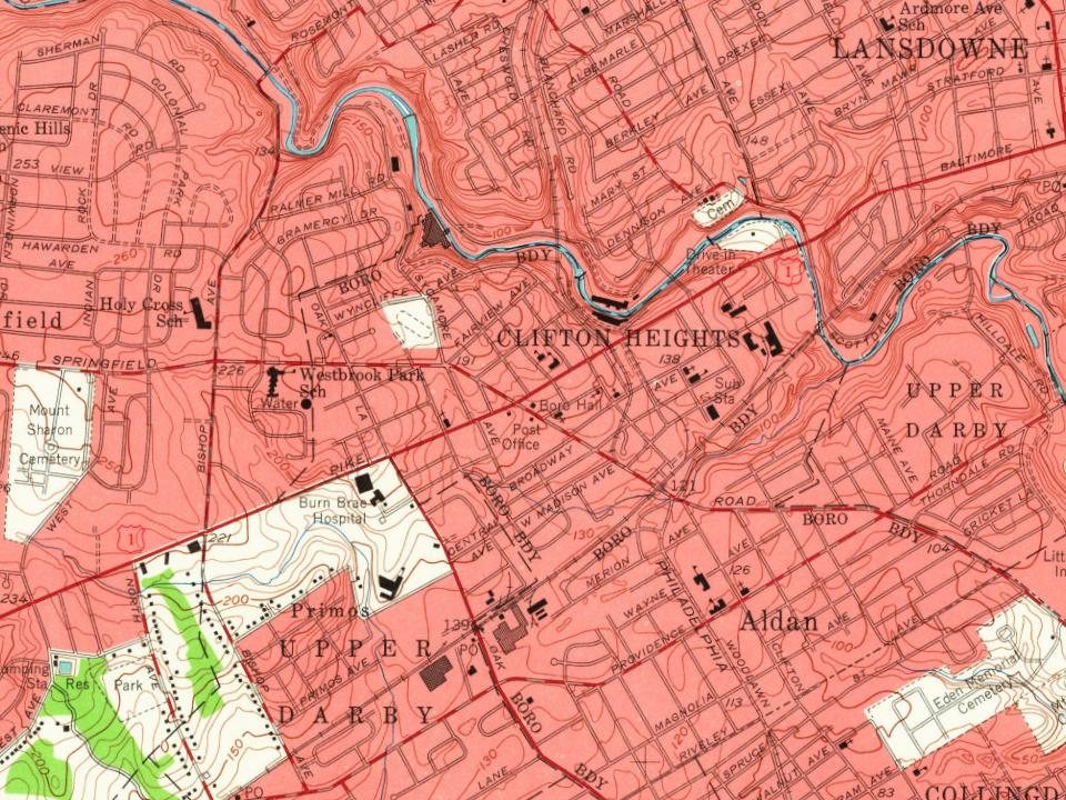
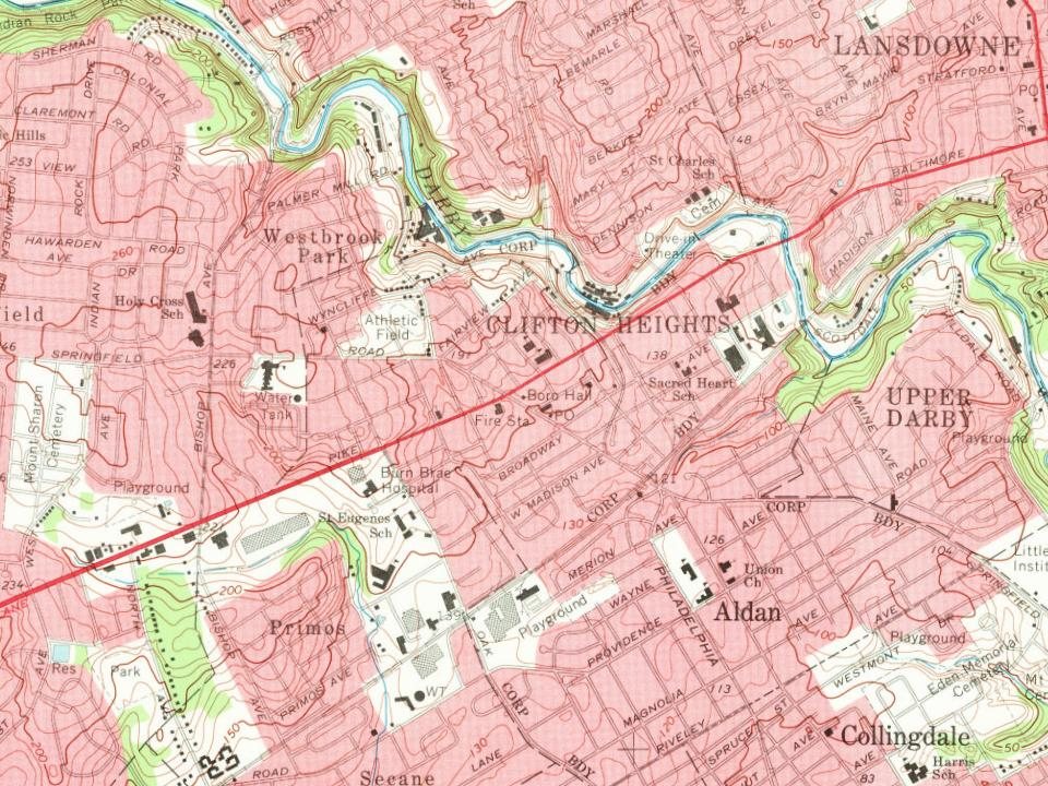
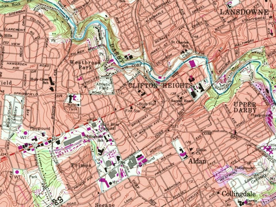
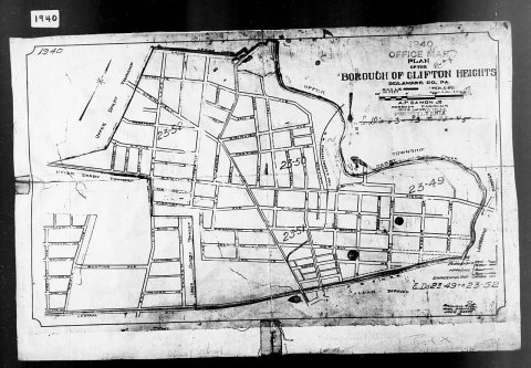
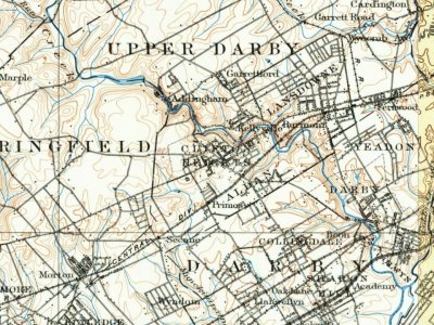
Every edition of the U.S. Geological Survey’s map of Clifton Heights. Tap a year, or press play to watch the town change.
1894Chester sheet · 1:62,500
U.S. Geological Survey historical topographic maps (public domain), via Esri’s collection of the scans. The red ring marks the center of Clifton Heights.
People over time
Clifton Heights, census by census
Peaked at 10,268 in 1960; 6,863 people lived here in 2020.
14 censuses, 1890–2020.
U.S. Census Bureau decennial counts, from the census table on Clifton Heights’ Wikipedia page.
The demographics of the greater Delaware Valley were significantly impacted by European colonization. By 1754, Native American populations in this region had been significantly displaced, however various uprisings of Native Americans were common throughout the region.
According to historian Freas B. Snyder, settlers set up a large tin kettle at a high point on what is now Oak Avenue, between Baltimore Avenue and Springfield Road. When hostile Indians were moving through the area, an alert would be sounded by banging on the tin kettle. This high point was called "Tin Kettle Hill" and would become a landmark used in three-point calculation surveying, along with a point in Central Philadelphia and a point on the Delaware River to the south.
Passages that mention Clifton Heights, cut from the printed page as they were published.
A history of Delaware County, Pennsylvania, and its people1914 · page 939Read the page →
Read the text
of the corporation and so continues at this date (1913). The business has greatly extended under his management and the size of the plant largely increased. In 1899 a tract at the junction of the Pennsylvania railroad and Darby creek, at Clifton Heights, was purchased and a large brick mill erected thereon for the manufacturing of fine worsted yarns, one of the finest and best equipped of the kind in the United States. It will be recalled that during the civil war the woolen mills of Thomas Kent made for the government immense quantities of uniform cloth for the soldiers' use. So during the
Text read by machine from the scan; it may contain errors.
A history of Delaware County, Pennsylvania, and its people1914 · page 1032Read the page →
Read the text
Katherine M. McMenamin, who for eighteen years has conducted a dry goods and notion store in Clifton Heights. Their home at the corner of Sycamore and Baltimore avenues was erected by their father in 1873 and has ever since been in the possession of the family. His widowed sister, Mrs. .\nn T. Mc- Cready, and his niece. Miss Mary F. McMenamin. also reside with him. Joseph P. Manley in his younger days was a baseball player and for five years played on the nine of the Glen wood of Clifton Heights, who won the championship of Delaware county. Pennsylvania, in 1872.
Text read by machine from the scan; it may contain errors.
Scans and text from the Internet Archive. Books published in 1930 or earlier, which are in the public domain.
Timeline
Clifton Heights, 1876 to 1971
Woven from the archive, old maps, post office records, the National Register and the people born here.
Nothing in the archives for these yearsWeddings on Main Street, storms, parades, school pictures, the old store. If it’s in your family album, it belongs here.
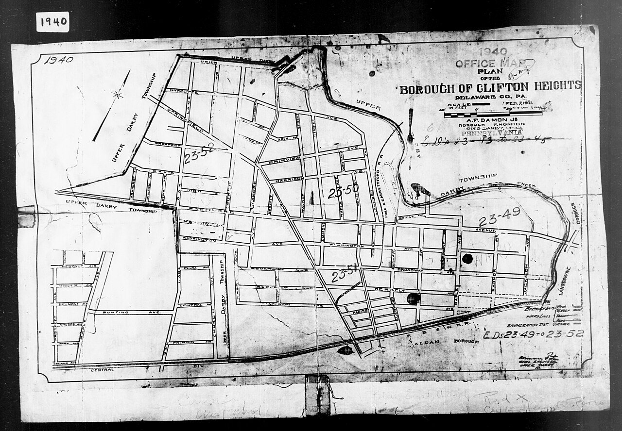
The Clifton Heights post office opened in 1876, the earliest record of the town by name (U.S. post office records). Wikidata gives 1885.
How does Clifton Heights rank for history?
Clifton Heights is more historic than 41% of U.S. towns, #845 of 1,035 in Pennsylvania. The History grade combines the town’s founding era, the share of homes built before 1940 and its National Register listings. It’s a character grade, so it isn’t part of the overall grade. How it works.
How old are the homes in Clifton Heights?
21% of Clifton Heights’ homes were built before 1940 (Census estimate, ±6.5 points), against a typical 18% for a Pennsylvania town; the median home was built in 1951.
Founding dates: Wikidata, Wikipedia, the U.S. post office records of Blevins & Helbock (CC0) and the Census. Homes by year built: Census ACS 2020–24. National Register of Historic Places: National Park Service (list of May 22, 2026). Old photos, postcards and papers: Wikimedia Commons, the Library of Congress and other public archives, credited on each item’s page. Maps: U.S. Geological Survey historical topographic maps (via Esri) and Sanborn fire-insurance maps (Library of Congress). History text and census tables: Wikipedia (CC BY-SA 4.0). Places that used to be: USGS Geographic Names Information System (2021).
From Wikimedia Commons (15), the Library of Congress (1), Wikipedia, Wikidata and Wikipedia for famous people, U.S. Geological Survey historical maps, U.S. Census counts (via Wikipedia), the US Post Offices dataset (Blevins & Helbock), the USGS Geographic Names Information System, Sanborn fire insurance maps (Library of Congress) and old county and town histories (Internet Archive). Archive images are copied here with their credits and licenses, shown on each photo’s page. Refreshed monthly.







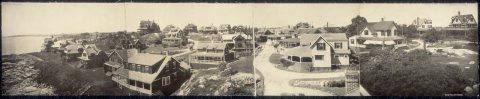

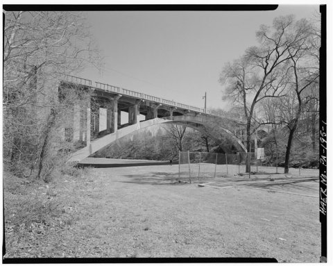 Date?
 2025
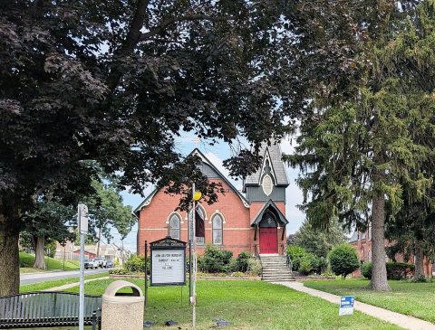 2025
 2025
 2025
 2025
 2025
 2024
 2024
 2017
 2017
 2017
 2007
