Bensalem Township’s post office opened in 1870, and 6 of its places are on the National Register
More historic than 44% of U.S. towns · #807 of 1,035 in Pennsylvania. What drives it
Most of Bensalem Township was built recently: 7% of its homes predate 1940 and the median home dates from 1975. Below: maps from 1942 on and the census since 1890.
The Bensalem Township post office opened in 1870, the earliest record of the town by name. Seven smaller post offices, Bridgewater (1833), Oakford (1855) and Eddington (1858), opened inside today’s town and later closed.
First census: 2,499 in 18902020 census: 62,707156 years
How historic is Bensalem Township?
C+
More historic than 44% of U.S. towns, on its age, its old homes and the National Register.
Founding year: the first Bensalem Township post office (Blevins & Helbock, CC0).The full story ↓
History grade
What drives Bensalem Township’s History grade
On its age, its old homes and the National Register, Bensalem Township is more historic than 44% of U.S. towns, #807 of 1,035 in Pennsylvania. Its National Register listings hold the grade up; its age pulls it down.
C+
HistoryA character grade: shown, never part of Bensalem Township’s overall grade.
Pennsylvania towns list about as much on the Register as the country (a typical Pennsylvania town has 2.1 per 10,000 residents, the U.S. 2.4), so Bensalem Township’s 1.4 sits near the middle of its state (55% of Pennsylvania towns have fewer) while its 9 historic buildings outnumber those of 75% of U.S. towns.
How sure. Graded on any two of the three inputs instead, the letter would range from C to B−. The pre-1940 share (±1.6 points) is firm at this size. The founding year is the first post office, not a stated founding date.
Founding year: the first post office (other dates in Quick answers). Homes: Census ACS 2020–24. National Register: National Park Service, May 2026 list; each listing counted once (boundary changes and added documentation belong to their listing), and a historic district counts its contributing buildings. How TownRatings grades history →
What stands out about Bensalem Township’s past
Read from the archive, the National Register and the record. The page puts what stands out first.
Andalusia Post Officepost officeBridgewater Post Officepost officeCopter-Liberty Bell AirportairportCornwells Heights Post Officepost officeGiles and Ransome AirportairportMaud Post Officepost office
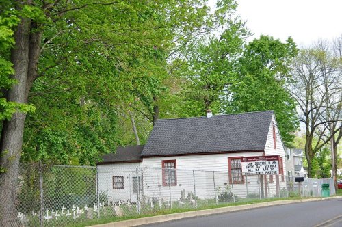
14cemeteries and burying grounds inside Bensalem Township
BeechwoodBensalem African Methodist Episcopal ChurchBensalem United Methodist ChurchGibbsHoly Ghost Preparatory School Burial YardKing David Memorial ParkResurrectionRoosevelt Memorial ParkRosedale Memorial ParkSaint Mary's Lithuanian National CatholicSaint ValentinesSisters of the Blessed SacramentVandergriftWilliamson - Johnson
US Post Offices dataset (Blevins & Helbock, CC0). Places and cemeteries from the USGS Geographic Names Information System (2021).
Help out
Start Bensalem Township’s collection
The first neighbors to add old photos shape how Bensalem Township’s history is told.
Decades since 1900 with photos
00s10s20s30s40s50s60s70s80s90s
0 of 10 decades. The empty ones are waiting for someone’s album.
The area of Bensalem Township appeared on the Holme Map of 1682, though not yet with a name. On January 2, 1685, the boundary was fixed between Bensalem and Philadelphia County along the Poquessing Creek. At the September 1692 session of Bucks County Court, a jury of thirteen men was formed to define boundaries of divisions that had been created up to that time. The report submitted in December states that "All the lands between Neshamineh and Poquessin, and so to the upper side of Joseph Growden's land in one and to be called 'Salem.'"
Every edition of the U.S. Geological Survey’s map of Bensalem Township. Tap a year, or press play to watch the town change.
1942Burlington sheet · 1:62,500
U.S. Geological Survey historical topographic maps (public domain), via Esri’s collection of the scans. The red ring marks the center of Bensalem Township.
People over time
Bensalem Township, census by census
Grew from 2,499 people in 1890 to 62,707 in 2020, more than tenfold.
14 censuses, 1890–2020.
U.S. Census Bureau decennial counts, from the census table on Bensalem Township’s Wikipedia page.
Famous people
5 famous people were born in Bensalem Township
Writers, athletes, leaders and more, ranked by how widely they’re known.
The Bensalem Township post office opened in 1870, the earliest record of the town by name (U.S. post office records).
How does Bensalem Township rank for history?
Bensalem Township is more historic than 44% of U.S. towns, #807 of 1,035 in Pennsylvania. The History grade combines the town’s founding era, the share of homes built before 1940 and its National Register listings. It’s a character grade, so it isn’t part of the overall grade. How it works.
What is on the National Register in Bensalem Township?
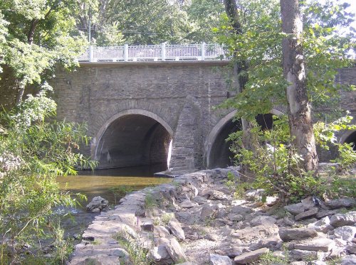
6 listings: 5 buildings, among them the Andalusia (a National Historic Landmark since 1966), and 1 structure. 9 historic buildings in all.
How old are the homes in Bensalem Township?
7% of Bensalem Township’s homes were built before 1940 (Census estimate, ±1.6 points), against a typical 18% for a Pennsylvania town; the median home was built in 1975.
Founding dates: Wikidata, Wikipedia, the U.S. post office records of Blevins & Helbock (CC0) and the Census. Homes by year built: Census ACS 2020–24. National Register of Historic Places: National Park Service (list of May 22, 2026). Old photos, postcards and papers: Wikimedia Commons, the Library of Congress and other public archives, credited on each item’s page. Maps: U.S. Geological Survey historical topographic maps (via Esri) and Sanborn fire-insurance maps (Library of Congress). History text and census tables: Wikipedia (CC BY-SA 4.0). Places that used to be: USGS Geographic Names Information System (2021).
From Wikidata (3), the National Register of Historic Places (6), Wikipedia, Wikidata and Wikipedia for famous people, U.S. Geological Survey historical maps, U.S. Census counts (via Wikipedia), the US Post Offices dataset (Blevins & Helbock) and the USGS Geographic Names Information System. Archive images are copied here with their credits and licenses, shown on each photo’s page. Refreshed monthly.


 ★ Landmark