174 years in pictures
Census counts: 6,499 in 1970, 54,539 in 2020. The archive holds 6 old photos and papers going back to 1880 and 7 maps from 1916 on.
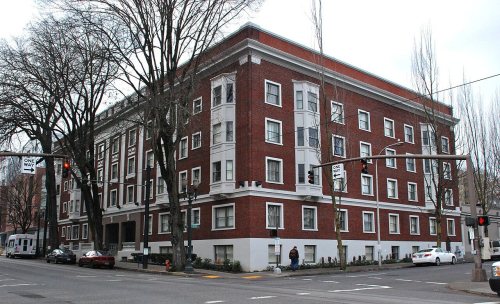
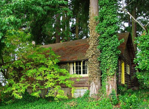
4 places on the National Register of Historic Places.
- 1852Tigard is settled
Each edition grades its towns against each other only.

A city of 57,929, settled in 1852.
Tigard grades B− overall, 47th of 142 graded towns in Oregon, with clear strengths and some subjects that lag. CDC estimates put its residents' health ahead of 84% of the country and the median household earns $109K. On the other side, homes are expensive, about $599K for a typical one and 6.1 times the Portland metro’s $97K median household income. Tigard’s property crime rate is 34.9 per 1,000 residents, above both Oregon’s towns (15.2) and U.S. towns (9.9). Tigard is easier to get around on foot or by transit than 94% of U.S. towns. Tigard has 4 places on the National Register of Historic Places, among them John W. Tigard House and Shaver-Bilyeu House.
Where Tigard beats most towns.
48,035 counted in 2010 and 54,539 in 2020; an estimated 57,929 in 2025.
Growth hasn’t slowed: 5.7% since 2020, after 13.5% in the decade before.
U.S. Census 2010 & 2020 counts · Census Bureau estimate, July 1, 2025
Each subject compared with towns across the country (schools within Oregon), ordered by how far Tigard is from typical.
How TownRatings grades towns →
Census counts: 6,499 in 1970, 54,539 in 2020. The archive holds 6 old photos and papers going back to 1880 and 7 maps from 1916 on.
4 places on the National Register of Historic Places.
Museums, parks, gardens and other places to visit around Tigard. Close and well known come first.
9 mi Stadium & arenaModa Center
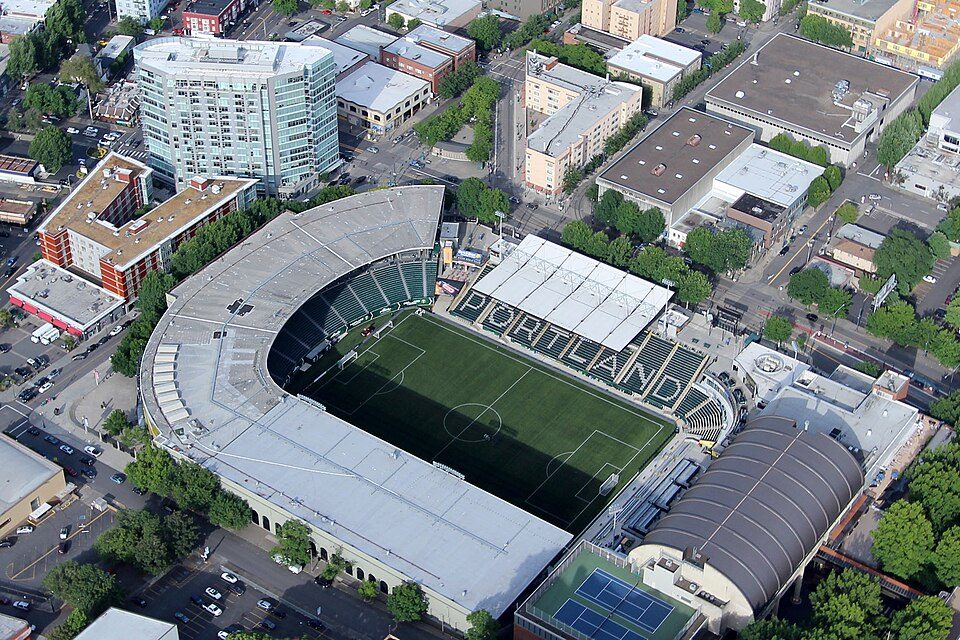
8 mi Stadium & arenaProvidence Park
34 mi WaterfallMultnomah Falls
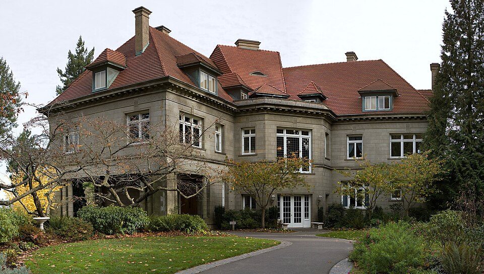
8 mi MuseumPittock Mansion
9 mi GardenForest Park
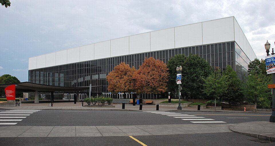
9 mi Stadium & arenaVeterans Memorial ColiseumModa Center: Lugnuts, CC BY-SA 3.0 · Providence Park: Pdx.rollingthunder, CC BY-SA 4.0 · Multnomah Falls: John Fowler from Placitas, NM, USA, CC BY 2.0 · Pittock Mansion: PittockBack.jpg: Cacophony derivative work: Tiptoety talk, CC BY-SA 3.0 · Forest Park: EncMstr, CC BY-SA 3.0 · Veterans Memorial Coliseum: Steve Morgan, CC BY-SA 3.0
Who provides power, water and the rest in Tigard, and how to reach them.
EPA SDWIS (Oct 9, 2026) · HIFLD + EIA-861 2025 · Census 2020 ZCTAs · NCES 2024–25 · registration: vote.gov, updated Oct 2, 2026.
Ordered by what stands out in Tigard.
Tigard draws workers from Portland and beyond, but it reports more crime than Tualatin and its other graded neighbors.
43,172 jobs are based in Tigard, 1.6 for every working resident, so most of the people who work here commute in.
Most working residents leave Tigard for work: only 13% work in town. 26% of workers work from home in Tigard. The top destinations are Portland (28%), Beaverton (10%) and Hillsboro (7%).
| Tigard | Oregon towns | U.S. towns | |
|---|---|---|---|
| Work from home | 26% | 14% | 11% |
| Median household income | $109,000 | $81,000 | $80,000 |
| Below the poverty line | 6.7% | 11% | 9.6% |
| Working residents who work in town | 13% | 9.5% | 8% |
Census LEHD 2023 · ACS
Its public schools are run by Tigard-Tualatin SD 23J. Three of its 14 schools are below, each with why it’s listed.
| School | Level | Students | Letter |
|---|---|---|---|
| Twality Middle SchoolLargest public middle schoolGrades 6–8 | Grades 6–8 | 1,006 | A− |
| Tigard High SchoolLargest public high schoolGrades 9–12 | Grades 9–12 | 1,771 | B+ |
| Mary Woodward Elementary SchoolTop results in townGrades K–5 | Grades K–5 | 417 | A |
NCES · EDFacts · graded within OR on state tests and graduation
18 miles of trail in 43 parks and preserves. The trail density in Tigard is 1.4 miles per square mile. The biggest park or preserve is Cook Family Park, at 74 acres.
| Tigard | Oregon towns | U.S. towns | |
|---|---|---|---|
| Miles of trail per square mile | 1.4 miles per square mile | 0.8 | 0.4 |
| Conserved land | 9.3% | 4.3% | 4.3% |
| Biggest places to walk | Trails | Acres |
|---|---|---|
| 1. Dirksen Nature Park | 1.6 mi | 50 |
| 2. Cach Nature Park | 0.8 mi | 19 |
| 3. Cook Family Park | 0.7 mi | 74 |
Trails & parks © OpenStreetMap contributors · Conserved land: USGS PAD-US
Each of the 3 graded towns on its borders reports less crime per resident, from Tualatin (C−) to King City (B+).
Tigard’s violent crime rate is 2.5 per 1,000 residents.
FBI crime data, 2025 · crimes reported to police
71% of Tigard adults had a checkup this year. Tigard beats the Oregon average on 12 of 26 CDC measures and trails it on 0. 17% of Tigard adults get no exercise outside work.
| Tigard | Oregon towns | U.S. towns | |
|---|---|---|---|
| Yearly checkup (CDC PLACES) | 71% | 73% | 79% |
| Get no exercise (CDC PLACES) | 17% | 21% | 25% |
| Sleep under 7 hours (CDC PLACES) | 30% | 32% | 36% |
| Smoke cigarettes (CDC PLACES) | 9.5% | 13% | 14% |
| What stands out | Tigard | OR |
|---|---|---|
| Fewer older adults who have lost all their teeth | 8.4% | 12.5% |
| Fewer adults with COPD | 5.1% | 6.8% |
CDC PLACES 2025 · modeled estimates for adults · CMS · HRSA
The typical Tigard home is worth about $599,000, down 0.9% in a year, 21% above the Oregon typical home.
| Tigard | Oregon towns | U.S. towns | |
|---|---|---|---|
| Median rent | $1,782 a month | $1,413 a month | $1,185 a month |
| Households that own their home | 62% | 65% | 73% |
Zillow Home Value Index · Redfin Data Center
Tigard has mild winters and pleasant summers. July afternoons reach 81°, January nights drop to 36° and about 4 inches of snow falls in a winter.
NOAA U.S. Climate Normals, 1991–2020
Expected storm and flood damage is higher than in 64% of U.S. communities. Since 1996, 13 flood insurance claims have been paid out in Tigard.
FEMA flood insurance claims · FEMA National Risk Index · OpenFEMA
16 within 15 miles of the center of Tigard
About 5 of every 100 Tigard residents are enrolled in college, about the same as Oregon.
Where Tigard’s working residents go each day. Line width shows the share.
Census LEHD 2023
4 places in Tigard on the National Register of Historic Places.
City in Oregon, United States
Tigard ( TY-gərd) is a city in Washington County, Oregon, United States. The population was 54,539 at the 2020 census, making it the 12th most populous city in Oregon. Incorporated in 1961, the city is located south of Beaverton and north of Tualatin, and is part of the Portland metropolitan area. Interstate 5 and Oregon Route 217 are the main freeways in the city, with Oregon Route 99W and Oregon Route 210 serving as other major highways. Public transit service is provided by TriMet, via several bus routes and the WES Commuter Rail line.
From Wikipedia, licensed CC BY-SA 4.0 · facts via Wikidata (CC0)
8 towns share a border with Tigard.
All 6 graded towns on its borders grade higher than its B−; Tualatin (B−) is closest.
| Town | OR rank | Overall | Cost | Safety | Schools | Health |
|---|---|---|---|---|---|---|
| Tigard | #47 | B− | D | D | A− | A− |
| Bull Mountain | #15 | A− | D | — | A− | A |
| Beaverton | #38 | B− | D | C− | A | A− |
| Metzger | #20 | B+ | D | — | A− | A− |
| Tualatin | #42 | B− | D | C− | A | A− |
| Durham | — | — | D | — | A− | B− |
| King City | #28 | B+ | D | B+ | A− | B |
| Garden Home-Whitford | #11 | A− | D | — | A | A− |
Durham has fewer than 2,500 residents, so it gets subject grades but no overall grade. Bull Mountain, Metzger, Durham and Garden Home-Whitford report no FBI crime data of their own. Compare Tigard with a neighbor →
Short answers, built from the data on this page.
Tigard grades B− overall, better than 47% of U.S. towns and #47 of 142 in Oregon. It grades A− for health, D for safety and A− for schools. Cost of living is its weak spot, with a D.
Yes. Cost of living, which also weighs rents, property taxes and how many households pay 30% or more of their income for housing, grades D.
2 notable people were born here, including Gary Hansen and Philip Toelkes.