Most of Webbers Falls was built recently: 9% of its homes predate 1940 and the median home dates from 1975. Below: 17 old photos and papers, maps from 1894 on, and the census since 1900.
Fire insurance maps drew every building, what it was made of and what it was used for, so insurers could price the risk of fire. Pick a year, then a sheet.
1894Sheet 1 of 1
Edition
Sheets
BrickWoodStone
Sanborn Map Company, via the Library of Congress. Editions published in 1930 or earlier, which are in the public domain.
By decade
Webbers Falls, decade by decade
One decade in the archive so far: the 1930s. Scroll each row; tap a photo for its story.
Nothing in the archives for these yearsWeddings on Main Street, storms, parades, school pictures, the old store. If it’s in your family album, it belongs here.
Walter Webber had settled here with some of the first Cherokee to go to Indian Territory west of the Mississippi River; it was then considered part of Arkansas Territory. Having acquired a small fleet of keelboats, he was able to stock the post with goods from other parts of the United States, so he opened a trading post and a portage service, as well as building a house. Of mixed-race Cherokee-European descent, Webber was married to a full-blood Cherokee. They had adopted many American ways and outfitted their house in European-American style. When English-speaking visitors came, one of their African-American slaves and domestic servants would translate. Webber also built a salt works, leasing the land for it from the Cherokee government, which held it communally as a tribe. In the early years when Webber was in the territory, there was considerable conflict with the Osage people, who …
Every edition of the U.S. Geological Survey’s map of Webbers Falls. Tap a year, or press play to watch the town change.
1948Webbers Falls sheet · 1:62,500
U.S. Geological Survey historical topographic maps (public domain), via Esri’s collection of the scans. The red ring marks the center of Webbers Falls.
Then & now
Stand where they stood
No then-and-now pairs yet. Take a photo from the same spot as an old one and they appear here side by side.
Retake this viewOn highway no. 1 of the "OK" state near Webbers Falls, Muskogee County, Oklahoma. Seven children and eldest son's famil…, 1938
Find the spot, match the angle, and add your photo. It becomes the first then-and-now pair on Webbers Falls’ page.
Founding dates: Wikidata, Wikipedia, the U.S. post office records of Blevins & Helbock (CC0) and the Census. Homes by year built: Census ACS 2020–24. National Register of Historic Places: National Park Service (list of May 22, 2026). Old photos, postcards and papers: Wikimedia Commons, the Library of Congress and other public archives, credited on each item’s page. Maps: U.S. Geological Survey historical topographic maps (via Esri) and Sanborn fire-insurance maps (Library of Congress). History text and census tables: Wikipedia (CC BY-SA 4.0). Places that used to be: USGS Geographic Names Information System (2021). How TownRatings grades history →
From the Library of Congress (17), Wikipedia, Wikidata and Wikipedia for famous people, U.S. Geological Survey historical maps, U.S. Census counts (via Wikipedia), the US Post Offices dataset (Blevins & Helbock), the USGS Geographic Names Information System and Sanborn fire insurance maps (Library of Congress). Archive images are copied here with their credits and licenses, shown on each photo’s page. Refreshed monthly.


 1938
 1938
 1939
 1939
 1939
 1939
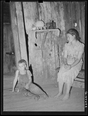 1939
 1939
 1939
 1939
 1939
 1939
 1939
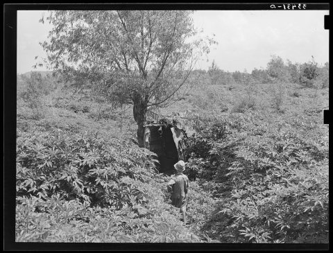 1939
 1939
 1939
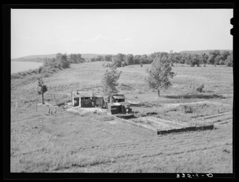 1939


