On its age, its old homes and the National Register, Pleasant Township is more historic than 30% of U.S. towns. Its share of homes from before 1940 holds the grade up; its National Register listings pull it down.
C
HistoryA character grade: shown, never part of Pleasant Township’s overall grade.
Ohio towns list about as much on the Register as the country (a typical Ohio town has 2.9 per 10,000 residents, the U.S. 2.4), so Pleasant Township’s 0.0 sits below most of its state (23% of Ohio towns have fewer) while its 0 listings outnumber those of 23% of U.S. towns.
How sure. Graded on two of the three inputs, so a change in either one moves the letter more than it would with three. The pre-1940 share is a Census survey estimate (±7.7 points).
Founding year: our sources. Homes: Census ACS 2020–24. National Register: National Park Service, May 2026 list; each listing counted once (boundary changes and added documentation belong to their listing), and a historic district counts its contributing buildings. How TownRatings grades history →
What stands out about Pleasant Township’s past
Read from the archive, the National Register and the record. The page puts what stands out first.
Lost post offices, old corners, places now gone and burying grounds
Two other post offices opened and closed inside today’s town.
Douglass
1826–1835
Loganville
1835–1905
18201920today
Hamlets and corners on the map
Logansville
Gone or out of use
Loganville Post Officepost officeSchool Number 1schoolSchool Number 2schoolSchool Number 5schoolSchool Number 6schoolSchool Number 7schoolSchool Number 8schoolSchool Number 9school
5cemeteries and burying grounds inside Pleasant Township
ArmstrongHuberLogansvilleMeansMoores
US Post Offices dataset (Blevins & Helbock, CC0). Places and cemeteries from the USGS Geographic Names Information System (2021).
On the map
Pleasant Township on the map, 1913 to 1961
Every edition of the U.S. Geological Survey’s map of Pleasant Township. Tap a year, or press play to watch the town change.
1913Bellefontaine sheet · 1:62,500
U.S. Geological Survey historical topographic maps (public domain), via Esri’s collection of the scans. The red ring marks the center of Pleasant Township.
The story so far
Pleasant Township, in brief
Wikipedia doesn’t have a history of Pleasant Township yet. The photos, dates and memories neighbors add here are how it gets written.
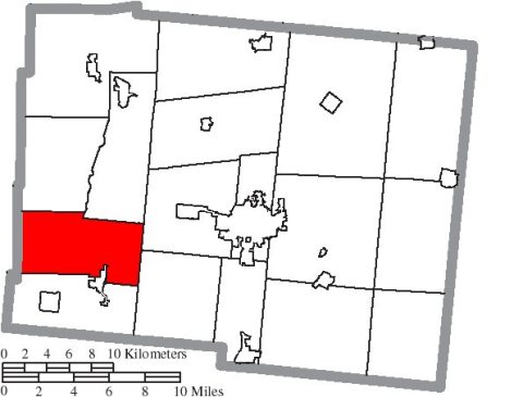
Pleasant Township is one of the seventeen townships of Logan County, Ohio, United States. As of the 2020 census, the population was 1,144.
Its population held steady between the last two censuses: 1,147 in 2010, 1,144 in 2020.
Intro from Wikipedia. Population: U.S. Census Bureau.
From the old history books
What they wrote about Pleasant Township in 1880
Passages that mention Pleasant Township, cut from the printed page as they were published.
History of Logan County and Ohio1880 · page 357Read the page →
Read the text
as Bloomfield. Of this upper part, Stokes was taken off in 1838, and Bloomfield and Washington became separate townships in 1839. Two years later. Pleasant Township was taken off the northern part of Miami, leaving the latter a rectangular body about seven miles long, from east to west, and about three miles wide. As constructed now, it is
Text read by machine from the scan; it may contain errors.
History of Logan County and Ohio1880 · page 359Read the page →
Read the text
as Bloomfield. Of this upper part, Stokes was taken off in 1838, and Bloomfield and Washington became separate townships in 1839. Two years later. Pleasant Township was taken off the northern part of Miami, leaving the latter a rectangular body about seven miles long, from east to west, and about three miles wide. As constructed now, it is
Text read by machine from the scan; it may contain errors.
History of Logan County and Ohio1880 · page 461Read the page →
Read the text
four original settlers: James Moore, Robert Dickson, Alfred Mathews and John Means, united in the formation of the first religious society in Pleasant Township, and not long afterward, a log meeting-house was built in Logansville. A few years later a society of the Presbyterian denomination was formed here, and they united with the Christians in the
Text read by machine from the scan; it may contain errors.
History of Logan County and Ohio1880 · page 459Read the page →
Read the text
extra amount of birch was applied to Dobbin, and the family roof-tree gained in safety. In about 1819-20, James Moore put in operation the pioncer grist-mill in Pleasant Township. The building was of logs, and stood on the west bank of the Miami River. A short time subsequent Mr: Moore constructed a frame saw-mill adjoining the first. These pioneer
Text read by machine from the scan; it may contain errors.
Scans and text from the Internet Archive. Books published in 1930 or earlier, which are in the public domain.
Timeline
Pleasant Township, 1826 to 1913
Woven from the archive, old maps, post office records, the National Register and the people born here.
Nothing in the archives for these yearsWeddings on Main Street, storms, parades, school pictures, the old store. If it’s in your family album, it belongs here.
Pleasant Township is more historic than 30% of U.S. towns. The History grade combines the town’s founding era, the share of homes built before 1940 and its National Register listings. It’s a character grade, so it isn’t part of the overall grade. How it works.
How old are the homes in Pleasant Township?
12% of Pleasant Township’s homes were built before 1940 (Census estimate, ±7.7 points), against a typical 15% for an Ohio town; the median home was built in 1977.
Founding dates: Wikidata, Wikipedia, the U.S. post office records of Blevins & Helbock (CC0) and the Census. Homes by year built: Census ACS 2020–24. National Register of Historic Places: National Park Service (list of May 22, 2026). Old photos, postcards and papers: Wikimedia Commons, the Library of Congress and other public archives, credited on each item’s page. Maps: U.S. Geological Survey historical topographic maps (via Esri) and Sanborn fire-insurance maps (Library of Congress). History text and census tables: Wikipedia (CC BY-SA 4.0). Places that used to be: USGS Geographic Names Information System (2021).
From Wikimedia Commons (5), U.S. Geological Survey historical maps, the US Post Offices dataset (Blevins & Helbock), the USGS Geographic Names Information System and old county and town histories (Internet Archive). Archive images are copied here with their credits and licenses, shown on each photo’s page. Refreshed monthly.


 2015
 2015
 2007
 2006


