Oxford Township dates to 1809, and 16 of its places are on the National Register
Most of Oxford Township was built recently: 8% of its homes predate 1940 and the median home dates from 1985. 16 places in town are on the National Register, among them a historic district with 5 buildings. Below: 10 old photos and papers, maps from 1960 on, and the census since 1820.
Oxford lies within the Congress Lands West of Miami River. In 1803, the United States Congress granted one township to the Ohio General Assembly in the region to build a college. The Ohio Legislature selected a township off Four Mile Creek, the College Township, and chartered Miami University in 1809.
Nothing in the archives for these yearsWeddings on Main Street, storms, parades, school pictures, the old store. If it’s in your family album, it belongs here.
Every edition of the U.S. Geological Survey’s map of Oxford Township. Tap a year, or press play to watch the town change.
1960College Corner sheet · 1:24,000
U.S. Geological Survey historical topographic maps (public domain), via Esri’s collection of the scans. The red ring marks the center of Oxford Township.
Then & now
Stand where they stood
No then-and-now pairs yet. Take a photo from the same spot as an old one and they appear here side by side.
Retake this viewNorthwest entrance to Miami University campus ca. 1900, c. 1900
Find the spot, match the angle, and add your photo. It becomes the first then-and-now pair on Oxford Township’s page.
Grew from 258 people in 1820 to 23,035 in 2020, more than tenfold.
20 censuses, 1820–2020.
U.S. Census Bureau decennial counts, from the census table on Oxford Township’s Wikipedia page.
Places that used to be
Lost post offices, old corners and places now gone
Another post office, Contreras, opened and closed inside today’s town.
Hamlets and corners on the map
ContrerasMcDonald
Gone or out of use
Contreras Post Officepost officeContreras Post Officepost officeDeep FordcrossingNation SchoolschoolNike Site CD-78CmilitaryNike Site CD-78LmilitarySchool Number 2schoolSchool Number 3schoolSchool Number 4schoolSchool Number 6schoolSchool Number 6schoolSchool Number 7schoolSchool Number 9school
US Post Offices dataset (Blevins & Helbock, CC0). Places and cemeteries from the USGS Geographic Names Information System (2021).
Help out
Finish Oxford Township’s story
Most archives stop around 1920. The photos from after that are in family albums, not libraries.
Decades since 1900 with photos
00s10s20s30s40s50s60s70s80s90s
2 of 10 decades. The empty ones are waiting for someone’s album.
In 1809, according to Wikidata. Oxford Township’s post office opened in 1817, and the census of 1820 counted 258 people here.
What is on the National Register in Oxford Township?
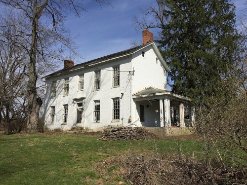
16 listings, 2 of them National Historic Landmarks: 1 building, 1 historic district, the Austin-Magie Farm and Mill District, with 5 contributing buildings, and 1 structure. 40 historic buildings in all.
Founding dates: Wikidata, Wikipedia, the U.S. post office records of Blevins & Helbock (CC0) and the Census. Homes by year built: Census ACS 2020–24. National Register of Historic Places: National Park Service (list of May 22, 2026). Old photos, postcards and papers: Wikimedia Commons, the Library of Congress and other public archives, credited on each item’s page. Maps: U.S. Geological Survey historical topographic maps (via Esri) and Sanborn fire-insurance maps (Library of Congress). History text and census tables: Wikipedia (CC BY-SA 4.0). Places that used to be: USGS Geographic Names Information System (2021). How TownRatings grades history →
From Wikimedia Commons (10), Wikidata (2), the National Register of Historic Places (3), Wikipedia, U.S. Geological Survey historical maps, U.S. Census counts (via Wikipedia), the US Post Offices dataset (Blevins & Helbock) and the USGS Geographic Names Information System. Archive images are copied here with their credits and licenses, shown on each photo’s page. Refreshed monthly.




 c. 1900
 c. 1900
 1907
 1908
 1908
 1909
 1909
 1911


