Margaretta Township’s post office opened in 1826, and 17% of its homes were built before 1940
More historic than 81% of U.S. towns · #290 of 993 in Ohio. What drives it
1 place in town is on the National Register, among them a historic district with 4 buildings. Below: 1 old photo or paper, maps from 1901 on, and old-book passages.
From Margaretta Township’s archive · credits on each photo
Quick answers
How Margaretta Township began
When was Margaretta Township founded?
1826
The Margaretta Township post office opened in 1826, the earliest record of the town by name. Three smaller post offices, Sandhill (1882), Weyers (1895) and Baybridge (1896), opened inside today’s town and later closed.
2020 census: 5,640200 years
How historic is Margaretta Township?
A−
More historic than 81% of U.S. towns, on its age, its old homes and the National Register.
Founding year: the first Margaretta Township post office (Blevins & Helbock, CC0).
History grade
What drives Margaretta Township’s History grade
On its age, its old homes and the National Register, Margaretta Township is more historic than 81% of U.S. towns, #290 of 993 in Ohio. All 3 inputs are above most U.S. towns; its age ranks highest and its share of homes from before 1940 lowest.
A−
HistoryA character grade: shown, never part of Margaretta Township’s overall grade.
Ohio towns list about as much on the Register as the country (a typical Ohio town has 2.9 per 10,000 residents, the U.S. 2.4), so Margaretta Township’s 7.3 sits above most of its state (70% of Ohio towns have fewer) while its 4 historic buildings outnumber those of 68% of U.S. towns.
How sure. Graded on any two of the three inputs instead, the letter would range from B+ to A−. The pre-1940 share is a Census survey estimate (±4.2 points). The founding year is the first post office, not a stated founding date.
Founding year: the first post office (other dates in Quick answers). Homes: Census ACS 2020–24. National Register: National Park Service, May 2026 list; each listing counted once (boundary changes and added documentation belong to their listing), and a historic district counts its contributing buildings. How TownRatings grades history →
What stands out about Margaretta Township’s past
Read from the archive, the National Register and the record. The page puts what stands out first.
Lost post offices, old corners, places now gone and burying grounds
Three other post offices opened and closed inside today’s town.
Sandhill
1882–1905
Weyers
1895–1902
Baybridge
1896–1963
18801950today
Hamlets and corners on the map
Crystal RockEdgewater EstatesGreenfield Village Mobile Home ParkSand HillSpringbrookWeyers
Gone or out of use
Sandhill Post Officepost officeWeyers Post Officepost office
4cemeteries and burying grounds inside Margaretta Township
CastaliaGravesOak LawnSandhill
US Post Offices dataset (Blevins & Helbock, CC0). Places and cemeteries from the USGS Geographic Names Information System (2021).
On the map
Margaretta Township on the map, 1901 to 1969
Every edition of the U.S. Geological Survey’s map of Margaretta Township. Tap a year, or press play to watch the town change.
1901Bellevue sheet · 1:62,500
U.S. Geological Survey historical topographic maps (public domain), via Esri’s collection of the scans. The red ring marks the center of Margaretta Township.
The story so far
Margaretta Township, in brief
Wikipedia doesn’t have a history of Margaretta Township yet. The photos, dates and memories neighbors add here are how it gets written.
Margaretta Township is one of the nine townships of Erie County, Ohio, United States. It is part of the Sandusky, Ohio metropolitan statistical area. As of the 2020 census the population was 5,640.
Its first post office opened in 1826. Between the 2010 and 2020 censuses its population fell from 5,981 to 5,640 (-6%).
Intro from Wikipedia. Population: U.S. Census Bureau.
From the old history books
What they wrote about Margaretta Township in 1916
Passages that mention Margaretta Township, cut from the printed page as they were published.
A standard history of Erie County, Ohio1916 · page 732Read the page →
Read the text
Elijah C. Witter was reared to man's estate in Margaretta Township, this county, and was educated in its public schools and in the high schools at Castalia and Milan. For a number of years he followed his father's vocation, having a good farm of 115 acres, located mainly in Margaretta Township, which he tilled successfully. Appointed rural letter carrier in November, 1905, he assumed the duties of that office, which he has since performed in a highly satisfactory manner. An
Text read by machine from the scan; it may contain errors.
A standard history of Erie County, Ohio1916 · page 766Read the page →
Read the text
mother a number of years later in 1895, when past eighty." The Altvaters were Protestant people. After his marriage John Roraell set out as a farmer, later was employed for several years in a paper mill, and finally bought forty-four acres of land in Margaretta Township. He sold that, and in 1880 moved to a farm which he had bought near Clarksfield, lived there until the spring of 1896, and then retuimed to Erie County, buyinii' land .just out.side the Village of Berlin Heights. He and his good wife still live at that home, and both are well preserved people
Text read by machine from the scan; it may contain errors.
Scans and text from the Internet Archive. Books published in 1930 or earlier, which are in the public domain.
Timeline
Margaretta Township, 1882 to 1963
Woven from the archive, old maps, post office records, the National Register and the people born here.
Nothing in the archives for these yearsWeddings on Main Street, storms, parades, school pictures, the old store. If it’s in your family album, it belongs here.
The Margaretta Township post office opened in 1826, the earliest record of the town by name (U.S. post office records).
How does Margaretta Township rank for history?
Margaretta Township is more historic than 81% of U.S. towns, #290 of 993 in Ohio. The History grade combines the town’s founding era, the share of homes built before 1940 and its National Register listings. It’s a character grade, so it isn’t part of the overall grade. How it works.
What is on the National Register in Margaretta Township?
One place: the Castalia Trout Club (listed 2019).
How old are the homes in Margaretta Township?
17% of Margaretta Township’s homes were built before 1940 (Census estimate, ±4.2 points), against a typical 15% for an Ohio town; the median home was built in 1967.
Founding dates: Wikidata, Wikipedia, the U.S. post office records of Blevins & Helbock (CC0) and the Census. Homes by year built: Census ACS 2020–24. National Register of Historic Places: National Park Service (list of May 22, 2026). Old photos, postcards and papers: Wikimedia Commons, the Library of Congress and other public archives, credited on each item’s page. Maps: U.S. Geological Survey historical topographic maps (via Esri) and Sanborn fire-insurance maps (Library of Congress). History text and census tables: Wikipedia (CC BY-SA 4.0). Places that used to be: USGS Geographic Names Information System (2021).
From Wikimedia Commons (6), the National Register of Historic Places (1), U.S. Geological Survey historical maps, the US Post Offices dataset (Blevins & Helbock), the USGS Geographic Names Information System and old county and town histories (Internet Archive). Archive images are copied here with their credits and licenses, shown on each photo’s page. Refreshed monthly.


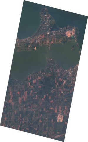 2025
 2015
 2008
 2006
 2005


