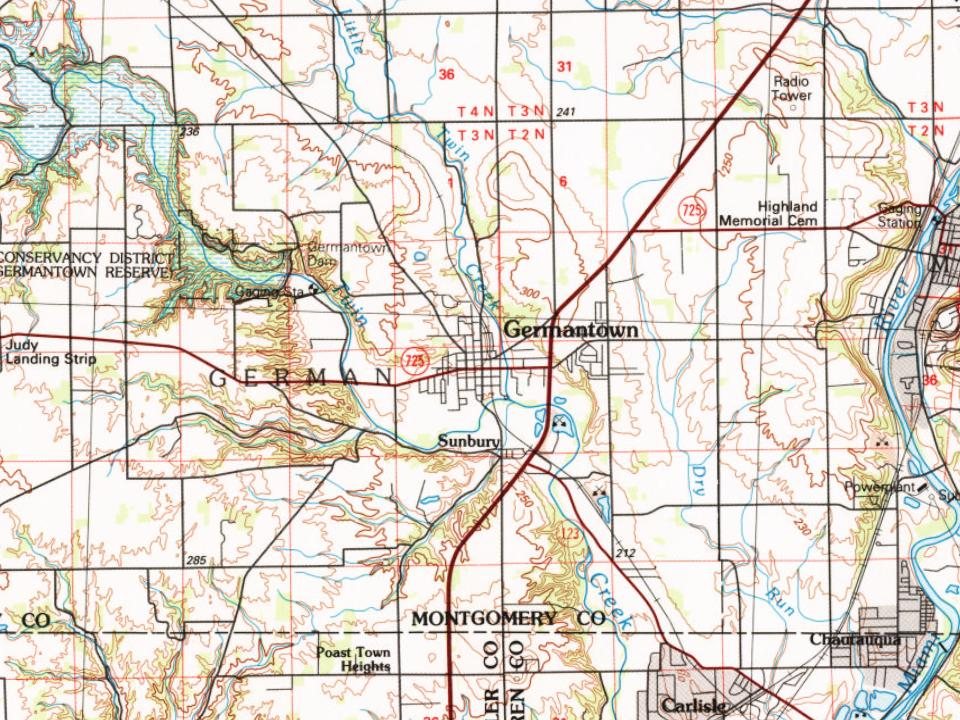
Germantown dates to 1804, and 15% of its homes were built before 1940
More historic than 86% of U.S. towns · #210 of 993 in Ohio. What drives it
5 places in town are on the National Register, among them a historic district with 38 buildings. Below: 2 old photos and papers, maps from 1886 on, and the census since 1830.
Founding year: Wikidata; Wikipedia’s history section gives the same year. First post office: 1818.The full story ↓
History grade
What drives Germantown’s History grade
On its age, its old homes and the National Register, Germantown is more historic than 86% of U.S. towns, #210 of 993 in Ohio. All 3 inputs are above most U.S. towns; its National Register listings ranks highest and its share of homes from before 1940 lowest.
A
HistoryA character grade: shown, never part of Germantown’s overall grade.
Ohio towns list about as much on the Register as the country (a typical Ohio town has 2.9 per 10,000 residents, the U.S. 2.4), so Germantown’s 75.5 sits above most of its state (91% of Ohio towns have fewer) while its 44 historic buildings outnumber those of 84% of U.S. towns.
How sure. Graded on any two of the three inputs instead, the letter would range from B+ to A. The pre-1940 share is a Census survey estimate (±5.2 points). Two sources give 1804.
Founding year: Wikidata (other dates in Quick answers). Homes: Census ACS 2020–24. National Register: National Park Service, May 2026 list; each listing counted once (boundary changes and added documentation belong to their listing), and a historic district counts its contributing buildings. How TownRatings grades history →
What stands out about Germantown’s past
Read from the archive, the National Register and the record. The page puts what stands out first.
Fire insurance maps drew every building, what it was made of and what it was used for, so insurers could price the risk of fire. Pick a year, then a sheet.
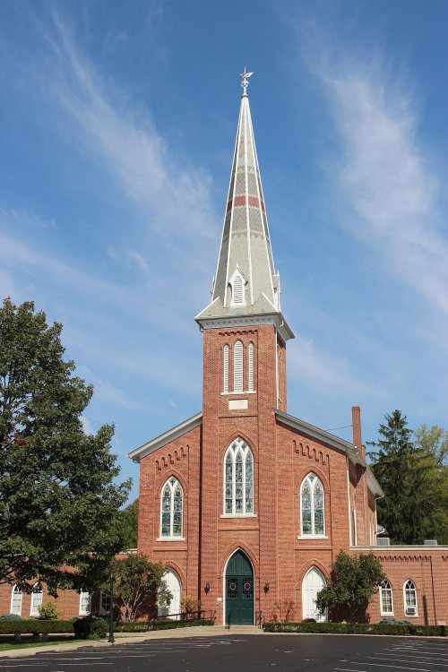
Germantown was established in 1804 by German-speaking settlers from Berks County, Pennsylvania. Philip Gunckel, the only member of the group who spoke English, is recognized as Germantown's founder, who chose the site for a grist mill and laid out the original town plan in 1814. The Gunckel Town Plan, maintaining many of its original 19th and early 20th century buildings, has been recognized as a Historic District and has been placed on the National Register of Historic Places.
Passages that mention Germantown, cut from the printed page as they were published.
History of the city of Dayton and Montgomery County, Ohio1909 · page 138Read the page →
Read the text
fourth cents ; man and horse three cents ; persons on foot, two cents. Soon after the completion of the bridge a road was laid out to the west from the north end of the bridge, then south across Wolf creek and continuing to the old Eaton road in the neighborhood of Germantown street. Thus the bridge was to be an outlet for travel west and south as well as north. CANAL BRIDGES.
Text read by machine from the scan; it may contain errors.
The history of Montgomery county, Ohio, containing a history of the county1882 · page 381Read the page →
Read the text
e Hardin, on part of which he afterward laid out the town of Germantown. At the general election, October 17, 1806, he was chosen to represent the inty in the Fifth General Assembly of Ohio, convened at Chillicothe the first >nday in December of that year.
Text read by machine from the scan; it may contain errors.
History of the Evangelical Lutheran Congregation in Germantown, Ohio1882Read the page →
Read the text
Henkel removed from Germantown to Goshen, Indiana, where he remained two and a half years, Mr. Reck quickly took advantage of the former's absence, and the vancancy of the charge, and came to Germantown, bringing with him several families which were to form the nucleus of a new-measure Lutheran congregation, and were finally to assimilate to themselves all the Lutherans in the town and its
Text read by machine from the scan; it may contain errors.
History of the city of Dayton and Montgomery County, Ohio1909 · page 874Read the page →
Read the text
Germantown was incorporated March 16, 1833. The articles of incorporation were amended February 20, 1834. The territory included within the corporate limits was two miles from east to west, extending to section lines on both sides, and a mile and a quarter in extreme width from north to south, beginning on Big Twin creek and extending to the half section line on the north. The first mayor was George Rowe, elected in 1833. At the same time J. W. Stamm was elected recorder. The succeeding mayors have been : J. Eminger, 1837 ; George Rowe, 1839; Jacob Koehne, 1842; M. B. Walker, 1845; William Gunckel, 1847;
Text read by machine from the scan; it may contain errors.
Scans and text from the Internet Archive. Books published in 1930 or earlier, which are in the public domain.
Timeline
Germantown, 1804 to 1917
Woven from the archive, old maps, post office records, the National Register and the people born here.
Nothing in the archives for these yearsWeddings on Main Street, storms, parades, school pictures, the old store. If it’s in your family album, it belongs here.
In 1804, according to Wikidata and Wikipedia’s history of the town. Germantown’s post office opened in 1818, and the census of 1830 counted 501 people here.
How does Germantown rank for history?
Germantown is more historic than 86% of U.S. towns, #210 of 993 in Ohio. The History grade combines the town’s founding era, the share of homes built before 1940 and its National Register listings. It’s a character grade, so it isn’t part of the overall grade. How it works.
What is on the National Register in Germantown?
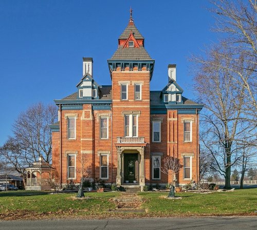
5 listings: 4 buildings, among them the John Stump House And Mill (listed 1975, the first), and 1 historic district, the Gunckel's Town Plan Historic District, with 38 contributing buildings. 44 historic buildings in all.
How old are the homes in Germantown?
15% of Germantown’s homes were built before 1940 (Census estimate, ±5.2 points), against a typical 15% for an Ohio town; the median home was built in 1972.
Founding dates: Wikidata, Wikipedia, the U.S. post office records of Blevins & Helbock (CC0) and the Census. Homes by year built: Census ACS 2020–24. National Register of Historic Places: National Park Service (list of May 22, 2026). Old photos, postcards and papers: Wikimedia Commons, the Library of Congress and other public archives, credited on each item’s page. Maps: U.S. Geological Survey historical topographic maps (via Esri) and Sanborn fire-insurance maps (Library of Congress). History text and census tables: Wikipedia (CC BY-SA 4.0). Places that used to be: USGS Geographic Names Information System (2021).
From Wikimedia Commons (4), the Library of Congress (1), Wikidata (4), the National Register of Historic Places (5), Wikipedia, Wikidata and Wikipedia for famous people, U.S. Geological Survey historical maps, U.S. Census counts (via Wikipedia), the US Post Offices dataset (Blevins & Helbock), the USGS Geographic Names Information System, Sanborn fire insurance maps (Library of Congress) and old county and town histories (Internet Archive). Archive images are copied here with their credits and licenses, shown on each photo’s page. Refreshed monthly.






 Date?
 2015
 2012
 2009