Founding year: Wikipedia. First post office: 1824.The full story ↓
History grade
What drives Camden’s History grade
On its age, its old homes and the National Register, Camden is more historic than 80% of U.S. towns. All 3 inputs are above most U.S. towns; its age ranks highest and its National Register listings lowest.
A−
HistoryA character grade: shown, never part of Camden’s overall grade.
Ohio towns list about as much on the Register as the country (a typical Ohio town has 2.9 per 10,000 residents, the U.S. 2.4), so Camden’s 4.9 sits near the middle of its state (64% of Ohio towns have fewer) while its 1 listings outnumber those of 51% of U.S. towns.
How sure. Graded on any two of the three inputs instead, the letter would range from B+ to A−. The pre-1940 share is a Census survey estimate (±8.7 points). Two sources give 1818.
Founding year: Wikipedia (other dates in Quick answers). Homes: Census ACS 2020–24. National Register: National Park Service, May 2026 list; each listing counted once (boundary changes and added documentation belong to their listing), and a historic district counts its contributing buildings. How TownRatings grades history →
What stands out about Camden’s past
Read from the archive, the National Register and the record. The page puts what stands out first.
Camden was laid out in 1818 as Dover. In 1824, the name was changed to Newcomb after State Senator George Newcomb as Dover, Ohio had already been established. This name did not catch on, and in 1835 the village was renamed to Camden after Camden, South Carolina.
Thomas Newton and John Newton, William Irwin and Abram Irwin, Matthew McClung and Elisha Carter all came in 1803, or the early part of 1804, and about the same time came William More, who laid out the town of Camden, and died there in 1833. In 1805 Isaac Sutton settled near Camden and John Lamm in the south part of the township. John Zimmerman also arrived in 1805 and in the same year William Stubbs settled in section 36. John Wright came in 1806 and settled near the south line of the township. The Wrights of Israel township are his descendants. Thomas Mur-
Text read by machine from the scan; it may contain errors.
The first church organization at Camden was the Methodist Episcopal, which organized a class there soon after the town was laid out, and about 1825 or 1826 a church was built on the hill, west of Camden, where the old cemetery is, and was used as such until about 1836, when the congregation purchased the land at the southeast corner of Hendrix and Lafayette streets and erected a new church. In 1849 or 1850, the old church proving inadequate, it was replaced by a larger frame church and about 1872 a parsonage was built. Again the church proved too small, being insufficient for the
Text read by machine from the scan; it may contain errors.
He resided for some years at the Millikin's island location, intending, as soon as the land was surveyed into sections, to settle in the valley of Seven Mile, about where the village of Camden now is. As soon as this was accomplished, and the lands were put in the market, hé bought three quarter sections, includiug the eastern part of the present town site of Camden, and moved there in 1803. Here he remained until William Bruce
Text read by machine from the scan; it may contain errors.
About the same timeas the above a gristand saw-mill was built by John Stubbs, on Paint creek, northwest of Camden. Simultaneously with the above a saw-mill was built upon Seven Mile by John Stubbs, uncle of the man just mentioned. This mill was south of Camden, on the northwest quarter of section fifteen. In 1834 he built a good grist-mill and put into it three run of stones.
Text read by machine from the scan; it may contain errors.
Scans and text from the Internet Archive. Books published in 1930 or earlier, which are in the public domain.
By decade
No old photos in the archives yet
Weddings on Main Street, storms, parades, school pictures, the old store. If it’s in your family album, it belongs here.
Be the first to add onePhotograph a print flat, in daylight, no flash.
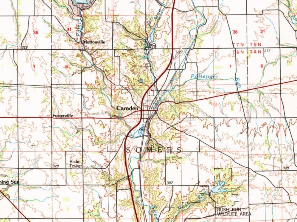
Every edition of the U.S. Geological Survey’s map of Camden. Tap a year, or press play to watch the town change.
1911Oxford sheet · 1:62,500
U.S. Geological Survey historical topographic maps (public domain), via Esri’s collection of the scans. The red ring marks the center of Camden.
Every building
Camden, building by building, 1895–1911
Fire insurance maps drew every building, what it was made of and what it was used for, so insurers could price the risk of fire. Pick a year, then a sheet.
In 1818, according to Wikipedia’s history of the town. Camden’s post office opened in 1824, and the census of 1860 counted 637 people here.
How does Camden rank for history?
Camden is more historic than 80% of U.S. towns. The History grade combines the town’s founding era, the share of homes built before 1940 and its National Register listings. It’s a character grade, so it isn’t part of the overall grade. How it works.
What is on the National Register in Camden?
One place: the Camden City Hall and Opera House (listed 1998).
How old are the homes in Camden?
21% of Camden’s homes were built before 1940 (Census estimate, ±8.7 points), against a typical 15% for an Ohio town; the median home was built in 1968.
Founding dates: Wikidata, Wikipedia, the U.S. post office records of Blevins & Helbock (CC0) and the Census. Homes by year built: Census ACS 2020–24. National Register of Historic Places: National Park Service (list of May 22, 2026). Old photos, postcards and papers: Wikimedia Commons, the Library of Congress and other public archives, credited on each item’s page. Maps: U.S. Geological Survey historical topographic maps (via Esri) and Sanborn fire-insurance maps (Library of Congress). History text and census tables: Wikipedia (CC BY-SA 4.0). Places that used to be: USGS Geographic Names Information System (2021).
From Wikidata (2), the National Register of Historic Places (1), Wikipedia, Wikidata and Wikipedia for famous people, U.S. Geological Survey historical maps, U.S. Census counts (via Wikipedia), the US Post Offices dataset (Blevins & Helbock), the USGS Geographic Names Information System, Sanborn fire insurance maps (Library of Congress) and old county and town histories (Internet Archive). Archive images are copied here with their credits and licenses, shown on each photo’s page. Refreshed monthly.