207 years in pictures
Census counts: 1,317 in 1820, 6,287 in 2020. The archive holds 6 old photos and papers going back to 1800 and 4 maps from 1892 on.
7 places on the National Register of Historic Places.
- 1819Woodstock is settled
Each edition grades its towns against each other only.

A town of 6,215, settled in 1819. 3.2 times the library visits per person than the typical New York town.
For most people who can afford it, yes. Woodstock grades B+ overall, ranked 278th of 745 in New York. Crime is low: it reports less per resident than 98% of U.S. towns. CDC estimates put its residents' health ahead of 86% of the country. What holds it back is price: the typical home is worth about $605K, 7 years of the Kingston metro’s $86K median household income. History is its standout character grade: an A, better than 90% of U.S. towns, with 7 places on the National Register. 69% of adults 25 and older hold a bachelor’s degree or more in Woodstock, against 32% in New York’s towns and 29% across U.S. towns. On civic life, just 2 of New York’s 1,187 towns do better. The biggest place to walk is Phoenicia - Mount Tobias Wild Forest, 3,017 acres with 6.8 miles of trail.
Where Woodstock beats most towns.
Census counts: 1,317 in 1820, 6,287 in 2020. The archive holds 6 old photos and papers going back to 1800 and 4 maps from 1892 on.
7 places on the National Register of Historic Places.
Each subject compared with towns across the country (schools within New York), ordered by how far Woodstock is from typical.
Its grades run from A+ for safety (better than 98% of comparable towns) to D− for cost of living (better than 2%), so the B+ overall blends very different results.
How TownRatings grades towns →
Museums, parks, gardens and other places to visit around Woodstock. Close and well known come first.
23 mi National Historic SiteHome of Franklin D. Roosevelt National Historic Site102K visitors a year
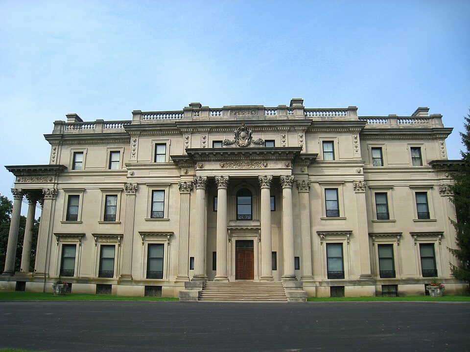
21 mi National Historic SiteVanderbilt Mansion National Historic Site295K visitors a year
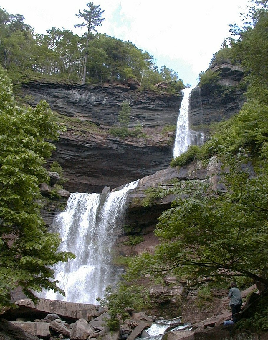
11 mi WaterfallKaaterskill Falls
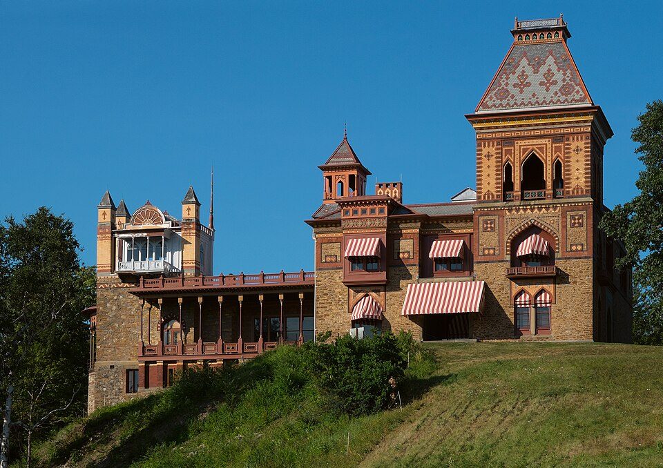
21 mi MuseumOlana State Historic Site
11 mi Ski areaHunter Mountain62 runs · 1,532 ft vertical
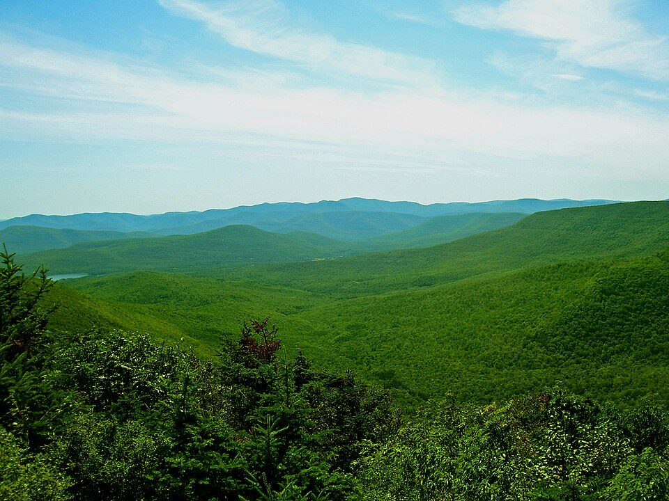
17 mi Park & preserveCatskill ParkHome of Franklin D. Roosevelt National Historic Site: Crunch, CC BY-SA 4.0 · Vanderbilt Mansion National Historic Site: Daderot, Public domain · Kaaterskill Falls: Mwanner, CC BY-SA 3.0 · Olana State Historic Site: Netniks, CC BY-SA 4.0 · Hunter Mountain: The original uploader was Daniel Case at English Wikipedia., CC BY-SA 3.0 · Catskill Park: The original uploader was Daniel Case at English Wikipedia., CC BY-SA 3.0
Who provides power, water and the rest in Woodstock, and how to reach them.
EPA SDWIS (Oct 9, 2026) · HIFLD + EIA-861 2025 · Census 2020 ZCTAs · NCES 2024–25 · registration: vote.gov, updated Aug 3, 2026.
Ordered by what stands out in Woodstock.
Woodstock keeps more of its land conserved than most of New York and gets more snow than nearly all U.S. towns, but it has homes that cost more against local pay than most of New York.
The public schools here belong to the Onteora Central School District. Its two schools are below. Enrollment at Woodstock’s public school: 189 students.
| School | Level | Students | Letter |
|---|---|---|---|
| Woodstock Elementary SchoolLargest public elementary schoolGrades K–4 | Grades K–4 | 189 | B+ |
| Hudson Valley Sudbury School PrivateLargest high schoolGrades K–12 | Grades K–12 | 73 | – |
NCES · EDFacts · graded within NY on state tests and graduation
Violent crime is rare: 0 reported in 2025, 0 per 1,000 residents.
The level of property crime for Woodstock comes to 1.4 per 1,000 residents. Police in Woodstock reported no violent crime.
| Woodstock | New York towns | U.S. towns | |
|---|---|---|---|
| Property crimes per 1,000 (2025) | 1.4 per 1,000 residents | 7.6 | 9.9 |
| Violent crimes per 1,000 (2025) | 0 per 1,000 residents | 0.8 | 1.6 |
FBI crime data, 2025 · crimes reported to police
Its 14,198 conserved acres are a larger share of the town than in 97% of New York towns.
Woodstock’s trail density stands at 0.8 miles per square mile. Count the trails in 24 parks and preserves and they come to 55 miles.
| Biggest places to walk | Trails | Acres |
|---|---|---|
| 1. Phoenicia - Mount Tobias Wild Forest | 6.8 mi | 3,017 |
| 2. Overlook Mountain Wild Forest | 6.7 mi | 1,124 |
| 3. Indian Head Wilderness | 5.1 mi | 2,950 |
Trails & parks © OpenStreetMap contributors · Conserved land: USGS PAD-US
Woodstock: 4% of adults 18 to 64 have no health insurance. Only 7 of the 755 New York towns we compare have a lower share of adults who binge drink than Woodstock. On the CDC’s 32 measures, Woodstock is ahead of New York on 17 and behind on 5.
| Woodstock | New York towns | U.S. towns | |
|---|---|---|---|
| Feel lonely (CDC PLACES) | 26% | 32% | 33% |
| Frequent mental distress (CDC PLACES) | 12% | 16% | 17% |
| Binge drink (CDC PLACES) | 13% | 17% | 16% |
| Yearly checkup (CDC PLACES) | 85% | 81% | 79% |
| What stands out | Woodstock | NY |
|---|---|---|
| Fewer adults facing food insecurity | 8.2% | 17.2% |
| Fewer uninsured adults | 4% | 7.9% |
| More adults who have had cancer | 12.8% | 7.7% |
CDC PLACES 2025 · modeled estimates for adults · CMS · HRSA
The Platte Clove weather station, 7 miles away, records that 86 inches of snow fall in a normal winter, more than in 95% of U.S. towns.
In Woodstock, the midsummer high is 82°F.
NOAA U.S. Climate Normals, 1991–2020
Woodstock has about as many jobs (1,739) as working residents, but only 308 people both live and work here. The average commute takes 26.6 minutes, against 32.6 across New York.
Most people who work leave Woodstock to do it: just 17% work in town. Since 2013, Woodstock has added 119 jobs, to 1,739 in 2023. Its mean commuting time comes in at 27 minutes. Half of commuters travel less than 34 miles.
| Woodstock | New York towns | U.S. towns | |
|---|---|---|---|
| Working residents who work in town | 17% | 10% | 8% |
| Median household income | $92,000 | $82,000 | $80,000 |
| Average trip to work | 27 minutes | 25 minutes | 25 minutes |
Census LEHD 2023 · ACS
FEMA puts 75% of Woodstock’s expected hazard losses down to inland flooding, and 7% to tornadoes. Expected damage from storms and floods is higher here than in 55% of U.S. communities. Paid flood insurance claims locally since 1979: 43.
FEMA flood insurance claims · FEMA National Risk Index · OpenFEMA
At 7 years of the Kingston metro’s $86K median household income, the typical home costs more against local pay than in 86% of New York towns; that ratio is one input to its D− for cost of living. 77.9% of renter households pay 30% or more of their income for housing, against 52.1% across New York.
Woodstock’s rent at the middle of the market is $1,694 a month. Among households in the town, 84% live in a home they own.
| Woodstock | New York towns | U.S. towns | |
|---|---|---|---|
| Median rent | $1,694 a month | $1,098 a month | $1,185 a month |
| Households that own their home | 84% | 75% | 73% |
Census ACS, 2020–24 · Zillow Home Value Index · Redfin Data Center
2 within 15 miles of the center of Woodstock
About 2 of every 100 Woodstock residents are enrolled in college, against 7 across New York.
32.9% of the town is conserved land, across 24 parks and preserves.
7 places in Woodstock on the National Register of Historic Places.
Town in New York, United States
Woodstock is a town in Ulster County, New York, United States, in the northern part of the county, northwest of Kingston. It lies within the borders of the Catskill Park. The population was 6,287 at the 2020 census, up from 5,884 in 2010. Although local Woodstock Sound-Outs were staged in the local area, the actual "Woodstock" Festival was held almost 60 miles (97 km) away at Max Yasgur's farm in the town of Bethel.
From Wikipedia, licensed CC BY-SA 4.0 · facts via Wikidata (CC0)
8 towns share a border with Woodstock.
It grades higher overall than all 4 graded towns on its borders; Saugerties (B) comes closest. Hurley next door grades lower for schools (C to Woodstock’s B) and higher for cost of living (C− to D−).
| Town | NY rank | Overall | Cost | Safety | Schools | Health |
|---|---|---|---|---|---|---|
| Woodstock | #278 | B+ | D− | A+ | B | A |
| Olive | #475 | C+ | C− | — | B | A− |
| Hurley | #488 | C+ | C− | — | C | A− |
| West Hurley | — | — | — | — | — | — |
| Zena | — | — | — | — | — | — |
| Shandaken | #453 | C+ | C− | A | B | B |
| Kingston | — | — | — | — | — | — |
| Saugerties | #299 | B | C− | A− | B− | A− |
Olive and Hurley report no FBI crime data of their own. West Hurley, Zena and Kingston aren’t graded (fewer than 1,000 residents, or not enough data). Compare Woodstock with a neighbor →
Short answers, built from the data on this page.
For most people who can afford it, yes. Woodstock grades B+ overall, better than 65% of U.S. towns and #278 of 745 in New York. It grades A for health, A+ for safety and B for schools. Cost of living is its weak spot, with a D−.
Yes. The typical home is worth about $605,000, 15% above the New York typical home. Cost of living, which also weighs rents, property taxes and how many households pay 30% or more of their income for housing, grades D−.