White Plains dates to 1683, and 30% of its homes were built before 1940
More historic than 91% of U.S. towns · #242 of 758 in New York. What drives it
11 places in town are on the National Register, among them a historic district with 10 buildings. Below: 18 old photos and papers, maps from 1885 on, and the census since 1880.
Founding year: Wikidata. First post office: 1797.The full story ↓
History grade
What drives White Plains’ History grade
On its age, its old homes and the National Register, White Plains is more historic than 91% of U.S. towns, #242 of 758 in New York. All 3 inputs are above most U.S. towns; its age ranks highest and its National Register listings lowest.
A
HistoryA character grade: shown, never part of White Plains’ overall grade.
New York towns list more on the Register than most of the country (a typical New York town has 12.3 per 10,000 residents, the U.S. 2.4), so White Plains’ 3.3 sits below most of its state (30% of New York towns have fewer) while its 20 historic buildings outnumber those of 79% of U.S. towns.
NoteThe founding year comes from Wikidata alone; no second source gives 1683.
How sure. Graded on any two of the three inputs instead, the letter would range from A− to A+. The pre-1940 share (±2.3 points) is firm at this size.
Founding year: Wikidata (other dates in Quick answers). Homes: Census ACS 2020–24. National Register: National Park Service, May 2026 list; each listing counted once (boundary changes and added documentation belong to their listing), and a historic district counts its contributing buildings. How TownRatings grades history →
What stands out about White Plains’ past
Read from the archive, the National Register and the record. The page puts what stands out first.
Fire insurance maps drew every building, what it was made of and what it was used for, so insurers could price the risk of fire. Pick a year, then a sheet.
Nothing in the archives for these yearsWeddings on Main Street, storms, parades, school pictures, the old store. If it’s in your family album, it belongs here.
At the time of the Dutch settlement of Manhattan in the early 17th century, the region had been used as farmland by the Weckquaeskeck tribe, a Wappinger people, and was called "Quarropas". To early traders it was known as "the White Plains", either from the white balsam (Gnaphalium polycephalum) which was said to have covered it, or from the heavy mist that local tradition suggests hovered over the swamplands near the Bronx River. The first non-native settlement came in November 1683, when a party of Connecticut Puritans moved westward from an earlier settlement in Rye and bought about 4,400 acres (18 km2), presumably from the Weckquaeskeck. However, John Richbell of Mamaroneck claimed to have earlier title to much of the territory through his purchase of a far larger plot extending 20 miles (32 km) inland, perhaps from a different tribe. The matter was not settled until 1721, when a Ro…
Passages that mention White Plains, cut from the printed page as they were published.
Historical sketch of the Washington headquarters,prepared under the auspices of the White Plains chapter, Daughters of the American revolution,1923 · page 40Read the page →
Read the text
White Plains, who had land lying on both sides of the White Plains-North Castle line, and perhaps John. It is evident from the records that part of the first Anthony’s lands came to him from his father James, and part was later granted him by the town of Rye. Deeds show that Anthony, Sr’s land ran from Cranberry Pond in North Castle down to Great Meadow Brook in White Plains
Text read by machine from the scan; it may contain errors.
Historical sketch of the Washington headquarters,prepared under the auspices of the White Plains chapter, Daughters of the American revolution,1923 · page 33Read the page →
Read the text
County abv the Plains betw’n the No. and East Rivers . 133.00” In the summer of 1781 Washington was again at White Plains. When the French troops hastened down from Newport, Rhode Island via Newtown, Bedford and White Plains to Eastchester to form a junction with the American forces near Kingsbridge, the plan was to cut off the light corps of
Text read by machine from the scan; it may contain errors.
Biographical history of Westchester County, New York..1899 · page 795Read the page →
Read the text
In 1898, a new postmaster being appointed, he accepted a similar position in White Plains postoffice. He had given a full quarter of a century to work and the improvement of the service of the Mount Vernon office. However, his ability in the line was so widely recognized that he received calls to other positions of similar character, and he soon became the deputy postmaster of White Plains, in which capacity he is now retained. He is recognized as an authority on postoffice matters, and his advice has been brought into requisition on many occasions, while he has frequently been called upon
Text read by machine from the scan; it may contain errors.
The World War history of the City of White Plains 1917-1918 together with a concise historical sketch of White Plains from the first settlement, 1683, to the incorporation of the city, 19161926Read the page →
Read the text
Service Roll of men whose homes were in the city of White Plains but who entered the Service elsewhere. Their names belong and are on other Honor Rolls.
Text read by machine from the scan; it may contain errors.
Scans and text from the Internet Archive. Books published in 1930 or earlier, which are in the public domain.
On the map
White Plains on the map, 1932 to 1979
Every edition of the U.S. Geological Survey’s map of White Plains. Tap a year, or press play to watch the town change.
1932White Plains sheet · 1:24,000
U.S. Geological Survey historical topographic maps (public domain), via Esri’s collection of the scans. The red ring marks the center of White Plains.
Then & now
Stand where they stood
No then-and-now pairs yet. Take a photo from the same spot as an old one and they appear here side by side.
Retake this viewPlate 39- Towns of White Plains and Scarsdale, Westchester, N.Y, 1868
Find the spot, match the angle, and add your photo. It becomes the first then-and-now pair on White Plains’ page.
In 1683, according to Wikidata. White Plains’ post office opened in 1797, and the census of 1880 counted 2,381 people here.
How does White Plains rank for history?
White Plains is more historic than 91% of U.S. towns, #242 of 758 in New York. The History grade combines the town’s founding era, the share of homes built before 1940 and its National Register listings. It’s a character grade, so it isn’t part of the overall grade. How it works.
What is on the National Register in White Plains?
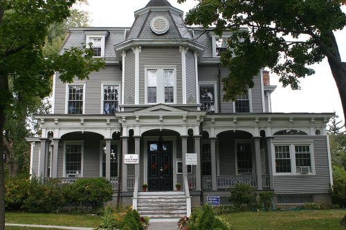
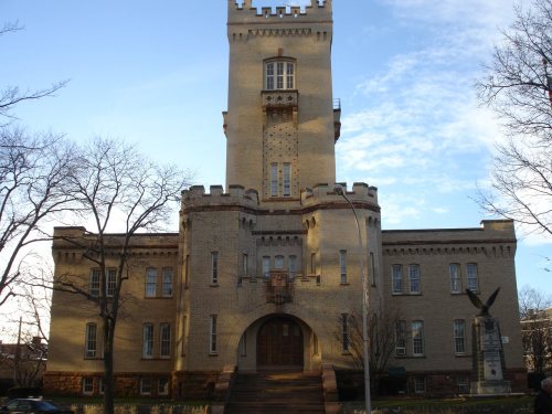
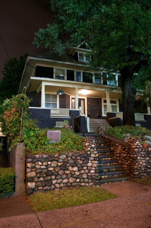
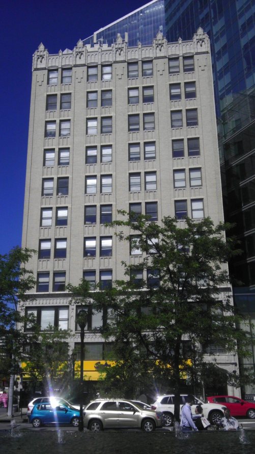
11 listings: 10 buildings, among them the Mapleton (listed 1976, the first), and 1 historic district, the Good Counsel Complex, with 10 contributing buildings. 20 historic buildings in all.
How old are the homes in White Plains?
30% of White Plains’ homes were built before 1940 (Census estimate, ±2.3 points), against a typical 27% for a New York town; the median home was built in 1961.
Founding dates: Wikidata, Wikipedia, the U.S. post office records of Blevins & Helbock (CC0) and the Census. Homes by year built: Census ACS 2020–24. National Register of Historic Places: National Park Service (list of May 22, 2026). Old photos, postcards and papers: Wikimedia Commons, the Library of Congress and other public archives, credited on each item’s page. Maps: U.S. Geological Survey historical topographic maps (via Esri) and Sanborn fire-insurance maps (Library of Congress). History text and census tables: Wikipedia (CC BY-SA 4.0). Places that used to be: USGS Geographic Names Information System (2021).
From Wikimedia Commons (16), the Library of Congress (2), the National Register of Historic Places (11), Wikipedia, Wikidata and Wikipedia for famous people, U.S. Geological Survey historical maps, U.S. Census counts (via Wikipedia), the US Post Offices dataset (Blevins & Helbock), the USGS Geographic Names Information System, Sanborn fire insurance maps (Library of Congress) and old county and town histories (Internet Archive). Archive images are copied here with their credits and licenses, shown on each photo’s page. Refreshed monthly.





 1887
 1890
 1913
 1914
 1923
 1923
 1923
 1923
 1923
 1948
 1968
 1968