Guest, Sign inJoin

Post to Stony Creek

We’ll email a one-tap link to publish your post. No password, and nothing is public until you click it.
Already a member? Sign in
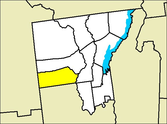
Stony Creek New YorkPhoto: JBC3 · Public domain
–Not graded
History · Stony Creek

Stony Creek dates to 1795, and 24% of its homes were built before 1940

Its Register listing is the Methodist Episcopal Church. Below: 1 old photo or paper, maps from 1903 on, and the census since 1860.

1795founded
1on the National Register
24%homes built before 1940
1old photo or paper
Quick answers

How Stony Creek began

When was Stony Creek founded?

1795

Stony Creek dates its founding to 1795 (Wikidata). The census first counted it in 1860.

First census: 960 in 18602020 census: 758231 years
Founding year: Wikidata. First post office: 1842.The full story ↓

What stands out about Stony Creek’s past

Read from the archive, the National Register and the record. The page puts what stands out first.

★ What stands out · Help out

Start Stony Creek’s collection

The first neighbors to add old photos shape how Stony Creek’s history is told.

Decades since 1900 with photos
00s10s20s30s40s50s60s70s80s90s
1 of 10 decades. The empty ones are waiting for someone’s album.
Places that used to be

Lost post offices, old corners and burying grounds

Stony Creek’s post office has been open since 1842. Four other post offices opened and closed inside today’s town.

Stony Creek
1842–today
Creek Centre
1855–1892
West Stony Creek
1879–1933
Knowelhurst
1889–1915
Glen Lake
1890–1946
18401930today
Hamlets and corners on the map
BakertownHarrisburgKnowelhurst
3cemeteries and burying grounds inside Stony Creek
Lens LakeScofieldVan Dusen

US Post Offices dataset (Blevins & Helbock, CC0). Places and cemeteries from the USGS Geographic Names Information System (2021).

People over time

Stony Creek, census by census

02004006008001,0001,2001,40018601880190019201940196019802000Peak: 1,342

Peaked at 1,342 in 1890; 767 people lived here in 2010.

16 censuses, 1860–2010.

U.S. Census Bureau decennial counts, from the census table on Stony Creek’s Wikipedia page.

The story

How Stony Creek came to be

From Wikipedia’s history of Stony Creek.

Read it all →

The town was first settled circa 1795. Stony Creek was established as a town in 1852 from a portion of the Town of Warrensburg called "Athol."

In the late 1800s and early 1900s, when a tannery existed at the confluence of Roaring Branch and Stony Creek near the center of town, the peak population of 1,250 was attained. During that time, extensive logging was done in western Stony Creek. Once many of the hemlock trees were taken out, and tanning practices changed, the tannery closed and Stony Creek's population decreased significantly and has remained at lower levels since then.

Text from Wikipedia, licensed CC BY-SA 4.0.

Timeline

Stony Creek, 1795 to 1933

Woven from the archive, old maps, post office records, the National Register and the people born here.

  1. 18th century
  2. 1795
    FoundingStony Creek is established
  3. 19th century
  4. 1842Post officeThe Stony Creek post office opens
  5. 1855Post officeThe Creek Centre post office opens
  6. 1879Post officeThe West Stony Creek post office opens
  7. 1890CensusPopulation peaks at 1,342
  8. 1892Post officeThe Creek Centre post office closes
  9. 20th century
  10. 1903On the mapFirst mapped by the U.S. Geological Survey
  11. 1919In the archiveStony Creek New York USGS topo map 1908
  12. 1933Post officeThe West Stony Creek post office closes
By decade

Stony Creek, decade by decade

One decade in the archive so far: the 1910s. Scroll each row; tap a photo for its story.

1920s–1990snothing yet
Nothing in the archives for these yearsWeddings on Main Street, storms, parades, school pictures, the old store. If it’s in your family album, it belongs here.
Add from your album
On the map

Stony Creek on the map, 1903 to 1968

Every edition of the U.S. Geological Survey’s map of Stony Creek. Tap a year, or press play to watch the town change.

Stony Creek on the 1903 USGS mapStony Creek on the 1955 USGS mapStony Creek on the 1968 USGS map1903Luzerne sheet · 1:62,500

U.S. Geological Survey historical topographic maps (public domain), via Esri’s collection of the scans. The red ring marks the center of Stony Creek.

On the National Register

1 historic place in Stony Creek

The country’s official list of buildings and places worth saving.

place listed
1
National Historic Landmarks
0
none yet
historic buildings protected
1
each building in a district counts
first listed
2010
Methodist Episcopal Church
Buildings

Architectural styles listings

Mid-19th Century Revivals1
Greek Revival1

National Park Service, National Register of Historic Places. Photos from Wikimedia Commons, credited on each place’s page.

Famous people

Famous people close to Stony Creek

Nobody well known was born in Stony Creek itself, so here are the best known from just nearby.

See all →
Stories next door

History across the town line

Each neighbor’s History grade, on the same three inputs.

Questions about Stony Creek’s history

What year was Stony Creek founded?

In 1795, according to Wikidata. Stony Creek’s post office opened in 1842, and the census of 1860 counted 960 people here.

What is on the National Register in Stony Creek?

One place: the Methodist Episcopal Church (listed 2010).

Memory lane

What the archives can’t tell you, neighbors can.

Town Square →
Start a conversation
Sources

Where this page comes from

Founding dates: Wikidata, Wikipedia, the U.S. post office records of Blevins & Helbock (CC0) and the Census. Homes by year built: Census ACS 2020–24. National Register of Historic Places: National Park Service (list of May 22, 2026). Old photos, postcards and papers: Wikimedia Commons, the Library of Congress and other public archives, credited on each item’s page. Maps: U.S. Geological Survey historical topographic maps (via Esri) and Sanborn fire-insurance maps (Library of Congress). History text and census tables: Wikipedia (CC BY-SA 4.0). Places that used to be: USGS Geographic Names Information System (2021). How TownRatings grades history →

From Wikimedia Commons (2), Wikidata (1), the National Register of Historic Places (1), Wikipedia, U.S. Geological Survey historical maps, U.S. Census counts (via Wikipedia), the US Post Offices dataset (Blevins & Helbock) and the USGS Geographic Names Information System. Archive images are copied here with their credits and licenses, shown on each photo’s page. Refreshed monthly.