203 years in pictures
Census counts: 1,604 in 1830, 2,036 in 2020. The archive holds 6 old photos and papers going back to 1867 and 3 maps from 1900 on.
- 1823Stockton is settled
Each edition grades its towns against each other only.
The best of Stockton’s subject grades are a B+ for cost of living and history; the weakest is a C for hazard risk. Stockton’s midsummer high is 79°F, where New York’s towns sit at 81°F and U.S. towns at 85°F. Stockton State Forest, at 964 acres with 1.8 miles of trail, is the biggest park or preserve. Stockton has fewer than 2,500 residents, so it gets subject grades but no overall grade.
Where Stockton beats most towns.
Where Stockton’s working residents go each day. Line width shows the share.
Census LEHD 2023
Each subject compared with towns across the country (schools within New York), ordered by how far Stockton is from typical.
How TownRatings grades towns →
Census counts: 1,604 in 1830, 2,036 in 2020. The archive holds 6 old photos and papers going back to 1867 and 3 maps from 1900 on.
Who provides power, water and the rest in Stockton, and how to reach them.
EPA SDWIS (Oct 9, 2026) · HIFLD + EIA-861 2025 · Census 2020 ZCTAs · NCES 2024–25 · registration: vote.gov, updated Aug 3, 2026.
Ordered by what stands out in Stockton.
In the year to September 2026, typical home values climbed 7.8%. Stockton’s typical rent comes in at $809 a month. The share of households in Stockton who are owner-occupiers is 82%, against 75% in New York’s towns and 73% across U.S. towns.
| Stockton | New York towns | U.S. towns | |
|---|---|---|---|
| Median rent | $809 a month | $1,101 a month | $1,185 a month |
| Households that own their home | 82% | 75% | 73% |
Census ACS, 2020–24 · Zillow Home Value Index · Redfin Data Center
The top destinations are Chautauqua (14%), Ellicott (8%) and Jamestown (8%). Commuting out is the norm in Stockton: 3% of working residents work locally. The average trip to work for Stockton comes to 23 minutes.
| Stockton | New York towns | U.S. towns | |
|---|---|---|---|
| Working residents who work in town | 3.1% | 10% | 8% |
| Below the poverty line | 6.6% | 9.5% | 9.6% |
| Average trip to work | 23 minutes | 25 minutes | 25 minutes |
| Median household income | $74,000 | $82,000 | $80,000 |
Census LEHD 2023 · ACS
NOAA U.S. Climate Normals, 1991–2020
The national flood insurance program has paid 13 claims in Stockton since 1979. FEMA expects more storm and flood damage in the town than in two thirds of U.S. communities. 89% of the town’s expected losses from natural hazards come from inland flooding. Federal aid has come to Stockton households in 7 declared disasters; the latest was in 2014.
FEMA flood insurance claims · FEMA disaster declarations and aid · FEMA National Risk Index · OpenFEMA
Among adults in Stockton, 30% feel lonely and 82% had a checkup this year. This New York town does better than the New York average on 5 of 32 CDC measures and worse on 6. In Stockton, nearly two in five adults sleep under 7 hours.
| Stockton | New York towns | U.S. towns | |
|---|---|---|---|
| Sleep under 7 hours (CDC PLACES) | 39% | 37% | 36% |
| Feel lonely (CDC PLACES) | 30% | 32% | 33% |
| Yearly checkup (CDC PLACES) | 82% | 81% | 79% |
| High blood pressure (CDC PLACES) | 37% | 34% | 35% |
| What stands out | Stockton | NY |
|---|---|---|
| Fewer uninsured adults | 5.7% | 7.9% |
| Fewer adults facing food insecurity | 13.1% | 17.2% |
| More adults with COPD | 8.3% | 6% |
CDC PLACES 2025 · modeled estimates for adults · CMS · HRSA
The trail density in Stockton is 0.1 miles per square mile. 6.8 miles of trail wind through 3 parks and preserves. Parks and preserves in the town: 3, covering 1,047 acres.
| Stockton | New York towns | U.S. towns | |
|---|---|---|---|
| Miles of trail per square mile | 0.1 miles per square mile | 0.4 | 0.4 |
| Conserved land | 4.2% | 5.2% | 4.3% |
| Biggest places to walk | Trails | Acres |
|---|---|---|
| 1. Stockton State Forest | 1.8 mi | 964 |
| 2. College Lodge Forest | 0.4 mi | 48 |
| 3. Kabob Wildlife Management Area | — | 35 |
Trails & parks © OpenStreetMap contributors · Conserved land: USGS PAD-US
Museums, parks, gardens and other places to visit around Stockton. Close and well known come first.
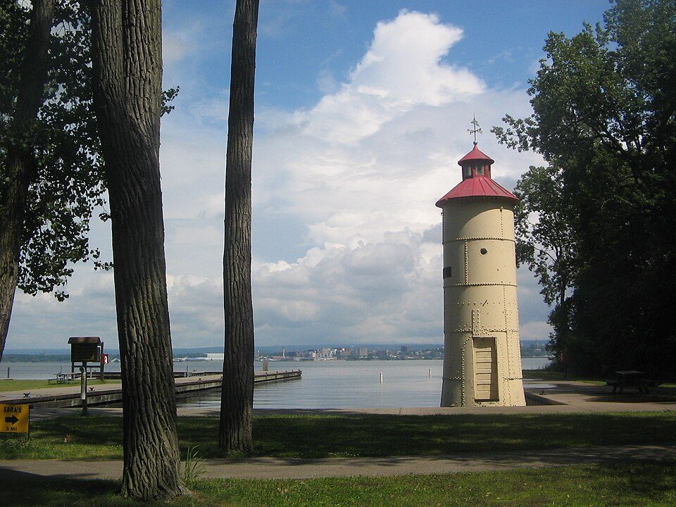
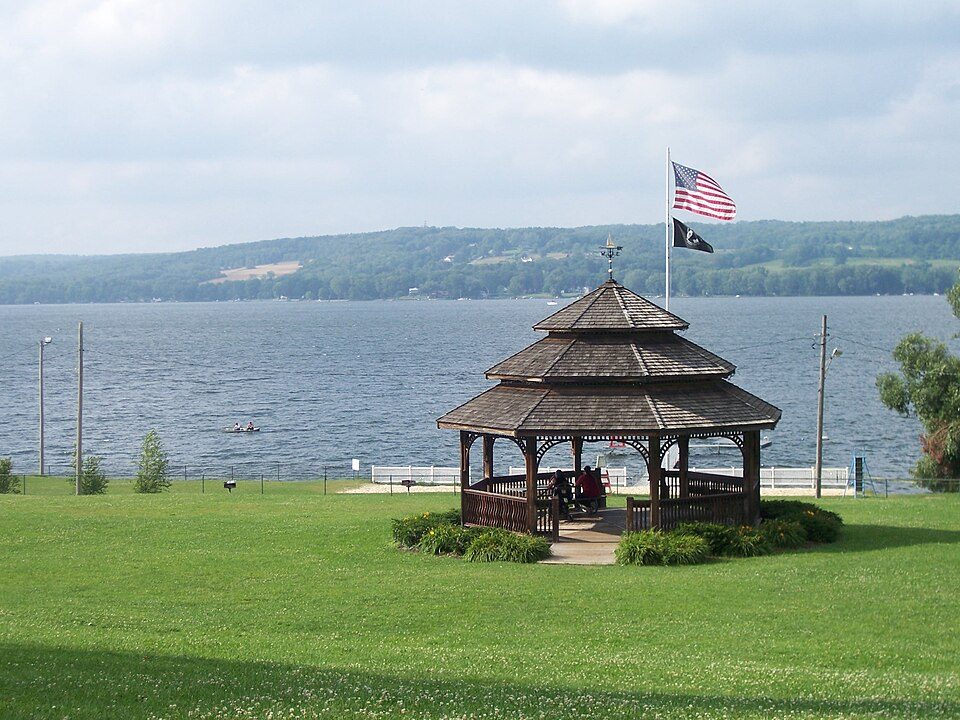
10 mi LakeChautauqua Lake
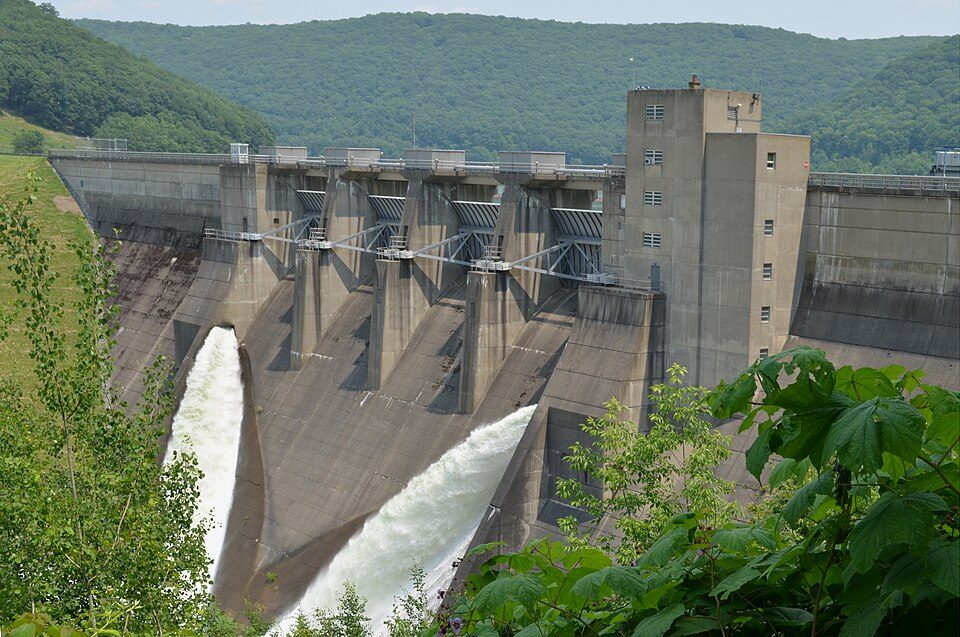
37 mi DamKinzua Dam
39 mi State parkPresque Isle State Park
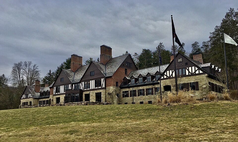
35 mi State parkAllegany State Park
15 mi MuseumLucille Ball-Desi Arnaz Center35 mi Ski areaHoliday Valley79 runs · 790 ft verticalChautauqua Lake: Banderas, Public domain · Kinzua Dam: Niagara, CC BY-SA 3.0 · Presque Isle State Park: Ruhrfisch, CC BY-SA 3.0 · Allegany State Park: Andre Carrotflower, CC BY-SA 4.0 · Lucille Ball-Desi Arnaz Center: G. Edward Johnson, CC BY 4.0
2 within 15 miles of the center of Stockton
About 1 of every 100 Stockton residents are enrolled in college, against 7 across New York.
Town in New York, United States
Stockton is a town in Chautauqua County, New York, United States. The population was 2,036 at the 2020 census. The town is named after Richard Stockton, who signed the Declaration of Independence.
From Wikipedia, licensed CC BY-SA 4.0 · facts via Wikidata (CC0)
5 towns share a border with Stockton.
| Town | NY rank | Overall | Cost | Safety | Schools | Health |
|---|---|---|---|---|---|---|
| Stockton | — | — | B+ | — | C+ | B |
| Chautauqua | #334 | B | B | — | A− | B− |
| Ellery | #341 | B | B− | — | A− | B |
| Charlotte | — | — | B+ | — | C+ | B− |
| Pomfret | #612 | C− | C− | — | C+ | B |
| Arkwright | — | — | — | — | — | — |
Stockton and Charlotte have fewer than 2,500 residents, so they get subject grades but no overall grade. Stockton, Chautauqua, Ellery, Charlotte and Pomfret report no FBI crime data of their own. Arkwright isn’t graded (fewer than 1,000 residents, or not enough data). Compare Stockton with a neighbor →
Short answers, built from the data on this page.
Not for the area. Cost of living, which also weighs rents, property taxes and how many households pay 30% or more of their income for housing, grades B+.