Schenectady dates to 1765, and 49% of its homes were built before 1940
Among the most historic 1% of U.S. towns · #12 of 758 in New York. What drives it
36 places in town are on the National Register, among them 3 National Historic Landmarks and four historic districts with 712 buildings between them. Below: 5 old photos and papers, maps from 1884 on, and the census since 1790.
Founding year: Wikidata. First post office: 1793.The full story ↓
History grade
What drives Schenectady’s History grade
On its age, its old homes and the National Register, Schenectady is among the most historic 1% of U.S. towns, #12 of 758 in New York. All 3 inputs put Schenectady near the top nationally; its share of homes from before 1940 ranks highest.
A+
HistoryA character grade: shown, never part of Schenectady’s overall grade.
New York towns list more on the Register than most of the country (a typical New York town has 12.3 per 10,000 residents, the U.S. 2.4), so Schenectady’s 109 sits above most of its state (77% of New York towns have fewer) while its 749 historic buildings outnumber those of 98% of U.S. towns.
NoteThe founding year comes from Wikidata alone; no second source gives 1765.
How sure. Graded on any two of the three inputs instead, the letter would still be A+. The pre-1940 share (±2.1 points) is firm at this size.
Founding year: Wikidata (other dates in Quick answers). Homes: Census ACS 2020–24. National Register: National Park Service, May 2026 list; each listing counted once (boundary changes and added documentation belong to their listing), and a historic district counts its contributing buildings. How TownRatings grades history →
What stands out about Schenectady’s past
Read from the archive, the National Register and the record. The page puts what stands out first.
The country’s official list of buildings and places worth saving. 3 are National Historic Landmarks, the highest tier. Boundary changes and added documentation are counted with their listing.
When first encountered by Europeans, the Mohawk Valley was the territory of the Mohawk nation, one of the Five Nations of the Iroquois Confederacy, or Haudenosaunee. They had occupied territory in the region since at least 1100 AD. Starting in the early 1600s, the Mohawks moved their settlements closer to the river; by 1629, they had also taken over territories on the Hudson River's west bank that were formerly held by the Algonquian-speaking Mahican people.
Passages that mention Schenectady, cut from the printed page as they were published.
History of the county of Schenectady, N. Y., from 1662 to 1886...1886Read the page →
Read the text
of which two are toll road bridges, and four railroad bridges, all built of iron, of the latest style and best construction. The road bridge from Scotia to Schenectady deserves special mention. At this crossing was the first ferry over the Mohawk from Schenectady to Scotia. The first bridge was built in about 1807, and was in two immense spans with but one pier, which was in the center of the river.
Text read by machine from the scan; it may contain errors.
History of the county of Schenectady, N. Y., from 1662 to 1886...1886Read the page →
Read the text
learned Scotch clergyman, then living in a neighboring parish. Aftera year or more thus spent, his father, learning of his absence, upon inquiry, found him in alaw office, in the city of Schenectady, laboriously studying a profession then most agreeable to his own wishes. He completed his legal term of study with the approbation of his parent, and was admitted to the bar in 1818, and opened an office in
Text read by machine from the scan; it may contain errors.
HE city of Schenectady is the capital of the county of the same name, and is located on the south side of the Mohawk River, seventeen miles north-west of Albany. It is one of the oldest cities in the state, and was first settled by the Dutch about the year 1660. ' Like most of the early settlements, Schenectady was for a long time terrorized over by Indians, who desolated the lands and the homesteads of the settlers. On the 8th of February, 1690, the little settlement, which then contained eighty houses, was completely wiped out by a band of French marauders and native savages. In the dark hours of the night about three hundred Indians and French entered the Palisades, which surrounded the settlement, at the unguarded portals, and fired the dwellings, and
Text read by machine from the scan; it may contain errors.
Scans and text from the Internet Archive. Books published in 1930 or earlier, which are in the public domain.
Timeline
Schenectady, 1690 to 1986
Woven from the archive, old maps, post office records, the National Register and the people born here.
Nothing in the archives for these yearsWeddings on Main Street, storms, parades, school pictures, the old store. If it’s in your family album, it belongs here.
Fire insurance maps drew every building, what it was made of and what it was used for, so insurers could price the risk of fire. Pick a year, then a sheet.
Schenectady’s post office has been open since 1793.
Hamlets and corners on the map
BellevueHungry HillMount PleasantSteinmetz Homes
Gone or out of use
Brandywine Avenue SchoolschoolBroadway Methodist Episcopal ChurchchurchEastern New York Hospital and SchoolhospitalEuclid Avenue SchoolschoolFranklin SchoolschoolFulton SchoolschoolHalsey SchoolschoolHorace Mann SchoolschoolMount Carmel HousebuildingOur Lady of Mount Carmel ConventchurchPolish National Alliance Community HousebuildingRiverside SchoolschoolSaint Adalbertus ConventchurchSaint Columbus SchoolschoolSaint Mary's Parochial SchoolschoolSchenectady ArmorymilitarySchenectady Fire Station Number 6buildingWoodlawn Schoolschool
11cemeteries and burying grounds inside Schenectady
First Presbyterian ChurchFirst Reformed Church ColumbariumHoly Name of JesusPark ViewSaint George's Episcopal ChurchSaint John the BaptistSaint JosephSaint JosephsSaint MarysValeZion Lutheran
US Post Offices dataset (Blevins & Helbock, CC0). Places and cemeteries from the USGS Geographic Names Information System (2021).
Help out
Finish Schenectady’s story
Most archives stop around 1920. The photos from after that are in family albums, not libraries.
Decades since 1900 with photos
00s10s20s30s40s50s60s70s80s90s
0 of 10 decades. The empty ones are waiting for someone’s album.
In 1765, according to Wikidata. Schenectady’s post office opened in 1793, and the first U.S. census counted 4,228 people here in 1790.
How does Schenectady rank for history?
Schenectady is among the most historic 1% of U.S. towns, #12 of 758 in New York. The History grade combines the town’s founding era, the share of homes built before 1940 and its National Register listings. It’s a character grade, so it isn’t part of the overall grade. How it works.
What is on the National Register in Schenectady?
36 listings, 3 of them National Historic Landmarks: 31 buildings, among them the Nott Memorial Hall (a National Historic Landmark since 1986), 4 historic districts with 712 contributing buildings, and 1 site. 749 historic buildings in all.
How old are the homes in Schenectady?
49% of Schenectady’s homes were built before 1940 (Census estimate, ±2.1 points), against a typical 27% for a New York town; the median home was built in 1941.
Founding dates: Wikidata, Wikipedia, the U.S. post office records of Blevins & Helbock (CC0) and the Census. Homes by year built: Census ACS 2020–24. National Register of Historic Places: National Park Service (list of May 22, 2026). Old photos, postcards and papers: Wikimedia Commons, the Library of Congress and other public archives, credited on each item’s page. Maps: U.S. Geological Survey historical topographic maps (via Esri) and Sanborn fire-insurance maps (Library of Congress). History text and census tables: Wikipedia (CC BY-SA 4.0). Places that used to be: USGS Geographic Names Information System (2021).
From Wikimedia Commons (5), the National Register of Historic Places (36), Wikipedia, Wikidata and Wikipedia for famous people, U.S. Geological Survey historical maps, U.S. Census counts (via Wikipedia), the US Post Offices dataset (Blevins & Helbock), the USGS Geographic Names Information System, Sanborn fire insurance maps (Library of Congress) and old county and town histories (Internet Archive). Archive images are copied here with their credits and licenses, shown on each photo’s page. Refreshed monthly.

 ★ Landmark
 ★ Landmark
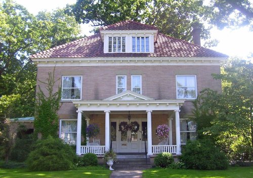 ★ Landmark
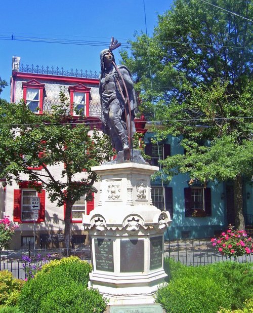
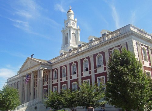


 1832
 1834

