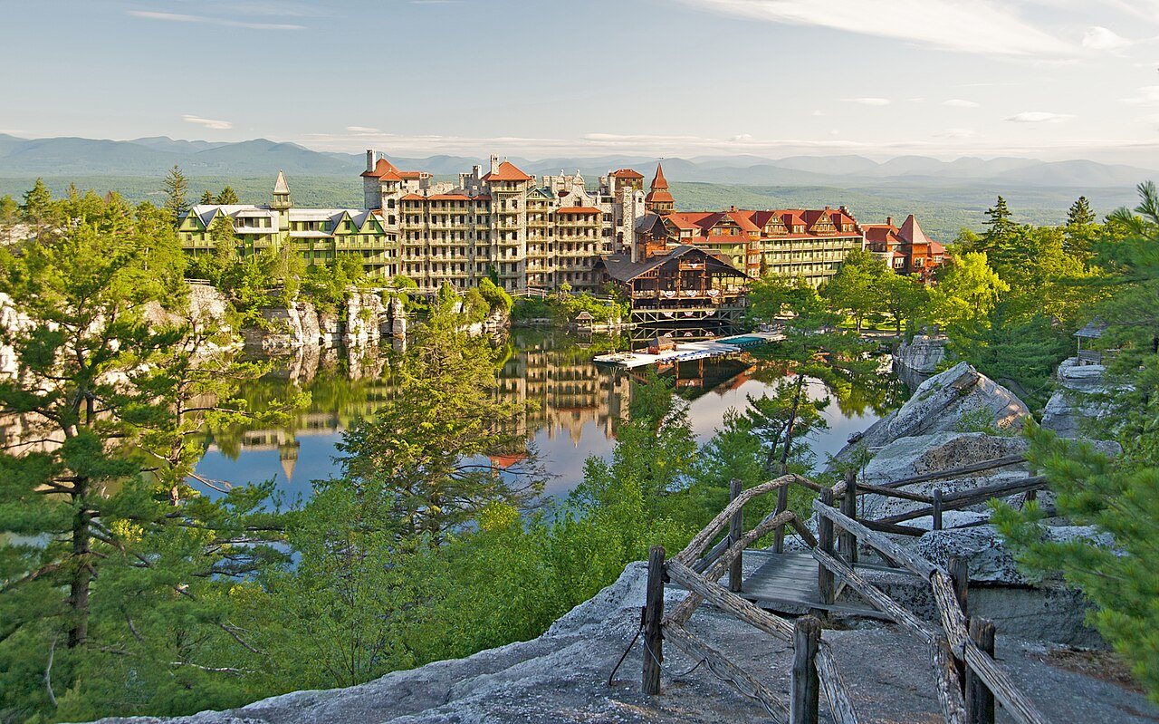
Rochester has 15,071 acres of parks, 2,047 for every 1,000 residents
31% of Rochester’s land is conserved, about 17,927 acres. 83 miles of mapped trail cross Rochester, 0.9 per square mile of land. The biggest trail networks: Minnewaska State Park Preserve (37.5 mi), Sundown Wild Forest (12.4 mi), Mohonk Preserve (11.4 mi).
Ahead of 87% of U.S. towns · #156 of 758 in New York. What drives it
Conserved land
31%
17,927 acres · of 89.3 sq mi of land
Trails
83 mi
0.9 per sq mi of land
Park land
15,071 ac
2,047 acres per 1,000 residents
Near a park
26%
of residents within ½ mile
Bike routes
5.1 mi
5.1 mi paths
Highest peak
2,221 ft
Big Rosy Bone Knob
Lakes & rivers
4
3 beaches
What kind of outdoors town is Rochester?
Read from the map. The page puts what stands out first.
On conserved land, trails, park land and how close residents live to a park, Rochester is ahead of 87% of U.S. towns, #156 of 758 in New York. Park acres per resident hold the grade up; the share of residents near a park pulls it down.
A
OutdoorsA character grade: shown, never part of Rochester’s overall grade.
How sure. Graded on any three of the four inputs instead, the letter would range from B+ to A+. Trails and many small parks come from OpenStreetMap, mapped by volunteers, so coverage varies from town to town; the half mile is a straight line from each census block, so a river or highway in the way isn’t counted against it.
31% of Rochester’s land. Who manages Rochester’s conserved land, from the USGS Protected Areas Database. Approximate, because parcels can overlap.
State conservation8,622 ac
State parks6,406 ac
Land trusts & nonprofits4,030 ac
Town or city41 ac
Not recorded1,190 ac
State Conservation Area · 15,012 acPrivate Conservation · 1,501 acPrivate Recreation or Education · 1,190 acConservation Easement · 872 acAgricultural Easement · 659 ac
Good to know
Conserved doesn’t always mean open to visitors. 1,544 acres are conservation easements, usually private land. Public access isn’t recorded for 10 of 101 parcels. The walks above are places people visit.
The biggest protected parcels
Parcel (PAD-US)
Managed by
Acres
Public access
Sundown Wild Forest
State Conservation Area
State conservation
8,441
Open
Minnewaska State Park Preserve
State Conservation Area
State parks
6,406
Open
Mohonk Preserve
Private Conservation
Land trusts & nonprofits
2,421
Restricted
Peterskill Gorge - Rochester Reform Church
Private Conservation
Land trusts & nonprofits
107
Closed
Ulster Fp Detached Parcel
State Conservation Area
State conservation
83
Open
Vernooy Kill State Forest
State Conservation Area
State conservation
82
Open
Open Space Institute Land
Private Conservation
Land trusts & nonprofits
59
Open
Patinkin - Coxing Bottom Lands
Private Conservation
Land trusts & nonprofits
59
Closed
Town Of Rochester Land
Local Park
Town or city
40
Unknown
Rock Hill
Private Conservation
Land trusts & nonprofits
24
Closed
3 smaller protected places aren’t shown.
Things to do
77 places to go in Rochester
Beaches, playgrounds, peaks, falls and more. Pick a kind.
Beaches in Rochester
Lake Minnewaska BeachIn Minnewaska State Park Preserve
Bike lanes are often missing from the map in smaller towns, so that number is likely low.
5.1 mi
off-road bike paths
Courts & fields
12Tennis
5Baseball
3Basketball
2Football
1Equestrian
1Volleyball
1Multi-sport
1Soccer
Includes school and college facilities, which aren’t always open to the public.
History along the way
31 places on the National Register, one a National Historic Landmark
The country’s official list of places worth saving (National Park Service). The map also marks 5 historic points from OpenStreetMap: plaques, memorials and old buildings.
The best walking months in Rochester: April, May, July and August
NOAA’s 1991–2020 normals for the town and the daylight at its latitude. Outlined months have long days, highs of 59 to 86 °F and little rain for the place.
Jan
Feb
Mar
Apr
May
Jun
Jul
Aug
Sep
Oct
Nov
Dec
Daylight (h)
9.5
10.5
11.8
13.3
14.5
15.2
14.9
13.8
12.4
11.0
9.8
9.1
High (°F)
34
38
47
60
71
79
84
82
74
63
50
39
Rain (in)
3.5
2.9
3.7
3.8
3.9
4.7
4.5
4.5
4.8
4.8
3.7
4.2
February is the driest month (2.9 in) and July the warmest (highs of 84 °F). 4.8 inches fall in September, the wettest month. The climate in Rochester →
Next door
Rochester and its neighbors
Rochester has the second most mapped trails of the 7 towns around it. Tap a town to see its outdoors.
The four inputs of the Outdoors grade, from the engine; shares are of land, not water.
Questions about parks and trails in Rochester
Where can I hike in Rochester?
The longest trail networks: Minnewaska State Park Preserve, 37.5 miles; Sundown Wild Forest, 12.4 miles; Mohonk Preserve, 11.4 miles. Each one is on the map above, with directions to the nearest trailhead or parking.
How much of Rochester is conserved land?
31% of its land, against a typical 5% for a New York town and 4% nationally (PAD-US). Conserved doesn’t always mean open to visitors: easements are usually private land.
Are dogs allowed on Rochester’s trails?
Minnewaska State Park Preserve and Sundown Wild Forest don’t have dog rules recorded on the map; check the signs at the trailhead.
Where can I bike in Rochester?
5.1 miles of bike routes are on the map: 5.1 of off-road paths.
Is there public land near Rochester?
112,990 acres of parks and open public land lie inside Rochester or within 10 miles of it (PAD-US), 15,071 of them inside the town line.
How much outdoors does Rochester have?
Ahead of 87% of U.S. towns on the Outdoors grade, #156 of 758 in New York. The grade combines the share of land that is conserved, miles of mapped trail per square mile of land, park acres per 1,000 residents and the share of residents within a half mile of a park. It’s a character grade, so it isn’t part of the overall grade. How it works.
Trail talk
Conditions, parking and favorite walks from Rochester neighbors.