Founding year: the first Richford post office (Blevins & Helbock, CC0).The full story ↓
History grade
What drives Richford’s History grade
On its age, its old homes and the National Register, Richford is more historic than 57% of U.S. towns. Its age holds the grade up; its National Register listings pull it down.
B
HistoryA character grade: shown, never part of Richford’s overall grade.
New York towns list more on the Register than most of the country (a typical New York town has 12.3 per 10,000 residents, the U.S. 2.4), so Richford’s 0.0 sits below most of its state (10% of New York towns have fewer) while its 0 listings outnumber those of 23% of U.S. towns.
How sure. Graded on any two of the three inputs instead, the letter would range from C+ to A−. The pre-1940 share is a Census survey estimate (±6.1 points). The founding year is the first post office, not a stated founding date.
Founding year: the first post office (other dates in Quick answers). Homes: Census ACS 2020–24. National Register: National Park Service, May 2026 list; each listing counted once (boundary changes and added documentation belong to their listing), and a historic district counts its contributing buildings. How TownRatings grades history →
What stands out about Richford’s past
Read from the archive, the National Register and the record. The page puts what stands out first.
European-American settlement began around 1808 when Evan Harris brought his family here. Samuel Smith was the first to settle within the present village site in 1813. The first tavern was built in the village in 1817 at the site of the Richford Hotel (now the Richford Quickway) by Beriah Wells. Ezekial Rich moved to the town in 1821 when he purchased the tavern from Beriah Wells. He established a glove and mitten factory, and later opened a general store. The town was first formed from the Town of Berkshire as the "Town of Arlington" in 1831. In 1832 it changed its name to the Town of Richford.
The men and heads of families whose names have been mentioned in this chapter were the founders of the town of Richford. They came during the undeveloped period of its history and by their efforts established what became one of the best outlying towns in the county, and that notwithstanding the fact that Richford inhabitants were compelled to contend against obstacles not met in all the towns, for in this isolated valley of East Owego creek there was little to attract settlement other than the general fertility of
Text read by machine from the scan; it may contain errors.
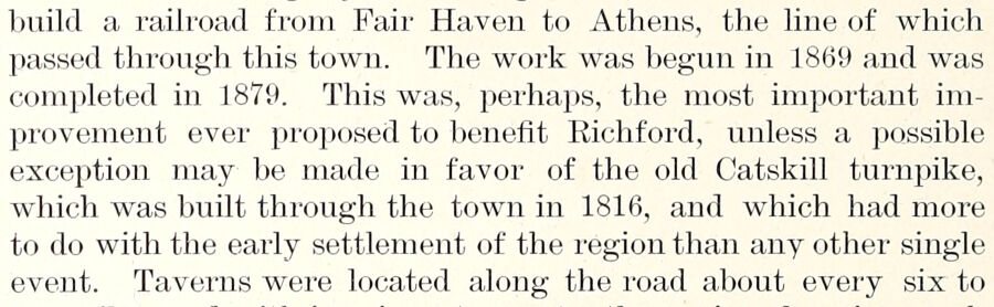
build a railroad from Fair Haven to Athens, the line of which passed through this town. The work was begun in 1869 and was completed in 1879. Tbis was, perhaps, the most important improvement ever proposed to benefit Richford, unless a possible exception may be made in favor of the old Catskill turnpike, which was built through the town in 1816, and which had more to do with the early settlement of the region than any other single event. Taverns were located along the road about every six to
Text read by machine from the scan; it may contain errors.
Scans and text from the Internet Archive. Books published in 1930 or earlier, which are in the public domain.
The Richford post office opened in 1823, the earliest record of the town by name (U.S. post office records).
How does Richford rank for history?
Richford is more historic than 57% of U.S. towns. The History grade combines the town’s founding era, the share of homes built before 1940 and its National Register listings. It’s a character grade, so it isn’t part of the overall grade. How it works.
How old are the homes in Richford?
20% of Richford’s homes were built before 1940 (Census estimate, ±6.1 points), against a typical 27% for a New York town; the median home was built in 1980.
Founding dates: Wikidata, Wikipedia, the U.S. post office records of Blevins & Helbock (CC0) and the Census. Homes by year built: Census ACS 2020–24. National Register of Historic Places: National Park Service (list of May 22, 2026). Old photos, postcards and papers: Wikimedia Commons, the Library of Congress and other public archives, credited on each item’s page. Maps: U.S. Geological Survey historical topographic maps (via Esri) and Sanborn fire-insurance maps (Library of Congress). History text and census tables: Wikipedia (CC BY-SA 4.0). Places that used to be: USGS Geographic Names Information System (2021).
From Wikimedia Commons (1), Wikipedia, Wikidata and Wikipedia for famous people, the US Post Offices dataset (Blevins & Helbock), the USGS Geographic Names Information System and old county and town histories (Internet Archive). Archive images are copied here with their credits and licenses, shown on each photo’s page. Refreshed monthly.


 Date?