Founding year: Wikipedia. First post office: 1811.The full story ↓
History grade
What drives Patterson’s History grade
On its age, its old homes and the National Register, Patterson is more historic than 38% of U.S. towns, #708 of 758 in New York. Its share of homes from before 1940 holds the grade up; its National Register listings pull it down.
C+
HistoryA character grade: shown, never part of Patterson’s overall grade.
New York towns list more on the Register than most of the country (a typical New York town has 12.3 per 10,000 residents, the U.S. 2.4), so Patterson’s 0.0 sits below most of its state (10% of New York towns have fewer) while its 0 listings outnumber those of 23% of U.S. towns.
NoteThe founding year comes from Wikipedia alone; no second source gives 1720.
How sure. Graded on two of the three inputs, so a change in either one moves the letter more than it would with three. The pre-1940 share is a Census survey estimate (±4.5 points).
Founding year: Wikipedia (other dates in Quick answers). Homes: Census ACS 2020–24. National Register: National Park Service, May 2026 list; each listing counted once (boundary changes and added documentation belong to their listing), and a historic district counts its contributing buildings. How TownRatings grades history →
What stands out about Patterson’s past
Read from the archive, the National Register and the record. The page puts what stands out first.
The town was first settled around 1720 in The Oblong, which was a disputed area in southeastern Province of New York also claimed by the Connecticut Colony. The Oblong was a strip of land approximately 1.81 miles wide (2.91 km) between Dutchess County, New York, and Connecticut, ceded to New York in the 1731 Treaty of Dover. Between 1720 and 1776, a large number of mostly Connecticut families settled in the southern Oblong. They could not settle west of it because that land was privately owned by the Philipse family. It had been granted a patent for virtually all of the remainder of the area of the future Putnam County.
Passages that mention Patterson, cut from the printed page as they were published.
History of Putnam County, New York1886 · page 310Read the page →
Read the text
the peak of the roof. This meeting house, which was in its day the only church for many miles around, stood till 1839. It was then torn down and the material sold to Peter S. Kent and carried to his farm in Patterson where it was used for outbuildings, which may now be seen on the homestead of Edison Smith in the town of Patterson. The pews sold in 1803 for $202, and in 1806 for §154. The minister's salary in 1824 was §200. The first deacons of the church were Eleazar Hamb-
Text read by machine from the scan; it may contain errors.
History of Putnam County, New York1886 · page 173Read the page →
Read the text
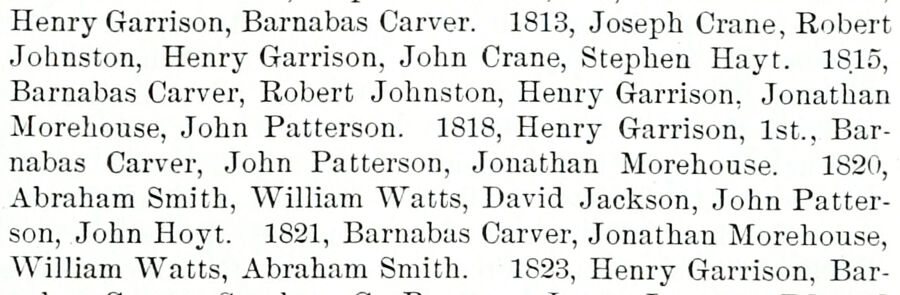
Henry Garrison, Barnabas Carver. 1813, Joseph Crane, Robert Johnston, Henry Garrison, John Crane, Stephen Hayt. ISlo, Barnabas Carver, Robert Johnston, Henry Garrison, Jonathan Moreliouse, John Patterson. 1818, Henry Garrison, 1st., Barnabas Carver, John Patterson, Jonathan Morehouse. 1820, Abraham Smith, William Watts, David Jackson, John Patterson, John Hoyt. 1821, Barnabas Carver, Jonathan Morehouse, William Watts, Abraham Smith. 1823, Henry Garrison, Bar-
Text read by machine from the scan; it may contain errors.
Scans and text from the Internet Archive. Books published in 1930 or earlier, which are in the public domain.
Timeline
Patterson, 1720 to 1957
Woven from the archive, old maps, post office records, the National Register and the people born here.
Fire insurance maps drew every building, what it was made of and what it was used for, so insurers could price the risk of fire. Pick a year, then a sheet.
In 1720, according to Wikipedia’s history of the town. Patterson’s post office opened in 1811, and the census of 1820 counted 1,578 people here.
How does Patterson rank for history?
Patterson is more historic than 38% of U.S. towns, #708 of 758 in New York. The History grade combines the town’s founding era, the share of homes built before 1940 and its National Register listings. It’s a character grade, so it isn’t part of the overall grade. How it works.
How old are the homes in Patterson?
19% of Patterson’s homes were built before 1940 (Census estimate, ±4.5 points), against a typical 27% for a New York town; the median home was built in 1970.
Founding dates: Wikidata, Wikipedia, the U.S. post office records of Blevins & Helbock (CC0) and the Census. Homes by year built: Census ACS 2020–24. National Register of Historic Places: National Park Service (list of May 22, 2026). Old photos, postcards and papers: Wikimedia Commons, the Library of Congress and other public archives, credited on each item’s page. Maps: U.S. Geological Survey historical topographic maps (via Esri) and Sanborn fire-insurance maps (Library of Congress). History text and census tables: Wikipedia (CC BY-SA 4.0). Places that used to be: USGS Geographic Names Information System (2021).
From Wikimedia Commons (6), Wikipedia, Wikidata and Wikipedia for famous people, U.S. Geological Survey historical maps, U.S. Census counts (via Wikipedia), the US Post Offices dataset (Blevins & Helbock), the USGS Geographic Names Information System, Sanborn fire insurance maps (Library of Congress) and old county and town histories (Internet Archive). Archive images are copied here with their credits and licenses, shown on each photo’s page. Refreshed monthly.




 2006
 2006
 2006
 2004
 2003
