Guest, Sign inJoin

Post to North Hempstead

We’ll email a one-tap link to publish your post. No password, and nothing is public until you click it.
Already a member? Sign in
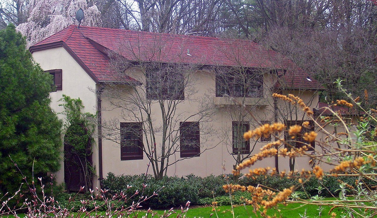
John Philip Sousa HouseJohn Philip Sousa House · Photo: Daniel Case · CC BY-SA 3.0
B+Outdoors
Outdoors in North Hempstead

7% of North Hempstead’s land is conserved, and 99% of residents live within a half mile of a park

The biggest trail networks: Kings Point Park (3.2 mi), Sands Point Preserve (2.5 mi), William Cullen Bryant Preserve (1.9 mi). 7% of North Hempstead’s land is conserved, about 2,249 acres. 25 miles of mapped trail cross North Hempstead, 0.5 per square mile of land.

Ahead of 74% of U.S. towns · #305 of 758 in New York. What drives it

Conserved land
7%
2,249 acres · of 53.5 sq mi of land
Trails
25 mi
0.5 per sq mi of land
Park land
2,432 ac
10 acres per 1,000 residents
Near a park
99%
of residents within ½ mile
Bike routes
6.8 mi
1.7 mi lanes · 4.9 mi paths
Highest peak
348 ft
Harbor Hill
Lakes & rivers
41
30 beaches · 1 boat launch

What kind of outdoors town is North Hempstead?

Read from the map. The page puts what stands out first.

Outdoors grade

How much outdoors does North Hempstead have?

On conserved land, trails, park land and how close residents live to a park, North Hempstead is ahead of 74% of U.S. towns, #305 of 758 in New York. The share of residents near a park holds the grade up; park acres per resident pull it down.

B+
OutdoorsA character grade: shown, never part of North Hempstead’s overall grade.
All U.S. towns we grade (21,298)Ahead of 74%
LessMore
New York towns of 2,500+ (758)Ahead of 60%

Among the 400 U.S. cities of 100,000 or more, North Hempstead ranks #239 on Outdoors.

Water is 23% of North Hempstead’s area (16 of 69 square miles), so every share here is of land; over land and water together, the conserved share would read 5%.

How sure. Graded on any three of the four inputs instead, the letter would range from B to A−. Trails and many small parks come from OpenStreetMap, mapped by volunteers, so coverage varies from town to town; the half mile is a straight line from each census block, so a river or highway in the way isn’t counted against it.

PAD-US, OpenStreetMap (© OpenStreetMap contributors), Census 2025 Gazetteer and 2020 blocks; details in Sources below. How TownRatings grades the outdoors →

The map

Conserved land, trails & bike routes

Tap a number to zoom to a park. Tap a layer to hide it.

123456
Easements protect land from building but are usually private.© OpenStreetMap contributors · USGS PAD-US
Places to walk

Pick a walk

The longest trail network is Kings Point Park, with 3.2 miles. Directions go to the nearest trailhead or public parking.

Kings Point Park

Park
179 acres3.2 mi of trail
Dog rules not recorded
Directionsto the parking lot

Sands Point Preserve

Managed by County of Nassau, New York
244 acres2.5 mi of trail
Trail 4Trail 5Trail 6Trail 2+1
Dog rules not recorded
Directionsto the parking lotWebsite ↗

William Cullen Bryant Preserve

Nature preserve
147 acres1.9 mi of trail
Dog rules not recorded
Directionsto the parking lot

Hempstead Harbor Shoreline Park

Nature preserve
57 acres0.9 mi of trail
Dog rules not recorded
Directionsto the parking lot

Clark Botanic Garden

Managed by Town of North Hempstead
13 acres0.7 mi of trail
Dog rules not recorded
Directionsto the parking lotWebsite ↗

Half Moon Wetland Conservancy

Nature preserve
27 acres0.5 mi of trail
Dog rules not recorded
No trailhead mapped yet
All 116 parks & preserves
Kings Point Park179 acres · 3.2 mi of trail
Directions
Sands Point Preserve244 acres · 2.5 mi of trail · County of Nassau, New York
Directions
William Cullen Bryant Preserve147 acres · 1.9 mi of trail
Directions
Hempstead Harbor Shoreline Park57 acres · 0.9 mi of trail
Directions
Clark Botanic Garden13 acres · 0.7 mi of trail · Town of North Hempstead
Directions
Half Moon Wetland Conservancy27 acres · 0.5 mi of trail
Nassau County Museum of Art47 acres · 0.2 mi of trail
Directions
Wilson Park12 acres · 0.2 mi of trail
Directions
Lake Success Village Park10 acres · 0.2 mi of trail · Incorporated Village of Lake Success
Directions
Manorhaven Preserve9 acres · 0.2 mi of trail · Incorporated Village of Manorhaven
Directions
Bay Walk Park4 acres · 0.2 mi of trail · Incorporated Village of Port Washington North
Directions
Christopher Morley Park97 acres · 0.1 mi of trail
Directions
Parkwood Pool and Sports Complex28 acres · 0.1 mi of trail · Great Neck Park District
Directions
Gerry Park13 acres · 0.1 mi of trail · Town of North Hempstead
Directions
Cedarmere10 acres · 0.1 mi of trail · Nassau County
Creek Park9 acres · 0.1 mi of trail
Directions
Merriman Park4 acres · 0.1 mi of trail · Manhasset Bay Park District
Strathmore Park4 acres · 0.1 mi of trail · Inc. Village of Great Neck
Directions
Manhasset Memorial Park4 acres · 0.1 mi of trail · Manhasset Park District
Directions
Westbury War Memorial Park3 acres · 0.1 mi of trail
Directions
Wyngate Park2 acres · 0.1 mi of trail
Directions
Greentree Foundation412 acres
Directions
Hempstead Harbor Natural Preserve179 acres · Nassau County Parks Department
Directions
North Hempsted Beach Park68 acres
Directions
The Park at East Hills50 acres · Incorporated Village of East Hills
Directions
Michael J. Tully Park35 acres · Town of North Hempstead, New York
Directions
Leeds Pond Preserve32 acres
Directions
Old Westbury Unique Area32 acres
Directions
Whitney Pond Park30 acres
Directions
North Hempstead Aerodrome22 acres · Town of North Hempstead
Directions
Manorhaven Beach Park21 acres · Town of North Hempstead
Directions
Manhasset Valley Park20 acres · Town of North Hempstead
Directions
Guggenheim Preserve18 acres
Clinton G. Martin Park16 acres
Directions
Spring Rock Golf Center15 acres
Directions
Allenwood Park14 acres
Directions
John D. Caemmerer Park14 acres
Directions
Lions Field13 acres
Directions
Great Neck Estates Park12 acres
Directions
Roslyn Country Club12 acres
Memorial Park10 acres
Directions
Stepping Stone Park and Marina10 acres · Great Neck Park District
Directions
Village Green Park10 acres
Directions
Mill Pond Park9 acres · Town of North Hempstead
Directions
Mineola Memorial Park9 acres
Directions
Roslyn Road Park9 acres
Directions
Strathmore-Vanderbilt Country Club8 acres
Martin "Bunky" Reid Park8 acres · Town of North Hempstead
Directions
Flower Hill Village Park8 acres · Incorporated Village of Flower Hill
Directions
Russell Gardens Park7 acres · Town of Great Neck
Directions
Baxter Pond Park7 acres
Barbara Johnson Preserve7 acres · County of Nassau
Directions
Gracewood Park7 acres
Herricks Park7 acres
Directions
Hamlet Park6 acres
Directions
Sunset Park6 acres · Port Washington Water Pollution Control District
Directions
Four Acre Park6 acres · Manhasset Park District
Merillon Field6 acres · Town of North Hempstead
Directions
Saddle Rock Village Park6 acres · Incorporated Village of Saddle Rock
Directions
Plandome Pond Park6 acres · Town of North Hempstead
Directions
Ridder's Pond Park5 acres · Town of North Hempstead
Directions
Pond Park5 acres
Charles J. Fuschillo Park5 acres
Directions
New Hyde Park Memorial Park5 acres · Incorporated Village of New Hyde Park
Lowell H. Kane Village Park4 acres · Incorporated Village of North Hills
Directions
Roger Fay Pool Park4 acres · Incorporated Village of Williston Park
Directions
Stannards Brook County Park4 acres
Willis Avenue Field Park4 acres
Directions
Plandome Village Green4 acres · Incorporated Village of Plandome
Waldmann Memorial Park4 acres · Incorporated Village of Munsey Park
Port Washington Town Dock4 acres · Town of North Hempstead
Directions
Park Circle3 acres
Cutter Mill Park3 acres
Directions
Copley Pond Park3 acres · Incorporated Village of Munsey Park
Directions
Roslyn Pines Swim & Tennis Club3 acres
Directions
Harbor Hill Preserve3 acres · North Shore Land Alliance
Directions
Thomas Field3 acres · Chaminade High School
Elderfields Preserve3 acres · County of Nassau, Long Island, New York
Directions
Roslyn Waterfront Promenade3 acres · Incorporated Village of Roslyn
Directions
Grace Avenue Park3 acres
Directions
Harbor Hills Park3 acres
Directions
Herricks Road Park3 acres
Directions
Blumenfeld Family Park3 acres · Town of North Hempstead
Directions
Broadway Park3 acres · Town of North Hempstead
Directions
Devlin Park3 acres · Incorporated Village of East Williston
Directions
Chatham at North Hills Club2 acres
Plandome Heights Village Preserve2 acres · Incorporated Village of Plandome Heights
South Park2 acres · Town of North Hempstead
Mary Jane Davies Green2 acres · Town of North Hempstead
Directions
Alvan O. Petrus Park2 acres · Town of North Hempstead
Directions
Great Neck Park DIstrict Dog Park2 acres · Great Neck Park District
Directions
Eighth Street Field Park2 acres
Thomaston Park2 acres · Great Neck Park District
Kennilworth Pool Club2 acres · Kennilwood Owners Association
Donald Street Park2 acres · Town of North Hempstead
Searingtown Pond Park1 acres · Town of North Hempstead
Directions
Patriots' Park1 acres · Manhasset Park District
Directions
Black Ink1 acres · Incorporated Village of Roslyn Estates
Ravine Park1 acres
Directions
East Park1 acres · Town of North Hempstead
Russell Gardens Tennis Courts1 acres · Town of Great Neck
Directions
Roslyn Harbor Pond Park1 acres · Incorporated Village of Roslyn Harbor
The Loch1 acres · Incorporated Village of Roslyn Estates
Directions
Broadlawn Harbour Yacht Club1 acres
Directions
Fireman Richard W. Provost Memorial Park1 acres · Town of North Hempstead
Skillman Street Park1 acres · Incorporated Village of Roslyn
Directions
Park Avenue Park1 acres · Manhasset Park District
Directions
Lakeville Park1 acres · Great Neck Park District
Directions
Plandome Field and Marine Club1 acres
East Williston Village Green1 acres · Incorporated Village of East Williston
Directions
Manor Park1 acres · Great Neck Park District
Directions
Emory Road Park1 acres · Incorporated Village of Mineola
Morgan's Dock Park1 acres · Incorporated Village of Manorhaven
Village of Saddle Rock Marina1 acres
Directions
Plandome Park Beach1 acres
Carle Place American Legion Memorial Park1 acres
Who protects it

2,249 conserved acres

7% of North Hempstead’s land. Water is left out: North Hempstead has 53.5 square miles of land and 15.7 of water, so the share counts land only. Who manages North Hempstead’s conserved land, from the USGS Protected Areas Database. Approximate, because parcels can overlap.

Town or city1,540 ac
County1,258 ac
Other or Unknown Local Government175 ac
State conservation85 ac
Regional agency49 ac
Regional Water Districts47 ac
Land trusts & nonprofits34 ac
Local Park · 2,526 acLocal Recreation Area · 431 acLocal Resource Management Area · 66 acConservation Easement · 52 acLocal Other or Unknown · 36 ac
Good to know

Conserved doesn’t always mean open to visitors. 38 acres are conservation easements, usually private land. Public access isn’t recorded for 33 of 119 parcels. The walks above are places people visit.

The biggest protected parcels
Parcel (PAD-US)Managed byAcresPublic access
TOWN OF NORTH HEMPSTEAD Land
Local Park
Town or city849Unknown
COUNTY OF NASSAU Land
Local Park
County504Unknown
Sands Point County Park
Local Park
County216Open
Aerodrome
Local Recreation Area
Town or city179Open
VILLAGE OF KINGS POINT Land
Local Park
Town or city174Unknown
William Cullen Bryant County Preserve
Local Recreation Area
County147Open
Morley County Park
Local Park
County98Open
Nassau County Lands
Local Resource Management Area
County55Open
GREAT NECK PARK DISTRICT Land
Local Park
Town or city54Unknown
The Park At East Hills
Local Park
Town or city50Open

5 smaller protected places aren’t shown.

Things to do

210 places to go in North Hempstead

Beaches, playgrounds, peaks, falls and more. Pick a kind.

Beaches in North Hempstead
Beacon Hill Residences Beach
Directions
Leeds Pond Beach
Directions
Manhasset Bay Estates Association Beach
Directions
PWEA Beach
Directions
Sands Point Village Beach
Directions

Plus 25 beaches without a name on the map. Tap “Show all on map” to see them.

Trails & water

16 named trails and 41 lakes & rivers

Biking & sports

6.8 miles of bike routes

Bike lanes are often missing from the map in smaller towns, so that number is likely low.

1.7 mi
painted or protected bike lanes
4.9 mi
off-road bike paths
0.2 mi
shoulders & shared lanes
Courts & fields
604Tennis
119Basketball
101Baseball
48Pickleball
39Soccer
19Football
11Softball
10Lacrosse

Includes school and college facilities, which aren’t always open to the public.

History along the way

52 places on the National Register, one a National Historic Landmark

The country’s official list of places worth saving (National Park Service). The map also marks 82 historic points from OpenStreetMap: plaques, memorials and old buildings.

History →
★
John Philip Sousa HouseNational Historic Landmark · Building · listed 1966
About it
Main Street Historic DistrictDistrict · listed 1974
About it
Old Westbury GardensBuilding · listed 1976
About it
Valley Road Historic DistrictDistrict · listed 1977
About it
Toll Gate HouseBuilding · listed 1977
About it
Grace and Thomaston BuildingsBuilding · listed 1978
About it
Saddle Rock Grist MillBuilding · listed 1978
About it
Horatio Gates Onderdonk HouseBuilding · listed 1980
About it
Main Street SchoolBuilding · listed 1983
About it
East Williston Village Historic DistrictDistrict · listed 1985
About it
George W. Denton HouseBuilding · listed 1985
About it
Sands-Willets HomesteadBuilding · listed 1985
About it

40 more on the History page.

When to get out

The best walking months in North Hempstead: April to September

NOAA’s 1991–2020 normals for the town and the daylight at its latitude. Outlined months have long days, highs of 59 to 86 °F and little rain for the place.

JanFebMarAprMayJunJulAugSepOctNovDec
Daylight (h)9.510.611.813.214.415.114.813.812.411.09.89.3
High (°F)404249617079858376655445
Rain (in)3.43.04.23.93.74.14.04.24.14.23.54.3

February is the driest month (3.0 in) and July the warmest (highs of 85 °F). 4.3 inches fall in December, the wettest month. The climate in North Hempstead →

Next door

North Hempstead and its neighbors

Tap a town to see its outdoors.

TownConserved
of land
Trail mi
per sq mi
Park acres
per 1,000
Near a park
½ mile
Outdoors
North Hempstead7%0.51099%B+
Oyster Bay21%1.72696%A+
Hempstead13%0.61094%A−
New York City26%1.6599%+A
University Gardens— not graded: under 1,000 residents or part of its town
New Cassel— not graded: under 1,000 residents or part of its town
Garden City4%1.3899%+A−
Jericho— not graded: under 1,000 residents or part of its town

The four inputs of the Outdoors grade, from the engine; shares are of land, not water.

Questions about parks and trails in North Hempstead

Where can I hike in North Hempstead?

The longest trail networks: Kings Point Park, 3.2 miles; Sands Point Preserve, 2.5 miles; William Cullen Bryant Preserve, 1.9 miles; Hempstead Harbor Shoreline Park, 0.9 miles. Each one is on the map above, with directions to the nearest trailhead or parking.

How much of North Hempstead is conserved land?

7% of its land, against a typical 5% for a New York town and 4% nationally (PAD-US). Conserved doesn’t always mean open to visitors: easements are usually private land.

Are dogs allowed on North Hempstead’s trails?

Kings Point Park and Sands Point Preserve don’t have dog rules recorded on the map; check the signs at the trailhead.

Where can I bike in North Hempstead?

6.8 miles of bike routes are on the map: 1.7 of painted or protected lanes, 4.9 of off-road paths and 0.2 of shoulders and shared lanes.

Is there public land near North Hempstead?

42,236 acres of parks and open public land lie inside North Hempstead or within 10 miles of it (PAD-US), 2,432 of them inside the town line.

How much outdoors does North Hempstead have?

Ahead of 74% of U.S. towns on the Outdoors grade, #305 of 758 in New York. The grade combines the share of land that is conserved, miles of mapped trail per square mile of land, park acres per 1,000 residents and the share of residents within a half mile of a park. It’s a character grade, so it isn’t part of the overall grade. How it works.

Trail talk

Conditions, parking and favorite walks from North Hempstead neighbors.

Town Square →
Share a tip
Sources

Where this page comes from

Conserved and public land: USGS Protected Areas Database of the United States (PAD-US), service updated July 2026. Parks, trails, playgrounds, beaches and other places: OpenStreetMap (© OpenStreetMap contributors, ODbL), map data as of 2026-10-28. Land and water area: Census 2025 Gazetteer. Residents near a park: 2020 Census blocks. National Register: National Park Service. How TownRatings grades the outdoors →