Guest, Sign inJoin

Post to Mount Pleasant

We’ll email a one-tap link to publish your post. No password, and nothing is public until you click it.
Already a member? Sign in
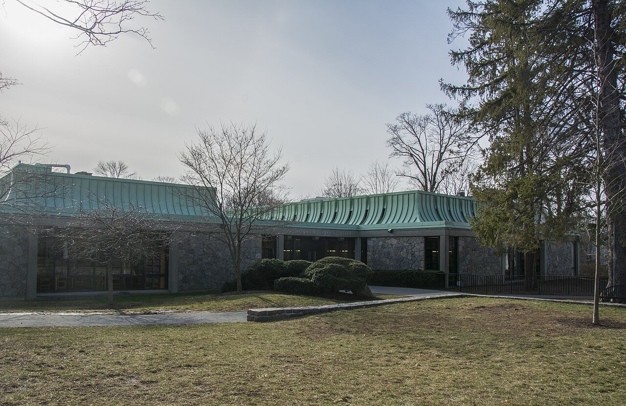
Mount Pleasant Public Library 04Photo: Ɱ · CC BY-SA 4.0
A+Outdoors
Outdoors in Mount Pleasant

Mount Pleasant has 76 miles of mapped trails, 2.8 for every square mile of land

25% of Mount Pleasant’s land is conserved, about 4,412 acres. 3,953 acres are parks and preserves, 88 per 1,000 residents. 94% of residents live within a half mile of a park.

Ahead of 98% of U.S. towns · #19 of 758 in New York. What drives it

Conserved land
25%
4,412 acres · of 27.4 sq mi of land
Trails
76 mi
2.8 per sq mi of land
Park land
3,953 ac
88 acres per 1,000 residents
Near a park
94%
of residents within ½ mile
Bike routes
14 mi
5.8 mi paths
Highest peak
709 ft
Sarles Hill
Lakes & rivers
18
2 beaches · 2 boat launches

What kind of outdoors town is Mount Pleasant?

Read from the map. The page puts what stands out first.

Outdoors grade

How much outdoors does Mount Pleasant have?

On conserved land, trails, park land and how close residents live to a park, Mount Pleasant is ahead of 98% of U.S. towns, #19 of 758 in New York. All four inputs are above most U.S. towns; trail miles rank highest, the share of residents near a park lowest.

A+
OutdoorsA character grade: shown, never part of Mount Pleasant’s overall grade.
All U.S. towns we grade (21,298)Ahead of 98%
LessMore
New York towns of 2,500+ (758)Ahead of 98%

Water is 16% of Mount Pleasant’s area (5 of 33 square miles), so every share here is of land; over land and water together, the conserved share would read 21%.

How sure. Graded on any three of the four inputs instead, the letter would still be A+. Trails and many small parks come from OpenStreetMap, mapped by volunteers, so coverage varies from town to town; the half mile is a straight line from each census block, so a river or highway in the way isn’t counted against it.

PAD-US, OpenStreetMap (© OpenStreetMap contributors), Census 2025 Gazetteer and 2020 blocks; details in Sources below. How TownRatings grades the outdoors →

The map

Conserved land, trails & bike routes

Tap a number to zoom to a park. Tap a layer to hide it.

12345678
Easements protect land from building but are usually private.© OpenStreetMap contributors · USGS PAD-US
Places to walk

Pick a walk

The longest trail network is Rockefeller State Park Preserve, with 35.3 miles. Directions go to the nearest trailhead or public parking.

Rockefeller State Park Preserve

Managed by New York State Office of Parks, Recreation and Historic Preservation
1,715 acres35.3 mi of trail
13 Bridges LoopPocantico River TrailFerguson Lake TrailLucy's Loop+1
Dog rules not recorded
Directionsto Visitor ParkingWebsite ↗

Graham Hills Park

Nature preserve
427 acres12.2 mi of trail
Blue Trail (Main Loop)TumbleweedPink TrailWhite Trail+1
Dog rules not recorded
Directionsto the parking lotWebsite ↗

Hardscrabble Wilderness Area

Managed by Town of Mount Pleasant
226 acres3.8 mi of trail
White TrailRed TrailHardscrabble Trail (white)Blue Trail+1
Dog rules not recorded
Directionsto the parking lot

Old Croton Aqueduct State Park

Park
27 acres2.5 mi of trail
Old Croton Aqueduct Trail
Dog rules not recorded
Directionsto the parking lotWebsite ↗

Pocantico Lake County Park

Managed by Westchester County
147 acres1.5 mi of trail
White TrailRed Trail
Dog rules not recorded
Directionsto the parking lot

Peabody Preserve Outdoor Classroom

Managed by Tarrytown Union Free School District
38 acres1.2 mi of trail
Red TrailOrange TrailBlue TrailGreen Trail+1
Dog rules not recorded
Directionsto the parking lotWebsite ↗

Douglas Park

Managed by Village of Sleepy Hollow
18 acres1 mi of trail
Dog rules not recorded
Directionsto the parking lot

Kensico Dam Plaza

Park
23 acres0.6 mi of trail
Dog rules not recorded
Directionsto the parking lotWebsite ↗
All 21 parks & preserves
Rockefeller State Park Preserve1,715 acres · 35.3 mi of trail · New York State Office of Parks, Recreation and Historic Preservation
Directions
Graham Hills Park427 acres · 12.2 mi of trail
Directions
Hardscrabble Wilderness Area226 acres · 3.8 mi of trail · Town of Mount Pleasant
Directions
Old Croton Aqueduct State Park27 acres · 2.5 mi of trail
Directions
Pocantico Lake County Park147 acres · 1.5 mi of trail · Westchester County
Directions
Peabody Preserve Outdoor Classroom38 acres · 1.2 mi of trail · Tarrytown Union Free School District
Directions
Douglas Park18 acres · 1 mi of trail · Village of Sleepy Hollow
Directions
Kensico Dam Plaza23 acres · 0.6 mi of trail
Directions
Kingsland Point Park20 acres · 0.4 mi of trail · Village of Sleepy Hollow
Directions
Nannahagen Park25 acres · 0.3 mi of trail
Barnhardt Park4 acres · 0.2 mi of trail · Village of Sleepy Hollow
Directions
Tappan Zee Park1 acres · 0.1 mi of trail
Directions
Horan's Landing1 acres · 0.1 mi of trail · Village of Sleepy Hollow
Directions
Cross County Trail Area66 acres
Directions
DeVries Park18 acres · Village of Sleepy Hollow
Directions
Leitas Pond Park / Carroll Park7 acres
Directions
Opperman's Pond Park6 acres
Soldiers And Sailors Field3 acres
Directions
Patriots Park2 acres · Village of Tarrytown
Directions
Jackson Park1 acres
Roselle Park1 acres
Who protects it

4,412 conserved acres

25% of Mount Pleasant’s land. Water is left out: Mount Pleasant has 27.4 square miles of land and 5.4 of water, so the share counts land only. Who manages Mount Pleasant’s conserved land, from the USGS Protected Areas Database. Approximate, because parcels can overlap.

Town or city2,408 ac
State parks1,834 ac
County729 ac
Land trusts & nonprofits226 ac
Other or Unknown Local Government95 ac
State conservation25 ac
Regional Water Districts3 ac
Local Park · 1,786 acState Park · 1,769 acLocal Resource Management Area · 905 acLocal Conservation Area · 271 acLocal Other or Unknown · 268 ac
Good to know

Conserved doesn’t always mean open to visitors. 151 acres are conservation easements, usually private land. Public access isn’t recorded for 13 of 56 parcels. The walks above are places people visit.

The biggest protected parcels
Parcel (PAD-US)Managed byAcresPublic access
Rockefeller State Park Preserve
State Park
State parks1,769Open
New York City Lands
Local Resource Management Area
Town or city902Open
DEPT OF WATER SUP G & E Land
Local Park
Town or city605Unknown
Graham Hills County Park
Local Park
County423Open
Kensico Fishing Access Area
Local Other or Unknown
Town or city268Unknown
TOWN OF MOUNT PLEASANT Land
Local Park
Town or city266Unknown
Hardscrabble Wilderness Area
Local Conservation Area
Town or city238Open
Pocantico Lake County Park
Local Park
County141Open
Girl Scouts of the United States of America Lands
Private Other or Unknown
Land trusts & nonprofits107Closed
COUNTY OF WESTCHESTER Land
Local Park
County70Unknown

5 smaller protected places aren’t shown.

Things to do

47 places to go in Mount Pleasant

Beaches, playgrounds, peaks, falls and more. Pick a kind.

Peaks in Mount Pleasant
Sarles Hill709 ft elevation
Directions
Buttermilk Hill692 ft elevation · In Rockefeller State Park Preserve
Directions
Reynolds Hill591 ft elevation
Directions
Kykuit Hill482 ft elevation
Directions
Beech Hill446 ft elevation
Directions
Cedar Hill331 ft elevation
Directions
Battle Hill144 ft elevation
Directions
Trails & water

25 named trails and 18 lakes & rivers

Named trails
Open to bikes · 20.7 miHorses · 46.1 miUnpaved · 68.5 mi
Old Croton Aqueduct Trail3.2 mi
Blue Trail (Main Loop)3.1 mi
White Trail2.7 mi
Red Trail2.1 mi
13 Bridges Loop2.0 mi
Pocantico River Trail1.9 mi
Tumbleweed1.8 mi
Pink Trail1.7 mi
Ferguson Lake Trail1.5 mi
Buttermilk Hill1.4 mi
15 more trails
Lucy's Loop
1.2 mi
Brothers' Path
1.1 mi
Big Tree Loop
1.1 mi
Spring Trail
1.0 mi
Lower Loop
0.9 mi
Doc's Trail
0.9 mi
Douglas Hill Loop
0.9 mi
Ridge Trail
0.9 mi
Reservoir Loop
0.9 mi
David's Loop
0.9 mi
Goat Trail
0.9 mi
Eagle Hill
0.9 mi
Orange Trail
0.8 mi
Brook Trail
0.8 mi
Farm Meadow Trail
0.8 mi
Lakes & rivers tap for directions
Biking & sports

14 miles of bike routes

Bike lanes are often missing from the map in smaller towns, so that number is likely low.

5.8 mi
off-road bike paths
8.4 mi
shoulders & shared lanes
Courts & fields
34Tennis
33Baseball
18Soccer
13Basketball
7Football
3Pickleball
2Volleyball

Includes school and college facilities, which aren’t always open to the public.

History along the way

13 places on the National Register, 3 of them National Historic Landmarks

The country’s official list of places worth saving (National Park Service). The map also marks 16 historic points from OpenStreetMap: plaques, memorials and old buildings.

History →
★
Dutch Reformed ChurchNational Historic Landmark · Building · listed 1966
About it
★
Philipsburg ManorNational Historic Landmark · Building · listed 1966
About it
★
John D. Rockefeller EstateNational Historic Landmark · District · listed 1976
About it
Tarrytown LighthouseStructure · listed 1979
About it
Hammond HouseBuilding · listed 1980
About it
Philipse Manor Railroad StationBuilding · listed 1991
About it
Union Church of Pocantico HillsBuilding · listed 2002
About it
Edward Harden MansionBuilding · listed 2004
About it
Sleepy Hollow CemeteryDistrict · listed 2009
About it
Marmaduke Forster HouseBuilding · listed 2011
About it
Usonia Historic DistrictDistrict · listed 2012
About it
St. John's Episcopal ChurchBuilding · listed 2017
About it

1 more on the History page.

When to get out

The best walking months in Mount Pleasant: April to June, August and September

NOAA’s 1991–2020 normals for the town and the daylight at its latitude. Outlined months have long days, highs of 59 to 86 °F and little rain for the place.

JanFebMarAprMayJunJulAugSepOctNovDec
Daylight (h)9.510.611.813.314.515.114.913.812.411.09.89.2
High (°F)384149617180858376645343
Rain (in)3.32.84.04.13.94.54.74.34.54.53.74.0

February is the driest month (2.8 in) and July the warmest (highs of 85 °F). 4.7 inches fall in July, the wettest month. The climate in Mount Pleasant →

Next door

Mount Pleasant and its neighbors

Mount Pleasant has the most mapped trails of the 8 towns around it. Tap a town to see its outdoors.

TownConserved
of land
Trail mi
per sq mi
Park acres
per 1,000
Near a park
½ mile
Outdoors
Mount Pleasant25%2.88894%A+
North Castle19%1.215096%A+
Greenburgh12%2.42797%A+
Ossining9%1.61498%A
Tarrytown19%3.43599%+A+
Briarcliff Manor6%1.93197%A
Sleepy Hollow27%6.03199%+A+
New Castle12%1.29794%A+

The four inputs of the Outdoors grade, from the engine; shares are of land, not water.

Questions about parks and trails in Mount Pleasant

Where can I hike in Mount Pleasant?

The longest trail networks: Rockefeller State Park Preserve, 35.3 miles; Graham Hills Park, 12.2 miles; Hardscrabble Wilderness Area, 3.8 miles; Old Croton Aqueduct State Park, 2.5 miles. Each one is on the map above, with directions to the nearest trailhead or parking.

How much of Mount Pleasant is conserved land?

25% of its land, against a typical 5% for a New York town and 4% nationally (PAD-US). Conserved doesn’t always mean open to visitors: easements are usually private land.

Are dogs allowed on Mount Pleasant’s trails?

Rockefeller State Park Preserve and Graham Hills Park don’t have dog rules recorded on the map; check the signs at the trailhead.

Where can I bike in Mount Pleasant?

14 miles of bike routes are on the map: 5.8 of off-road paths and 8.4 of shoulders and shared lanes.

Is there public land near Mount Pleasant?

42,346 acres of parks and open public land lie inside Mount Pleasant or within 10 miles of it (PAD-US), 3,953 of them inside the town line.

How much outdoors does Mount Pleasant have?

Ahead of 98% of U.S. towns on the Outdoors grade, #19 of 758 in New York. The grade combines the share of land that is conserved, miles of mapped trail per square mile of land, park acres per 1,000 residents and the share of residents within a half mile of a park. It’s a character grade, so it isn’t part of the overall grade. How it works.

Trail talk

Conditions, parking and favorite walks from Mount Pleasant neighbors.
Town Square →
Share a tip
Sources

Where this page comes from

Conserved and public land: USGS Protected Areas Database of the United States (PAD-US), service updated July 2026. Parks, trails, playgrounds, beaches and other places: OpenStreetMap (© OpenStreetMap contributors, ODbL), map data as of 2026-10-28. Land and water area: Census 2025 Gazetteer. Residents near a park: 2020 Census blocks. National Register: National Park Service. How TownRatings grades the outdoors →