Milo’s post office opened in 1831, and 42% of its homes were built before 1940
More historic than 97% of U.S. towns · #74 of 758 in New York. What drives it
12 places in town are on the National Register, among them two historic districts with 210 buildings between them. Below: 1 old photo or paper, maps from 1902 on, and the census since 1820.
The Milo post office opened in 1831, the earliest record of the town by name. Three smaller post offices, Milo Centre (1828), Second Milo (1887) and Mays Mill (1890), opened inside today’s town and later closed.
First census: 2,612 in 18202020 census: 6,803195 years
How historic is Milo?
A+
More historic than 97% of U.S. towns, on its age, its old homes and the National Register.
Founding year: the first Milo post office (Blevins & Helbock, CC0).The full story ↓
History grade
What drives Milo’s History grade
On its age, its old homes and the National Register, Milo is more historic than 97% of U.S. towns, #74 of 758 in New York. All 3 inputs are above most U.S. towns; its share of homes from before 1940 ranks highest and its age lowest.
A+
HistoryA character grade: shown, never part of Milo’s overall grade.
New York towns list more on the Register than most of the country (a typical New York town has 12.3 per 10,000 residents, the U.S. 2.4), so Milo’s 336 sits above most of its state (88% of New York towns have fewer) while its 229 historic buildings outnumber those of 94% of U.S. towns.
How sure. Graded on any two of the three inputs instead, the letter would range from A to A+. The pre-1940 share is a Census survey estimate (±5.8 points). The founding year is the first post office, not a stated founding date.
Founding year: the first post office (other dates in Quick answers). Homes: Census ACS 2020–24. National Register: National Park Service, May 2026 list; each listing counted once (boundary changes and added documentation belong to their listing), and a historic district counts its contributing buildings. How TownRatings grades history →
What stands out about Milo’s past
Read from the archive, the National Register and the record. The page puts what stands out first.
National Park Service, National Register of Historic Places. Photos from Wikimedia Commons, credited on each place’s page.
Places that used to be
Lost post offices, old corners, places now gone and burying grounds
Milo had its own post office from 1831 to 1865. Three other post offices opened and closed inside today’s town.
Penn Yan
1818–today
Milo Centre
1828–1903
Milo
1831–1865
Himrod
1865–today
Second Milo
1887–1900
Mays Mill
1890–1905
18101920today
Hamlets and corners on the map
HimrodKenka MillsMays MillsMilo CenterMilo MillsPenn YanRandall CrossingSecond MiloSeneca MillsWillow Grove
Gone or out of use
Chestnut Street Public SchoolschoolHutton Street Public SchoolschoolLiberty Street Public SchoolschoolPenn Yan AcademyschoolSchool Number 10schoolSchool Number 12schoolSchool Number 2schoolSchool Number 3schoolSchool Number 5schoolSchool Number 6schoolSchool Number 7schoolSchool Number 8schoolSchool Number 9school
3cemeteries and burying grounds inside Milo
Grove MountRapleeSecond Milo
US Post Offices dataset (Blevins & Helbock, CC0). Places and cemeteries from the USGS Geographic Names Information System (2021).
Help out
Start Milo’s collection
The first neighbors to add old photos shape how Milo’s history is told.
Decades since 1900 with photos
00s10s20s30s40s50s60s70s80s90s
0 of 10 decades. The empty ones are waiting for someone’s album.
The region was within the realm of the Seneca tribe before Europeans entered the area.
Settlement began around 1788 by members of the Universal Friends, a religious sect. In 1818, the town was founded from part of the Town of Benton, while still part of Ontario County. By 1820, the population was about 1,612. When Yates county was formed in 1823, Milo became part of the new county.
In 1833, the Village of Penn Yan was incorporated, setting itself apart from the town.
The Crooked Lake Canal ran partly across the northern part of Milo when it opened in 1833. Around 1877, the canal ceased to function and its lands were taken over by railroads.
Passages that mention Milo, cut from the printed page as they were published.
Genealogy of the descendants of Omri Warner1916 · page 166Read the page →
Read the text
Milo was the only one that took part in the war of 1812. He was drafted and served in Canada from Aug. 29 to Sept. 24, 1814, not quite a month, but he contracted disease that made him a cripple for two years.
Text read by machine from the scan; it may contain errors.
Scans and text from the Internet Archive. Books published in 1930 or earlier, which are in the public domain.
Timeline
Milo, 1818 to 2000
Woven from the archive, old maps, post office records, the National Register and the people born here.
Nothing in the archives for these yearsWeddings on Main Street, storms, parades, school pictures, the old store. If it’s in your family album, it belongs here.
The Milo post office opened in 1831, the earliest record of the town by name (U.S. post office records).
How does Milo rank for history?
Milo is more historic than 97% of U.S. towns, #74 of 758 in New York. The History grade combines the town’s founding era, the share of homes built before 1940 and its National Register listings. It’s a character grade, so it isn’t part of the overall grade. How it works.
What is on the National Register in Milo?
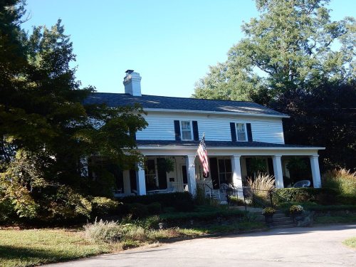
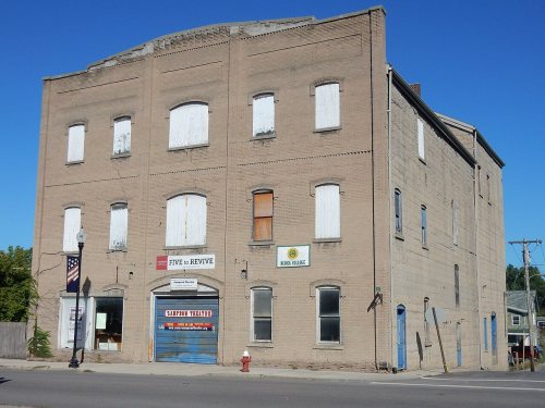
12 listings: 9 buildings, 2 historic districts, the Yates County Courthouse Park District and the Penn Yan Historic District, with 210 contributing buildings, and 1 site. 229 historic buildings in all.
How old are the homes in Milo?
42% of Milo’s homes were built before 1940 (Census estimate, ±5.8 points), against a typical 27% for a New York town; the median home was built in 1956.
Founding dates: Wikidata, Wikipedia, the U.S. post office records of Blevins & Helbock (CC0) and the Census. Homes by year built: Census ACS 2020–24. National Register of Historic Places: National Park Service (list of May 22, 2026). Old photos, postcards and papers: Wikimedia Commons, the Library of Congress and other public archives, credited on each item’s page. Maps: U.S. Geological Survey historical topographic maps (via Esri) and Sanborn fire-insurance maps (Library of Congress). History text and census tables: Wikipedia (CC BY-SA 4.0). Places that used to be: USGS Geographic Names Information System (2021).
From Wikimedia Commons (4), the National Register of Historic Places (12), Wikipedia, Wikidata and Wikipedia for famous people, U.S. Geological Survey historical maps, U.S. Census counts (via Wikipedia), the US Post Offices dataset (Blevins & Helbock), the USGS Geographic Names Information System and old county and town histories (Internet Archive). Archive images are copied here with their credits and licenses, shown on each photo’s page. Refreshed monthly.






 2020
 2020
 2020

