Founding year: Wikipedia. First post office: 1804.The full story ↓
History grade
What drives Manheim’s History grade
On its age, its old homes and the National Register, Manheim is more historic than 94% of U.S. towns, #179 of 758 in New York. All 2 inputs are above most U.S. towns; its share of homes from before 1940 ranks highest and its National Register listings lowest.
A
HistoryA character grade: shown, never part of Manheim’s overall grade.
New York towns list more on the Register than most of the country (a typical New York town has 12.3 per 10,000 residents, the U.S. 2.4), so Manheim’s 26.2 sits near the middle of its state (60% of New York towns have fewer) while its 8 historic buildings outnumber those of 74% of U.S. towns.
NoteThe founding year comes from Wikipedia alone; no second source gives 1756.
How sure. Graded on two of the three inputs, so a change in either one moves the letter more than it would with three. The pre-1940 share is a Census survey estimate (±7.3 points).
Founding year: Wikipedia (other dates in Quick answers). Homes: Census ACS 2020–24. National Register: National Park Service, May 2026 list; each listing counted once (boundary changes and added documentation belong to their listing), and a historic district counts its contributing buildings. How TownRatings grades history →
What stands out about Manheim’s past
Read from the archive, the National Register and the record. The page puts what stands out first.
Lost post offices, old corners, places now gone and burying grounds
Manheim had its own post office from 1804 to 1853. Five other post offices opened and closed inside today’s town.
Manheim
1804–1853
Manheim Centre
1826–1869
East Creek
1835–1935
Brockett's Bridge
1853–1882
Ingham Mills
1866–1902
Dolgeville
1882–today
Manheim
1897–1901
18001910today
Hamlets and corners on the map
DolgevilleEast CreekIngham MillsIngham Mills StationManheim Center
Gone or out of use
First Methodist Episcopal ChurchchurchNumber 1 Hose CompanybuildingSchool Number 4schoolSchool Number 5schoolSchool Number 6schoolSchool Number 8schoolSchool Number 9school
6cemeteries and burying grounds inside Manheim
DolgevilleFink - Van ValkenburghLowerRural ParkUpperYellow Church
US Post Offices dataset (Blevins & Helbock, CC0). Places and cemeteries from the USGS Geographic Names Information System (2021).
Help out
Start Manheim’s collection
The first neighbors to add old photos shape how Manheim’s history is told.
Decades since 1900 with photos
00s10s20s30s40s50s60s70s80s90s
0 of 10 decades. The empty ones are waiting for someone’s album.
East Canada Creek and a grist-mill, sawmill and carding works about half a mile north of the present Mohawk turnpike. The building of the last-named bridge led to his settling in Manheim. The bridge was paid for by Montgomery county, and in order to get the necessary timber he purchased a one-hundredacre lot west of the creek and near the bridge in March, 1794. Finishing the bridge, he erected the mills which were in operation in 1795. These improvements attracted emigrants, and by 1800 there was a lively settlement here; it became
Text read by machine from the scan; it may contain errors.
East Canada Creek, and eight miles from Little Falls, with which it is now connected by railroad. The principal part of the village, which includes all the factories, post-office, schools, business blocks, etc., is situated in the northeast corner of the township of Manheim. Many handsome residences, the academy, the Episcopal church, the lumber yards, etc., lie on the further side of the creek in the township of Oppenheim, Fulton county.
Text read by machine from the scan; it may contain errors.
A history of Herkimer county, including the upper Mohawk valley, from the earliest period to the present time1856 · page 408Read the page →
Read the text
all that part of the county of Montgomery, bounded northerly by the north hounds of the state, easterly by Palatine, then extending to the west bounds of the present town of Manheim, southerly by the Mohawk river, and westerly by a north and south line running across the Mohawk river, at the fording place, near the house of William Cunningham, leaving the same house to the west of said line. This fixed the west line of the town on the present western limits of the
Text read by machine from the scan; it may contain errors.
A history of Herkimer county, including the upper Mohawk valley, from the earliest period to the present time1856 · page 437Read the page →
Read the text
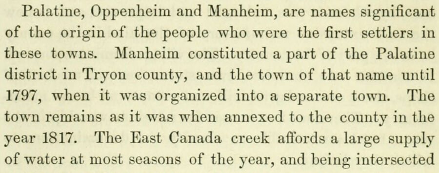
Palatine, Oppenheim and Manheim, are names significant of the origin of the people who were the first settlers in these towns. Manheim constituted a part of the Palatine district in Tryon county, and the town of that name until 1797, when it was organized into a separate town. The town remains as it was when annexed to the county in the year 1817. The East Canada creek affords a large supply of water at most seasons of the year, and being intersected
Text read by machine from the scan; it may contain errors.
Scans and text from the Internet Archive. Books published in 1930 or earlier, which are in the public domain.
Timeline
Manheim, 1756 to 1940
Woven from the archive, old maps, post office records, the National Register and the people born here.
In 1756, according to Wikipedia’s history of the town. Manheim’s post office opened in 1804, and the census of 1820 counted 1,777 people here.
How does Manheim rank for history?
Manheim is more historic than 94% of U.S. towns, #179 of 758 in New York. The History grade combines the town’s founding era, the share of homes built before 1940 and its National Register listings. It’s a character grade, so it isn’t part of the overall grade. How it works.
What is on the National Register in Manheim?
5 listings: 5 buildings, among them the US Post Office-Dolgeville (listed 1988, the first). 8 historic buildings in all.
How old are the homes in Manheim?
46% of Manheim’s homes were built before 1940 (Census estimate, ±7.3 points), against a typical 27% for a New York town; the median home was built in 1945.
Founding dates: Wikidata, Wikipedia, the U.S. post office records of Blevins & Helbock (CC0) and the Census. Homes by year built: Census ACS 2020–24. National Register of Historic Places: National Park Service (list of May 22, 2026). Old photos, postcards and papers: Wikimedia Commons, the Library of Congress and other public archives, credited on each item’s page. Maps: U.S. Geological Survey historical topographic maps (via Esri) and Sanborn fire-insurance maps (Library of Congress). History text and census tables: Wikipedia (CC BY-SA 4.0). Places that used to be: USGS Geographic Names Information System (2021).
From Wikimedia Commons (3), the National Register of Historic Places (5), Wikipedia, Wikidata and Wikipedia for famous people, U.S. Geological Survey historical maps, U.S. Census counts (via Wikipedia), the US Post Offices dataset (Blevins & Helbock), the USGS Geographic Names Information System and old county and town histories (Internet Archive). Archive images are copied here with their credits and licenses, shown on each photo’s page. Refreshed monthly.




 2021
 2012
 2011


