Founding year: Wikidata. First post office: 1808.The full story ↓
History grade
What drives Lawrence’s History grade
On its age, its old homes and the National Register, Lawrence is more historic than 59% of U.S. towns. Its age holds the grade up; its National Register listings pull it down.
B
HistoryA character grade: shown, never part of Lawrence’s overall grade.
New York towns list more on the Register than most of the country (a typical New York town has 12.3 per 10,000 residents, the U.S. 2.4), so Lawrence’s 0.0 sits below most of its state (10% of New York towns have fewer) while its 0 listings outnumber those of 23% of U.S. towns.
NoteThe founding year comes from Wikidata alone; no second source gives 1828.
How sure. Graded on any two of the three inputs instead, the letter would range from C+ to A−. The pre-1940 share is a Census survey estimate (±6.9 points).
Founding year: Wikidata (other dates in Quick answers). Homes: Census ACS 2020–24. National Register: National Park Service, May 2026 list; each listing counted once (boundary changes and added documentation belong to their listing), and a historic district counts its contributing buildings. How TownRatings grades history →
What stands out about Lawrence’s past
Read from the archive, the National Register and the record. The page puts what stands out first.
Settlers began arriving in the region shortly after 1800, but many left permanently to Vermont and New Hampshire during the War of 1812, leaving only five families in the town, who often survived off of venison due to difficulty reclaiming farmland at the time. A state road constructed through the region in 1827 helped renew settlement of Lawrence.
The town was formed in 1828 from parts of the Towns of Brasher and Hopkinton.
Like Lowell and all other manufacturing centres located on the banks of the Merrimack, the city of Lawrence owes its inception and growth to the water-power and facilities afforded by that noble stream. Methuen and Andover were towns before the city of Lawrence was ever dreamed of by its founders. The Pentucket Indians then inhabited territory on which Lawrence now stands, and they were the lords of the valley of the Merrimack. In 1640 eight men from the colony at Newbury proceeded up the Merrimack as far as a tributary to that stream called Little river, which has its source in Plaistow, and discharges itself into the Merrimack a few miles below Mitchell's Falls. They settled here and called it Haverhill. They bought land on the Merrimack for a dozen miles from the Indians.
Text read by machine from the scan; it may contain errors.
Though Lawrence had in 1845 a population of only about one hundred and fifty, the inhabitants had so far increased in numbers in 1848 as to lead to the railroad magnates putting the town into direct railway conection with Boston, Lowell, and Salem. The Boston and Maine Railroad Company then began to run their trains to South Lawrence, and in the same year put up their station on the north side of the river. On the 2d of July, 1848, the Lowell and Lawrence ran free trains and carried over eight thousand people. On September 4th, 1848, the Essex Railroad from Lawrence to Salem was opened, and in October, 1849, the Manchester and Lawrence road was opened.
Text read by machine from the scan; it may contain errors.
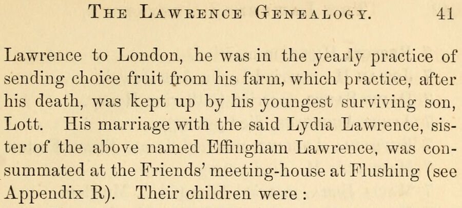
Historical genealogy of the Lawrence family1858 · page 41Read the page →
Read the text
The Lawrence Genealooy. 41 Lawrence to London, he was in the yearly practice of sending choice fruit from his farm, which practice, after his death, was kept up by his youngest surviving son, Lott. His marriage with the said Lydia Lawrence, sister of the above named Effingham Lawrence, was consummated at the Friends' meeting-house at Fhishing (see Appendix R). Their children were :
Text read by machine from the scan; it may contain errors.
Historical genealogy of the Lawrence family1858 · page 123Read the page →
Read the text
Secondly. By quit claim deed, made by Joseph Lawrence of Flushing, to Joseph Bonny of Woodbridge, in the province of East New Jersey, in the year 1735, as identifying the second ancestor, Joseph Lawrence, with the said Elizabeth Lawrence above identified as the lawful wife of the first ancestor, William Lawrence, who came over from England to America as aforesaid (see Appendix D).
Text read by machine from the scan; it may contain errors.
Scans and text from the Internet Archive. Books published in 1930 or earlier, which are in the public domain.
Timeline
Lawrence, 1808 to 1919
Woven from the archive, old maps, post office records, the National Register and the people born here.
Nothing in the archives for these yearsWeddings on Main Street, storms, parades, school pictures, the old store. If it’s in your family album, it belongs here.
In 1828, according to Wikidata. Lawrence’s post office opened in 1808, and the census of 1830 counted 1,097 people here.
How does Lawrence rank for history?
Lawrence is more historic than 59% of U.S. towns. The History grade combines the town’s founding era, the share of homes built before 1940 and its National Register listings. It’s a character grade, so it isn’t part of the overall grade. How it works.
How old are the homes in Lawrence?
22% of Lawrence’s homes were built before 1940 (Census estimate, ±6.9 points), against a typical 27% for a New York town; the median home was built in 1975.
Founding dates: Wikidata, Wikipedia, the U.S. post office records of Blevins & Helbock (CC0) and the Census. Homes by year built: Census ACS 2020–24. National Register of Historic Places: National Park Service (list of May 22, 2026). Old photos, postcards and papers: Wikimedia Commons, the Library of Congress and other public archives, credited on each item’s page. Maps: U.S. Geological Survey historical topographic maps (via Esri) and Sanborn fire-insurance maps (Library of Congress). History text and census tables: Wikipedia (CC BY-SA 4.0). Places that used to be: USGS Geographic Names Information System (2021).
From the Library of Congress (2), Wikipedia, Wikidata and Wikipedia for famous people, U.S. Geological Survey historical maps, U.S. Census counts (via Wikipedia), the US Post Offices dataset (Blevins & Helbock), the USGS Geographic Names Information System and old county and town histories (Internet Archive). Archive images are copied here with their credits and licenses, shown on each photo’s page. Refreshed monthly.





 1913


