204 years in pictures
The archive holds 6 old photos and papers going back to 1850.
- 1822Keeseville is settled
Each edition grades its towns against each other only.

18% of residents live below the poverty line in Keeseville, where New York’s towns sit at 9.5% and U.S. towns at 9.6%. We don’t grade Keeseville yet; the figures below are still real.
Where Keeseville beats most towns.
1,815 counted in 2010 and 2,931 in 2020.
U.S. Census 2010 & 2020 counts

The archive holds 6 old photos and papers going back to 1850.
Museums, parks, gardens and other places to visit around Keeseville. Close and well known come first.
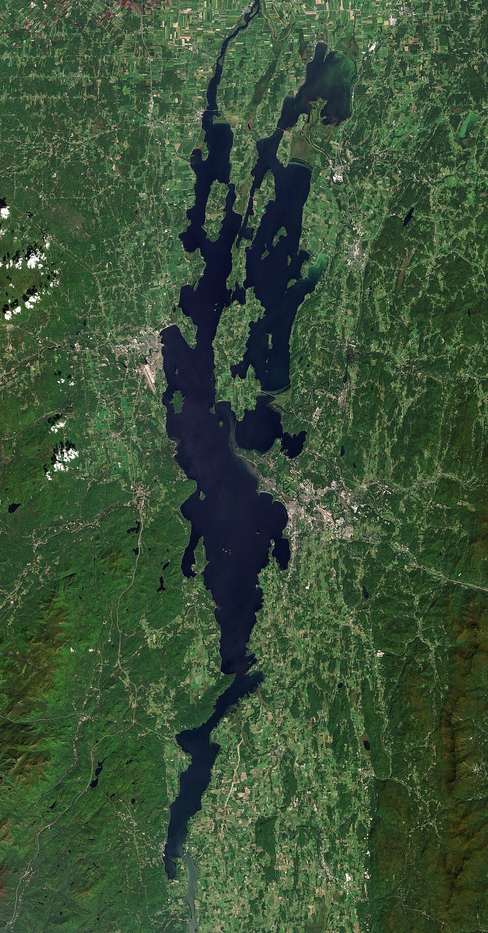
Big draw8 mi LakeLake Champlain
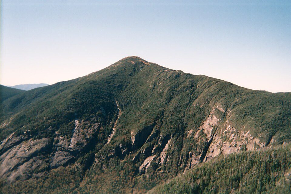
35 mi MountainMount Marcy
2 mi Canyon & gorgeAusable Chasm
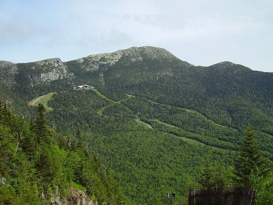
33 mi MountainMount Mansfield
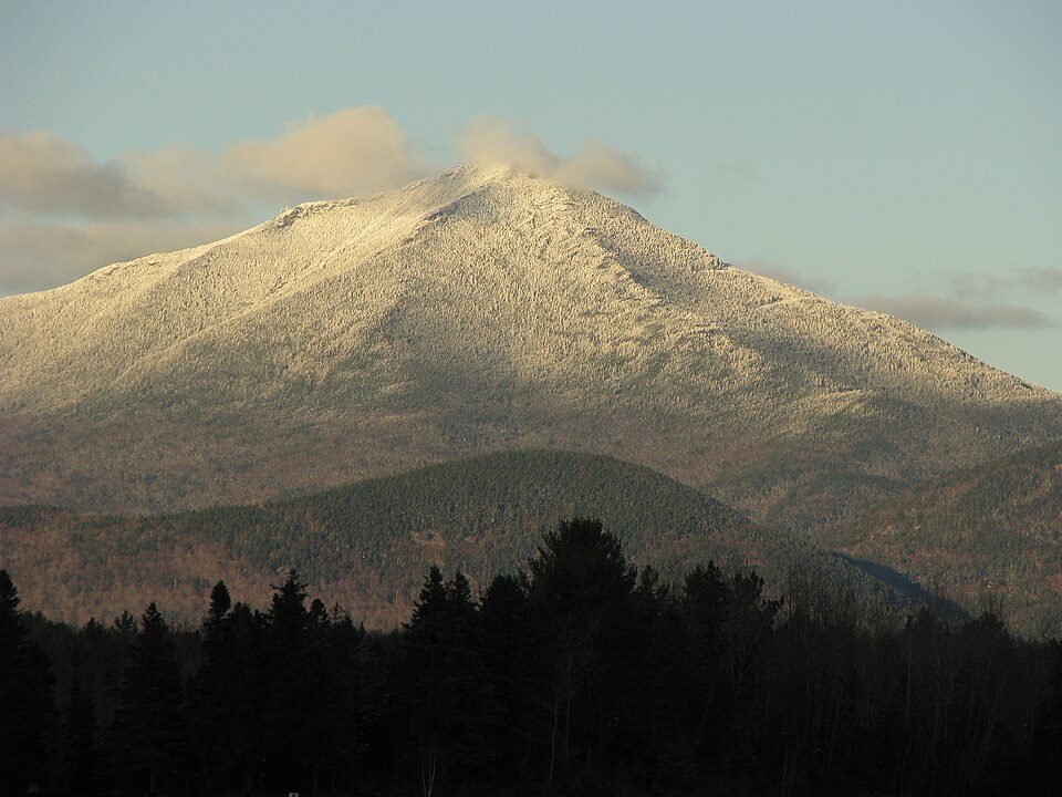
23 mi MountainWhiteface Mountain
36 mi LakeLake Tear of the CloudsLake Champlain: Copernicus Sentinel-2, ESA, CC BY-SA 3.0 igo · Mount Marcy: Daniel Tripp, Public domain · Ausable Chasm: Alan Prusila / Alanp35 at en.wikipedia, CC BY-SA 3.0 · Mount Mansfield: Original uploader was Calzarette (Joe Calzarette) at en.wikipedia, Public domain · Whiteface Mountain: Mwanner, CC BY-SA 3.0 · Lake Tear of the Clouds: TheKilimanjaro, CC BY-SA 4.0
Keeseville is unincorporated, so Clinton County and regional agencies provide most services.
EPA SDWIS (Oct 9, 2026) · HIFLD + EIA-861 2025 · Census 2020 ZCTAs · NCES 2024–25 · registration: vote.gov, updated Aug 3, 2026.
Ordered by what stands out in Keeseville.
The typical Keeseville home is worth about $209,000, up 1.5% in a year, 60% below the New York typical home.
| Keeseville | New York towns | U.S. towns | |
|---|---|---|---|
| Median rent | $1,091 a month | $1,101 a month | $1,185 a month |
| Households that own their home | 74% | 75% | 73% |
Zillow Home Value Index · Redfin Data Center
Most working residents leave Keeseville for work: only 5% work in town. At 21 minutes, Keeseville’s average trip to work is against 25 minutes in New York’s towns and 25 minutes across U.S. towns. Jobs based in Keeseville fell to 309 in 2023, 156 fewer than in 2013.
| Keeseville | New York towns | U.S. towns | |
|---|---|---|---|
| Average trip to work | 21 minutes | 25 minutes | 25 minutes |
| Median household income | $62,000 | $82,000 | $80,000 |
| Working residents who work in town | 4.6% | 10% | 8% |
Census LEHD 2023 · ACS
Keeseville has cold, snowy winters and pleasant summers. The July high in Keeseville is 80°F.
NOAA U.S. Climate Normals, 1991–2020
Expected storm and flood damage is higher than in 62% of U.S. communities.
FEMA National Risk Index · OpenFEMA
Keeseville beats the New York average on 8 of 32 CDC measures and trails it on 8. 34% of adults sleep under 7 hours in Keeseville.
| Keeseville | New York towns | U.S. towns | |
|---|---|---|---|
| Sleep under 7 hours (CDC PLACES) | 34% | 37% | 36% |
| Smoke cigarettes (CDC PLACES) | 15% | 13% | 14% |
| Binge drink (CDC PLACES) | 17% | 17% | 16% |
| No health insurance, 18–64 (CDC PLACES) | 5.5% | 5.9% | 8.1% |
| What stands out | Keeseville | NY |
|---|---|---|
| Fewer uninsured adults | 5.5% | 7.9% |
| Fewer adults facing food insecurity | 12.6% | 17.2% |
| More smokers | 14.7% | 11.3% |
CDC PLACES 2025 · modeled estimates for adults · CMS · HRSA
0.6 miles of trail in 1 park or preserve. Keeseville’s trail density is 0.1 miles per square mile.
| Keeseville | New York towns | U.S. towns | |
|---|---|---|---|
| Conserved land | 0.6% | 5.2% | 4.3% |
| Miles of trail per square mile | 0.1 miles per square mile | 0.4 | 0.4 |
| Biggest places to walk | Trails | Acres |
|---|---|---|
| 1. Taylor Pond Wild Forest | — | 1 |
Trails & parks © OpenStreetMap contributors · Conserved land: USGS PAD-US
4 within 15 miles of the center of Keeseville
About 7 of every 100 Keeseville residents are enrolled in college, about the same as New York.
Where Keeseville’s working residents go each day. Line width shows the share.
Census LEHD 2023
5 notable people were born in Keeseville.
Hamlet and CDP in New York, United States
Keeseville is a hamlet (and census-designated place) in Clinton and Essex counties, New York, United States. The population was 1,815 at the 2010 census. The hamlet was named after the Keese family, early settlers from Vermont. It developed along the Ausable River, which provided water power for mills and industrial development. Keeseville is in the towns of Au Sable and Chesterfield and is south of the city of Plattsburgh. It is located inside what are now the boundaries of Adirondack Park, which was authorized in the 20th century. On January 23, 2013, the town's select board voted to dissolve the village. As of 2016, the U.S. Census Bureau still had Keeseville listed as a village.
From Wikipedia, licensed CC BY-SA 4.0 · facts via Wikidata (CC0)
2 towns share a border with Keeseville.
| Town | NY rank | Overall | Cost | Safety | Schools | Health |
|---|---|---|---|---|---|---|
| Keeseville | — | — | — | — | — | — |
| Au Sable | #533 | C | B− | — | C+ | B+ |
| Chesterfield | — | — | B+ | — | C | B |
Chesterfield has fewer than 2,500 residents, so it gets subject grades but no overall grade. Au Sable and Chesterfield report no FBI crime data of their own. Keeseville isn’t graded (fewer than 1,000 residents, or not enough data). Compare Keeseville with a neighbor →
Short answers, built from the data on this page.
We don’t grade Keeseville yet; the figures below are still real.
5 notable people were born here, including William Henry Jackson and Frank O'Connor.