The original settlers arrived c. 1830 and called the village Winkelried.
The first hotel in the village was The Jefferson House, named after President Jefferson, and the village was subsequently renamed to Jeffersonville. The hotel is now known as the Abel Building and still stands on Main St.
In 1897 and 1898, a total of bills from hotels and saloons in town showed that 3000 kegs of beer were consumed in a village with a population of 500.
Every edition of the U.S. Geological Survey’s map of Jeffersonville. Tap a year, or press play to watch the town change.
1921Livingston Manor sheet · 1:62,500
U.S. Geological Survey historical topographic maps (public domain), via Esri’s collection of the scans. The red ring marks the center of Jeffersonville.
From the old history books
What they wrote about Jeffersonville in 1873
Passages that mention Jeffersonville, cut from the printed page as they were published.
One of the interesting features of our history should be an account of the German settlements of CaUicoon and the adjoining towns. These settlements, commenced in 1840, although a Dutchman named Poli located near Jeffersonville as early && 1837. In 1847, it was estimated that two hundred and fifty German families were in Cochecton, CaUicoon and Fremont, and in 1855, the State census shows that erf the 2,649 residents of that nationality iu Sullivan, 1*924 were in those towns. In ad-
Text read by machine from the scan; it may contain errors.
horns, and in 1842 Abraham Schneider located in the village and buUt a saw-mill. Victor Hofer and other valuable immigrants also settled in the neighborhood, and in a few years Shermerhorn's anticipations became realities. Jeffersonville was a thriving village before the stumps of forest-trees had disappeared from its streets.
Text read by machine from the scan; it may contain errors.
Scans and text from the Internet Archive. Books published in 1930 or earlier, which are in the public domain.
Timeline
Jeffersonville, 1875 to 1980
Woven from the archive, old maps, post office records, the National Register and the people born here.
Nothing in the archives for these yearsWeddings on Main Street, storms, parades, school pictures, the old store. If it’s in your family album, it belongs here.
Founding dates: Wikidata, Wikipedia, the U.S. post office records of Blevins & Helbock (CC0) and the Census. Homes by year built: Census ACS 2020–24. National Register of Historic Places: National Park Service (list of May 22, 2026). Old photos, postcards and papers: Wikimedia Commons, the Library of Congress and other public archives, credited on each item’s page. Maps: U.S. Geological Survey historical topographic maps (via Esri) and Sanborn fire-insurance maps (Library of Congress). History text and census tables: Wikipedia (CC BY-SA 4.0). Places that used to be: USGS Geographic Names Information System (2021). How TownRatings grades history →
From Wikimedia Commons (12), Wikipedia, Wikidata and Wikipedia for famous people, U.S. Geological Survey historical maps, U.S. Census counts (via Wikipedia), Sanborn fire insurance maps (Library of Congress) and old county and town histories (Internet Archive). Archive images are copied here with their credits and licenses, shown on each photo’s page. Refreshed monthly.


 1976
 1976
 1977
 1977
 2018
 2018
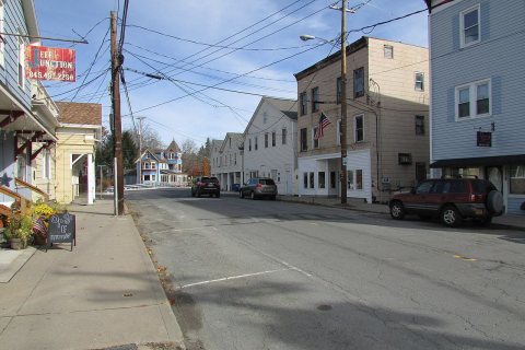 2018
 2018
 2018
 2012
