7 places in town are on the National Register, among them two historic districts with 76 buildings between them. Below: 12 old photos and papers, maps from 1950 on, and the census since 1870.
On its age, its old homes and the National Register, Delaware is more historic than 98% of U.S. towns. All 2 inputs put Delaware near the top nationally; its share of homes from before 1940 ranks highest.
A+
HistoryA character grade: shown, never part of Delaware’s overall grade.
New York towns list more on the Register than most of the country (a typical New York town has 12.3 per 10,000 residents, the U.S. 2.4), so Delaware’s 367 sits above most of its state (89% of New York towns have fewer) while its 83 historic buildings outnumber those of 88% of U.S. towns.
How sure. Graded on two of the three inputs, so a change in either one moves the letter more than it would with three. The pre-1940 share is a Census survey estimate (±9.5 points).
Founding year: our sources. Homes: Census ACS 2020–24. National Register: National Park Service, May 2026 list; each listing counted once (boundary changes and added documentation belong to their listing), and a historic district counts its contributing buildings. How TownRatings grades history →
What stands out about Delaware’s past
Read from the archive, the National Register and the record. The page puts what stands out first.
Nothing in the archives for these yearsWeddings on Main Street, storms, parades, school pictures, the old store. If it’s in your family album, it belongs here.
Wikipedia doesn’t have a history of Delaware yet. The photos, dates and memories neighbors add here are how it gets written.
Delaware is a town in Sullivan County, New York, United States. The population was 2,203 at the 2020 census. The Town of Delaware is in the western part of the county.
Between the 2010 and 2020 censuses its population fell from 2,670 to 2,203 (-17%).
Intro from Wikipedia. Population: U.S. Census Bureau.
From the old history books
What they wrote about Delaware in 1908
Passages that mention Delaware, cut from the printed page as they were published.
History of the state of Delaware1908 · page 527Read the page →
Read the text
two churches, a school house, a postoffice, two stores, a hotel, a smithy and a dozen or more dwellings. Kirkwood in the southeast lies partly in Red Lion Hundred and is a station on the Delaware Railroad with a passenger and freight depot, three stores, a hotel, a school house, a postoffice, a smithy and about a dozen houses. Summit Bridge lies south of the Delaware and Chesapeake canal, and is so called after a high bridge which once spanned the canal at that point. It has a church,
Text read by machine from the scan; it may contain errors.
History of the state of Delaware1908 · page 665Read the page →
Read the text
" Plymouth " was a settlement founded by some Massachusetts colonists in the early sixties, southwest of Canterbury, The town was laid out in 1866, and was made a station by the Delaware railroad. Baptist and congregational churches were established here in 1867, but disbanded six years later, the members joining the churches at Magnolia.
Text read by machine from the scan; it may contain errors.
Scans and text from the Internet Archive. Books published in 1930 or earlier, which are in the public domain.
Timeline
Delaware, 1810 to 1970
Woven from the archive, old maps, post office records, the National Register and the people born here.
Delaware is more historic than 98% of U.S. towns. The History grade combines the town’s founding era, the share of homes built before 1940 and its National Register listings. It’s a character grade, so it isn’t part of the overall grade. How it works.
What is on the National Register in Delaware?
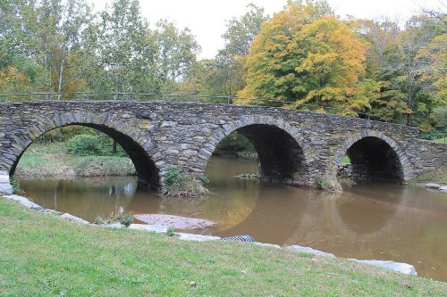
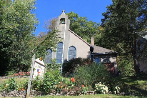
7 listings: 4 buildings, 2 historic districts, the St. Joseph's Seminary and the Callicoon Downtown Historic District, with 76 contributing buildings, and 1 structure. 83 historic buildings in all.
How old are the homes in Delaware?
36% of Delaware’s homes were built before 1940 (Census estimate, ±9.5 points), against a typical 27% for a New York town; the median home was built in 1961.
Founding dates: Wikidata, Wikipedia, the U.S. post office records of Blevins & Helbock (CC0) and the Census. Homes by year built: Census ACS 2020–24. National Register of Historic Places: National Park Service (list of May 22, 2026). Old photos, postcards and papers: Wikimedia Commons, the Library of Congress and other public archives, credited on each item’s page. Maps: U.S. Geological Survey historical topographic maps (via Esri) and Sanborn fire-insurance maps (Library of Congress). History text and census tables: Wikipedia (CC BY-SA 4.0). Places that used to be: USGS Geographic Names Information System (2021).
From Wikimedia Commons (1), the Library of Congress (11), the National Register of Historic Places (7), U.S. Geological Survey historical maps, U.S. Census counts (via Wikipedia), the US Post Offices dataset (Blevins & Helbock), the USGS Geographic Names Information System and old county and town histories (Internet Archive). Archive images are copied here with their credits and licenses, shown on each photo’s page. Refreshed monthly.






 1810
 1835
 1840
 1855
 1875
 1939
 1939
 1939
 1939
 1939
 1939
 1939


