Passages that mention Hardenburgh, cut from the printed page as they were published.
History of Ulster County, New York, with illustrations and biographical sketches of its prominent men and pioneers1880Read the page →
Read the text
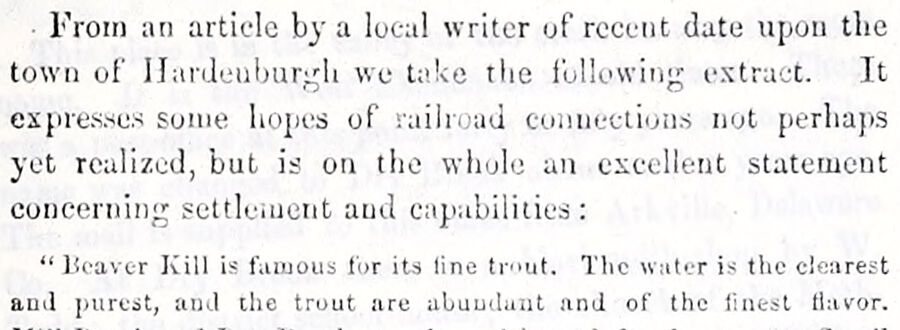
From an article by a local writer of recent date upon the town of Hardenburgh we take the following extract. It expresses some hopes of railroad connections not perhaps yet realized, but is on the whole an excellent statement concerning settlement and capabilities: “Heaver Kill is famous for its line trout. The water is the clearest anil purest, and the trout are abundant and of the finest flavor.
Text read by machine from the scan; it may contain errors.
History of Ulster County, New York, with illustrations and biographical sketches of its prominent men and pioneers1880Read the page →
Read the text
The town of Hardenburgh is situated at the western extremity of the county, being included to a considerable extent in the sharp angle formed by the boundary lines of the counties of Sullivan and Delaware. It is laid out obliquely with reference to the four cardinal points of the compass, and its boundaries may be approximately stated as follows: Northwest by the county line; northeast by the town of Shandaken ; southeast by the towns of Slnin-
Text read by machine from the scan; it may contain errors.
The history of Ulster County, New York1907 · page 366Read the page →
Read the text
at the time he was chosen, resided at the place now called Slide Mountain, near the head of Big Indian Valley, on the farm lately occupied by James W. Dutcher. He afterwards moved to Dry Brook, in what is now the town of Hardenburgh, and settled on the farm now, or lately, owned by William Todd. Milk continued to represent the town as its Supervisor until 1810, when Aaron Adams was chosen and re-elected till 1816; when he was succeeded by Henry W. Rogers.
Text read by machine from the scan; it may contain errors.
The history of Ulster County, New York1907 · page 259Read the page →
Read the text
There are no incorporated villages in the town, but several small hamlets where post-offices have been established, as follows : Belleayre, Hardenburgh, Dry Brook, Seager and Turnwood. Dry Brook is the eldest of these, and it was formerly known as West Shandaken. There was a post-office there over sixty years ago, and the mail comes in by way of Arkville on the Ulster & Delaware Railway, which has long been the
Text read by machine from the scan; it may contain errors.
Scans and text from the Internet Archive. Books published in 1930 or earlier, which are in the public domain.
Timeline
Hardenburgh, 1859 to 1956
Woven from the archive, old maps, post office records, the National Register and the people born here.
Nothing in the archives for these yearsWeddings on Main Street, storms, parades, school pictures, the old store. If it’s in your family album, it belongs here.
Founding dates: Wikidata, Wikipedia, the U.S. post office records of Blevins & Helbock (CC0) and the Census. Homes by year built: Census ACS 2020–24. National Register of Historic Places: National Park Service (list of May 22, 2026). Old photos, postcards and papers: Wikimedia Commons, the Library of Congress and other public archives, credited on each item’s page. Maps: U.S. Geological Survey historical topographic maps (via Esri) and Sanborn fire-insurance maps (Library of Congress). History text and census tables: Wikipedia (CC BY-SA 4.0). Places that used to be: USGS Geographic Names Information System (2021). How TownRatings grades history →
From Wikimedia Commons (8), Wikidata (1), the National Register of Historic Places (4), Wikipedia, U.S. Geological Survey historical maps, U.S. Census counts (via Wikipedia), the US Post Offices dataset (Blevins & Helbock), the USGS Geographic Names Information System and old county and town histories (Internet Archive). Archive images are copied here with their credits and licenses, shown on each photo’s page. Refreshed monthly.





 2021
 2021
 2021
 2017
 2010
 2007


