On its age, its old homes and the National Register, Fort Edward is more historic than 92% of U.S. towns, #210 of 758 in New York. All 2 inputs are above most U.S. towns; its share of homes from before 1940 ranks highest and its National Register listings lowest.
A
HistoryA character grade: shown, never part of Fort Edward’s overall grade.
New York towns list more on the Register than most of the country (a typical New York town has 12.3 per 10,000 residents, the U.S. 2.4), so Fort Edward’s 15.9 sits near the middle of its state (53% of New York towns have fewer) while its 5 historic buildings outnumber those of 70% of U.S. towns.
How sure. Graded on two of the three inputs, so a change in either one moves the letter more than it would with three. The pre-1940 share is a Census survey estimate (±10.1 points).
Founding year: our sources. Homes: Census ACS 2020–24. National Register: National Park Service, May 2026 list; each listing counted once (boundary changes and added documentation belong to their listing), and a historic district counts its contributing buildings. How TownRatings grades history →
What stands out about Fort Edward’s past
Read from the archive, the National Register and the record. The page puts what stands out first.
Every edition of the U.S. Geological Survey’s map of Fort Edward. Tap a year, or press play to watch the town change.
1895Glens Falls sheet · 1:62,500
U.S. Geological Survey historical topographic maps (public domain), via Esri’s collection of the scans. The red ring marks the center of Fort Edward.
Every building
Fort Edward, building by building, 1884–1924
Fire insurance maps drew every building, what it was made of and what it was used for, so insurers could price the risk of fire. Pick a year, then a sheet.
The town is located at the "Great Carrying Place", a portage around the falls on the Hudson, which had been used by Native Americans for thousands of years before European colonization. It was located on the Native American "Great War Path", later used by French and English colonists during their own warfare, during the colonial years, especially during the eighteenth century.
He served the town of Fort Edward as its Supervisor for five terms, namely’, in the y’ears 1885, 1S86 and 1887, and again for two years in 1896-7 and in 1S9S, and Chairman two terms. He was a member of Fort Edward Council, Royal Arcanum; member of the Business Men's Club of Fort Edward, was vice-president of the Glens Falls Trust Company, had been a director in the First National Bank of Fort Edward, and president of the Fort Edward Electric Light
Text read by machine from the scan; it may contain errors.
He was educated at Fort Edward and began the active duties of life as a clerk for his father, who kept a general store in Fort Edward. Subsequently he occupied the position of clerk in a hardware store in Schenectady during the year 1857, and in 1858 embarked in business for himself, in the general merchandise line, in Fort Edward. In 1S65 he engaged in the book and stationery business, .which he has conducted for thirtv-hve vears.
Text read by machine from the scan; it may contain errors.
Scans and text from the Internet Archive. Books published in 1930 or earlier, which are in the public domain.
Timeline
Fort Edward, 1777 to 1918
Woven from the archive, old maps, post office records, the National Register and the people born here.
Nothing in the archives for these yearsWeddings on Main Street, storms, parades, school pictures, the old store. If it’s in your family album, it belongs here.
Fort Edward is more historic than 92% of U.S. towns, #210 of 758 in New York. The History grade combines the town’s founding era, the share of homes built before 1940 and its National Register listings. It’s a character grade, so it isn’t part of the overall grade. How it works.
How old are the homes in Fort Edward?
54% of Fort Edward’s homes were built before 1940 (Census estimate, ±10.1 points), against a typical 27% for a New York town; the median home was built in 1938.
Founding dates: Wikidata, Wikipedia, the U.S. post office records of Blevins & Helbock (CC0) and the Census. Homes by year built: Census ACS 2020–24. National Register of Historic Places: National Park Service (list of May 22, 2026). Old photos, postcards and papers: Wikimedia Commons, the Library of Congress and other public archives, credited on each item’s page. Maps: U.S. Geological Survey historical topographic maps (via Esri) and Sanborn fire-insurance maps (Library of Congress). History text and census tables: Wikipedia (CC BY-SA 4.0). Places that used to be: USGS Geographic Names Information System (2021).
From Wikimedia Commons (22), the Library of Congress (2), Wikipedia, Wikidata and Wikipedia for famous people, U.S. Geological Survey historical maps, U.S. Census counts (via Wikipedia), Sanborn fire insurance maps (Library of Congress) and old county and town histories (Internet Archive). Archive images are copied here with their credits and licenses, shown on each photo’s page. Refreshed monthly.
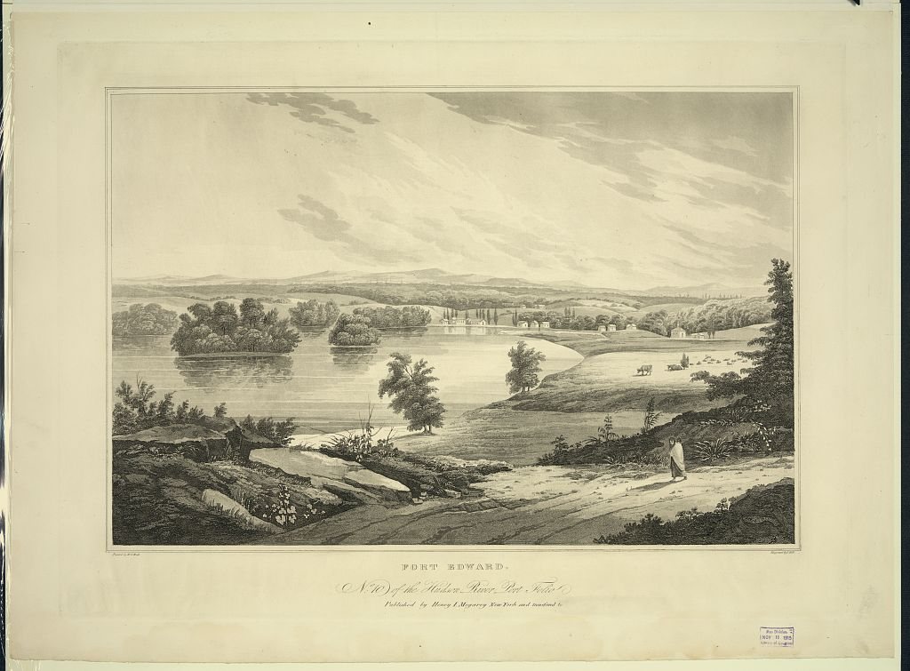


 1821
 1870
 c. 1870
 c. 1870
 2021
 2021
 2021
 2021
 2021
 2021
 2021
 2021
 2021
 2021
 2021
 2021
 2014
 2009
 2008
