Canandaigua dates to 1788, and 40% of its homes were built before 1940
More historic than 97% of U.S. towns · #67 of 758 in New York. What drives it
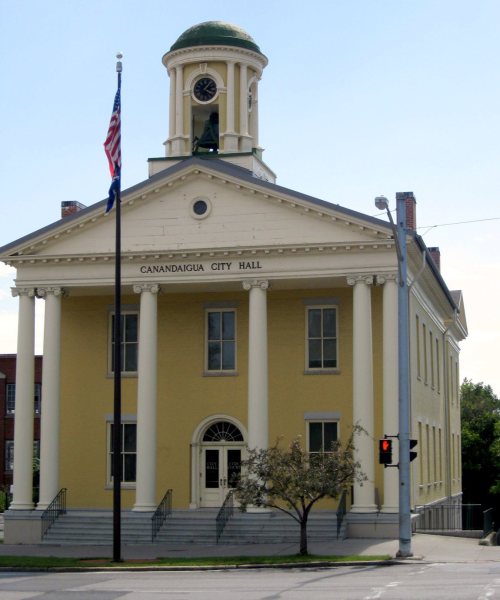
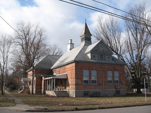
15 places in town are on the National Register, among them three historic districts with 430 buildings between them. Below: 1 old photo or paper, maps from 1886 on, and the census since 1810.
Founding year: Wikidata. First post office: 1794.The full story ↓
History grade
What drives Canandaigua’s History grade
On its age, its old homes and the National Register, Canandaigua is more historic than 97% of U.S. towns, #67 of 758 in New York. All 3 inputs are above most U.S. towns; its share of homes from before 1940 ranks highest and its age lowest.
A+
HistoryA character grade: shown, never part of Canandaigua’s overall grade.
New York towns list more on the Register than most of the country (a typical New York town has 12.3 per 10,000 residents, the U.S. 2.4), so Canandaigua’s 430 sits above most of its state (90% of New York towns have fewer) while its 452 historic buildings outnumber those of 97% of U.S. towns.
NoteThe founding year comes from Wikidata alone; no second source gives 1788.
How sure. Graded on any two of the three inputs instead, the letter would range from A to A+. The pre-1940 share is a Census survey estimate (±4.2 points).
Founding year: Wikidata (other dates in Quick answers). Homes: Census ACS 2020–24. National Register: National Park Service, May 2026 list; each listing counted once (boundary changes and added documentation belong to their listing), and a historic district counts its contributing buildings. How TownRatings grades history →
What stands out about Canandaigua’s past
Read from the archive, the National Register and the record. The page puts what stands out first.
Developed near Canandaigua Lake at the site of the historic Seneca village of Tganödä:gwëh, by the mid-19th century Canandaigua was an important railroad junction and home port for several steamboats that operated on the lake. After the Civil War, local industries included two brick works, the Lisk Manufacturing Company, several mills, and the regionally prominent McKechnie Brewery. The shire town of the original county of western New York, Canandaigua was the site of the trial of Susan B. Anthony in 1873 on charges of voting illegally because only men were allowed to vote.
Passages that mention Canandaigua, cut from the printed page as they were published.
History of Ontario county, New York1893 · page 214Read the page →
Read the text
As has been stated in this chapter, the town of Canandaigua was organized in January, 1789, and at that time its territory included two townships of land, hence about seventytwo square miles of land. However, in 1824 all that part of the town lying directly east of the lake was annexed to Gorham, and consequently reduced the area and population of Canandaigua. The early settlement of the town was surprisingly rapid, and notwithstanding the hardships of the pioneer period, and the material check to immigration ju=t preceding and during the War of
Text read by machine from the scan; it may contain errors.
History of Ontario county, New York1893 · page 206Read the page →
Read the text
Returning, however, from thisdigression to the subject of early settlement in the town of Canandaigua, we may say generally that great difficulty is encountered in learning the names of pioneers, while the exact or even approximate date of their settlement in the town cannot be learned. In a later department of this volume the reader will find sketches of many of the pioneer families in the towns, properly arranged and classified, and furnishing a reasonably complete biographical record of those named ; wherefore in the present connection it cannot be consid-
Text read by machine from the scan; it may contain errors.
Scans and text from the Internet Archive. Books published in 1930 or earlier, which are in the public domain.
Timeline
Canandaigua, 1788 to 1973
Woven from the archive, old maps, post office records, the National Register and the people born here.
Nothing in the archives for these yearsWeddings on Main Street, storms, parades, school pictures, the old store. If it’s in your family album, it belongs here.
U.S. Geological Survey historical topographic maps (public domain), via Esri’s collection of the scans. The red ring marks the center of Canandaigua.
Every building
Canandaigua, building by building, 1886–1911
Fire insurance maps drew every building, what it was made of and what it was used for, so insurers could price the risk of fire. Pick a year, then a sheet.
Canandaigua’s post office has been open since 1794.
Hamlets and corners on the map
Arsenal HillCanandaigua Manufactured Home CommunityRoseland Park
Gone or out of use
Frederick F Thompson Memorial HospitalhospitalSaint Mary's Conventchurch
4cemeteries and burying grounds inside Canandaigua
CalvaryPioneerWest AvenueWoodlawn
US Post Offices dataset (Blevins & Helbock, CC0). Places and cemeteries from the USGS Geographic Names Information System (2021).
Questions about Canandaigua’s history
What year was Canandaigua founded?
In 1788, according to Wikidata. Canandaigua’s post office opened in 1794, and the census of 1810 counted 450 people here.
How does Canandaigua rank for history?
Canandaigua is more historic than 97% of U.S. towns, #67 of 758 in New York. The History grade combines the town’s founding era, the share of homes built before 1940 and its National Register listings. It’s a character grade, so it isn’t part of the overall grade. How it works.
What is on the National Register in Canandaigua?
15 listings: 11 buildings, 3 historic districts, the North Main Street Historic District, the Sonnenberg Gardens and the Canandaigua Historic District, with 430 contributing buildings, and 1 site. 452 historic buildings in all.
How old are the homes in Canandaigua?
40% of Canandaigua’s homes were built before 1940 (Census estimate, ±4.2 points), against a typical 27% for a New York town; the median home was built in 1962.
Founding dates: Wikidata, Wikipedia, the U.S. post office records of Blevins & Helbock (CC0) and the Census. Homes by year built: Census ACS 2020–24. National Register of Historic Places: National Park Service (list of May 22, 2026). Old photos, postcards and papers: Wikimedia Commons, the Library of Congress and other public archives, credited on each item’s page. Maps: U.S. Geological Survey historical topographic maps (via Esri) and Sanborn fire-insurance maps (Library of Congress). History text and census tables: Wikipedia (CC BY-SA 4.0). Places that used to be: USGS Geographic Names Information System (2021).
From Wikimedia Commons (2), the Library of Congress (1), Wikidata (3), the National Register of Historic Places (15), Wikipedia, Wikidata and Wikipedia for famous people, U.S. Geological Survey historical maps, U.S. Census counts (via Wikipedia), the US Post Offices dataset (Blevins & Helbock), the USGS Geographic Names Information System, Sanborn fire insurance maps (Library of Congress) and old county and town histories (Internet Archive). Archive images are copied here with their credits and licenses, shown on each photo’s page. Refreshed monthly.




 2025
 2025


