
Huntley's Drugs, 1976
Cairo’s story
223 years in pictures
Census counts: 2,353 in 1820, a low of 1,487 in 1920, 6,644 in 2020. The archive holds 12 old photos and papers going back to 1976.
- 1803Cairo is settled
Each edition grades its towns against each other only.
Cairo's standout: it reports less crime per resident than 95% of U.S. towns. Overall it grades C+, ranked 493rd of 745 in New York. Its weakest subject is schools: its public schools trail 84% of New York towns on state tests and graduation. 16% of the land in Cairo is conserved, where New York’s towns sit at 5.2% and U.S. towns at 4.3%. The biggest place to walk is Windham-Blackhead Range Wilderness, 5,631 acres with 13 miles of trail. Most errands need a car: it is less walkable than 86% of U.S. towns.
Where Cairo beats most towns.
Where Cairo’s working residents go each day. Line width shows the share.
Census LEHD 2023
Each subject compared with towns across the country (schools within New York), ordered by how far Cairo is from typical.
Its grades run from A+ for safety (better than 95% of comparable towns) to D for walkability (better than 15%), so the C+ overall blends very different results.
How TownRatings grades towns →
Census counts: 2,353 in 1820, a low of 1,487 in 1920, 6,644 in 2020. The archive holds 12 old photos and papers going back to 1976.
Who provides power, water and the rest in Cairo, and how to reach them.
EPA SDWIS (Oct 9, 2026) · HIFLD + EIA-861 2025 · Census 2020 ZCTAs · NCES 2024–25 · registration: vote.gov, updated Aug 3, 2026.
Ordered by what stands out in Cairo.
For Cairo, the trail network density is 0.8 miles per square mile. Across 4 parks and preserves: 47 miles of trail. Parks and preserves locally: 4, covering 5,725 acres.
| Biggest places to walk | Trails | Acres |
|---|---|---|
| 1. Windham-Blackhead Range Wilderness | 13 mi | 5,631 |
| 2. Dutcher Notch Primitive Bicycle Corridor | 1.4 mi | 19 |
| 3. Angelo Canna Town Park | 0.5 mi | 28 |
Trails & parks © OpenStreetMap contributors · Conserved land: USGS PAD-US
Its one school is below. 432 students attend Cairo’s public school.
| School | Level | Students | Letter |
|---|---|---|---|
| Cairo-Durham Elementary SchoolLargest public elementary schoolGrades PK–5 | Grades PK–5 | 432 | C− |
NCES · EDFacts · graded within NY on state tests and graduation
Violent crime is rare: 0 reported in 2025, 0 per 1,000 residents.
The property offense rate in Cairo is 2.9 per 1,000 residents. The town recorded no violent offenses.
| Cairo | New York towns | U.S. towns | |
|---|---|---|---|
| Property crimes per 1,000 (2025) | 2.9 per 1,000 residents | 7.6 | 9.9 |
| Violent crimes per 1,000 (2025) | 0 per 1,000 residents | 0.8 | 1.6 |
FBI crime data, 2025 · crimes reported to police
Cairo’s average trip to work stands at 29 minutes, above both New York’s towns (25 minutes) and U.S. towns (25 minutes). Commuting out is the norm locally: just over a tenth of working residents work locally. Also worth knowing: it had 1,234 jobs in 2023, up 223 from 2013. Half commute less than 21 miles.
| Cairo | New York towns | U.S. towns | |
|---|---|---|---|
| Average trip to work | 29 minutes | 25 minutes | 25 minutes |
| Working residents who work in town | 11% | 10% | 8% |
Census LEHD 2023 · ACS
In July, afternoons reach 84°; in January, nights fall to 15°, and about 31 inches of snow falls in a winter.
NOAA U.S. Climate Normals, 1991–2020
In Cairo, 39% of adults sleep under 7 hours. On the CDC’s 32 measures, Cairo is ahead of New York on 3 and behind on 8.
| Cairo | New York towns | U.S. towns | |
|---|---|---|---|
| Frequent physical distress (CDC PLACES) | 15% | 14% | 14% |
| Sleep under 7 hours (CDC PLACES) | 39% | 37% | 36% |
| Yearly checkup (CDC PLACES) | 81% | 81% | 79% |
| High blood pressure (CDC PLACES) | 37% | 34% | 35% |
| What stands out | Cairo | NY |
|---|---|---|
| Fewer uninsured adults | 6.1% | 7.9% |
| Fewer adults facing housing insecurity | 11.7% | 14.5% |
| More adults with COPD | 8.4% | 6% |
CDC PLACES 2025 · modeled estimates for adults · CMS · HRSA
Since 1980, 31 flood insurance claims have been paid out in Cairo. Storm and flood damage is expected to run lower than in just over half of U.S. communities. Federal aid has come to Cairo households in 9 declared disasters; the latest was in 2017. Of the losses FEMA expects in the town, 75% come from inland flooding and 10% from hurricanes.
FEMA flood insurance claims · FEMA disaster declarations and aid · FEMA National Risk Index · OpenFEMA
Museums, parks, gardens and other places to visit around Cairo. Close and well known come first.
 11 mi MuseumOlana State Historic Site
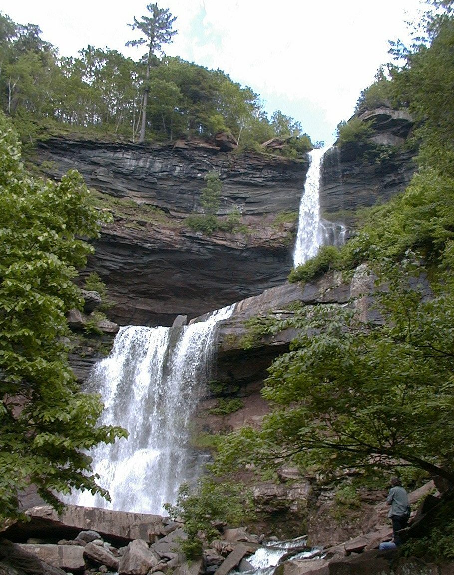 8 mi WaterfallKaaterskill Falls
 37 mi National Historic SiteHome of Franklin D. Roosevelt National Historic Site102K visitors a year
 34 mi National Historic SiteVanderbilt Mansion National Historic Site295K visitors a year
 36 mi TheatreTanglewood
 12 mi Ski areaHunter Mountain62 runs · 1,532 ft vertical
Olana State Historic Site: Netniks, CC BY-SA 4.0 · Kaaterskill Falls: Mwanner, CC BY-SA 3.0 · Home of Franklin D. Roosevelt National Historic Site: Crunch, CC BY-SA 4.0 · Vanderbilt Mansion National Historic Site: Daderot, Public domain · Tanglewood: Daderot., CC BY-SA 3.0 · Hunter Mountain: The original uploader was Daniel Case at English Wikipedia., CC BY-SA 3.0
1 within 15 miles of the center of Cairo
About 4 of every 100 Cairo residents are enrolled in college, against 7 across New York.
8 notable people were born in Cairo.


Town in New York, United States
Cairo is a town in Greene County, New York, United States. The population was 6,644 at the 2020 census. It is the third largest town in the county. The town is in the southern part of the county, partly in the Catskill Park. The town contains a hamlet, also named Cairo.
From Wikipedia, licensed CC BY-SA 4.0 · facts via Wikidata (CC0)
8 towns share a border with Cairo.
| Town | NY rank | Overall | Cost | Safety | Schools | Health |
|---|---|---|---|---|---|---|
| Cairo | #493 | C+ | C | A+ | C− | B− |
| Athens | #642 | C− | C− | — | C | B |
| Windham | — | — | B | A+ | B+ | B+ |
| Jewett | — | — | — | — | — | — |
| Coxsackie | #586 | C | C+ | — | C | B |
| Greenville | #361 | B− | C | — | C | A− |
| Catskill | #629 | C− | C | — | C | B− |
| Durham | #237 | B+ | B | A+ | C− | B+ |
Windham has fewer than 2,500 residents, so it gets subject grades but no overall grade. Athens, Coxsackie, Greenville and Catskill report no FBI crime data of their own. Jewett isn’t graded (fewer than 1,000 residents, or not enough data). Compare Cairo with a neighbor →
Short answers, built from the data on this page.
Cairo grades C+ overall, better than 36% of U.S. towns and #493 of 745 in New York. It grades B− for health, A+ for safety and C− for schools. Walkability is its weak spot, with a D.
Cost of living, which also weighs rents, property taxes and how many households pay 30% or more of their income for housing, grades C.
8 notable people were born here, including Jennifer Connelly and Thurlow Weed.


